Crossdoney

Last updated

Crossdoney
Cros Domhnaigh
Village
Crossdoney, County Cavan - geograph.ie - 1828285.jpg
The village is on the R154 road
Ireland adm location map.svg
Red pog.svg
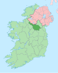
Crossdoney
Location in Ireland
Coordinates: 53°57′11″N7°26′04″W / 53.9531°N 7.4345°W / 53.9531; -7.4345 Coordinates: 53°57′11″N7°26′04″W / 53.9531°N 7.4345°W / 53.9531; -7.4345
CountryIreland
Province Ulster
County Cavan

Crossdoney (Irish : Cros Domhnaigh, meaning 'cross of the church') [1] is a village and townland in County Cavan, Ireland. The village is on the R154 regional road where it terminates at a junction with the R198. Peculiarly, all buildings in the village sit on one side of the road, and this gives rise to the widely used local expression: "All to one side like Crossdoney". [2]

Contents

Crossdoney 1837

Description from Lewis's Topographical Dictionary of Ireland, 1837

CROSSDONEY, a village and post-town, in the parish of KILMORE, barony of CLONMAHON, county of CAVAN, and province of ULSTER, 4 miles (S.W) from Cavan town, and 59¼ (N.W) from Dublin city; the population is returned with the parish. This small neat village, containing only 12 houses, is situated on the road from Killesandra to Cavan, and is surrounded by several gentlemen's seats. Fairs are held on 5 April, 27 May, 26 August and 17 November. Near it is a good bleaching establishment; and at its entrance is Lismore, the seat of Col. Nesbitt, one of the oldest in the county.

Transport

Bus

Whartons Travel operate bus route 975 on behalf of the National Transport Authority. It serves Crossdoney five times daily in each direction (no Sunday service) providing services to Cavan, Arva, Drumlish and Longford, terminating at Longford railway station. [3] [4]

Rail

Crossdoney railway station was a stop on the MGWR line between Cavan town and Inny Junction. The line opened first in July 1856, with a branch opened to Killeshandra in 1886. The entire route closed to passengers in 1947, finally closing for goods in January 1960. The Crossdoney station house is now a private residence.[ citation needed ]

See also

Related Research Articles

<span class="mw-page-title-main">County Cavan</span> County in Ireland

County Cavan is a county in Ireland. It is in the province of Ulster and is part of the Northern and Western Region. It is named after the town of Cavan and is based on the historic Gaelic territory of East Breffny (Bréifne). Cavan County Council is the local authority for the county, which had a population of 76,176 at the 2016 census.

<span class="mw-page-title-main">Ballymahon</span> Town in Leinster, Ireland

Ballymahon on the River Inny is a town in the southern part of County Longford, Ireland. It is located at the junction of the N55 National secondary road and the R392 regional road.

<span class="mw-page-title-main">Longford</span> Town in County Longford, Ireland

Longford is the county town of County Longford in Ireland. It has a population of 10,008 according to the 2016 census. It is the biggest town in the county and about one third of the county's population lives there. Longford lies at the meeting of Ireland's N4 and N5 National Primary Route roads, which means that traffic travelling between Dublin and County Mayo, or north County Roscommon passes around the town. Longford railway station, on the Dublin-Sligo line, is used heavily by commuters.

<span class="mw-page-title-main">Cavan</span> County town of Cavan, Ireland

Cavan is the county town of County Cavan in Ireland. The town lies in Ulster, near the border with County Fermanagh in Northern Ireland. The town is bypassed by the main N3 road that links Dublin with Enniskillen, Ballyshannon and Donegal Town.

<span class="mw-page-title-main">Carrigallen</span> Village in County Leitrim, Ireland

Carrigallen is a small village in County Leitrim, Ireland. It is located on the R201 and R203 roads in the east of the county. As of 2016, the village had a population of 387.

<span class="mw-page-title-main">N55 road (Ireland)</span> Road in Ireland

The N55 road is a national secondary road in Ireland linking Athlone to Cavan town.

<span class="mw-page-title-main">Ballinamuck</span> Village in Leinster, Ireland

Ballinamuck is a village in north County Longford, Ireland.

<span class="mw-page-title-main">Killucan and Rathwire</span> Town in Leinster, Ireland

The villages of Killucan and Rathwire are co-located in the east of County Westmeath, Ireland. They have a combined population of 1,370 according to the 2016 census. Killucan is on the R156 road about 15 km (9.3 mi) from Mullingar and 60 km (37 mi) from Dublin.

<span class="mw-page-title-main">R154 road (Ireland)</span> Road in Ireland

The R154 road is a regional road in Ireland, linking the R147 near Clonee, County Meath to Crossdoney in County Cavan. The road is single carriageway throughout. Many parts of the route have dangerous bends.

<span class="mw-page-title-main">Arvagh</span> Village in County Cavan, Ireland

Arvagh, or Arva, is a village in County Cavan, Ireland, on the shores of Garty Lough and overlooked by Bruse Mountain. It is located on the junction of the R198 and R203 regional roads.

<span class="mw-page-title-main">Ballyjamesduff</span> Town in County Cavan, Ireland

Ballyjamesduff is a town in County Cavan, Ireland. A former market town, it was the winner of the 1966 and 1967 Irish Tidy Towns Competition.

<span class="mw-page-title-main">Longford railway station</span> Station in County Longford, Ireland

Longford Railway Station serves the town of Longford in County Longford, Ireland.

<span class="mw-page-title-main">Lanesborough–Ballyleague</span> Town in Leinster, Ireland

Lanesborough–Ballyleague, more commonly known simply as Lanesborough, is a town in the midlands of Ireland. Lanesborough is on the County Longford (east) side and Ballyleague on the County Roscommon (west) side of the River Shannon. They are located at the northern tip of Lough Ree on the N63 national secondary road at its junction with the R371 and R392. The town of Longford is 16 km north-east on the N63, the town of Roscommon is 15 km south-west on the N63, the town of Ballymahon is 20 km south-east on the R392 and the town of Strokestown is 15 km north-west on the R371.

<span class="mw-page-title-main">Killeshandra</span> Village in County Cavan, Ireland

Killeshandra or Killashandra, is a village in County Cavan, Ireland. It is 20 kilometres (12 mi) west of Cavan Town in the centre of County Cavan's lakeland and geopark region and the Erne catchment environment of rivers, lakes, wetlands and woodland. Together with the Lough Oughter Special Protected Area (SPA), it has been recognised by the EU programme for wildlife Natura 2000 since 2010. Killeshandra is noted by Fáilte Ireland as an "Angling Centre of Excellence", and as a hub for the Cavan Walking Festival which takes place in May each year. There are several looped walking and cycling trails in Killykeen Forest Park. The town is also home to Killeshandra Gaelic Football Club, known locally as the Killeshandra Leaguers. Rockfield Lake, which is popular with anglers, is a few kilometres southwest of the town.

<span class="mw-page-title-main">Birdhill</span> Town in County Tipperary, Ireland

Birdhill is a village in County Tipperary, Ireland. It is in the barony of Owney and Arra and is part of the parish of Newport, Birdhill and Toor in the Roman Catholic Archdiocese of Cashel and Emly. Its Irish name was historically anglicised as Knockan or Knockaneeneen.

<span class="mw-page-title-main">Newtownforbes</span> Village in Leinster, Ireland

Newtownforbes is a village in County Longford, Ireland. It was historically called Lisbrack, an anglicisation of the Irish name.

<span class="mw-page-title-main">Warrington Corporation Tramways</span>

Warrington Corporation Tramways was the owner and operator of an electric tramway system in the early 20th century serving the town of Warrington, at the time a county borough of Lancashire, England.

<span class="mw-page-title-main">Kilnaleck</span> Village in County Cavan, Ireland

Kilnaleck or Kilnalec is a small village in County Cavan, Ireland on the R154 regional road. Kilnaleck was once the centre of a mining boom when in 1879 some local businessmen and a school headmaster decided to develop the coal that existed nearby. However, the coal was very deep and hard to extract and the mine was forced to close. The village is part of Crosserlough parish.

Cavan General Hospital is a public hospital located in Cavan, County Cavan, Ireland. It is managed by RCSI Hospitals.

Crossdoney railway station was a station on the Inny Junction to Cavan branch of the Midland Great Western Railway, Ireland 3/4 mile from the village of Crossdoney County Cavan. It was also the junction for the branch line to Killashandra, the only intermediate station being Arva Road. The line opened in 1856 after the well known architect George Wilkinson designed the station building in the modest Italianate style. The line closed to passenger traffic in 1947 and finally to goods traffic in January 1960. The previous station along the dismantled branch was Drumhawnagh whereas the next station along the branch is Cavan.

References

  1. "Cros Domhnaigh/Crossdoney". Placenames Database of Ireland (logainm.ie). Retrieved 8 January 2022.
  2. "Bringing Lismore back from the dead". Anglo Celt. Retrieved 10 August 2020.
  3. "Route 975 Cavan - Arvagh- Longford Bus Service Commences - National Transport AuthorityNational Transport Authority". Archived from the original on 18 December 2017. Retrieved 7 August 2014.
  4. "Whartons Travel - Cavan to Longford Bus - Longford to Cavan Bus". Archived from the original on 9 February 2013. Retrieved 19 December 2015.