Dowra

Last updated

Dowra
An Damhshraith
Village
Dowra - Main Street.jpg
Looking east - up 'Main Street' - on the Cavan side
Country Ireland
Province Ulster
Connacht (Part)
County Cavan
Leitrim (Part)
Elevation
57 m (187 ft)
Population
 (2002)
  Total147
Time zone UTC+0 (WET)
  Summer (DST) UTC-1 (IST (WEST))
Irish Grid Reference G989267

Dowra (Irish : An Damhshraith, meaning 'the river-meadow of the ox') [1] is a village and townland in northwest County Cavan, Ireland. Located in a valley on Lough Allen, [2] it is the first village on, and marks the most uppermost navigable point of, the River Shannon. On one side of its bridge is County Cavan; on the other is County Leitrim. The nucleus of the village is situated on the Cavan side. It is located on the junction of the R200 and R207 regional roads.

Contents

Transport

Bus Éireann route 462 serves Dowra on Saturdays only linking it to Drumkeeran, Dromahair and Sligo. [3]

History

The village was formed in the late 19th century after another village close by, Tober, was washed away by landslides in the summer of 1863. Back in 1925, Dowra village comprised 18 houses, with 10 being licensed to sell alcohol. [4]

The remains of the Black Pig's Dyke can be seen outside the village.[ citation needed ] It is noted on the Ordnance Survey's Edition of 1911 Six-inch to One-mile map, 1/2 mile west of Dowra alongside the River Shannon (forming part of the Leitrim / Cavan border) - see Leitrim Sheet 5. It is again noted 3/4 mile downstream just below where the Owennayla River joins the Shannon on the east side of Canbeg Township, County Leitrim - see Leitrim Sheet 18.

Places of interest

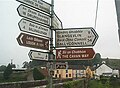
The source of the River Shannon, known as the Shannon Pot is located about 12 km (7 miles) to the north. The Cavan Way hiking trail starts in the village and the Leitrim Way passes through it. The Miners' Way is nearby.

Restoration of Dowra Courthouse was completed in 2014 with the new building opening as a Community Creative Arts Space. [5]

Economy

The main industries in the locality are agriculture, forestry and construction. There is a livestock market held every Saturday. [6]

Education

The local national school is in County Leitrim, just across the bridge from the village centre.

Religion

The village church is located approximately 5 km north and is called the Church of the Immaculate Conception, Doobally.

See also

Related Research Articles

<span class="mw-page-title-main">County Leitrim</span> County in Ireland

County Leitrim is a county in Ireland. It is in the province of Connacht and is part of the Northern and Western Region. It is named after the village of Leitrim. Leitrim County Council is the local authority for the county, which had a population of 35,087 according to the 2022 census.

<span class="mw-page-title-main">County Cavan</span> County in Ireland

County Cavan is a county in Ireland. It is in the province of Ulster and is part of the Northern and Western Region. It is named after the town of Cavan and is based on the historic Gaelic territory of East Breffny (Bréifne). Cavan County Council is the local authority for the county, which had a population of 81,201 at the 2022 census.

<span class="mw-page-title-main">Carrick-on-Shannon</span> Town in County Leitrim, Ireland

Carrick-on-Shannon is the county town of County Leitrim in Ireland. It is the largest town in the county of Leitrim. A smaller part of the town lies in County Roscommon. As of the 2022 census, the population of the town was 4,743. It is situated on a strategic crossing point of the River Shannon. The Leitrim part of the town is in the civil parish of Kiltoghert which is in the ancient barony of Leitrim.

<span class="mw-page-title-main">Ballinamore</span> Town in County Leitrim, Ireland

Ballinamore is a small town in County Leitrim, Ireland.

<span class="mw-page-title-main">Carrigallen</span> Village in County Leitrim, Ireland

Carrigallen is a small village in County Leitrim, Ireland. It is located on the R201 and R203 roads in the east of the county. As of 2016, the village had a population of 387.

<span class="mw-page-title-main">Drumshanbo</span> Town in County Leitrim, Ireland

Drumshanbo is a small town situated in the heart of County Leitrim, Ireland. Drumshanbo is surrounded by a scenic area of soft rolling hills, woodlands, lakes and the Sliabh an Iarainn and Arigna mountains. It is a well preserved town with traditional pubs, shops, and restaurants.

<span class="mw-page-title-main">Roosky</span> Village in Leitrim and Roscommon, Ireland

Roosky, Ruskey, or Rooskey is a village on the River Shannon in the northern midlands of Ireland, near the point where counties Leitrim, Longford, and Roscommon meet. The N4 road from Dublin to Sligo passes by the Leitrim side of the village.

Sligo–Leitrim is a parliamentary constituency that has been represented in Dáil Éireann, the lower house of the Irish parliament or Oireachtas, from the 2016 general election. The constituency elects 4 deputies on the system of proportional representation by means of the single transferable vote (PR-STV). Another constituency of the same name existed from 1948 to 2007.

<span class="mw-page-title-main">Dromahair</span> Village in County Leitrim, Ireland

Dromahair is a village in County Leitrim in the northern part of Connacht, the western province in Ireland. Dromahair is 10 km (6 mi) from Manorhamilton and 17 km (10 mi) from Sligo town.

<span class="mw-page-title-main">Drumkeeran</span> Village in County Leitrim, Ireland

Drumkeeran, also Drumkeerin, is a village and townland in County Leitrim, Ireland, located at the junction of the R280 and R200 roads. It is situated in drumlin hills at the foot of Corry Mountain, just north of Lough Allen.

<span class="mw-page-title-main">Drumsna</span> Village in County Leitrim, Ireland

Drumsna is a village in County Leitrim, Ireland. It is situated 6 km east of Carrick-on-Shannon on the River Shannon and is located off the N4 National primary route which links Dublin and Sligo. The harbour dates to 1817 and was a hive of commercial waterway activity until the more northern navigation canal to Carrick-on-Shannon was opened in 1850. Today, the waterway is busy with anglers and tourist pursuits in the summer months.

<span class="mw-page-title-main">Regional road (Ireland)</span> Class of road in Ireland

A regional road in the Republic of Ireland is a class of road not forming a major route, but nevertheless forming a link in the national route network. There are over 11,600 kilometres of regional roads. Regional roads are numbered with three-digit route numbers, prefixed by "R". The equivalent road category in Northern Ireland are B roads.

<span class="mw-page-title-main">Belcoo</span> Village and townland in County Fermanagh, Northern Ireland

Belcoo ( is a small village and townland in County Fermanagh, Northern Ireland, 10 miles from Enniskillen. It is on the County Fermanagh/County Cavan border beside the village of Blacklion in the Republic of Ireland. It had a population of 540 in the 2011 Census. It is situated within the Fermanagh and Omagh District.

<span class="mw-page-title-main">Blacklion</span> Village in County Cavan, Ireland

Blacklion is a border village in west County Cavan, Ireland. It is situated on the N16 national primary road, just across the border from the County Fermanagh village of Belcoo.

<span class="mw-page-title-main">Jamestown, County Leitrim</span> Village in County Leitrim, Ireland

Jamestown is a village on the banks of the River Shannon in the south of County Leitrim, Ireland. It lies some 5 km east-south-east of the county town, Carrick-on-Shannon. It was named after King James VI & I.

The Cavan Way is a long-distance trail in County Cavan, Ireland. It is 22 kilometres long and begins in Blacklion and ends in Dowra. It is typically completed in one day. It is designated as a National Waymarked Trail by the National Trails Office of the Irish Sports Council and is managed by Cavan County Council. The trail was devised by a local man, Harold Johnston, and set up by the Blacklion Community Council and the Cavan County Development Team between 1984 and 1985.

<span class="mw-page-title-main">Miners Way and Historical Trail</span>

The Miners' Way and Historical Trail is a long-distance trail in Ireland. It is a 118-kilometre (73-mile) long circular route that begins and ends in Arigna, County Roscommon. It is typically completed in five days. It is designated as a National Waymarked Trail by the National Trails Office of the Irish Sports Council and is managed by Roscommon Integrated Development Company, Roscommon County Council, Leitrim County Council and Sligo County Council. The trail was developed to encourage tourism in the area in the wake of the closure of the Arigna mines in 1990. The route was originally conceived by a local priest, Father Sean Tynan, and built with funding from the European Regional Development Fund. The trail was opened by broadcaster Donncha Ó Dúlaing in July 2000.

<span class="mw-page-title-main">Shannon River Basin</span> River in Ireland

The Shannon River Basin consists of the area containing Ireland's longest river, the River Shannon, and all of its tributaries and lakes. The official Ordnance Survey Ireland length of the Shannon from its Shannon Pot source is 224 miles (360 km) made up of 63.5 miles (102.2 km) tidal water flow and 160.5 miles (258.3 km) freshwater flow.

<span class="mw-page-title-main">Leitrim Way</span>

The Leitrim Way is a 57km long-distance trail between Leitrim village, and Manorhamilton County Leitrim, Ireland. This route is generally completed over 2–3 days, and brings walkers through a variety of landscape forms common to this beautiful part of the northwest of Ireland. The Leitrim Way forms part of Ireland's National Waymarked Ways.

References

  1. "An Damhshraith/Dowra". logainm.ie. Irish Placenames Commission. Retrieved 31 December 2019.
  2. "An Taisce sees Dowra as model village whose rare qualities must be preserved". Irish Times . 12 April 2002.
  3. "Timetable - Carrigallen − Ballinamore − Sligo - No.462" (PDF). Archived from the original (PDF) on 24 January 2013. Retrieved 4 May 2013.
  4. Intoxicating Liquor Commission Report (Report). Vol. Reports of Committees (Irish Free State). The Stationery Office. 1925. p. 31. Archived from the original on 15 December 2018. Retrieved 21 May 2017.
  5. "Restored former Dowra Courthouse transforms village". The Cavan Times. 19 November 2014.
  6. "New Year quotes off to a flyer". Irish Independent . 6 January 2015. Archived from the original on 31 December 2019. Retrieved 31 December 2019.

54°11′22.68″N8°0′54.15″W / 54.1896333°N 8.0150417°W / 54.1896333; -8.0150417