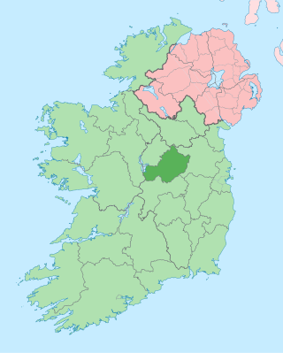
County Westmeath is a county in Ireland. It is in the province of Leinster and is part of the Eastern and Midland Region. It formed part of the historic Kingdom of Meath, which was named Mide because the kingdom was located in the geographical centre of Ireland. Westmeath County Council is the administrative body for the county, and the county town is Mullingar. At the 2022 census, the population of the county was 95,840.
County Offaly is a county in Ireland. It is part of the Eastern and Midland Region and the province of Leinster. It is named after the ancient Kingdom of Uí Failghe. It was formerly known as King's County, in honour of Philip II of Spain. Offaly County Council is the local authority for the county. The county population was 82,668 at the 2022 census.

Mullingar is the county town of County Westmeath in Ireland. It is the third most populous town in the Midland Region, with a population of 22,667 in the 2022 census.

Lough Owel is a mesotrophic lough in the Midlands of Ireland, situated north of Mullingar, the county town of Westmeath. It has a maximum depth of 21 metres (69 ft). Water from Lough Owel feeds the Royal Canal, a canal crossing Ireland from Dublin to the River Shannon. The lake is close to the N4 primary road.
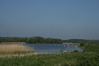
Lough Ennell is a lake near the town of Mullingar, County Westmeath, Ireland. It is situated beside the N52 road, off the Mullingar/Kilbeggan road. The lake is part of the Lough Ennell Special Protection Area. It is 6.5 km (4.0 mi) long by 2 km (1.2 mi) wide, with an area of about 12 km2 (4.6 sq mi). Lough Ennell has a large area of shallow water with nearly two-thirds of its area being less than 25 feet and almost half of it being under 10 ft (3.0 m) deep. The lake produced Ireland's largest ever lake brown trout at 26 lbs (11.8 kg).

Kilbeggan is a town in County Westmeath, Ireland. It is in the barony of Moycashel.

Ferbane is a town in County Offaly, Ireland. It is on the north bank of the River Brosna, between Birr and Athlone at the junction of the N62 and R436 roads, 20 km south of Athlone. The name of the town is said to come from the white bog cotton which grows in the surrounding Bog of Allen.
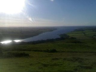
Lough Derravaragh is a lake in County Westmeath, Ireland, north of Mullingar between Castlepollard, Crookedwood and Multyfarnham.
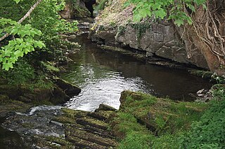
The Silver River is a river that flows through principally though the south of County Offaly in central Ireland. Its source is in the Slieve Bloom Mountains. The village of Cadamstown, on the river, is home to the Silver River Geological Reserve.
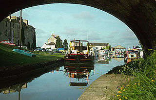
Shannon Harbour is a small village situated on the banks of the Grand Canal in County Offaly, Ireland. The older or regional name of the village is Cluain Uaine Bheag, meaning "Clononey Beg" or "little Clononey," named in contrast to Cluain Uaine Mhor or Clononey Mor on the other side of a stream off the River Brosna. The name reflects the distance, population, and low-lying land of the area compared to its counterpart.

Moycashel, previously the barony of Rossaughe, and before that, Delamares country, is a barony in south County Westmeath, in Ireland. It was formed by 1542. It is bordered by three other baronies: Clonlonan to the west, Rathconrath to the north, Moyashel and Magheradernon to the north-east and Fartullagh to the west. The largest population centre is Kilbeggan.

The Offaly Way is a long-distance trail in County Offaly, Ireland. It is 37 kilometres long and begins in Cadamstown and ends at Lemanaghan, on the R436 road between the towns of Clara and Ferbane. It is typically completed in two days. It is designated as a National Waymarked Trail by the National Trails Office of the Irish Sports Council and is managed by Offaly County Council, Bord na Mona and the Offaly Integrated Development Company. The trail provides a link between the Slieve Bloom Way and the Grand Canal Way.
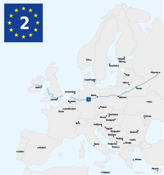
The Westmeath Way is a long-distance trail in County Westmeath, Ireland. It is 100 kilometres long and begins in Kilbeggan and ends in Athlone. It is typically completed in two days. It is designated as a National Waymarked Trail by the National Trails Office of the Irish Sports Council and is managed by Westmeath County Council and the Westmeath Way Committee. The trail forms part of the Dublin-Galway Greenway, part of the route 2 of the EuroVelo European cycle network.

The Shannon River Basin consists of the area containing Ireland's longest river, the River Shannon, and all of its tributaries and lakes. The official Ordnance Survey Ireland length of the Shannon from its Shannon Pot source is 224 miles (360 km) made up of 63.5 miles (102.2 km) tidal water flow and 160.5 miles (258.3 km) freshwater flow.

Corkaree is a barony in north County Westmeath, Ireland. It was formed by 1672. It is bordered by three other baronies: Fore, Moyashel and Magheradernon and Moygoish.

Moyashel and Magheradernon is a barony in the centre of County Westmeath, in Ireland, formed by 1672. It is bordered by eight other baronies: Corkaree and Fore, Delvin and Farbill, Fartullagh and Moycashel and Rathconrath and Moygoish.

Clonlonan is a barony in south–west County Westmeath, Ireland. It was formed by 1672. It is bordered by County Offaly to the south and a small part of County Roscommon at Long Island on the River Shannon to the west. It also borders four other Westmeath baronies: Kilkenny West and Rathconrath, Moycashel and Brawny. The largest centre of population in the barony is the town of Moate.
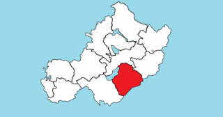
Fartullagh, previously Tyrrells country, is a barony in south–east County Westmeath, in Ireland. It was formed by 1542. It is bordered by County Offaly to the south and three other baronies: Moycashel, Moyashel and Magheradernon and Farbill.

The Athlone to Mullingar Cycleway is a long-distance cycling and walking trail in County Westmeath, which forms a section of the Dublin-Galway Greenway. It is a 42 kilometres long rail-trail over the disused Athlone-Mullingar rail line beginning in Athlone and ending in Mullingar.
Friarstown is a townland in County Westmeath, Ireland. The townland is located in the civil parish of Clonfad. The southern shores of Lough Ennell borders the townland to the north, and Dalystown is to the east. The River Brosna forms its western border with the townland of Clonsingle.

