Rivers of Ireland

Last updated

Shown here are all the major rivers and tributaries of Ireland with their lengths (in kilometres and miles). Starting with the Northern Ireland rivers, and going in a clockwise direction, the rivers (and tributaries) are listed in regard to their entry into the different seas: the Irish Sea, the Celtic Sea and the Atlantic Ocean. Also shown are two tables. Table 1 shows the longest rivers in Ireland with their lengths (in kilometres and miles), the counties they flow through, and their catchment areas (in square kilometres). Table 2 shows the largest rivers in Ireland (by mean flow) in cubic metres per second.

Contents

Some of the larger or better-known rivers of Ireland are shown on this map (large version). Ireland physical medium.png
Some of the larger or better-known rivers of Ireland are shown on this map (large version).

The longest river in Ireland is the River Shannon, at 360.5 kilometres (224.0 mi). The river develops into three lakes along its course, Lough Allen, Lough Ree and Lough Derg. Of these, Lough Derg is the largest. The Shannon enters the Atlantic Ocean at the Shannon Estuary. Other major rivers include the River Liffey, River Lee, River Swilly, River Foyle, River Lagan, River Erne, River Blackwater, River Nore, River Suir, River Barrow (The Three Sisters), River Bann, River Slaney, River Boyne, River Moy and River Corrib.
Longest Irish Rivers (with Basin areas)

Lengths obtained from the Ordnance Survey of Ireland: Rivers and their Catchment Basins 1958 (Table of Reference), and for the rivers Bann and Erne - Notes on River Basins by Robert A. Williams

RiverCountiesLengthBasin Area
1 River Shannon (including estuary and flow through lakes)a Cavan, Leitrim, Roscommon, Longford, Westmeath, Galway, Offaly,

Tipperary, Clare, Limerick, Kerry

360 km (224 mi)16,800 km2 [1]
2 River Barrow b Laois, Kildare, Kilkenny, Carlow,

Wexford, Waterford

192 km (119 mi)3,067 km2 [1]
3 River Suir bTipperary, Waterford, Kilkenny, Wexford184 km (114.5 mi)3,610 km2 [1]
4 River Blackwater (Munster) Kerry, Cork, Waterford168 km (104.5 mi)3,324 km2 [1]
5 River Bann (including flow through L. Neagh)c Down, Armagh, Antrim, Londonderry 159 km (99 mi)5,808 km2 [2]
6 River Nore bTipperary, Laois, Kilkenny140 km (87 mi)2,530 km2 [1]
7 River Suck (Shannon)Roscommon, Galway133 km (83 mi)1,600 km2 [3]
8 River Liffey Wicklow, Kildare, Dublin 132 km (82 mi)1,256 km2 [1]
9 River Erne Cavan, Fermanagh, Donegal 129 km (80 mi) [4] 4,372 km2 [1]
10 River Foyle (including Rivers Mourne, Strule & Camowen) Tyrone, Londonderry, Donegal129 km (80 mi)2,925 km2 [2]
11 River Slaney Wicklow, Carlow, Wexford 117 km (73 mi)1,762 km2 [1]
12 River Boyne Kildare, Offaly, Meath, Louth 113 km (70 mi)2,695 km2 [1]
13 River Moy Sligo, Mayo 101 km (62.5 mi)2,086 km2 [1]
14 River Clare (Corrib)dMayo, Roscommon, Galway93 km (58 mi)1,108 km2 [5]
15 River Blackwater (Ulster) (Bann) cTyrone, Monaghan, Armagh92 km (57 mi)1,507 km2 [2]
16t River Inny (Shannon)Cavan, Longford, Westmeath89 km (55.5 mi)1,254 km2 [3]
16t River Lee Cork89 km (55.5 mi)1,253 km2 [1]
18 River Lagan Down, Antrim86 km (53.5 mi)565 km2 [2]
19 River Brosna (Shannon)Westmeath, Offaly79 km (49 mi)1,248 km2 [3]
20 River Laune (includes Lough Leane and River Flesk)Kerry76 km (47.25 mi)829 km2
21 River Feale (Shannon)Cork, Limerick, Kerry74 km (46 mi)1,170 km2 [6]
22 River Bandon Cork72 km (45 mi)608 km2 [1]
23 River Blackwater (Boyne) Cavan, Meath68 km (42.5 mi)733 km2 [7]
24 River Annalee (Erne)Monaghan, Cavan66.8 km (41.75 mi)522 km2 [7]
25 River Bride (M. Blackwater)Cork, Waterford64 km (40 mi)419 km2
26 Boyle River (including Lung River) (Shannon)Mayo, Sligo, Roscommon64 km (40 mi) [4] 725 km2
27 River Deel (Shannon)Cork, Limerick63.2 km (39.5 mi)481 km2 [7]
28 River Robe (Corrib)dMayo62.8 km (39.25 mi)320 km2
29 River Finn (County Donegal) (Foyle)Donegal, Tyrone62.8 km (39.25 mi)505 km2 [7]
30 River Maigue (Shannon)Cork, Limerick62 km (38.75 mi)1,000 km2
31 Fane River Monaghan, Armagh, Louth61.2 km (38.25 mi)350 km2
32 Ballisodare River Sligo60.8 km (38 mi)650 km2 [2]
33 River Dee (Louth) Cavan, Meath, Louth60.4 km (37.75 mi)392 km2 [7]
34 River Fergus (Shannon)Clare58.4 km (36.5 mi)1,043 km2
35 Little Brosna River (Shannon)Offaly, Tipperary57.6 km (36 mi)662 km2
36 Mulkear River (including Bilboa River) (Shannon)Tipperary, Limerick55.9 km (34.75 mi)650 km2
37 River Glyde (Co. Louth)Cavan, Meath, Louth55.9 km (34.75 mi)348 km2

TABLE 1

a

b

c

d

Largest Irish Rivers (by flow)

River

(River Basin)

Mean Discharge

(m³/s)

1 River Shannon [1] a209 (300)
2 River Corrib [1] 105.5
3 River Bann [15] b92 (102.5)
4 River Foyle [16] 90
5 River Blackwater (Munster) [1] 87.5
6 River Erne [1] 85
7 River Suir [1] c76
8 River Moy [1] 63
9 River Barrow [1] c46.5
10 River Laune [1] 43
11 River Nore [1] c42
12 River Lee [1] 40
13 River Slaney [1] 39
14 River Boyne [1] 38.5
15 River Cong [7] (Corrib)37.6
16 River Feale [17] (Shannon)34.6
17 River Fergus [17] (Shannon)25.7
18 River Clare [18] (Corrib)22.9
19 River Suck [18] (Shannon)22.2
20 River Avoca [1] 22
21 River Bandon [1] 21.5
22 River Mourne [18] (Foyle)21.1
23 River Blackwater (Ulster) [18] (Bann)19.7
24 River Ballisodare [7] 18.25
25 River Inny [18] (Shannon)18.4
26 River Liffey [1] 17
27 River Derg [18] (Foyle)16.2
28 River Maigue [17] (Shannon)15.6
29 River Main [18] (Bann)15.4
30 River Blackwater (Boyne) [7] (Boyne)15.08
31 Aille River (Connacht) [19] (Corrib)15.0
32 Owenmore River (County Mayo) [18] 14.7
33 Boyle River [7] (Shannon)13.57
34 River Deel [7] (Shannon)12.56
35 Mulkear River [7] (Shannon)12.55

TABLE 2

a The River Shannon's 209 m3/s is to Limerick City (Catchment area: 11,700 km2). If the discharges from all of the rivers and streams into the Shannon Estuary (including the rivers Feale 34.6m3/s, Maigue 15.6m3/s, Fergus 25.7m3/s, and Deel 7.4m3/s) [17] [20] are added to the discharge at Limerick giving a total catchment of 16,865 km2, the total discharge of the River Shannon at its mouth at Loop Head reaches 300 m3/s

b The River Bann's 92 m3/s is to Movanagher Gauging station (Basin area 5209.8 km2). [21] The 102.5 m3/s is based on the total basin area of 5808 km2 [2] .

c The Three Sisters (Barrow, Nore & Suir) total flow into Waterford Harbour is 154 m3/s and the combined flow of the Barrow and Nore rivers is 86 m3/s before joining the river Suir near Waterford City.

Rivers in Ulster

With length in miles (and km)

Rivers in the Republic of Ireland, flowing into the Irish Sea

With length in miles (and km)

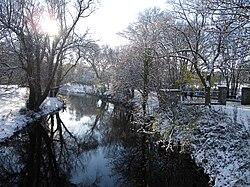
River Dodder River Dodder Rathgar snow.JPG
River Dodder

Rivers in the Republic of Ireland, flowing into the Celtic Sea

With length in miles (and km)

River Goul RiverGoul1876-2.jpg
River Goul
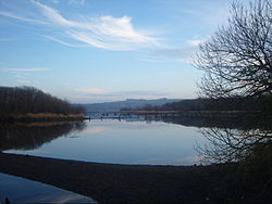
River Lee The Gearagh 2.jpg
River Lee

Rivers in the Republic of Ireland, flowing into the Atlantic Ocean

With length in miles (and km)

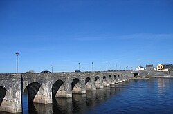
River Shannon Shannonbridge.jpg
River Shannon
River Annalee Annalee river, Butlersbridge, Cavan Aug 2003.jpg
River Annalee

See also

Related Research Articles

<span class="mw-page-title-main">River Shannon</span> Longest river in the British Isles

The River Shannon is the major river on the island of Ireland, and at 360.5 km in length, is the longest river in the British Isles. It drains the Shannon River Basin, which has an area of 16,865 km2 (6,512 sq mi), – approximately one fifth of the area of Ireland.

<span class="mw-page-title-main">Geography of Ireland</span> Geography of the island of Ireland, Northwestern Europe

Ireland is an island in Northern Europe in the north Atlantic Ocean. The island lies on the European continental shelf, part of the Eurasian Plate. The island's main geographical features include low central plains surrounded by coastal mountains. The highest peak is Carrauntoohil, which is 1,039 metres (3,409 ft) above sea level. The western coastline is rugged, with many islands, peninsulas, headlands and bays. The island is bisected by the River Shannon, which at 360.5 km (224 mi) with a 102.1 km (63 mi) estuary is the longest river in Ireland and flows south from County Cavan in Ulster to meet the Atlantic just south of Limerick. There are a number of sizeable lakes along Ireland's rivers, of which Lough Neagh is the largest.

<span class="mw-page-title-main">Lough Neagh</span> Freshwater lake in Northern Ireland

Lough Neagh is a freshwater lake in Northern Ireland and is the largest lake on the island of Ireland and in the United Kingdom. It has a surface area of 151 square miles and is about 19 miles (31 km) long and 9 miles (14 km) wide. According to Northern Ireland Water, it supplies 40.7% of Northern Ireland's drinking water. Its main inflows are the Upper River Bann and Blackwater, and its main outflow is the Lower Bann. There are several small islands including Ram's Island, Coney Island and Derrywarragh Island. The lake bed is owned by the 12th Earl of Shaftesbury and the lake is managed by Lough Neagh Partnership. Its name comes from Irish Loch nEachach, meaning "Eachaidh's lake".

<span class="mw-page-title-main">River Barrow</span> Second-longest river in Ireland, one of the Three Sisters

The Barrow is a river in Ireland. It is one of The Three Sisters; the other two being the River Suir and the River Nore. The Barrow is the longest of the three rivers and, at 192 km (120 mi), the second-longest river in Ireland, behind the River Shannon. The catchment area of the River Barrow is 3,067 km2 before the River Nore joins it a little over 20 km before its mouth. The river's long term average flow rate, again before it is joined by River Nore, is 37.4 cubic metres per second. At the merger with the River Suir, its catchment area is ca. 5,500 km2 and its discharge over 80 m3/s.

<span class="mw-page-title-main">The Three Sisters (Ireland)</span> Three substantial rivers in southern Ireland

The Three Sisters are three rivers in Ireland: the River Barrow, the River Nore and the River Suir. The Suir and Nore rise in the same mountainous area in County Tipperary, near the Devil's Bit, while the Barrow rises in the Slieve Bloom Mountains in County Laois. The Nore flows into the Barrow about 17 km before the Suir and Barrow join to form an estuary called Waterford Harbour east of the city of Waterford. The rivers fan out to drain a large portion of the southern part of the island, including Counties Tipperary, Carlow, Kilkenny, Wexford and Waterford, among others.

<span class="mw-page-title-main">River Corrib</span> River in Galway, Ireland

The River Corrib in the west of Ireland flows from Lough Corrib through Galway to Galway Bay. The river is among the shortest in Europe, with only a length of six kilometres from the lough to the Atlantic. It is popular with local whitewater kayakers as well as several rowing clubs and pleasure craft. The depth of this river reaches up to 94 feet.

<span class="mw-page-title-main">River Suir</span> River in southern Ireland, one of the Three Sisters

The River Suir is a river in Ireland that flows into the Atlantic Ocean through Waterford after a distance of 185 kilometres (115 mi). The catchment area of the Suir is 3,610 km2. Its long term average flow rate is 76.9 cubic metres per second (m3/s), about twice the flow of either the River Barrow or the River Nore before these join, but a little less than the Barrow's flow when it meets the Suir 20 km downstream.

<span class="mw-page-title-main">River Bann</span> Longest river in Northern Ireland, passing through Lough Neagh

The River Bann is the longest river in Northern Ireland, its length, Upper and Lower Bann combined, being 129 km (80 mi). However, the total length of the River Bann, including its path through the 30 km (19 mi) long Lough Neagh is 159 km (99 mi). Another length of the River Bann given is 90 mi. The river winds its way from the southeast corner of Northern Ireland to the northwest coast, pausing in the middle to widen into Lough Neagh. The River Bann catchment has an area of 5,775 km2. The River Bann has a mean discharge rate of 92 m3/s. According to C. Michael Hogan, the Bann River Valley is a settlement area for some of the first human arrivals in Ireland after the most recent glacial retreat.

<span class="mw-page-title-main">River Feale</span> River in southwestern Ireland, flowing to the Shannon Estuary

The River Feale rises near Rockchapel in the Mullaghareirk Mountains of County Cork in the southwest of Ireland and flows northwestwards for 75 kilometres through Abbeyfeale in County Limerick and Listowel in County Kerry before finally emptying into Cashen Bay, a wide estuary north of Ballyduff. Then it flows out through the Shannon's estuary and joins with the Atlantic Ocean with a flow rate of 34.6 m2/s. The river, along with its tributaries, combine to add to over 160 km of waterways. For the final 10 km stretch it is known as the Cashen River. The river contains a large salmon and sea trout population.

<span class="mw-page-title-main">River Erne</span> River in northwestern Ireland

The River Erne in the northwest of the island of Ireland, is the second-longest river in Ulster, flowing through Northern Ireland and the Republic of Ireland, and forming part of their border.

<span class="mw-page-title-main">River Blackwater (Northern Ireland)</span> River in Counties Armagh and Tyrone, Northern Ireland, and County Monaghan, Ireland

The River Blackwater or Ulster Blackwater is a river mainly in County Armagh and County Tyrone, Northern Ireland. It also forms part of the border between the United Kingdom and the Republic of Ireland, flowing between Counties Tyrone and Monaghan, intersecting into County Monaghan briefly. Its source is to the north of Fivemiletown, County Tyrone. The river divides County Armagh from County Tyrone and also divides County Tyrone from County Monaghan.

<span class="mw-page-title-main">Ulster Canal</span> Disused canal in Ireland

The Ulster Canal is a canal running through part of County Armagh, County Tyrone and County Fermanagh in Northern Ireland and County Monaghan in the Republic of Ireland. The Ulster Canal was built between 1825 and 1842 and was 74 km (46 mi) long with 26 locks. It ran from Charlemont on the River Blackwater to near Wattlebridge on the Finn River, south-east of Upper Lough Erne. It was an ill-considered venture, with the locks built narrower than the other Irish waterways, preventing through trade, and an inadequate water supply. It was an abject failure commercially, and contributed to the collapse of the Lagan Navigation Company, who took it over from the government but were then refused permission to abandon it when they could not afford the maintenance costs. It finally closed in 1931. Waterways Ireland started work on rebuilding the canal at its southern end in 2015.

<span class="mw-page-title-main">Inland Waterways Association of Ireland</span> Non-governmental organisation

The Inland Waterways Association of Ireland is a registered charity and a limited company in the Republic of Ireland and also operates in Northern Ireland. It was founded in 1954 to campaign for the conservation and development of the waterways and their preservation as working navigations. As of 2008, the association had approximately 4,400 members which were organised in twenty branches.

<span class="mw-page-title-main">Shannon River Basin</span> River in Ireland

The Shannon River Basin consists of the area containing Ireland's longest river, the River Shannon, and all of its tributaries and lakes. The official Ordnance Survey Ireland length of the Shannon from its Shannon Pot source is 224 miles (360 km) made up of 63.5 miles (102.2 km) tidal water flow and 160.5 miles (258.3 km) freshwater flow.

<span class="mw-page-title-main">Owenmore River (County Sligo)</span> River in Ireland

The Owenmore River is a river in County Sligo, Ireland. Its source is in the far south of Sligo, near Gorteen and Lough Gara, from which it runs for 52.3 km to its juncture with the Unshin River near Collooney to form the Ballisodare River. Its catchment covers 655 square kilometres (253 sq mi), predominantly located in Sligo but with small parts in County Mayo and County Roscommon. The catchment is underlain by limestone, and the total length of all the rivers in the Greater Owenmore Basin Area is 639 kilometres (397 mi). There are approximately 1,470 hectares (5.7 sq mi) of lakes in the catchment, with Lough Arrow comprising most of this.

References

  1. 1 2 3 4 5 6 7 8 9 10 11 12 13 14 15 16 17 18 19 20 21 22 23 24 25 26 27 28 Comprehensive study of Riverine Inputs Details of hydrometric stations, sampling stations Page 17, Table 2 Archived 2017-08-05 at the Wayback Machine
  2. 1 2 3 4 5 6 7 8 9 10 11 12 13 14 15 16 17 18 19 20 21 22 23 24 25 26 27 28 29 30 31 32 33 34 35 36 37 38 39 40 41 42 43 44 45 46 47 48 49 50 51 52 53 54 55 56 57 58 59 60 61 62 63 64 65 66 67 68 69 70 71 72 73 74 75 76 77 78 79 80 81 82 83 84 85 86 87 88 89 90 91 92 93 94 95 96 97 98 99 100 101 102 103 104 105 106 107 108 109 110 111 112 113 114 115 116 117 118 119 120 121 122 123 124 125 126 127 128 129 130 131 132 133 134 135 136 137 138 139 140 141 142 143 144 145 146 147 148 149 150 151 152 153 154 155 156 157 158 159 160 161 162 163 164 165 166 167 168 169 170 171 172 173 174 175 176 177 178 179 180 181 182 183 184 185 186 187 188 189 190 191 192 193 194 195 196 197 198 199 200 201 202 203 204 205 206 Ordnance Survey of Ireland: Rivers and their Catchment Basins 1958 (Table of Reference)
  3. 1 2 3 Dublin Marine Institute 1998: Studies of Irish Rivers and Lakes: Moriarty, Christopher
  4. 1 2 3 4 5 6 7 Robert A. Williams (27 May 1872). "Notes on river basins" via Internet Archive.
  5. "Western CFRAM Units of Management" (PDF). Archived (PDF) from the original on 2 November 2014. Retrieved 30 October 2014.
  6. "Biology and Management of European Eel p.29" (PDF). wordpress.com. Archived (PDF) from the original on 7 September 2014. Retrieved 30 October 2014.
  7. 1 2 3 4 5 6 7 8 9 10 11 "Irish Hydro Power Association". Archived from the original on 5 November 2014. Retrieved 9 November 2014.
  8. 1 2 "Secondary Schools Teacher Resources - Ordnance Survey Ireland". osi.ie. Archived from the original on 27 March 2015. Retrieved 27 May 2018.
  9. Shannon River Basin: Furthest sourceShannon River Basin#Furthest sources [ circular reference ]
  10. Boyle River (Ireland) [ circular reference ]
  11. "Home". www.askaboutireland.ie. Archived from the original on 10 January 2020. Retrieved 24 September 2021.
  12. Ulster BlackwaterRiver Blackwater, Northern Ireland [ circular reference ]
  13. 1 2 "European Commission Rivers Map" (PDF). Archived (PDF) from the original on 19 August 2015. Retrieved 16 November 2014.
  14. River Robe [ circular reference ]
  15. "- National River Flow Archive". ceh.ac.uk. Archived from the original on 4 March 2016. Retrieved 15 January 2016.
  16. "SMILE - Sustainable Mariculture in northern Irish Lough Ecosystems". www.ecowin.org. Archived from the original on 12 November 2013. Retrieved 19 October 2014.
  17. 1 2 3 4 Long-term effects of hydropower installations and associated river regulation on River Shannon eel populations: mitigation and management Archived 2016-03-04 at the Wayback Machine
  18. 1 2 3 4 5 6 7 8 Royal Irish Academy, Atlas of Ireland (Royal Irish Academy, Dublin, 1979) Hydrology P. 23 - Rivers: Mean Discharge
  19. "OPW". Archived from the original on 24 September 2015. Retrieved 20 June 2014.
  20. "Department of Housing, Planning and Local Government". Department of Housing, Planning and Local Government. Archived from the original on 27 May 2018. Retrieved 27 May 2018.
  21. "Search for gauging stations". ceh.ac.uk. 5 October 2015. Archived from the original on 28 January 2016. Retrieved 15 January 2016.