Ballynahinch River is a river in County Down, Northern Ireland. It is one of the two component watercourses which form the Annacloy River, also known as the Quoile River.

Ballynahinch River is a river in County Down, Northern Ireland. It is one of the two component watercourses which form the Annacloy River, also known as the Quoile River.
The Ballynahinch River, flowing east through Ballynahinch, and the Carson's Dam River, flowing south through Crossgar, join at Kilmore, and the united stream is called the Annacloy River, and lower down the River Quoile, falling into the southwest angle of Strangford Lough near Downpatrick. [1]
The banks of the Ballynahinch River in the early days (18th century) were dotted with little bleach greens, but as bleaching became more centralised in the Lagan-Bann region, the small greens went out of existence. The first water-powered scutch mills were introduced about 1750, the second in Down being at Rademon. [2]

Downpatrick is a town in County Down, Northern Ireland. It is on the Lecale peninsula, about 21 mi (34 km) south of Belfast. In the Middle Ages, it was the capital of the Dál Fiatach, the main ruling dynasty of Ulaid. Its cathedral is said to be the burial place of Saint Patrick. Today, it is the county town of Down and the joint headquarters of Newry, Mourne and Down District Council. Downpatrick had a population of 11,545 according to the 2021 Census.

Down District Council was a Local Council in County Down in Northern Ireland. It merged with Newry and Mourne District Council in April 2015 under local government reorganisation in Northern Ireland to become Newry, Mourne and Down District Council.

Ballynahinch is a town in County Down, Northern Ireland. It had a population of 6,164 people in the 2021 census.

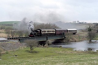
The Belfast and County Down Railway (BCDR) was an Irish gauge railway in Ireland linking Belfast with County Down. It was built in the 19th century and absorbed into the Ulster Transport Authority in 1948. All but the line between Belfast and Bangor was closed in the 1950s, although some of it has been restored near Downpatrick by a heritage line, the Downpatrick and County Down Railway.

The Quoile is a river in County Down, Northern Ireland.

The A24 is a major road in Northern Ireland running from Belfast to Clough near Newcastle, passing through Carryduff and Ballynahinch. In Belfast, the route forms the Ormeau Road. At Clough it meets the A2.

Saul is a village in County Down, Northern Ireland, within the civil parish of Saul and Ballee.

Newry River, also known as the River Clanrye, is a river in Northern Ireland flowing through counties Down and Armagh. The river passes through the city of Newry and empties into Carlingford Lough near Warrenpoint.

Seaforde is a small village in County Down, Northern Ireland. It is within the townland of Naghan, one mile (1.6 km) north of Clough on the main Ballynahinch to Newcastle road. It is part of the Newry, Mourne and Down area.

Quoile Castle is a castle situated 1.5 miles (2.4km) from Downpatrick, County Down, Northern Ireland, just off the main road from Downpatrick to Strangford, on the east bank of the River Quoile. The castle was built during the late 16th / early 17th Century and was continuously used up to the 1700s. It has been suggested that it was built by Captain Richard West. Quoile Castle is a State Care Historic Monument in the townland of Quoile, in Down District Council area, at grid ref: J4963 4701.

Spa is a small village in County Down, Northern Ireland, close to Ballynahinch. It is situated in the Down District Council area.
Down High School is a controlled co-educational grammar school located in Downpatrick, County Down, Northern Ireland. The school has students from the ages of eleven to eighteen in the senior school — of which there are approximately 970 pupils. On 21 July 2014, John O'Dowd, the education minister, approved a development proposal to close the preparatory department of Down High School and it closed on 30 June 2014. There are roughly 250 pupils engaged in A-level study in the sixth form. In July 2015, some £20 million was granted by the education minister to begin the new build project in 2017.

Struell Wells are a set of four holy wells in the townland of Struell, 1.5 miles (2.4 km) east of Downpatrick, County Down, Northern Ireland. The wells date from before the time of Saint Patrick, and even today are used for people seeking cures. On Mid-Summer Eve and the Friday before Lammas, hundreds of pilgrims used to visit Struell. The earliest written reference to the wells is in 1306, but none of the surviving buildings is earlier than about 1600. Pilgrimages to the site are well documented from the 16th century to the 19th century. The site is managed by the Northern Ireland Environment Agency.

Annacloy River is a river in County Down, Northern Ireland, which goes through Dromara Hills and Strangford Lough.

The A21, also Comber road, is a road in County Down in Northern Ireland. The route commences in Bangor, passing through Newtownards, Comber, and Ballygowan, and finishes on the northern outskirts of Ballynahinch.

Listooder is a hamlet and townland situated outside Crossgar towards both Ballynahinch and Saintfield in County Down, Northern Ireland. Listooder derives its name from the Irish word Lios an tSúdaire meaning "fort of the leather tanner" or "ring-fort". From the mid 19th century, the hamlet was known as the Cock, while the townland which centres around the fort was called Listooder.

Ballynahinch Junction railway station was on the Belfast and County Down Railway which ran from Belfast to Newcastle, County Down in Northern Ireland. The railway split off from the Belfast and County Down Railway onto the B&CDR Ballynahinch Branch ending at Ballynahinch station.
Gores Island, also known as Gore's Island, is an island in Strangford Lough, County Down, Northern Ireland. It is connected to nearby Castle Island, and thence to the mainland, by a narrow roadway that is passable only at low tides. It has been inhabited previously, but has had no residents since 1910

The Quoile Bridge is a railway bridge across the River Quoile in Downpatrick, County Down, Northern Ireland. It is 43 metres (141 ft) long and carries a single-track line.

The Braid River is a river in the borough of Mid and East Antrim, County Antrim, Northern Ireland. It is a tributary to the River Main. Historically, the valley in which the river flows divided the boundaries between the parishes of Skerry and Rathcavan in the 19th century.