
River Mahon (Irish : an Mhachain) flows from the Comeragh Mountains in County Waterford, Ireland.
River Mahon (Irish : an Mhachain) flows from the Comeragh Mountains in County Waterford, Ireland.
Falling down the 80-metre Mahon Falls and proceeding past a hawthorn "Fairy Tree", identified by ribbons tied to its branches (the tree was chopped down and replanted), the river then passes through the village of Mahon Bridge and on past Flahavan's Mill and under the 8-arched rail bridge in Kilmacthomas. The river is joined by the Ách Mór tributary river at Ballylaneen and ends its journey three miles further downstream at Bunmahon on Ireland's south coast. It drains into the region of the Atlantic Ocean known as the Celtic Sea.
In former times, the river powered five different mills, one at Mahon Bridge, three at Kilmacthomas and one at Ballylaneen.
The river is popular with whitewater kayakers. There has been no known source-to-sea descent to date but the river has been paddled from Mahon Bridge to the sea at Bonmahon by an international team of B1 and B2 kayakers in August 2012. On 21 October 2005, Michael Reynolds, a kayaker from Tramore, County Waterford, performed the only known descent in a kayak of the vertical 55 foot drop at the top of Mahon falls. [1] [2] Coordinates: 52°08′N7°22′W / 52.133°N 7.367°W


County Kilkenny is a county in Ireland. It is in the province of Leinster and is part of the South-East Region. It is named after the city of Kilkenny. Kilkenny County Council is the local authority for the county. As of the 2016 census the population of the county was 99,232. The county was based on the historic Gaelic kingdom of Ossory (Osraighe), which was coterminous with the Diocese of Ossory.
County Waterford is a county in Ireland. It is in the province of Munster and is part of the South-East Region. It is named after the city of Waterford. Waterford City and County Council is the local authority for the county. The population of the county at large, including the city, was 116,176 according to the 2016 census. The county is based on the historic Gaelic territory of the Déise. There is an Irish-speaking area, Gaeltacht na nDéise, in the south-west of the county.

Cohoes is an incorporated city located in the northeast corner of Albany County in the U.S. state of New York. It is called the "Spindle City" because of the importance of textile manufacturing to its growth in the 19th century. The city's factories processed cotton from the Deep South.
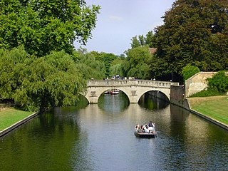
The River Cam is the main river flowing through Cambridge in eastern England. After leaving Cambridge, it flows north and east into the Great Ouse to the south of Ely at Pope's Corner. The Great Ouse connects the Cam to the North Sea at King's Lynn: The total distance from Cambridge to the sea is about 40 mi (64 km) and is navigable for punts, small boats, and rowing craft. The Great Ouse also connects to England's canal system via the Middle Level Navigations and the River Nene. In total, the Cam runs for around 69 kilometres (43 mi) from its furthest source to its confluence with the Great Ouse.
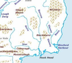
The Three Sisters are three rivers in Ireland: the River Barrow, the River Nore and the River Suir. The Suir and Nore rise in the same mountainous area in County Tipperary, near the Devil's Bit, while the Barrow rises in the Slieve Bloom Mountains in County Laois. The Nore flows into the Barrow about 17 km before the Suir and Barrow join to form an estuary called Waterford Harbour east of the city of Waterford. The rivers fan out to drain a large portion of the southern part of the island, including Counties Tipperary, Carlow, Kilkenny, Wexford and Waterford, among others.
This is a list of the extreme points of Ireland – the points that are farthest north, south, east or west in Ireland. It includes the Republic of Ireland and Northern Ireland.
Thomastown, historically known as Grennan, is a town in County Kilkenny in the province of Leinster in the south-east of Ireland. It is a market town along a stretch of the River Nore which is known for its salmon and trout, with a number of historical landmarks in the vicinity. Visitor attractions include Jerpoint Abbey, Kilfane Glen gardens, and Mount Juliet Golf Course.
The River Nore is one of the principal rivers in the South-East Region of Ireland. The 140-kilometre-long (87 mi) river drains approximately 2,530 square kilometres (977 sq mi) of Leinster and Munster, that encompasses parts of three counties. Along with the River Suir and River Barrow, it is one of the constituent rivers of the group known as the Three Sisters.
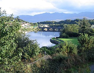
The River Laune is a river in County Kerry, Ireland, which flows from Lough Leane, one of the Lakes of Killarney, through Beaufort, past Ballymalis Castle, through the town of Killorglin, and empties into the sea, first at Castlemaine harbour beside the river Maine and then out through Dingle Bay. The Laune is well known for salmon and trout fishing.

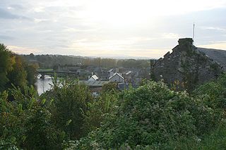
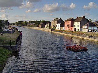
Kilmacthomas or Kilmactomas, often referred to locally as "Kilmac", is a town on the River Mahon in County Waterford, Ireland. It lies on the R677, a road north of the N25 national primary road from Dungarvan to Waterford.
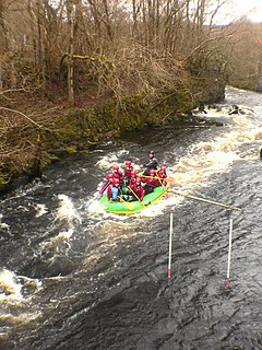
Canolfan Tryweryn is the National White Water Centre for Wales, and is based near Bala in North Wales. It developed the first commercial white water rafting operation in the UK in 1986, and since then has grown to become the largest and one of the most well-known rafting organisations in the UK. The centre is home to paddlesport National Governing Body Canoe Wales. The National White Water Centre is ideal for canoeing, kayaking, play-boating and coached groups who sometimes run BCU/CW Star Awards.

Ballylaneen is a small village and townland in County Waterford, Ireland, approximately halfway between the villages of Kilmacthomas and Bunmahon on a hill by the River Mahon.

The Kinnickinnic River, called the Kinni for short, is a 22-mile-long (35 km) river in northwestern Wisconsin in the United States. The Kinni is a cold water fishery supporting a population of native Brook Trout and naturally reproducing Brown Trout.

Flahavan's is an Irish milling company which has been run by the Flahavan family since about 1785 located in the village of Kilmacthomas. The current chairman is John Flahavan.

The Comeragh Mountains are a glaciated mountain range situated in southeast Ireland in County Waterford. They are located between the town of Dungarvan and stretch inland to the town of Clonmel on the County Tipperary border and the villages of Kilrossanty and Kilmacthomas in County Waterford.
Mahon Bridge, also spelled Mahonbridge, is a village in the parish of Kilrossanty in mid County Waterford, Ireland, located on the R676 road between Carrick on Suir and Dungarvan. The nearest town is Kilmacthomas.
The River Blackwater, also called the Enfield Blackwater, or Kildare Blackwater is a river that flows through the counties of Kildare and Meath in Ireland. It is a tributary of the River Boyne which flows into the Irish Sea at Drogheda.

The Colligan River is a fast-flowing river in Ireland, flowing through County Waterford. It is reputed to be one of the fastest in Europe.

The Waterford Greenway, also known locally as the Déise Greenway, is a route on a former railway track in County Waterford, Ireland, used for cycling and hiking. It opened in March 2017, on what was originally the Mallow/Waterford railway line, and forms part of EuroVelo 1 route.
{{cite web}}: CS1 maint: archived copy as title (link)