
The River Shannon is the major river on the island of Ireland, and at 360 km in length, is the longest river in the British Isles. It drains the Shannon River Basin, which has an area of 16,900 km2 (6,525 sq mi), – approximately one fifth of the area of Ireland.
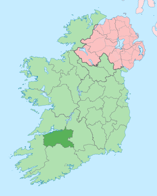
County Limerick is a western county in Ireland. It is in the province of Munster and is located in the Mid-West which comprises part of the Southern Region. It is named after the city of Limerick. Limerick City and County Council is the local council for the county. The county's population at the 2022 census was 209,536 of whom 102,287 lived in Limerick City, the county capital.

County Tipperary is a county in Ireland. It is in the province of Munster and the Southern Region. The county is named after the town of Tipperary, and was established in the early 13th century, shortly after the Norman invasion of Ireland. It is Ireland's largest inland county and shares a border with eight counties, more than any other. The population of the county was 167,895 at the 2022 census. The largest towns are Clonmel, Nenagh and Thurles.

Shown here are all the major rivers and tributaries of Ireland with their lengths. Starting with the Northern Ireland rivers, and going in a clockwise direction, the rivers are listed in regard to their entry into the different seas: the Irish Sea, the Celtic Sea and the Atlantic Ocean. Also shown are two tables. Table 1 shows the longest rivers in Ireland with their lengths, the counties they flow through, and their catchment areas. Table 2 shows the largest rivers in Ireland in cubic metres per second.

Askeaton is a town in County Limerick, Ireland. The town is built on the banks of the River Deel which flows into the Shannon Estuary 3 km to the north. Askeaton is on the N69 road between Limerick and Tralee; it is 25 km west of Limerick and 8 km north of Rathkeale. The town is in a townland and civil parish of the same name.

Rathkeale is a town in west County Limerick, in Ireland. It is 30 km (18 mi) southwest of Limerick city on the N21 road to Tralee, County Kerry, and lies on the River Deel. The town is in a townland and civil parish of the same name.

Newcastle West or simply Newcastle is a town in west County Limerick, Ireland. It is the largest town in the county, excluding Limerick city. It is also the county town, and sits on the River Arra which flows into the River Deel. Newcastle West is in the middle of a great bowl-shaped valley in West Limerick, known one time as the valley of the Wild Boar, apparently due to the abundance of this animal here when the area was thickly wooded. The crest of the town carries the image of a wild boar. The town is partly in the civil parish of Newcastle.

The River Slaney is a large river in the southeast of Ireland. It rises on Lugnaquilla Mountain in the western Wicklow Mountains and flows west and then south through counties Wicklow, Carlow and Wexford for 117.5 km (73 mi), before entering St George's Channel in the Irish Sea at Wexford town. The estuary of the Slaney is wide and shallow and is known as Wexford Harbour. The catchment area of the River Slaney is 1,762 km2. The long-term average flow rate of the River Slaney is 37.4m3/s
The River Feale rises near Rockchapel in the Mullaghareirk Mountains of County Cork in the southwest of Ireland and flows northwestwards for 75 kilometres through Abbeyfeale in County Limerick and Listowel in County Kerry before finally emptying into Cashen Bay, a wide estuary north of Ballyduff. Then it flows out through the Shannon's estuary and joins with the Atlantic Ocean with a flow rate of 34.6 m2/s. The river, along with its tributaries, combine to add to over 160 km of waterways. For the final 10 km stretch it is known as the Cashen River. The river contains a large salmon and sea trout population.

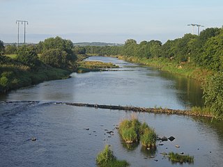
The River Maigue rises in the Milford area of north County Cork, Ireland. The River Maigue is 38.75 miles (62.36 km) long. It drains an area of 1,000 square kilometres (390 sq mi)

The N21 road is a national primary road in Ireland. The route runs from the M20 outside Limerick to Tralee with connecting roads to other parts of County Kerry. It is 84.37 km (52.43 mi) in length. It runs through the towns of Abbeyfeale, Newcastle West, Adare and the village of Templeglantine. Prior to October 2010 the N21 also ran through the town of Castleisland. The town has since been bypassed. Rathkeale was also bypassed in 1992.

The Shannon Estuary in Ireland is a large estuary where the River Shannon flows into the Atlantic Ocean. The estuary has Limerick City at its head and its seaward limits are marked by Loop Head to the north and Kerry Head to the south. The estuary defines the main boundary between County Kerry/County Limerick to the south and County Clare to the north.

The River Fergus is a river within the Shannon River Basin which flows in County Clare, Ireland. The river begins at Lough Fergus in north Clare and flows into the Shannon Estuary. The source is at Lough Fergus in the townland of Kilmore North.

The Boyle River is a river in Ireland. Forming part of the Shannon River Basin, it flows from Lough Gara on the Sligo/Roscommon county border and thence through the town of Boyle to Lough Key. From there is continues eastwards through the village of Knockvicar to the River Shannon at Lough Drumharlow, near Carrick-on-Shannon. The length of the Boyle River is 64.4 km (40 mi). The area of its basin is 725 km2.

Clarina is a village in County Limerick in the province of Munster, Ireland. It lies between Mungret and Kildimo on the N69 road 8 km (5 mi) west of the centre of Limerick city close to the River Maigue. The Maigue is a tributary of the River Shannon and enters the Shannon estuary between Limerick city and the mouth of the Deel river, Askeaton, county Limerick.

The Shannon River Basin consists of the area containing Ireland's longest river, the River Shannon, and all of its tributaries and lakes. The official Ordnance Survey Ireland length of the Shannon from its Shannon Pot source is 224 miles (360 km) made up of 63.5 miles (102.2 km) tidal water flow and 160.5 miles (258.3 km) freshwater flow.

The Limerick–Tralee line, also known as the North Kerry line, is a former railway line from Limerick railway station to Tralee railway station in Ireland. It also has branch lines to Foynes and Fenit. Much of the line today has now been converted into a greenway, the Great Southern Trail.

The River Funshion is a river in Munster, Ireland, a tributary of the Munster Blackwater.
The River Camoge or Camogue is a river in Munster, Ireland, a tributary of the Maigue, which is itself a Shannon tributary.

