
The Nenagh River (Irish: An Ghaothach) [1] rises in the Silvermine Mountains in County Tipperary, Ireland. It flows east of Nenagh and into Lough Derg just north of Dromineer.
The Nenagh River (Irish: An Ghaothach) [1] rises in the Silvermine Mountains in County Tipperary, Ireland. It flows east of Nenagh and into Lough Derg just north of Dromineer.
The river, and its tributary the Ollatrim river, is popular for angling, it holds a stock of wild salmon and trout. There are also coarse fish particularly near the mouth of the river during spawning times. Funds were allocated to the Ormonde Anglers Association to improve areas for spawning and in-stream structures improving access, fencing, protecting banks and installing a number of deflectors. [2] [3] There is 22 km of trout fishing and a further 15 km on the Ollatrim. It is classified as a rich lowland river. [4]
Slí Eala ("Way of the Swan") is a 10 km waymarked trail which follows the banks of the Nenagh River from Dromineer via Ballyartella to Scott's Bridge, on the N52 road north of Nenagh. The walk takes its name from the population of mute swans on the river. There are trailheads at Scott's Bridge and in Dromineer village. [5]
There are several bridges over the river.

Nenagh meaning “The Fair of Ormond” or simply "The Fair", is the county town and second largest town in County Tipperary in Ireland. Nenagh used to be a market town, and the site of the East Munster Ormond Fair.
Kanturk is a town in the north west of County Cork, Ireland. It is situated at the confluence of the Allua (Allow) and Dallow (Dalua) rivers, which stream further on as tributaries to the River Blackwater. It is about 50 kilometres from Cork, Blarney and Limerick, and lies just north of the main N72 road, 15 km from Mallow and about 40 km from Killarney. Kanturk is within the Cork North-West Dáil constituency.

Borrisokane is a town in County Tipperary, Ireland. It is situated at the junction of the N52 and N65 national secondary roads. At the 2016 census, it had a population of 942. The Ballyfinboy River flows through the town on its way to Lough Derg, 12 km (7 mi) to the west. It is also a civil parish in the historical barony of Ormond Lower and an Ecclesiastical parish in the Roman Catholic Diocese of Killaloe.

Shinrone is a village in County Offaly, Ireland. It lies at the junction of the R491 regional road between Nenagh and Roscrea where it is joined by the R492 to Sharavogue. According to the 2016 census, the village then had 645 inhabitants.

Portroe is a village in north County Tipperary, Ireland. The village is located on the R494 regional road, 3 km from the eastern shore of Lough Derg and 10 km west of the town of Nenagh. Portroe spans the townlands of Garrykennedy, Glencrue and Shesharoe.
Portland is a townland in the barony of Ormond Lower, County Tipperary in Ireland. It is located north-east of the Portumna bridge, in the civil parish of Lorrha.

The Little Brosna River rises near Dunkerrin, County Offaly, Ireland. It flows for 36 miles before joining the River Shannon.
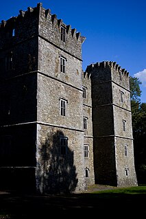
The Ballyfinboy River rises close to Moneygall in County Offaly, Ireland and flows in a generally northwesterly direction into Lough Derg at Drominagh. It forms part of the boundary between County Tipperary and County Offaly. The river flows through the towns of Cloughjordan and Borrisokane west of which it flows past Ballyfinboy Castle, a ruined tower house with a Sheela na gig in the townland of Ballyfinboy.
Derrinsallow is a townland in the historical Barony of Ormond Lower, County Tipperary, Ireland. It is located North-West of Birr on the south-west bank of the Little Brosna River within the civil parish of Dorrha. The Little Brosna River provided power to the 19th century corn mills at Derrinsallow which although now in ruins are mentioned in the National Inventory of Architectural Heritage. The mill race is a popular fishing area. A triple arched limestone bridge from the 19th century crosses the river here.

Portumna bridge lies east of the town of Portumna, in County Galway, Ireland. It is a five-span road bridge, which carries the N65 across the River Shannon to Lehinch in County Tipperary. The present bridge was designed by C. E. Stanier of London, and completed in 1911, with a central section resting on Hayes's Island which divides the river into two channels. The structure of the main bridge, consisting of steel girders supported by concrete filled cast iron cylinders, and the pivoting swing bridge over the navigation channel, are of technical and engineering interest. The house on Hayes Island, accessed from the bridge, was the bridge operator's house and pre-dates the present bridge. The opening section was replaced in October 2008.
Ballinderry is a village and a townland in the historical Barony of Ormond Lower, County Tipperary, Ireland. It is located between Terryglass and Nenagh where the R493 road crosses the Ballyfinboy River.

Garrykennedy is a townland, settlement and harbour in the historical Barony of Owney and Arra, County Tipperary, Ireland. It is located on the eastern shore of Lough Derg, 2 km north of Portroe
Ballyartella is a townland in the historical Barony of Ormond Lower, County Tipperary, Ireland. It is located between the Nenagh River and the R495 road which runs from Nenagh to Dromineer.
Sopwell is a townland in the historical Barony of Ormond Lower, County Tipperary, Ireland.
The Ollatrim River rises in County Tipperary, Ireland. It joins the Nenagh River east of Nenagh town and together they flow into Lough Derg north of Dromineer. A short section of the river forms the border between County Offaly and County Tipperary. The river flows through the Townland of Ollatrim.
Ollatrim is a townland in the historical Barony of Ormond Upper, County Tipperary, Ireland. It is located in north Tipperary between the settlements of Toomevara and Moneygall. The Ollatrim River flows through Ollatrim and the R445 road passes over the river within the townland.

Killaloe Bridge is a road bridge over the River Shannon between Ballina in County Tipperary and Killaloe, County Clare in Ireland. Built on the site of an earlier structure, the eighteenth-century bridge has thirteen arches and includes a lifting section that was added in 1929. The bridge has only one vehicular lane, with traffic lights to control vehicle movement. The bridge is a protected structure, listed on the Record of Protected Structures by both Clare County Council (#210) and Tipperary County Council (#S672).

The River Ara is a river in County Tipperary, Ireland.

Tyone is a townland in the historical Barony of Ormond Upper, County Tipperary, Ireland.
Ashleypark is a townland in the historical Barony of Ormond Upper, County Tipperary, Ireland.
| Wikimedia Commons has media related to Nenagh River . |
{{cite web}}: CS1 maint: archived copy as title (link)