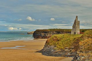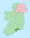
County Waterford is a county in Ireland. It is in the province of Munster and is part of the Southern Region. It is named after the city of Waterford. Waterford City and County Council is the local authority for the county. The population of the county at large, including the city, was 127,363 according to the 2022 census. The county is based on the historic Gaelic territory of the Déise. There is an Irish-speaking area, Gaeltacht na nDéise, in the southwest of the county.

Ballymahon on the River Inny is a town in the southern part of County Longford, Ireland. It is located at the junction of the N55 National secondary road and the R392 regional road.

Castlepollard is a village in north County Westmeath, Republic of Ireland. It lies west of Lough Lene and northeast of Lough Derravaragh and Mullingar.

Enniscrone – also spelt Inniscrone and officially named Inishcrone – is a small seaside town in County Sligo, Ireland. Its sandy beach, tourist campsite, and golf course all attract visitors. As of the 2022 census, the town had a population of 1,291 people.

Ballybunion or Ballybunnion is a coastal town and seaside resort in County Kerry, Ireland, on the Wild Atlantic Way, 15 km (9 mi) from the town of Listowel. As of the 2022 census, Ballybunion had a population of 1,618.

Ballintra is a village in the parish of Drumholm in the south of County Donegal, Ireland, just off the N15 road between Donegal town and Ballyshannon. Ballintra lies on the northern bank of the Blackwater river. The river rises in the hills that lie inland from the town, and flows through a number of small lakes before spilling over a small waterfall in a gorge behind the village.

Stradone is a village located in County Cavan, Ireland. It is situated in the civil parish of Laragh six miles from Cavan, near the N3 road between Cavan and Virginia. Stradone is classified as a 'small village' in the Cavan County Council Development Plan 2014-2020.

Kilmacthomas or Kilmactomas, often referred to locally as "Kilmac", is a town on the River Mahon in County Waterford, Ireland. It lies on the R677, a road north of the N25 national primary road from Dungarvan to Waterford.

River Mahon flows from the Comeragh Mountains in County Waterford, Ireland.

Ballyduff is a village in County Waterford, Ireland. It is also a parish in the Roman Catholic Diocese of Waterford and Lismore.

Ahascragh is a village in east County Galway, Ireland. It is located 11 km (7 mi) north-west of Ballinasloe on the Ahascragh/Bunowen River, a tributary of the River Suck. The R358 regional road passes through the village. As of the 2022 census, it had a population of 186 people.

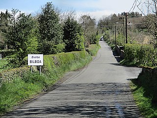
Bilboa is a settlement located on the boundaries of counties Carlow, Laois and Kilkenny in Ireland. A bridge, a short distance from the village and built c. 1800, is known as the 'Three Counties Bridge'.

Drumone is a small village and townland in western County Meath, Ireland.

Street or Streete is a village and parish in County Westmeath, Ireland. It lies on the regional road between Lismacaffery and Rathowen. Its Irish name was historically anglicised as Straid or Strade.

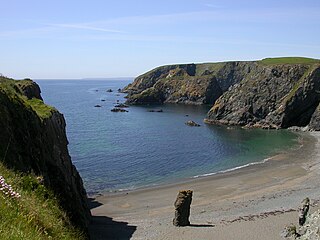
The Copper Coast Geopark is a designated area comprising a stretch of the southern coast of Ireland in County Waterford, extending for some 25 km of coastline from Kilfarrasy in the east to Stradbally in the west. It was the first geopark to be designated in the country.

Dunkerrin is a small village in County Offaly, Ireland, just south of Roscrea and near the County Tipperary border. It is on the R445 road which was once the main road from Dublin to Limerick. Dunkerrin is now bypassed by the M7, the nearest access is junction 23 at Moneygall.
John Benjamin Keane was an Irish architect of the 19th century. (d.1859). He was engineer on the River Suir navigation.

Ladysbridge, known for census purposes as Knockglass, is a village in County Cork, Ireland. As of the 2016 census, the area had a population of 658 people.

Curry is a village and townland in County Sligo, Ireland. The townland has an area of approximately 3.9 square kilometres (1.5 sq mi), and had a population of 148 people as of the 2011 census.


