
The River Shannon ) is the major river on the island of Ireland, and at 360 km in length, is the longest river in the British Isles. It drains the Shannon River Basin, which has an area of 16,900 km2 (6,525 sq mi), – approximately one fifth of the area of Ireland.

Lough Corrib is a lake in the west of Ireland. The River Corrib or Galway River connects the lake to the sea at Galway. It is the largest lake within the Republic of Ireland and the second largest on the island of Ireland. It covers 176 km² and lies mostly in County Galway with a small area of its northeast corner in County Mayo.

The River Corrib in the west of Ireland flows from Lough Corrib through Galway to Galway Bay. The river is among the shortest in Europe, with only a length of six kilometres from the lough to the Atlantic. It is popular with local whitewater kayakers as well as several rowing clubs and pleasure craft. The depth of this river reaches up to 94 feet.

Shown here are all the major rivers and tributaries of Ireland with their lengths. Starting with the Northern Ireland rivers, and going in a clockwise direction, the rivers are listed in regard to their entry into the different seas: the Irish Sea, the Celtic Sea and the Atlantic Ocean. Also shown are two tables. Table 1 shows the longest rivers in Ireland with their lengths, the counties they flow through, and their catchment areas. Table 2 shows the largest rivers in Ireland in cubic metres per second.

The Six Mile Water is a river in southern County Antrim, Northern Ireland. It is an indirect tributary of the River Bann, via Lough Neagh.
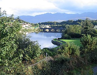
The River Laune is a river in County Kerry, Ireland, which flows from Lough Leane, one of the Lakes of Killarney, through Beaufort, past Ballymalis Castle, through the town of Killorglin, and empties into the sea, first at Castlemaine harbour beside the river Maine and then out through Dingle Bay. The Laune is well known for salmon and trout fishing.

The River Erne in the northwest of the island of Ireland, is the second-longest river in Ulster, flowing through Northern Ireland and the Republic of Ireland, and forming part of their border.
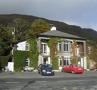
An Mám is a small Gaeltacht village and its surrounding lands in Connemara, County Galway, Ireland.

The River Blackwater or Ulster Blackwater is a river mainly in County Armagh and County Tyrone, Northern Ireland. Its source is to the north of Fivemiletown, County Tyrone. The river divides County Armagh from County Tyrone and also divides County Tyrone from County Monaghan, making it part of the border between the United Kingdom and the Republic of Ireland.

Cregg Mill is a converted 18th-century watermill in the townland of Cregg, near Corrandulla village in County Galway, Ireland, approximately 9 miles (14 km) from Galway City. The mill serviced the local area, including neighbouring Cregg Castle, and served as a feeding centre for the poor of Corrandulla during the Great Famine. An advertisement in the early twentieth century shows that wheat, rye, oats, and barley were kiln-dried and ground there.
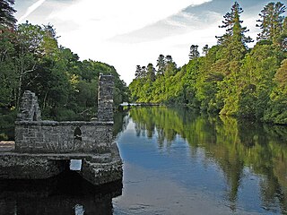
The River Cong is a short river of moderate flow in Ireland, primarily in County Mayo but also touching County Galway.
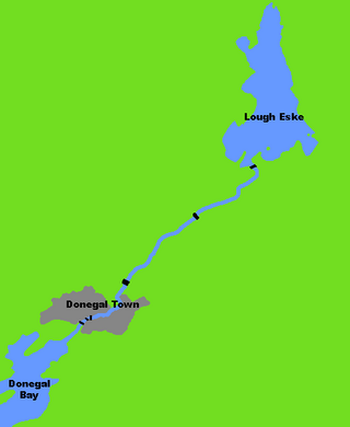
The River Eske is a river in County Donegal, Ireland. It begins at Lough Eske in the southeast of the county before flowing mainly westwards to the town of Donegal and into the Atlantic Ocean via Donegal Bay.

The River Roe is a river located in County Londonderry, Northern Ireland. It flows north from Glenshane in the Sperrin Mountains to Lough Foyle, via the settlements of Dungiven, Burnfoot, Limavady and Myroe. The River Roe's length is 34.25 miles (55.12 km)

The River Annalee is a river in County Cavan, Ireland.

The River Fane is a river flowing from County Monaghan to Dundalk Bay in County Louth, Ireland.
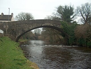
The River Moyola or Moyola River stretches for approximately 27 miles from the Sperrin Mountains to Lough Neagh. The Moyola starts a small river for the first few miles of its length and proceeds to expand to a medium-sized river and then to a large river for its last couple of miles before Lough Neagh. In ancient times, the River Moyola was known as the 'Bior', and served as the border between the Airgiallan kingdoms of Fir Li and Ui Tuirtri.
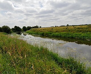
The Figile River is a river in eastern Ireland.

The Glenamoy River is a river in north County Mayo, in the northwest of Ireland. It contains sea trout and salmon.


