The Irish grid reference system is a system of geographic grid references used for paper mapping in Ireland. Any location in Ireland can be described in terms of its distance from the origin, which lies off the southwest coast. The Irish grid partially overlaps the British grid, and uses a similar co-ordinate system but with a meridian more suited to its westerly location.
Ordnance Survey of Northern Ireland (OSNI) is the official mapping agency of Northern Ireland. The agency ceased to exist separately on 1 April 2008 when it became part of Land and Property Services, an executive agency of the Northern Ireland Department of Finance and Personnel, along with the Rate Collection Agency, the Valuation and Lands Agency, and the Land Registry.

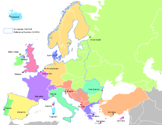
An ordnance datum (OD) is a vertical datum used by an ordnance survey as the basis for deriving altitudes on maps. A spot height may be expressed as above ordnance datum (AOD). Usually mean sea level (MSL) at a particular place is used for the datum.
The Department of Housing, Local Government and Heritage is a department of the Government of Ireland. It is led by the Minister for Housing, Local Government and Heritage.

The National Concert Hall (NCH) is a national cultural institution, sometimes described as "the home of music in Ireland". It comprises the actual concert hall operation, which in various chambers hosts over 1,000 events each year, as well as Ireland's National Symphony Orchestra and three choirs: the National Symphony Chorus, Cór na nÓg and Cor Linn.

The Down Survey was a cadastral survey of Ireland, carried out by English scientist, William Petty, in 1655 and 1656. It was created to provide for precise re-allocation of land confiscated from the Irish.
Geological Survey Ireland or Geological Survey of Ireland, founded in 1845, is the National Earth Science agency of Ireland.

Irish Transverse Mercator (ITM) is the geographic coordinate system for Ireland. It was implemented jointly by the Ordnance Survey Ireland (OSi) and the Ordnance Survey of Northern Ireland (OSNI) in 2001. The name is derived from the Transverse Mercator projection it uses and the fact that it is optimised for the island of Ireland.

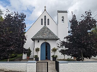
Kilteel is the name of a village, townland and civil parish located in the barony of South Salt, County Kildare, Ireland. The townland of Kilteel Upper contains the remains of a church with a decorated Romanesque chancel arch, the ruins of a 13th-century preceptory of the Knights Hospitaller and a well-preserved 15th-century tower house. The historic settlement is located on the southwest corner of the English Pale and served an important function as a border fortress during the medieval period.

The Ordnance Survey (OS) is the national mapping agency for Great Britain. The agency's name indicates its original military purpose, which was to map Scotland in the wake of the Jacobite rising of 1745. There was also a more general and nationwide need in light of the potential threat of invasion during the Napoleonic Wars. Since 1 April 2015, the Ordnance Survey has operated as Ordnance Survey Ltd, a government-owned company, 100% in public ownership. The Ordnance Survey Board remains accountable to the Secretary of State for Science, Innovation and Technology. It was also a member of the Public Data Group.
The Ordnance Memoir of Ireland was a projected 1830s topography of Ireland to be published alongside the maps of the Ordnance Survey of Ireland using materials gathered by surveyors as they traversed the country. The project was cancelled in 1840 as too expensive and beyond the survey's original scope. Material gathered before the cancellation mostly covers Ulster. Much was eventually published in the later twentieth century. The memoirs are a useful primary source for local history and genealogy of the period shortly before the Great Famine.

Galmoy is a barony in the north western part of County Kilkenny, Ireland. It is one of 12 baronies in County Kilkenny. The size of the barony is 162.7 square kilometres (62.8 sq mi). There are 12 civil parishes in Galmoy. While it is named after the village of Galmoy, today the chief town of the barony is Urlingford. Galmoy barony lies at the north-western corner of the county between Fassadinin to the east, and Crannagh to the south. It is surrounded on two sides by counties Tipperary to the west and Laois to the north. The M8 Dublin/Cork motorway bisects the barony. It is situated 121 kilometres (75 mi) from Dublin city and 131 kilometres (81 mi) from Cork city. Galmoy is currently administered by Kilkenny County Council. The barony was part of in the historic kingdom of Osraige (Ossory).

Truskmore is a mountain with a height of 647 metres (2,123 ft) on the border of County Sligo and County Leitrim in Ireland. It is the highest summit in the Dartry Mountains and the highest in Sligo. It is in the middle of a plateau whose edges are marked by high cliffs, including Benbulbin (526m), Benwiskin (514m), Slievemore (597m) and Kings Mountain (462m). The top of Truskmore lies in County Sligo, a short distance from the border with County Leitrim; however, the mountain itself is in both counties.

Civil parishes are units of territory in the island of Ireland that have their origins in old Gaelic territorial divisions. They were adopted by the Anglo-Norman Lordship of Ireland and then by the Elizabethan Kingdom of Ireland, and were formalised as land divisions at the time of the Plantations of Ireland. They no longer correspond to the boundaries of Roman Catholic or Church of Ireland parishes, which are generally larger. Their use as administrative units was gradually replaced by Poor Law Divisions in the 19th century, although they were not formally abolished. Today they are still sometimes used for legal purposes, such as to locate property in deeds of property registered between 1833 and 1946.

The Cartography of Dublin is the history of surveying and creation of maps of the city of Dublin in Ireland. The following is a list of notable historical maps of Dublin City and County Dublin.

Kilbride, or Manor Kilbride, is a village, civil parish and electoral division in County Wicklow, Ireland, located at the western edge of the Wicklow Mountains in the barony of Talbotstown Lower.
St. Doologe's, also St. Doologue's, and formerly St. Tullogue's, or St. Euleck's, is a civil parish in the centre of Wexford town in Ireland.

The barony of Callan is a barony in the west of County Kilkenny, Ireland. The barony is 22.9 square kilometres (8.8 sq mi) in size. It is one of 12 baronies in County Kilkenny. Unusually for a barony, it contains only two civil parishes which together comprise 65 townlands. The chief town is Callan. The barony is bordered by the baronies of Shillelogher to the north and by Kells to the south. The N76 road bisects the barony. Notable features include Callan Motte and Callan Augustinian Friary.

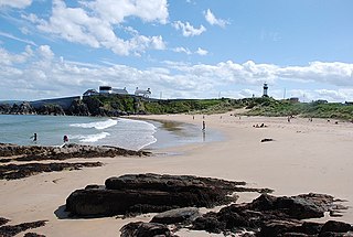
Shrove is a coastal hamlet and townland in Inishowen in the north of County Donegal in the north of Ulster, the northern province in Ireland. The hamlet is located a short distance to the north of Greencastle in the north-east of Inishowen, a peninsula on the north coast of Ireland. The name of both the hamlet and the townland is also sometimes written as Shroove, and is sometimes written as Stroove by some government bodies.

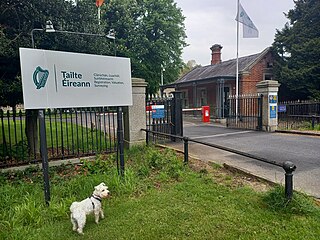
Tailte Éireann is a state agency in Ireland responsible for property registrations, property valuation and national mapping services. It was established on 1 March 2023 from a merger of the Property Registration Authority (PRA), the Valuation Office (VO) and Ordnance Survey Ireland (OSI).


