Products
The vast majority of OSNI's income came from the licensing of its digital mapping data, which, because of the long history of mapping in Ireland (see Ordnance Survey) is amongst the most detailed and comprehensive in the world. Digital products range from the Large Scale (1:1250 urban and 1:2500 rural) vector database, 1:10,000 raster mapping derived automatically from the L/S vector, 1:50,000 and 1:250,00 vectors, 1;10,000 orthophotography, 1:25,000 leisure maps, the 1:50,000 raster series, 1:250,000 Ireland North raster, street maps of the main conurbations, as well as paper derivatives of all the raster products.
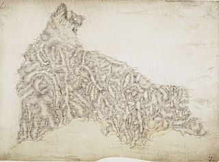
In 2005 OSNI began, with the Public Records Office of Northern Ireland (PRONI), to digitise the complete set of historical maps dating back to the 1830s. (The earliest comprehensive and accurately surveyed large scale mapping in the world). These are being georectified to match modern mapping projections and are being annotated with points of interest from PRONI's archives.
OSNI also maintained the UK's only common address database, Pointer, which cross matches and validates the address data from the Royal Mail, Valuation and Lands Agency, OSNI and local authorities, and georeferences each address, as well as giving it a unique identifier. This allows spatial interrogation by customers of the >800,000 addresses in NI using computerised Geographic Information Systems (GIS) combined with digital mapping and the customer's own data.
Supporting the interconnectivity of Geographical Information (GI) for the benefit of the Northern Ireland economy, society and administration was OSNI's primary purpose. In support of this, OSNI also provides the secretariat for Mosaic, the GI strategy for Northern Ireland, which is the first such strategy to be implemented in the UK. In support of Mosaic, OSNI is currently (2006) building a GeoHub for the region, which will be able to host and connect to spatial data from multiple sources, permit a metadata (data about the data) search and, using thin client browser applications, via the Internet, permit multiple data layers to be interrogated, connected, analysed, licensed, downloaded, uploaded and updated.
Starting in Spring 2006, OSNI's own full product range is available via a map-enabled e-commerce website at www.osni.gov.uk OSNI's surveying technology is based on both photogrammetry and ground survey using total station electronic theodolites in combination with pen (tablet) computers, so that the data is updated directly into the digital format. The photogrammetry (using flight-derived stereo imagery at high resolution) is also used to maintain height models of the topography (Digital Terrain Model or DTM). Computer software permits the draping of aerial photography and/or mapping over such models for the purposes of fly-through or drive-through 3D visualisations. OSNI's Geodesy section maintains the positional reference system to millimetre precision and OSNI's ground stations allow high accuracy use of the GPS system.

A geographic information system (GIS) consists of integrated computer hardware and software that store, manage, analyze, edit, output, and visualize geographic data. Much of this often happens within a spatial database, however, this is not essential to meet the definition of a GIS. In a broader sense, one may consider such a system also to include human users and support staff, procedures and workflows, the body of knowledge of relevant concepts and methods, and institutional organizations.

In modern mapping, a topographic map or topographic sheet is a type of map characterized by large-scale detail and quantitative representation of relief features, usually using contour lines, but historically using a variety of methods. Traditional definitions require a topographic map to show both natural and artificial features. A topographic survey is typically based upon a systematic observation and published as a map series, made up of two or more map sheets that combine to form the whole map. A topographic map series uses a common specification that includes the range of cartographic symbols employed, as well as a standard geodetic framework that defines the map projection, coordinate system, ellipsoid and geodetic datum. Official topographic maps also adopt a national grid referencing system.

A digital elevation model (DEM) or digital surface model (DSM) is a 3D computer graphics representation of elevation data to represent terrain or overlaying objects, commonly of a planet, moon, or asteroid. A "global DEM" refers to a discrete global grid. DEMs are used often in geographic information systems (GIS), and are the most common basis for digitally produced relief maps. A digital terrain model (DTM) represents specifically the ground surface while DEM and DSM may represent tree top canopy or building roofs.

Topography is the study of the forms and features of land surfaces. The topography of an area may refer to the land forms and features themselves, or a description or depiction in maps.

Esri is an American multinational geographic information system (GIS) software company. It is best known for its ArcGIS products. With a 40% market share, Esri is the world's leading supplier of GIS software, web GIS and geodatabase management applications.
A GIS file format is a standard for encoding geographical information into a computer file, as a specialized type of file format for use in geographic information systems (GIS) and other geospatial applications. Since the 1970s, dozens of formats have been created based on various data models for various purposes. They have been created by government mapping agencies, GIS software vendors, standards bodies such as the Open Geospatial Consortium, informal user communities, and even individual developers.

The Irish grid reference system is a system of geographic grid references used for paper mapping in Ireland. The Irish grid partially overlaps the British grid, and uses a similar co-ordinate system but with a meridian more suited to its westerly location.

Ordnance Survey Ireland was the national mapping agency of Ireland. It was established on 4 March 2002 as a body corporate. It was the successor to the former Ordnance Survey of Ireland. It and the Ordnance Survey of Northern Ireland (OSNI) were themselves the successors to the Irish operations of the British Ordnance Survey. OSI was part of the Irish public service. OSI was headquartered at Mountjoy House in the Phoenix Park in Dublin, which had previously been the headquarters of the British Ordnance Survey in Ireland until 1922.
The Public Record Office of Northern Ireland (PRONI) is situated in Belfast, Northern Ireland. It is a division within the Engaged Communities Group of the Department for Communities (DfC).
Address Point is a mapping/GIS data product supplied by Great Britain's national mapping agency, Ordnance Survey. It is based on the UK’s postal mail organisation, the Royal Mail, list of postal addresses, Postcode Address File (PAF). The most significant difference between Royal Mail list and Address Point is that Address Point includes the geographic coordinates of each postal address. This enables users to map the individual addresses.

The Vector Map (VMAP), also called Vector Smart Map, is a vector-based collection of geographic information system (GIS) data about Earth at various levels of detail. Level 0 (low resolution) coverage is global and entirely in the public domain. Level 1 (global coverage at medium resolution) is only partly in the public domain.
The River Tall is a small river in County Armagh, Northern Ireland which joins the River Blackwater just south of Verner’s Bridge. It is navigable for 4 km by dinghy or canoe.

The Geospatial Data Abstraction Library (GDAL) is a computer software library for reading and writing raster and vector geospatial data formats, and is released under the permissive X/MIT style free software license by the Open Source Geospatial Foundation. As a library, it presents a single abstract data model to the calling application for all supported formats. It may also be built with a variety of useful command line interface utilities for data translation and processing. Projections and transformations are supported by the PROJ library.
SOCET SET is a software application that performs functions related to photogrammetry. It is developed and published by BAE Systems. SOCET SET was among the first commercial digital photogrammetry software programs. Prior to the development of digital solutions, photogrammetry programs were primarily analog or custom systems built for government agencies.
Integrated Land and Water Information System (ILWIS) is a geographic information system (GIS) and remote sensing software for both vector and raster processing. Its features include digitizing, editing, analysis and display of data, and production of quality maps. ILWIS was initially developed and distributed by ITC Enschede in the Netherlands for use by its researchers and students. Since 1 July 2007, it has been released as free software under the terms of the GPL-2.0-only license. Having been used by many students, teachers and researchers for more than two decades, ILWIS is one of the most user-friendly integrated vector and raster software programmes currently available. ILWIS has some very powerful raster analysis modules, a high-precision and flexible vector and point digitizing module, a variety of very practical tools, as well as a great variety of user guides and training modules all available for downloading. The current version is ILWIS 3.8.6. Similar to the GRASS GIS in many respects, ILWIS is currently available natively only on Microsoft Windows. However, a Linux Wine manual has been released.

Irish Transverse Mercator (ITM) is the geographic coordinate system for Ireland. It was implemented jointly by the Ordnance Survey Ireland (OSi) and the Ordnance Survey of Northern Ireland (OSNI) in 2001. The name is derived from the Transverse Mercator projection it uses and the fact that it is optimised for the island of Ireland.

Ordnance Survey (OS) is the national mapping agency for Great Britain. The agency's name indicates its original military purpose, which was to map Scotland in the wake of the Jacobite rising of 1745. There was also a more general and nationwide need in light of the potential threat of invasion during the Napoleonic Wars. Since 1 April 2015, Ordnance Survey has operated as Ordnance Survey Ltd, a government-owned company, 100% in public ownership. The Ordnance Survey Board remains accountable to the Secretary of State for Science, Innovation and Technology. It was also a member of the Public Data Group.

A national mapping agency is an organisation, usually publicly owned, that produces topographic maps and geographic information of a country. Some national mapping agencies also deal with cadastral matters.
The Ordnance Survey International or Ordnance Survey Overseas Directorate its predecessors built an archive of air photography, map and survey records for the United Kingdom from 1946 to 1999. The Ordnance Survey International Collection held mapping records that were acquired outside the UK.

Digimap is a web mapping and online data delivery service developed by the EDINA national data centre for UK academia. It offers a range of on-line mapping and data download facilities which provide maps and spatial data from Ordnance Survey, British Geological Survey, Landmark Information Group and OceanWise Ltd Ltd.,, Getmapping Ltd, the Environment Agency, OpenStreetMap, CollinsBartholomew Ltd, and various other sources.


