List of rivers of Italy

Last updated

Location of some among the main Italian rivers Italy main rivers location.jpg
Location of some among the main Italian rivers

This is a list of rivers which are at least partially located in Italy. They are organized according to the body of water they drain into, with the exceptions of Sicily and Sardinia, which are listed separately. At the bottom, all of the rivers are also listed alphabetically.

Contents

Italian rivers are generally shorter than those of other European regions because Italy is partly a peninsula along which the Apennine chain rises, dividing the waters into two opposite sides. The longest Italian river is the Po, which flows for 652 km (405 mi) along the Po Valley.

Rivers in Italy total about 1,200, [1] and give rise, compared to other European countries, to a large number of marine mouths. This is due to the relative abundance of rain events in Italy, and to the presence of the Alpine chain rich in snowfields and glaciers in the northern part of the country, in the presence of the Apennines in the center-south and in the coastal extension of Italy.

Characteristics of Italian rivers

Flamingos in the delta of the Po river Decollo - panoramio.jpg
Flamingos in the delta of the Po river

List of rivers in Italy over 150 km (93 mi)

Rivers of Italy over 150 km (93 mi) in length
RiverLengthRegions crossedType
Po 652 km (405 mi) Piedmont, Lombardy, Emilia-Romagna, Veneto Alpine
Adige 410 km (250 mi) Trentino-Alto Adige/Südtirol, Veneto Alpine
Tiber 405 km (252 mi) Emilia-Romagna, Tuscany, Umbria, Lazio Apennine
Adda 313 km (194 mi) Lombardy Alpine
Oglio 280 km (170 mi) Lombardy Alpine
Tanaro 276 km (171 mi) Piedmont, Liguria Alpine
Ticino 248 km (154 mi) Switzerland, Piedmont, Lombardy Alpine
Arno 241 km (150 mi) Tuscany Apennine
Piave 231 km (144 mi) Friuli-Venezia Giulia, Veneto Alpine
10º Reno 212 km (132 mi) Tuscany, Emilia-Romagna Apennine
11º Sarca-Mincio 203 km (126 mi) Trentino-Alto Adige/Südtirol, Veneto, Lombardy Alpine
12º Volturno 175 km (109 mi) Molise, Campania Apennine
13º Brenta 174 km (108 mi) Trentino-Alto Adige/Südtirol, Veneto Alpine
14º Secchia 172 km (107 mi) Emilia-Romagna, Lombardy Apennine
15º Tagliamento 170 km (110 mi) Friuli-Venezia Giulia, Veneto Alpine
16º Dora Baltea 168 km (104 mi) Aosta Valley, Piedmont Alpine
17º Ombrone 160 km (99 mi) Tuscany Apennine
18º Chiese 160 km (99 mi) Trentino-Alto Adige/Südtirol, Lombardy Alpine
19º Liri-Garigliano 158 km (98 mi) Abruzzo, Lazio, Campania Apennine
20º Bormida 153 km (95 mi) Liguria, Piedmont Alpine
21º Aterno-Pescara 152 km (94 mi) Abruzzo Apennine
22º Tirso 152 km (94 mi) Sardinia Sardinian

List of Italian rivers above 50 m3/s (1,800 cu ft/s)

Rivers of Italy above 50 m3/s (1,800 cu ft/s) of average flow at the mouth
RiverFlow at the mouthRegions crossedType
Po 1,540 m3/s (54,000 cu ft/s) Piedmont, Lombardy, Emilia-Romagna, Veneto Alpine
Ticino 350 m3/s (12,000 cu ft/s) Switzerland, Piedmont, Lombardy Alpine
Tiber 324 m3/s (11,400 cu ft/s) Emilia-Romagna, Tuscany, Umbria, Lazio Apennine
Adige 235 m3/s (8,300 cu ft/s) Trentino-Alto Adige/Südtirol, Veneto Alpine
Adda 187 m3/s (6,600 cu ft/s) Lombardy Alpine
Isonzo 170 m3/s (6,000 cu ft/s) Slovenia, Friuli-Venezia Giulia Alpine
Nera 160 m3/s (5,700 cu ft/s) Marche, Umbria, Lazio Apennine
Oglio 137 m3/s (4,800 cu ft/s) Lombardy Alpine
Piave 137 m3/s (4,800 cu ft/s) Veneto, Friuli-Venezia Giulia Alpine
10º Liri-Garigliano 120 m3/s (4,200 cu ft/s) Abruzzo, Lazio Apennine
11º Tanaro 116 m3/s (4,100 cu ft/s) Liguria, Piedmont Alpine
12º Arno 110 m3/s (3,900 cu ft/s) Tuscany Apennine
13º Dora Baltea 96 m3/s (3,400 cu ft/s) Aosta Valley, Piedmont Alpine
14º Reno 95 m3/s (3,400 cu ft/s) Emilia-Romagna Apennine
15º Brenta 93 m3/s (3,300 cu ft/s) Trentino-Alto Adige/Südtirol, Veneto Alpine
16º Livenza 85 m3/s (3,000 cu ft/s) Friuli-Venezia Giulia, Veneto Alpine
17º Volturno 83 m3/s (2,900 cu ft/s) Molise, Campania Apennine
18º Isarco 78 m3/s (2,800 cu ft/s) Trentino-Alto Adige/Südtirol Alpine
19º Sesia 70 m3/s (2,500 cu ft/s) Piedmont Alpine
20º Tagliamento 70 m3/s (2,500 cu ft/s) Friuli-Venezia Giulia Alpine
21º Toce 70 m3/s (2,500 cu ft/s) Piedmont Alpine
22º Sele 69 m3/s (2,400 cu ft/s) Campania Apennine
23º Mincio 60 m3/s (2,100 cu ft/s) Veneto, Lombardy Alpine
24º Velino 60 m3/s (2,100 cu ft/s) Lazio, Umbria Apennine
25º Rienza 60 m3/s (2,100 cu ft/s) Trentino-Alto Adige/Südtirol Alpine
26º Aterno-Pescara 57 m3/s (2,000 cu ft/s) Abruzzo Apennine
27º Sile 55 m3/s (1,900 cu ft/s) Veneto Alpine

Draining into the North Sea

Draining into the Black Sea

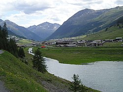
Acqua Granda (or Spol) Livigno&LagoDelGallo.JPG
Acqua Granda (or Spöl)

Draining into the Adriatic Sea

The Reno near Casalecchio Reno a Casalecchio di Reno (BO).jpg
The Reno near Casalecchio

For the purposes of this list, the Italian rivers draining into the Adriatic Sea begin at the coastal border between Italy and Slovenia and follow the Adriatic coast of Italy until it reaches Santa Maria di Leuca. Beyond this point, rivers empty into the Ionian Sea rather than the Adriatic. The rivers are ordered according to how far along the coast the river mouth is from the Italian/Slovenian border, the first river having its mouth the closest to the border and the last being closest to Santa Maria di Leuca.

Tributaries of the Adige

The Adige crossing Verona. Etsch verona.jpg
The Adige crossing Verona.

Tributaries of the Po

The Po in Boretto (RE). Fiume Po a Boretto.JPG
The Po in Boretto (RE).

The tributaries of the Po are organized into right- and left-hand tributaries. The lists are ordered from the river closest to the source of the Po to the river closest to the mouth of the Po.

Right-hand tributaries

Left-hand tributaries

Rivers draining into Lake Maggiore

The Ticino and the Ponte Coperto of Pavia Pavia Ponte Coperto.JPG
The Ticino and the Ponte Coperto of Pavia

Rivers draining into Lake Como

The Adda in Imbersago Adda7.JPG
The Adda in Imbersago

Draining into the Ionian Sea

The Stilaro near Bivongi Stilaro a Bivongi.JPG
The Stilaro near Bivongi

For the purposes of this list, the Italian rivers draining into the Ionian Sea begin at Santa Maria di Leuca in the east and extend to the Strait of Messina in the west. Sicilian rivers are excluded because they are listed in their own section below. The rivers are ordered according to how far east their mouth is, the first river having the easternmost mouth and the last having the westernmost mouth.

Draining into the Tyrrhenian Sea

The Garigliano near its mouth GariglianoFoce.jpg
The Garigliano near its mouth

For the purposes of this list, the Italian rivers draining into the Tyrrhenian Sea begin at the Strait of Messina in the south and extend north up to San Pietro Point near Portovenere. Sicilian and Sardinian rivers are excluded from this list because those rivers are in their own sections below. The rivers are ordered according to how far south their mouth is, the first river having the southernmost mouth and the last having the northernmost mouth.

Tributaries of the Tiber

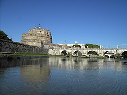
The Tiber: ponte Sant'Angelo (Rome) TevereCastello-PonteSantAngelo.JPG
The Tiber: ponte Sant'Angelo (Rome)

Draining into the Ligurian Sea

The Polcevera in Bolzaneto (Genova) Bolzaneto Polcevera 03.jpg
The Polcevera in Bolzaneto (Genova)

For the purposes of this list, the Italian rivers draining into the Ligurian Sea begin at San Pietro Point near Portovenere in the east and extend to the border with France near Monaco. Sardinian rivers are excluded from this list because those rivers are in their own section below. The rivers are ordered according to how close their mouth is to San Pietro Point. The river with its mouth closest to this geographic point is listed first and rivers further away from this point are listed in the order in which their mouth empties into the sea as one proceeds along the coast up to the border with France.

Rivers of Sicily

River Simeto Simeto.JPG
River Simeto

Rivers of Sardinia

The Temo in Bosa Fiume Temo Bosa Sardegna o.jpg
The Temo in Bosa

Alphabetical list

Notes

  1. "Lista Fiumi in Italia" (in Italian). Retrieved 23 February 2022.

Related Research Articles

<span class="mw-page-title-main">Geography of Italy</span> Geographical features of Italy

The geography of Italy includes the description of all the physical geographical elements of Italy. Italy, whose territory largely coincides with the homonymous geographical region, is located in southern Europe and comprises the long, boot-shaped Italian Peninsula crossed by the Apennines, the southern side of Alps, the large plain of the Po Valley and some islands including Sicily and Sardinia. Italy is part of the Northern Hemisphere. Two of the Pelagie Islands are located on the African continent.

<span class="mw-page-title-main">Apennine Mountains</span> Mountain ranges stretching the length of Italy

The Apennines or Apennine Mountains are a mountain range consisting of parallel smaller chains extending c. 1,200 km (750 mi) along the length of peninsular Italy. In the northwest they join with the Ligurian Alps at Altare. In the southwest they end at Reggio di Calabria, the coastal city at the tip of the peninsula. Since 2000 the Environment Ministry of Italy, following the recommendations of the Apennines Park of Europe Project, has been defining the Apennines System to include the mountains of north Sicily, for a total distance of 1,500 kilometres (930 mi). The system forms an arc enclosing the east side of the Ligurian and Tyrrhenian seas.

<span class="mw-page-title-main">Montferrat</span> Geographic region of northern Italy

Montferrat is a historical region of Piedmont in Northern Italy. It comprises roughly the modern provinces of Alessandria and Asti. Montferrat is one of the most important wine districts of Italy. It also has a strong literary tradition, including the 18th century Asti-born poet and dramatist Vittorio Alfieri and the Alessandrian Umberto Eco.

<span class="mw-page-title-main">Province of Brescia</span> Province of Italy

The province of Brescia is a province in the Lombardy region of Italy. It has a population of some 1,265,964 and its capital is the city of Brescia.

<span class="mw-page-title-main">Cedegolo</span> Comune in Lombardy, Italy

Cedegolo is an Italian comune of 1,258 inhabitants in Val Camonica, province of Brescia, in Lombardy, northern Italy.

<span class="mw-page-title-main">Lake Iseo</span> Lake in Lombardy, Italy

Lake Iseo or Iseo lake, also known as Sebino, is the fourth largest lake in Lombardy, Italy, fed by the Oglio River.

<span class="mw-page-title-main">Costa Volpino</span> Comune in Lombardy, Italy

Costa Volpino is a comune in the province of Bergamo, in Lombardy, Italy. Situated at the end of Valle Camonica, where the Oglio river enters the Lake Iseo, it is bounded by other communes of Lovere and Rogno.

<span class="mw-page-title-main">Tanaro</span> Italian river

The Tanaro, is a 276-kilometre (171 mi) long river in northwestern Italy. The river begins in the Ligurian Alps, near the border with France, and is the most significant right-side tributary to the Po in terms of length, size of drainage basin, and discharge.

<span class="mw-page-title-main">Val Camonica</span>

Val Camonica or Valcamonica, also Valle Camonica and anglicized as Camonica Valley, is one of the largest valleys of the central Alps, in eastern Lombardy, Italy. It extends about 90 kilometres (56 mi) from the Tonale Pass to Corna Trentapassi, in the commune of Pisogne near Lake Iseo. It has an area of about 1,335 km2 (515 sq mi) and 118,323 inhabitants. The River Oglio runs through its full length, rising at Ponte di Legno and flowing into Lake Iseo between Pisogne and Costa Volpino.

<span class="mw-page-title-main">Oglio</span> River in Lombardy, Italy

The Oglio is a left-side tributary of the river Po in Lombardy, Italy. It is 280 kilometres (170 mi) long. In the hierarchy of the Po's tributaries, with its 280 kilometres (170 mi) of length, it occupies the 2nd place per length, while it is the 4th per basin surface, and the 3rd per average discharge at the mouth.

<span class="mw-page-title-main">Po Valley</span> Plain in Northern Italy

The Po Valley, Po Plain, Plain of the Po, or Padan Plain is a major geographical feature of Northern Italy. It extends approximately 650 km (400 mi) in an east-west direction, with an area of 46,000 km2 including its Venetic extension not actually related to the Po river basin; it runs from the Western Alps to the Adriatic Sea. The flatlands of Veneto and Friuli are often considered apart since they do not drain into the Po, but they effectively combine into an unbroken plain, making it the largest in Southern Europe. It has a population of 17 million, or a third of Italy's total population.

<span class="mw-page-title-main">Orba (river)</span> River in Italy

The Orba is a torrent of northern Italy.

<span class="mw-page-title-main">Geography of Piedmont</span>

The Geography of Piedmont is that of a territory predominantly mountainous, 43.3%, but with extensive areas of hills which represent 30.3% of the territory, and of plains (26.4%).

<span class="mw-page-title-main">Reno (river)</span> River in Italy

The Reno is a river of Emilia-Romagna, northern Italy. It is the tenth longest river in Italy and the most important of the region apart from the Po.

<span class="mw-page-title-main">Versa (Tanaro)</span> River in Italy

The Versa, a left tributary of the Tanaro, is a 35-kilometre (22 mi) torrent in the Province of Asti in north-west Italy. It is the river of the valley called Valle Versa. In 1836 the Versa was identified, along with the Rotaldo, the Grana, the Stura and the Gattola, as one of the five torrents of the still extant Province of Casale.

<span class="mw-page-title-main">Brescia and Garda Prealps</span>

The Brescia and Garda Prealps are a mountain range in the southern part of the Alps. They are located mainly in Lombardy but also in Trentino Alto Adige and in Veneto, in the northern part of Italy.

<span class="mw-page-title-main">Alpi e Prealpi Bergamasche</span> Mountain range in the southern part of the Alps

The Bergamasque Alps and Prealps are a mountain range in the southern part of the Alps. They are located in Lombardy, in the northern part of Italy.

<span class="mw-page-title-main">Bergamasque Prealps</span>

The Bergamasque Prealps are a mountain range within the Alps. The range is located in Lombardy, in the north of Italy.

<span class="mw-page-title-main">Po (river)</span> River in Italy

The Po is the longest river in Italy. It flows eastward across northern Italy, starting from the Cottian Alps. The river's length is either 652 km (405 mi) or 682 km (424 mi), if the Maira, a right bank tributary, is included. The headwaters of the Po are a spring seeping from a stony hillside at Pian del Re, a flat place at the head of the Val Po under the northwest face of Monviso. The Po then extends along the 45th parallel north before ending at a delta projecting into the Adriatic Sea near Venice.