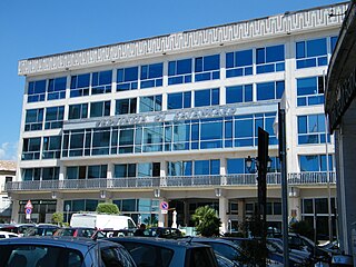
The province of Catanzaro is a province of the Calabria region of Italy. The city Catanzaro is both capital of the province and capital of the region of Calabria. The province contains 80 comuni. Its provincial president is Sergio Abramo.

The province of Crotone is a province in the Calabria region of Italy. It was formed in 1992 out of a section of the province of Catanzaro. The provincial capital is the city of Crotone. It borders the provinces of Cosenza, Catanzaro, and also the Ionian Sea. It contains the mountain Pizzuta, the National Park of the Sila, Montagnella Park, and the Giglietto Valley. Crotone was founded in 710 BCE. It participated in the Second Punic War against the Roman Republic.
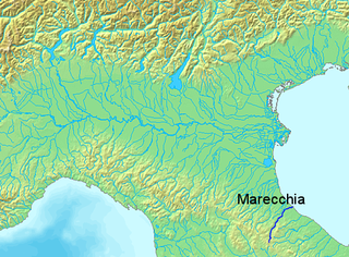
The Marecchia is a river in eastern Italy, flowing from near Monte dei Frati in the province of Arezzo, Tuscany, to the Adriatic Sea in Rimini, Emilia-Romagna. Along its course, the river passes next to or near the settlements of Novafeltria, Verucchio, and Santarcangelo di Romagna. It passes near the Republic of San Marino. Among its tributaries are the San Marino river and the Ausa.

The Ofanto, known in ancient times as Aufidus or Canna, is a 134 or 170 km river in southern Italy that flows through the regions of Campania, Basilicata, and Apulia, into the Gulf of Manfredonia near Barletta.
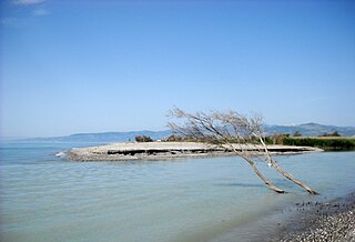
The Sinni is a 94 km long river in the Basilicata region of southern Italy. In antiquity, the city of Siris lay at its mouth. Near the town of Senise, a dam on the river was built in 1970-1982, the largest in Europe built with earth. In correspondence of it, it forms the Lago di Monte Cotugno, one of the largest artificial basins in Italy.

The Basento is a river in the Basilicata region of southern Italy. It rises at Monte Arioso in the southern Apennine Mountains, southwest of Potenza in the province of Potenza. The river flows northeast near Pignola and Potenza before curving east near Vaglio Basilicata. It curves southeast and flows near Brindisi Montagna, Trivigno, and Albano di Lucania. A right tributary coming from Lago di Ponte Fontanelle flows into the river in this area. The river forms the border between the province of Potenza and the province of Matera for a short distance before flowing into the province of Matera. It flows eastward near Tricarico, Calciano, and Grassano before curving southeast. The river flows near Grottole, Miglionico, Pomarico, Ferrandina, and Monte Finese before curving eastward. It flows near Pisticci and Bernalda before flowing into the Gulf of Taranto, which is part of the Ionian Sea, near Metaponto. The main city on the Basento is Potenza, the capital of Basilicata.

The Tordino is a river flowing in the province of Teramo, in the Abruzzo region of central Italy. In Roman times it may have been known as "Batinus".

The Crati is a river in Calabria, southern Italy. It is the largest river of Calabria and the third largest river of southern Italy after the Volturno and the Sele. In classical antiquity it was known as the Crathis or Crater.

The Tronto is a 115-kilometre (71 mi) long Italian river that arises at Monti della Laga and ends in the Adriatic Sea at Porto d'Ascoli, San Benedetto del Tronto. It traverses the Lazio, Marche, and Abruzzo regions of Italy.

Cecita Lake is a man made lake in the province of Cosenza, Calabria, southern Italy.
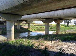
The Bradano is a river in the Basilicata and Apulia regions of southern Italy. Its source is Lago Pesole in the province of Potenza. The river flows southeast near Monte Torretta, Acerenza, and Oppido Lucano. After crossing into the province of Matera, it is joined by a right tributary, the Alvo. The river flows near Irsina before being joined by a left tributary, the Basentello. Shortly after that, it is joined by another right tributary, the Bilioso. The river then enters Lago di San Giuliano. After flowing out of the lake, the Bradano is joined by a left tributary, the Gravina, and flows southeast near Montescaglioso before entering the province of Taranto. It is then joined by a left tributary, the Gravina di Matera, before re-entering the province of Matera after a short distance. The river flows near the border with the province of Taranto before entering the Gulf of Taranto near Lido di Metaponto.
The Carapelle is a river in the province of Foggia in the Apulia region of Italy. The source of the river is north of Anzano di Puglia near the border with the province of Avellino in the Daunian Mountains, along the Campanian Apennine. The river flows northeast near Monteleone di Puglia before curving eastward and flowing near Accadia and Sant'Agata di Puglia before being joined by a right tributary, the Calaggio. The river then curves northeast and is joined by a left tributary, the Carapellotto, before flowing past Ordona and Carapelle. The river connects with the Saline di Margherita di Savoia salt marsh via two branches on the south bank of the river before emptying into the Gulf of Manfredonia in the Adriatic Sea northwest of Zapponeta.

The Musone is a river in the Marche region of Italy. The source of the river is east of Matelica and south of Monte San Vicino in the province of Macerata. The river flows northeast near Apiro, Cingoli and Staffolo before crossing into the province of Ancona near Filottrano. The river then flows southeast and is joined by a tributary south of Osimo before curving northeast near Loreto. Finally, the river empties into the Adriatic Sea north of Porto Recanati and south of Numana.
The Vitravo is a river in the Calabria region of southern Italy. The source of the river is in the province of Cosenza near the border with the province of Crotone. The river forms the border between the two provinces for a short distance before entering the province of Crotone. The Vitravo flows southeast near Verzino and Pallagorio before curving east. The river flows north of Rocca di Neto before flowing into the Neto as a left tributary shortly before the Neto flows into the Ionian Sea.
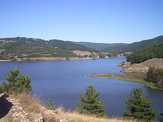
Lago di Ariamacina is a lake in the province of Cosenza, Calabria, southern Italy. It is located in the La Sila range within Sila National Park. The Neto flows into and out of the lake. The lake is a reservoir built between 1953 and 1955 by damming the Neto. Its purpose is to generate hydroelectricity. North of the lake is Lago di Cecita and south of the lake is Lago Arvo.
The Mucone is a river in the province of Cosenza, Calabria, southern Italy. The source of the river is in La Sila north of Botte Donato. It flows into Lago di Cecita and flows out of the lake near the western border of Sila National Park. The river flows northwest before curving west near Acri. It flows near Bisignano before flowing into the Crati east of Torano Castello. The Mucone is the largest right tributary of the Crati.

The Garga is a river in the province of Cosenza, Calabria, southern Italy. Its source is Pollino National Park near Morano Calabro. The river flows southeast near Saracena before curving east near Firmo. It then joins the Coscile as a right tributary of that river.

The Gulf of Saint Euphemia is a gulf on the west coast of Calabria, southern Italy. It is part of the Tyrrhenian Sea and borders the province of Cosenza, the province of Catanzaro, and the province of Vibo Valentia.
The Esaro is a river in the province of Cosenza, Calabria, southern Italy. Its source is near Sant'Agata di Esaro. The river flows northeast near Roggiano Gravina before being joined by a left tributary, the Grondo, and a right tributary a short distance further. It then joins the Coscile as a right tributary of that river north of Spezzano Albanese, near the ancient site known as Interamnium. It is the main tributary of the Coscile.

The Esaro is a river in the province of Crotone, Calabria, southern Italy. Its source is near Cutro. The river flows southeast near Crotone Airport before curving northeast and eventually flowing into the Ionian Sea just north of Crotone.


