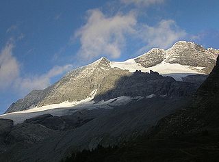
The Lepontine Alps are a mountain range in the north-western part of the Alps. They are located in Switzerland and Italy.

The Pennine Alps, sometimes referred to as the Valais Alps, are a mountain range in the western part of the Alps. They are located in Italy and Switzerland (Valais).

The river Ticino is the most important perennial left-bank tributary of the Po. It has given its name to the Swiss canton through which its upper portion flows.

Valais, more formally, the Canton of Valais, is one of the 26 cantons forming the Swiss Confederation. It is composed of thirteen districts and its capital and largest city is Sion.
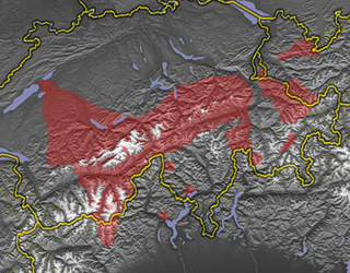
Walser German and Walliser German are a group of Highest Alemannic dialects spoken in parts of Switzerland, Italy, Liechtenstein, and Austria (Vorarlberg).

The Simplon Pass is a high mountain pass between the Pennine Alps and the Lepontine Alps in Switzerland. It connects Brig in the canton of Valais with Domodossola in Piedmont (Italy). The pass itself and the villages on each side of it, such as Gondo, are in Switzerland. The Simplon Tunnel was built beneath the vicinity of the pass in the early 20th century to carry rail traffic between the two countries.

The Bernese Oberland, sometimes also known as the Bernese Highlands, is the highest and southernmost part of the canton of Bern. It is one of the canton's five administrative regions. It constitutes the Alpine region of the canton and the northern side of the Bernese Alps, including many of its highest peaks, among which the Finsteraarhorn, the highest in both range and canton.

The Simplon Tunnel is a railway tunnel on the Simplon railway that connects Brig, Switzerland and Domodossola, Italy, through the Alps, providing a shortcut under the Simplon Pass route. It is straight except for short curves at either end. It consists of two single-track tunnels built nearly 15 years apart. The first to be opened is 19,803 m (64,970 ft) long; the second is 19,824 m (65,039 ft) long, making it the longest railway tunnel in the world for most of the twentieth century, from 1906 until 1982, when the Daishimizu Tunnel opened.
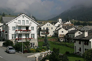
Simplon, earlier known as Simpeln, is a municipality in the district of Brig in the canton of Valais in Switzerland.
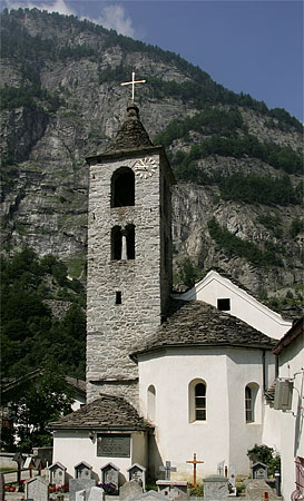
Zwischbergen is a municipality in the district of Brig in the canton of Valais in Switzerland.

The Toce is a river in Piedmont, Italy, which stretches the length of the Val d'Ossola from the Swiss border to Lake Maggiore into which it debouches near Fondotoce in the commune of Verbania. The river is 83.6 kilometres (51.9 mi) long and is formed in the upper Val Formazza by the confluence of a number of torrents in the plain of Riale.

The Valais Republic or Vallais was a sister republic of France that existed between 1802 and 1810 in the French-speaking part of Switzerland, during the Napoleonic Wars, in territory corresponding to the modern Swiss canton of Valais.

The Autostrada A26 is an autostrada 197.1 kilometres (122.5 mi) long in Italy located in the regions of Liguria and Piedmont. It is named the Autostrada dei Trafori after the numerous tunnels through which it passes, both Apennine and Subalpine. It runs northwards from Genoa on the Ligurian coast, over the Apennines, and across the wide plain of the Po valley to the environs of Lake Maggiore and the mouth of the Val d’Ossola. In addition to this ‘main trunk’ of the road, there are three side branches, also of motorway class which function as link roads between the A26 and the A7, the A4 and the A8. The A26, together with these link roads, is managed by Autostrade per l'Italia S.p.A. It is a part of the E25 and E62 European routes.

The Seehorn is a mountain of the Swiss Pennine Alps, overlooking Gondo in the canton of Valais. Unlike most other mountains in Valais, the Seehorn lies on the south side of the Alps, in the southern Simplon Valley.
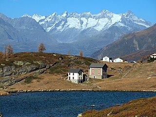
Rotelsee is a lake near Simplon Pass in the canton of Valais, Switzerland. The water of the lake powers a small turbine in the monastery Simplon Hospice. The distance from the lake to the monastery is 220m and the difference of altitude is 30m.

The Melezza, in Italy the Melezzo Orientale, is a 42 km Alpine torrent which runs through the eastern part of the Val Vigezzo, in the Province of Verbano Cusio Ossola, northern Italy; and through the Centovalli of Canton Ticino, Switzerland. Belonging to the Po basin, it is a tributary of the Maggia which in its turn flows into Lago Maggiore.

The A9 motorway, a motorway in western Switzerland, is a divided highway connecting from Ballaigues to southwestern Switzerland. It is part of the National Road N9.

The Simplon Valley or Divedro Valley is a valley of the Alps, situated between the Pennine and the Lepontine ranges. The valley is drained by the Diveria or Chrummbach, a tributary of the Toce at Crevoladossola. The Simplon Valley is the only valley of Valais located south of the main chain of the Alps.

The Gondo Gold Mine was the largest gold mine in Switzerland. The mine is located in the south of the canton of Valais near the Italian border at over 1200 m above sea level. In its heyday up to 500 men worked here, while the municipality of Gondo itself had only 100 inhabitants.


