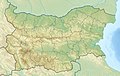
Map of rivers, drainage divide and main drainage basins in Bulgaria Danube a1 Timok a2 Topolovets a3 Voynishka reka a4 Vidbol a5 Archar a6 Skomlya a7 Lom a8 Tsibritsa a9 Ogosta a10 Iskar a11 Vit a12 Osam a13 Barata a14 Yantra a15 Rusenski Lom a16 Topchiyska reka a17 Tsaratsar a18 Senkovets a19 Kanagyol a20 Suha reka a21 Nishava Black sea b0 Shablenska reka b1 Batova reka b2 Provadiyska reka b3 Kamchiya b18 Fandakliyska reka b4 Dvoynitsa b5 Hadzhiyska reka b6 Aheloy b7 Aytoska reka b8 Chukarska reka b9 Rusokastrenska reka b10 Sredetska reka b11 Fakiyska reka b12 Izvorska reka b13 Ropotamo b14 Dyavolska reka b15 Kitenska reka b16 Veleka b17 Rezovska reka Aegean sea c1 Struma c2 Mesta c3 Maritsa c4 Arda c5 Tundzha c6 Luda reka
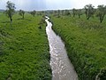
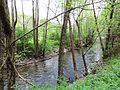
This is a list of rivers in Bulgaria, organised geographically, taken clockwise from the westernmost tributaries of the Danube drainage. Tributaries are listed down the page in an downstream direction, i.e. the first tributary listed is closest to the source, and tributaries of tributaries are treated similarly. The main stem (or principal) river of a catchment is labelled as (MS), right-bank tributaries are indicated by (R), left-bank tributaries by (L). Note that in general usage, the 'right or left bank of a river' refers to the right or left hand bank, as seen when looking downstream. The list encompasses most of the main rivers of Bulgaria. It includes rivers shared with other countries. There is also a list of rivers over 50km. The Bulgarian word for river, река (transliteration reka) is often a part of the river names in the country.
There are 540 rivers in Bulgaria.[1] The longest river in Bulgaria is the Danube (2,888km), which spans most of the country's northern border for a length of 470km. The longest one to run through the country (and also the deepest) is the Maritsa (480km), while the longest river that runs solely in Bulgaria is the Iskar (368km).[2]
The density of rivers is highest in the mountain areas and lowest in Dobrudzha, the Danubian Plain and the Upper Thracian Plain.[1] There are two catchment basins: the Black Sea (57% of the territory and 42% of the rivers) and the Aegean Sea (43% of the territory and 58% of the rivers) basins.[1][3] The territory of Bulgaria is 110,994km2, of which 63,270km2 fall within the Black Sea catchment bason, divided between the Danube (49,950km2) and Black Sea Coast drainage (13,320km2), and 47,730km2 fall within the Aegean Sea basin, divided between the Maritsa (34,166km2), Mesta (2,767km2) and Struma (10,797km2) drainage.
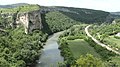
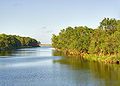
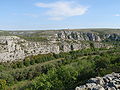
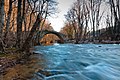
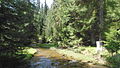
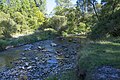
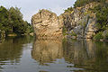
The Balkan Mountains divide Bulgaria into two nearly equal drainage systems. The larger system drains northward to the Black Sea, mainly by way of the Danube. This system includes the entire Danubian Plain and a stretch of land running 48–80km inland from the coastline in the south. The Danube gets slightly more than 4% of its total volume from its Bulgarian tributaries. As it flows along the northern border, the Danube averages 1.6 to 2.4km in width. The river's highest water levels usually occur during the May floods; it is frozen over an average of 40 days per year. The longest river located entirely in Bulgarian territory, the Iskar, with a length of 368km and a catchment area of 8,640km2, is the only Bulgarian Danubian tributary that does not rise in the Balkan Mountains. Instead, the Iskar has its origin in the Rila Mountains. It passes through Sofia's eastern suburbs and crosses the Balkan Mountains through a spectacular 65km–long gorge.[1] Other important tributaries of the Danube include the rivers Lom, Ogosta, Vit, Osam and Yantra.[1][3] The longest river flowing directly to the Black Sea is the Kamchiya (254km), while other rivers from north to south include the Batova, Dvoynitsa, Aheloy, Sredetska reka, Ropotamo, Veleka, Rezovo, etc.[4]
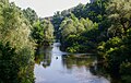
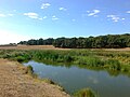
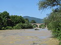
The Aegean Sea catchment basin drains the Thracian Plain and most of the higher lands to the south and southwest. Several major rivers flow directly to the Aegean Sea. Many of their tributaries fall swiftly from the mountains and have cut deep, scenic gorges. The 480km–long Maritsa (of them 321km in Bulgaria) and its tributaries drain all of the western Thracian Plain, most of Sredna Gora, the southern slopes of the Balkan Mountains, and the northern slopes of the eastern Rhodopes. After it leaves Bulgaria, the Maritsa forms most of the Greco-Turkish border.[4] Maritsa's major tributaries are the Tundzha, Arda, Topolnitsa, Vacha, Stryama, etc. The other Bulgarian rivers flowing directly to the Aegean are the Struma and the Mesta.[3][4]
Мичев (Michev), Николай (Nikolay); Михайлов (Mihaylov), Цветко (Tsvetko); Вапцаров (Vaptsarov), Иван (Ivan); Кираджиев (Kiradzhiev), Светлин (Svetlin) (1980). Географски речник на България[Geographic Dictionary of Bulgaria] (in Bulgarian). София (Sofia): Наука и култура (Nauka i kultura).
Дончев (Donchev), Дончо (Doncho); Каракашев (Karakashev), Христо (Hristo) (2004). Теми по физическа и социално-икономическа география на България (Topics on Physical and Social-Economic Geography of Bulgaria) (in Bulgarian). София (Sofia): Ciela. ISBN954-649-717-7.
This page is based on this Wikipedia article Text is available under the CC BY-SA 4.0 license; additional terms may apply. Images, videos and audio are available under their respective licenses.