
There are more than 130 named rivers and streams in the traditional County Dublin, Ireland, which comprises the city of Dublin and the surrounding counties of Dún Laoghaire–Rathdown, Fingal and South Dublin.
There are more than 130 named rivers and streams in the traditional County Dublin, Ireland, which comprises the city of Dublin and the surrounding counties of Dún Laoghaire–Rathdown, Fingal and South Dublin.
The rivers and streams are listed in one table, with systems such as the Liffey (and that of its major sub-system, the Dodder), Broadmeadow, Tolka and Shanganagh identified within the table. The name of each watercourse, the location of its mouth or confluence point and whether, for tributaries, they enter their parent on the right or left bank, is noted. Unnamed tributaries are not included. Most are shown on the back cover map of the Doyle reference, and those in the central area are shown on the main and section-specific maps in the Sweeney reference.
| Name Alternative name(s) | System, if applicable | Order (Classic) | Order (Strahler) | Bank | Source | Mouth / point of confluence | Refs | Notes |
|---|---|---|---|---|---|---|---|---|
| Delvin River Irish : An Ailbhine | Delvin | 1st | 2 | - | NW of Garristown | Near Knocknagin, N of Bremore | [1] | Runs N of Naul, S of Stamullin, two cascades of over 5m near Naul |
| Bartramstown River | Delvin | 2nd | 1 | Left | Near Fourknocks | NE of Garristown | [1] | |
| Hurley River | Nanny (Meath) | 2nd | 2 | Right | Tobergregan, S of Garristown | (to the Nanny R., Meath) | [1] | |
| Bremore River | - | 1st | 2 | - | NW of Balbriggan | N of Balbriggan | [2] | |
| Bracken River Matt River | - | 1st | 3 | - | W and S of Balbriggan | Balbriggan | [1] | |
| Inch Stream | Bracken (Matt) | 2nd | 2 | Right | S of Balbriggan | Stephenstown, Balbriggan | ||
| Tanner's Water | Bracken (Matt) | 3rd | 1 | Right | E of Balrothery | N of Balrothery | ||
| Brook Stream Mill Stream | Brook Stream | 1st | 2 | - | Branches W of Skerries | Skerries | [1] | Supplying (but not flowing through) the mill pond for the mill complex at Skerries |
| Milverton Stream | Brook Stream | 2nd | 1 | Left | NW of Skerries | W of Skerries | [1] | |
| St. Catherine's Stream | - | 1st | 1 | - | NW of Kenure Demesne | Brook's End, N of Rush | [1] | |
| Kenure Stream | - | 1st | 1 | - | W of Kenure Demesne | E of Kenure Demesne | [3] | Runs alongside Palmer Road in culvert, and then in nice valley down to north end of Rush's North Beach |
| Rush Town Stream Brook Stream | - | 1st | 1 | - | W of Rush | North Beach, Rush | [3] | |
| Bride's Stream | Bride's Stream | 1st | 2 | - | N of Lusk | S of Whitestown, Rogerstown Estuary | [3] | |
| Jone's Stream | Bride's Stream | 2nd | 1 | Left | NE of Lusk | S of Whitestown, Rogerstown Estuary | [3] | |
| Baleally Stream | - | 1st | 1 | - | Lusk (south of Round Tower) | Newhaggard, after Baleally, Rogerstown Estuary | [3] | |
| Ballyboghil (or Ballyboughal) River | Ballyboghil | 1st | 3 | - | Tobergregan, S of Garristown | Rogerstown Estuary | [3] | |
| Daws River | Ballyboghil | 2nd | 2 | Right | Rath, by Meath border | N of Oldtown | [3] | |
| Richardstown River | Ballyboghil | 2nd | 2 | Left | Grallagh | Gracedieu, S of Richardstown | [3] | |
| Corduff River Ballough Stream or River Nine-Stream River | Ballyboghil | 2nd | 2 | Left | Many branches | Just W of Rogerstown Estuary, near Newhaggard | [3] | |
| Wimbletown Stream | Ballyboghil | 3rd | 1 | Left | N of Ballyboghil | To Corduff, at Newtowncorduff, S of Ballough | [3] | One of two parallel streams, the nameless other comes from branches beyond Damastown |
| Turvey River (last part: River Pill) | - | 1st | 2 | - | Branches from Cookstown, Magillstown | S of Newbridge Demesne | [3] | |
| Lissenhall Stream | - | 1st | - | near Behinstown | 1 | Lissenhall, south of Newport House | [3] | |
| Broadmeadow River (or Broad Meadow Water) Irish : Abhainn Ghabhra | Broadmeadow | 1st | 3 | - | (Meath, near Dunshaughlin) | Broadmeadow Estuary | [3] | 5th largest flow in Dublin, wide Broadmeadow Estuary now semi-impounded by rail embankment |
| Dun Water | Broadmeadow | 2nd | 2 | Right | Dublin/Meath border | [3] | ||
| Ward River Swords River | Broadmeadow | 2nd | 2 | Right | (Meath) | N of Swords | [4] | |
| Shallon Stream | Broadmeadow | 3rd | 1 | Right | Cherryhound | To Ward | [4] | |
| Mabestown Stream | Broadmeadow | 3rd | 1 | Left | To Ward, Laurestown, near Corrstown | |||
| St. Margaret's Stream | Broadmeadow | 3rd | 1 | Right | Near St. Margaret's | To Ward | [4] | |
| Gaybrook Stream Gay Brook | - | 1st | 2 | - | Near Cloghran | W of Malahide (Yellow Walls / Cave Marsh) | [4] | |
| Sluice River | Sluice | 1st | 2 | - | from below three streams | N end of Baldoyle Bay | [4] | |
| Forrest Little Stream | Sluice | 2nd | 1 | n/a | Near Dublin Airport | Merger with Wad in Baskin area | [4] | |
| Wad Stream | Sluice | 2nd | 1 | n/a | Near Dublin Airport | Merger with Forrest Little in Baskin area | [4] | |
| Kealy's Stream | Sluice | 2nd | 1 | n/a | Near Dublin Airport | Merger with above two in Kinsealy, forming Sluice | [4] | |
| Hazelbrook Stream | Sluice | 2nd | 1 | Left | S of Malahide | W of Portmarnock | [4] | |
| Mayne River | Mayne | 1st | 3 | - | from below two streams | Midpoint of Baldoyle Bay | [4] | Studied for GDSDS |
| Cuckoo Stream | Mayne | 2nd | 2 | n/a | branches near Dublin Airport | Merger with Turnapin E of Balgriffin | [4] | |
| Turnapin Stream | Mayne | 2nd | 2 | n/a | Harristown | Merger with Cuckoo Stream E of Balgriffin | [4] | Main flow of Mayne |
| Grange Stream | Mayne | 2nd | 2 | Right | W Donaghmede | Baldoyle | [4] [5] | Long visible sections culverted in Donaghmede in 1980's, and in Baldoyle in early 2000s - still in open from the former Racecourse lands to near the Mayne |
| Seagrange Park Stream | Mayne | 3rd | 1 | Right | Bayside / lower Kilbarrack | Baldoyle | [4] [5] | Visible along DART line from Bayside and at eastern side of Seagrange Park |
| Bloody Stream | 1st | 1 | - | Black Linn, Howth | Claremont Strand | [6] [7] | One of several Howth Estate streams (the only named one) | |
| Offington Stream | 1st | 1 | - | E of Deer Park golf course | Western Howth Harbour | [7] [8] | ||
| Boggeen Stream Gray's Brook Tramway Brook Boddeen Stream | 1st | 1 | - | W of Thormanby Road, Howth (hollow where part of Thormanby Woods built) | Eastern Howth Harbour | [7] [9] | Gray's or Grey's Brook much used locally, still visible in the woodland N of Thormanby Woods and along Gray's Lane | |
| Coulcour Brook Coolcur Brook | 1st | 1 | - | Above Howth village | Balscadden Bay | [7] [10] | Visible briefly on Cowbooter Lane | |
| Whitewater Brook | 1st | 2 | - | S part of the Ben of Howth | Whitewater Brook Cove, having crossed under Carrickbrack and Thormanby Roads | [7] [11] | Visible briefly near Cliff Walk, and by public car park upstream, and unnamed tributary visible at chain of small ponds above Thormanby Road | |
| Balsaggart Stream | 1st | 1 | - | Between the Ben of Howth and Shelmartin | W of Drumleck Point | [7] [12] | Comes to Carrickbrack Road (and sometimes onto it) by Lonethorn | |
| Carrickbrack Stream | 1st | 1 | - | Between Dun Hill and Shelmartin | E Sutton Strand | [13] [14] | Piped mouth sometimes visible on Sutton Strand | |
| Santa Sabina Stream | 1st | 2 | - | Howth Demesne (S of main avenue) | E Sutton Strand (155m from Carrickbrack) | [13] [15] | Piped mouth sometimes visible on Sutton Strand | |
| Kilbarrack Stream Daunagh Water | 1st | - | S of Turnapin | S of Bayside, with secondary, artificial mouth at end of Kilbarrack Road | [15] [16] | |||
| Blackbanks Stream | 1st | 1 | - | Edenmore, S of Tonlegee Road | Meeting of Howth and James Larkin Roads | [15] [17] | ||
| Fox Stream Foxe's Lane Watercourse | 1st | 1 | - | Former quarry area, now Edenmore Park | S of Fox's Lane, Raheny | [15] [17] | ||
| Santry River Raheny River (part) Quinn's River | 1st | 2 | - | Harristown and Dubber | Alongside Bull Island causeway, Raheny | [18] [19] | Studied for GDSDS | |
| Naniken River Nannikin or Naneken (part) Ballyhoy River | 1st | 1 | - | N Santry | By Duck Pond, St. Anne's Park | [20] [21] | ||
| Wad River | 1st | 1 | - | Poppintree | Inner end of Tolka Estuary / Clontarf Bay | [21] [22] | ||
| River Tolka Irish : An Tulcha | Tolka | 1st | - | - | (Meath, NW of Batterstown) | Tolka Estuary / Clontarf Bay | [23] [24] | River Tolka Flooding Study added to GDSDS |
| Clonee Stream | Tolka | 2nd | - | Right | (Meath) | N of N3, near Clonee | [25] | |
| (West) Pinkeen Stream | Tolka | 2nd | - | Left | (Meath) | Damastown | [25] | |
| (East) Pinkeen Stream | Tolka | 2nd | - | Left | N of Tyrellstown | Mulhuddart | [25] | |
| Warrenstown Stream | Tolka | 2nd | - | Left | N of Warrenstown | S of Warrenstown | [25] | |
| Scribblestown Stream Cappoge Stream | Tolka | 2nd | - | Left | N of Abbotstown | Scribblestown | [25] [26] | |
| Finglaswood Stream Mount Olivat Stream | Tolka | 2nd | - | Left | SW Finglas | Finglaswood / Tolka Valley Park | [25] [26] | |
| Finglas River | Tolka | 2nd | - | Left | Ratoath Road, N of Finglas | S of Finglas | [25] [27] | Studied for GDSDS |
| Claremont Stream | Tolka | 2nd | - | Left | W of Finglas | Glasnevin (near RC church) | [25] [28] | |
| Cemetery Drain | Tolka | 2nd | - | Right | Near Liffey Junction | Glasnevin (near RC church) | [29] [30] | |
| Hampstead Stream | Tolka | 2nd | - | Left | DCU and Hillside Farm branches | W Drumcondra | [30] [31] | |
| Marino Stream | Tolka | 2nd | - | Left | High Park area, Drumcondra | Tolka Estuary, Clontarf | [30] [31] | |
| River Liffey Irish : An Life (previously Irish : An Riuithreach) | Liffey | 1st | - | - | (Wicklow, Liffey Head Bog) | Dublin Bay | [32] [33] | |
| Brittas River | Liffey | 2nd | - | Right | Seechon Mountain, Dublin | S of Kilbride, Wicklow | [34] | |
| Tobermaclugg Stream | Liffey | 2nd | - | Right | S of Grand Canal | W of Lucan | [35] | |
| Griffeen River (part) Racreena River (part) Esker River | Liffey | 2nd | - | Right | Saggart Hill | Lucan | [36] | |
| Kilmahuddrick Stream | Liffey | 3rd | - | Right | Kilmahuddrick | To Griffeen, N of Grand Canal | [35] | |
| Westmanstown Stream | Liffey | 2nd | - | Left | (Meath) | S of Luttrellstown | [37] | |
| Diswellstown Stream | Liffey | 2nd | - | Left | Carpenterstown and Castleknock | S of Diswellstown, west of Knockmaroon | [37] | |
| Glenaulin Stream Pound Lane Stream | Liffey | 2nd | - | Right | W of Palmerstown | Glenaulin Weir | [37] | |
| Furry Glen Stream Knockmaroon Stream | Liffey | 2nd | - | Left | W of Farmleigh | S of Furry Glen | [37] | |
| St Laurence Stream | Liffey | 2nd | - | Right | Ballyfermot | S of Chapelizod | [37] | |
| Creosote Stream | Liffey | 2nd | - | Right | Inchicore | Garden of Remembrance | [37] | |
| Magazine Stream | Liffey | 2nd | - | Left | E Castleknock | Islandbridge | [37] | |
| River Camac Cammock or Cammoke River (part) Clondalkin River Irish : An Chamóg | Liffey | 2nd | - | Right | Mount Seskin | By Heuston Station | [38] | 4th largest flow in Dublin, studied for GDSDS |
| Ferny Glinn | Liffey | 3rd | - | Left | To Camac, Brittas Ponds area | [38] | ||
| The Two Slades | Liffey | 3rd | - | Left | To W | To Camac, N of Brittas | [38] | Two distinct streams but no separate names |
| Toberach | Liffey | 3rd | - | Right | To E | To Camac, N of Brittas | [38] | The last stretch of this small stream had a separate name, "The Stream of the Neighing of Horses" |
| Boherboy Stream (Upper reaches) Corbally Slade River | Liffey | 3rd | - | Right | Next valley east of Slade of Saggart | To Camac, N of Saggart village, near Citywest | [38] | |
| Brownsbarn Stream | Liffey | 3rd | - | Right | Between Corbally and Lugmore | To Camac, N of Saggart village, near Citywest | [38] | |
| Fettercairn Stream | Liffey | 3rd | - | Right | To Camac, NE of Saggart village | [38] | ||
| Robinhood Stream Coolfan River | Liffey | 3rd | - | Right | Ballymount and Greenhills | To Camac, by Robinhood Ind. Estate | [38] | |
| Gallblack Stream | Liffey | 3rd | - | Left | From the merger of the next two streams | To Camac, near Bluebell Cemetery | [38] | |
| Blackditch Stream | Liffey | 4th | - | n/a | Rowlagh | Merger with Gallanstown to form Gallblack | [38] | |
| Gallanstown Stream | Liffey | 4th | - | n/a | Neilstown | Merger with Blackditch to form Gallblack | [38] | |
| Drimnagh Castle Stream Bluebell Stream | Liffey | 3rd | - | Right | To Camac, bend of Lansdowne Valley | [38] | Supplies the moat at Drimnagh Castle | |
| Walkinstown Stream | Liffey | 3rd | - | Right | To Camac, Lansdowne Valley | [38] | ||
| Finisk Stream Viceregal Stream Zoo Stream | Liffey | 2nd | - | Right | E Castleknock | Just upstream of Heuston Bridge | [39] | Flows through Aras an Uachtarain and Zoo lakes |
| Bradogue River (also Bradoge, Bradok) Glascoynock Pole Water St. Michan's Streams | Liffey | 2nd | - | Left | Cabra | Ormond Quay | [39] [40] | |
| River Poddle (Upper reaches) Tymon River Irish : An Poitéal | Liffey | 2nd | - | Right | Cookstown / N Tallaght | Wellington Quay | [41] [42] | Studied for GDSDS. Related are the two City Watercourse lines (from the Dodder and from Mount Argus). Alternate (artificial) courses include the Abbey Stream and Tenter Water, and related artificial lines include Lord Limerick's Watercourse and probably Col(e)man's Brook. |
| Commons Water Coombe Stream | Liffey | 3rd | - | Left | Crumlin and Drimnagh | To Poddle, at New Street / Kevin Street junction | [43] [44] | Passes through the Coombe |
| Steyne River Stein and other variants | Liffey | 2nd | - | Right | S of Adelaide Road near Charlemont Bridge | Burgh Quay | [45] [46] | |
| River Dodder Irish : An Dothra | Liffey | 2nd | - | Right | Kippure (mountain) | Ringsend | [47] [48] | 3rd largest flow in Dublin, merges with the Grand Canal as they join the Liffey |
| Tromanallison ("Allison's Brook") | Liffey | 3rd | - | n/a | Near Kippure | Headwaters of Dodder | [46] | Either primary source or very early contributor to the Dodder |
| Mareen's Brook | Liffey | 3rd | - | Right | (Wicklow) SE of Kippure | To Dodder, SE of Kippure | [46] | |
| Cot Brook | Liffey | 3rd | - | Left | Kippure / Seefingan area | Dodder main course merged in Glenasmole | [49] | |
| Slade Brook | Liffey | 3rd | - | Left | Seefingan (mountain) | To Dodder, Glenasmole | [49] | |
| Glassavullaun Stream | Liffey | 3rd | - | Left | Seefingan (mountain) area | Glenasmole (to reservoir system rather than main Dodder flow) | [50] | |
| Ballinascorney Stream | Liffey | 3rd | - | Left | Ballinascorney | Glenasmole (most of flow to reservoir system rather than main Dodder flow) | [50] | |
| Ballymaice Stream | Liffey | 3rd | - | Left | Glenasmole (most of flow to reservoir system rather than main Dodder flow) | [50] | ||
| Piperstown Stream | Liffey | 3rd | - | Left | Around Featherbed Bog | To Dodder, below Friarstown Glen | [50] | |
| Jobstown Stream Tallaght Stream | Liffey | 3rd | - | Left | To Dodder, S of Jobstown | E of Tallaght | [50] | |
| Orlagh Stream | Liffey | 3rd | - | Right | Woodtown / Orlagh | To Dodder, N of Firhouse / Knocklyon | ||
| Owendoher River | Liffey | 3rd | - | Right | Near Glendoo Mountain | To Dodder, NW of Rathfarnham village, alongside Bushy Park | [51] [52] | |
| Glendoo Stream | Liffey | 4th | - | Right | W of Glendoo Mountain | To Owendoher headwaters, near Piperstown Gap | [53] | |
| Whitechurch Stream (part) River Glin | Liffey | 4th | - | Right | Tibradden area | To Owendoher, Willbrook (Rathfarnham) | [51] [53] | |
| Little Dargle River | Liffey | 3rd | - | Right | Two Rock Mountain | N of Churchtown by Terenure | [53] [54] | Prominent in Marlay Park |
| Castle Stream | Liffey | 4th | - | Right | Rathfarnham | To Little Dargle, near Ely Arch (Rathfarnham) | [53] [55] [56] | |
| River Slang Dundrum River Dundrum Slang Ticknock Stream (upper part) | Liffey | 3rd | - | Right | Three Rock Mountain | To Dodder, near Milltown | [53] [57] | |
| Wyckham Stream | Liffey | 4th | - | Left | SW of Dundrum, and formerly boosted by an offtake from the Little Dargle | To the Slang, south of Dundrum | ||
| Muckross Stream | Liffey | 3rd | - | Left | To Dodder, Simmonscourt | [53] [58] | ||
| Swan River Swan Water | Liffey | 3rd | - | Left | Towards Kimmage | To the Dodder, above London Bridge near Irishtown | [53] [59] | |
| Elm Park Stream | 1st | - | - | Goatstown | Merrion Strand (South Bull) | [60] [61] | ||
| Trimleston Stream St. Helen's Stream | 1st | - | - | SW of St. Helen's | Booterstown | [60] [61] | ||
| Nutley Stream | 1st | - | - | Clonskeagh | Williamstown | [61] [62] | Previously first stream south of Liffey / Dodder, coming to sea by Sandymount Martello Tower | |
| Priory Stream | 1st | - | - | E Stillorgan | Blackrock Park | [63] | ||
| Carysfort-Maretimo Stream Glaslower | 1st | - | - | Sandyford | Maretimo | [63] | ||
| Monkstown Stream Rochestown Stream Carrickbrennan Stream Mickey Brien's Stream Drayton Stream | 1st | - | - | Rochestown | West Pier, Dun Laoghaire Harbour | [63] | ||
| Glasthule O'Toole's Stream | 1st | - | - | Between Rochestown and Glenageary | Scotsman's Bay | [63] | ||
| Kill o'the Grange Stream | Kill o'the Grange | 1st | - | - | Kill o'the Grange | Killiney Strand | [64] | Connected to a surface water drainage diversion going as far as Sandyford Ind. Estate. Studied for GDSDS. |
| Deansgrange Stream Clonkeen Stream | Kill o'the Grange | 2nd | - | - | Deansgrange | Near Johnstown Road | [64] | Sometimes the whole system is called by this name |
| Shanganagh River | Shanganagh | 1st | - | - | Merger of the below rivers and streams, near Cherrywood | Killiney Strand | [65] | |
| Bride's Glen Stream Loughlinstown River (south or main branch) | Shanganagh | 2nd | - | - | Three Rock Mountain | Near Cherrywood | [65] | |
| Loughlinstown River (north or Carrickmines branch) | Shanganagh | 2nd | - | - | Merger of the below rivers and streams | Near Cherrywood | [65] | |
| St Bride's Stream Cabinteely Stream Foxrock Stream | Shanganagh | 3rd | - | - | Foxrock | Cabinteely, meeting with the Carrickmines River | [65] | |
| Carrickmines River | Shanganagh | 3rd | - | - | Merger of the below streams | Cabinteely, meeting with Cabinteely Stream | [65] | Studied for GDSDS. Previously formed slightly earlier, with Racecourse Stream meeting Ballyogan Stream, and then that Carrickmines River being joined by Glenamuck - the current setup was made during M50 work. |
| Racecourse Stream | Shanganagh | 4th | - | - | Between Leopardstown and Murphystown Roads | Carrickmines, meeting with Ballyogan Stream | [65] | |
| Ballyogan Stream Kilgobbin Stream | Shanganagh | 4th | - | - | Three Rock Mountain | Carrickmines, meeting with Racecourse Stream | [65] | |
| Glenamuck Stream | Shanganagh | 5th | - | - | Ballyogan, to Ballyogan Stream | [65] | Used to join Carrickmines River directly, not via Ballyogan Stream (before the SE Motorway section of the M50). | |
| Golf Stream | Shanganagh | 6th | - | - | Jamestown | To Glenamuck Stream | [65] | |
| Crinken Stream | 1st | - | - | Rathmichael | N of Bray | [65] | ||
| Glencullen River (part) Cookstown River Irish : Abhainn Ghleann Cuilinn | Dargle (Wicklow) | 2nd | - | Right | Glendoo / Glencullen | To Dargle, near Bray | [65] | |
| Middle Brook | Dargle (Wicklow) | 3rd | - | Right | Glendoo Mountain | To Glencullen | ||
| Brockey Stream Glasnabrockey | Dargle (Wicklow) | 3rd | - | Right | Ballynabrockey | To Glencullen, by Glencullen Bridge | [65] |

The River Dodder is one of the three main rivers in Dublin, Ireland, the others being the Liffey, of which the Dodder is the largest tributary, and the Tolka.

Rogerstown Estuary is a sea inlet and estuary in Ireland. It is situated just north of the Donabate-Portrane peninsula, and also south of Rush, on Ireland's east coast about 25 km (16 mi) north of Dublin. It is a designated nature reserve, Special Area of Conservation, and a Ramsar site.

The River Tolka, also once spelled Tolga, is one of Dublin's three main rivers, flowing from County Meath to Fingal within the old County Dublin, and through the north of Dublin city, Ireland. By flow of water, the Tolka is the second largest river in Dublin, following the Liffey, but runs more slowly than the Dodder.
Clonee is a village and a townland in County Meath, Ireland. It borders County Dublin to the east at the townlands of Huntstown and Littlepace, and is sometimes used in addresses for housing in those townlands. The River Tolka passes the village.

The River Camac is one of the larger rivers in Dublin and was one of four tributaries of the Liffey critical to the early development of the city.

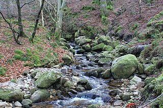
Rockbrook is a small area, once site of a small settlement, now semi-suburban, in County Dublin, Ireland. It is in the local government area of South Dublin.

Santry River is a small watercourse on the north side of Dublin city, one of the forty or so watercourses monitored by Dublin City Council. It runs, mostly unculverted, from Harristown and Dubber near Dublin Airport, through Santry and Coolock, reaching the sea at Raheny, in a lagoon area inshore of Bull Island.

The Naniken River is a minor river on the north side of Dublin city, Ireland, one of more than forty watercourses monitored by Dublin City Council. It is culverted for its upper course, visible in St Anne's Park for its entire lower course, and causes flooding somewhere along its line most years. The river flows entirely within the jurisdiction of Dublin City Council.

Booterstown Marsh, a Nature Reserve, is located in Booterstown, County Dublin, between the coastal railway line and the Rock Road. It is an area of salt marsh and muds, with brackish water. It includes the only salt marsh, and the only bird sanctuary, in south Dublin Bay. It lies just outside the boundary of Dublin city, and just north of Booterstown DART station and its car park.

The River Slang, also known as the Dundrum Slang or the Dundrum River, a tributary of the River Dodder, is a stream which rises on Three Rock Mountain, County Dublin. It is in the local government area of Dún Laoghaire–Rathdown.
The Owendoher River is a small river in southern County Dublin, Ireland, the largest tributary of the River Dodder, and a part of the River Liffey system.
The Lyreen River is a small river in County Kildare, Ireland, a tributary of the Rye River (Ryewater), and ultimately of the River Liffey.

The River Delvin is a river of northern County Dublin, about 18 kilometres (11 mi) long and forming much of the Dublin-Meath boundary; it is thus largely under the responsibility of Fingal County Council, sometimes shared with Meath County Council.

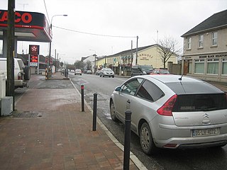
Ballyboughal is a village and district in central Fingal within the traditional County Dublin, near the Naul. The name means the town of the staff, and a major relic, the Bachal Isu, was protected in this area until Strongbow moved it to Christ Church, Dublin. It is 4.4 km from Oldtown.
The Bradogue River is a small river in Dublin that rises in Cabra and flows into the River Liffey, with its primary outfall at Ormond Quay. It is culverted for its entire course.

The Broadmeadow River or Broad Meadow Water, is a river of County Meath and northern County Dublin, about 25 kilometres (16 mi) long. It opens into a wide estuary between Swords and Malahide, and reaches the open sea several kilometres downstream, north of Malahide village. One of the larger watercourses by volume in County Dublin, the Broadmeadow is a salmonid river, with several species of fish, including brown trout. It has many small, and a few larger, tributaries, notably the Ward River. It is under the responsibility of Meath County Council and Fingal County Council, as well as oversight of the Environmental Protection Agency.
The Ward River, sometimes historically the Swords River, is a watercourse of County Meath and northern County Dublin. About 18 kilometres (11 mi) long; it runs through the town of Swords and then flows into the Broadmeadow River. The Ward is a salmonid river, with several species of fish, including brown trout. It has several small tributaries. The river is in the jurisdictions of Meath and Fingal County Councils, as well as within the oversight of the Environmental Protection Agency.
The Ballyboghil River or Ballyboughal Water is a river in Fingal, in the traditional County Dublin, about 18 kilometres (11 mi) long, reaching the sea by way of the 4.5 kilometres (2.8 mi)-long estuary. One of the larger watercourses by volume in the north County Dublin, the Ballyboghil is a salmonid river, with several species of fish, including brown trout. It has many small tributaries, and one larger tributary system. It is under the responsibility of Fingal County Council, and the oversight of the Environmental Protection Agency.
The Glencullen River, often the Cookstown River below Enniskerry, is a watercourse of Dún Laoghaire–Rathdown and northern County Wicklow. It is about 11 kilometres (6.8 mi) long; it passes the nature reserve of Knocksink Wood and the village of Enniskerry, and joins the River Dargle near Bray. The river is in the jurisdictions of Dún Laoghaire–Rathdown and Wicklow County Councils, as well as within the purview of the Environmental Protection Agency.
The Mayne River, is a small watercourse of northern County Dublin. It forms from the merger of the Cuckoo and Turnapin Streams, which rise near Dublin Airport and help drain the airport campus. The river is in the jurisdiction of Fingal County Council and within the oversight of the Environmental Protection Agency.