
This is a list of seaports around the coast of the island of Ireland, including those found in Northern Ireland.
This is a list of seaports around the coast of the island of Ireland, including those found in Northern Ireland.
| Types | |
|---|---|
| Rankings | |
| Locations | |
| Port management | |
| Conventions | |
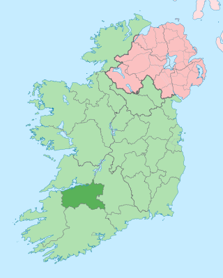
County Limerick is a western county in Ireland. It is in the province of Munster and is located in the Mid-West which comprises part of the Southern Region. It is named after the city of Limerick. Limerick City and County Council is the local council for the county. The county's population at the 2022 census was 209,536 of whom 102,287 lived in Limerick City, the county capital.

Irish coffee is a caffeinated alcoholic drink consisting of Irish whiskey, hot coffee and sugar, which has been stirred and topped with cream. The coffee is drunk through the cream.

Foynes is a town and major port in County Limerick in the midwest of Ireland, located at the edge of hilly land on the southern bank of the Shannon Estuary. The population of the town was 512 as of the 2022 census.

Askeaton is a town in County Limerick, Ireland. The town is built on the banks of the River Deel which flows into the Shannon Estuary 3 km to the north. Askeaton is on the N69 road between Limerick and Tralee; it is 25 km west of Limerick and 8 km north of Rathkeale. The town is in a townland and civil parish of the same name.

Patrickswell, historically known as Toberpatrick, is a small town in County Limerick, Ireland. It is primarily a commuter village for people working in Limerick, including the nearby industrial suburb of Raheen. The population was 848 at the 2022 census.

Adare is a village in County Limerick, Ireland, located southwest of the city of Limerick. Adare is designated as a heritage town by the Irish government. The village is in a townland and civil parish of the same name.
Events from the year 1943 in Ireland.

Kerry Head is a headland located in County Kerry, Ireland that stretches into the Atlantic Ocean just north of Banna Strand. On the southern edge of the headland sits Ballyheigue.

The N21 road is a national primary road in Ireland. The route runs from the M20 outside Limerick to Tralee with connecting roads to other parts of County Kerry. It is 84.37 km (52.43 mi) in length. It runs through the towns of Abbeyfeale, Newcastle West, Adare and the village of Templeglantine. Prior to October 2010 the N21 also ran through the town of Castleisland. The town has since been bypassed. Rathkeale was also bypassed in 1992.

Limerick railway station also known as Colbert Station or Limerick Colbert serves the city of Limerick in County Limerick, Ireland. It is on Parnell Street and is the main station on the Limerick Suburban Rail network. It has approximately 2,500 rail passengers a day travelling on four rail routes. The Bus Éireann bus station on site services approximately one million passengers a year, with 125 buses departing each day.

Loop Head, is a headland on the north side of the mouth of the River Shannon, in County Clare in the west of Ireland.

The Shannon Estuary in Ireland is a large estuary where the River Shannon flows into the Atlantic Ocean. The estuary has Limerick City at its head and its seaward limits are marked by Loop Head to the north and Kerry Head to the south. The estuary defines the main boundary between County Kerry/County Limerick to the south and County Clare to the north.

The N69 road is a national secondary road in Ireland. It runs from Limerick to Tralee and passes through Mungret, Clarina, Kildimo, Askeaton (bypassed), Foynes, Loghill, Glin, Tarbert, and Listowel.

Cahiracon, sometimes written as Caheracon, is a hamlet and townland in County Clare, Ireland. The hamlet is just off the R473 road and directly across the Shannon Estuary from Foynes in County Limerick. It was home to Saint John Bosco Community College, founded in 2002 as the result of an amalgamation of two older institutions. The college later moved to a new building in Kildysart.

Shanagolden is a small village in County Limerick, Ireland. It is west of the 'Golden Vale', an area of fertile agricultural land in the province of Munster. The village is around 35 km west of Limerick city on the R521 road between Foynes and Newcastlewest. The population was 303 at the 2016 census. The village is in a townland and civil parish of the same name.
Shannon Foynes Port is a port operating company managing the operations of cargo facilities within the Shannon Estuary. It is the second largest port in Ireland. It is operated and managed by the Shannon Foynes Port Company (SFPC), whose main operating office is based in Foynes, County Limerick. SFPC has statutory jurisdiction over all marine activities in the estuary between a line drawn from Kerry Head to Loop Head, and Limerick.
Mary Ellen Spring Rice was an Irish nationalist activist during the early 20th century. She was actively involved in gun-running during 1913-14, notably as part of the Howth Gun Run.
St Senan's GAA club is a Gaelic Athletic Association club in the parish of Foynes-Shanagolden-Robertstown, County Limerick, Ireland. The club was founded in 1947 and fields teams solely in Gaelic football.

The Limerick–Tralee line, also known as the North Kerry line, is a former railway line from Limerick railway station to Tralee railway station in Ireland. It also has branch lines to Foynes and Fenit. Much of the line today has now been converted into a greenway, the Great Southern Trail.

The Limerick to Foynes Railway is a 42 kilometres (26 mi) mothballed line in County Limerick, Ireland that connected the city of Limerick with the port of Foynes. A tender was published, for the works to reopen the line, in mid-2022. These works, starting with the clearing of vegetation, had begun by late 2022.