List of ports and harbors of the Arctic Ocean

Last updated

This is a list of ports and harbors of the Arctic Ocean . The entries are sorted travelling east from the International Date Line.

Contents

North America

United States

Location State Water bodyCoordinatesFeatures & notes [1] Image
Kivilina Alaska Chukchi Sea 67°43′38″N164°32′21″W / 67.72722°N 164.53917°W / 67.72722; -164.53917 (Kivilina, Alaska) US rank:86 [2] Kivalina 2.jpg
Utqiaġvik Alaska Chukchi Sea 71°17′26″N156°47′19″W / 71.29056°N 156.78861°W
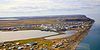
 / 71.29056; -156.78861 (Barrow, Alaska) Barrow AK.jpg
Prudhoe Bay Alaska Beaufort Sea 70°19′32″N148°42′41″W / 70.32556°N 148.71139°W / 70.32556; -148.71139 (Prudhoe Bay, Alaska) Aerial View of Prudhoe Bay.jpg

Canada

Location Province / Territory Water bodyCoordinatesFeatures & notes [1] Image
Tuktoyaktuk Northwest Territories Beaufort Sea 69°27′03″N133°02′09″W / 69.45083°N 133.03583°W / 69.45083; -133.03583 [3] Port Brabant to 1950 [4] Tuktoyaktuk airial photo 1987.jpg
Port of Churchill Manitoba Hudson Bay 58°46′45″N94°11′36″W / 58.77917°N 94.19333°W / 58.77917; -94.19333 [5] Churchill Seaport 1996-08-12.jpg
Iqaluit Nunavut Frobisher Bay 63°44′58″N68°31′18″W / 63.74944°N 68.52167°W / 63.74944; -68.52167 (Iqaluit) [6] Opened 25 July 2023 [7] IqaluitHarbourView.jpg

Greenland

Location Municipality Water bodyCoordinatesFeatures & notes [1] Image
Nuuk Port and Harbour Sermersooq Labrador Sea 64°10′15″N51°43′15″W / 64.17083°N 51.72083°W / 64.17083; -51.72083 (Nuuk Port and Harbour) Nuuk-port.jpg
Port of Ilulissat Avannaata Disko Bay 69°13′19″N51°05′42″W / 69.22194°N 51.09500°W / 69.22194; -51.09500 (Port of Ilulissat) The HDMS Thetis Sits in the Port of Ilulissat, Greenland (27720617071).jpg

Europe

Iceland

Location Regions Water bodyCoordinatesFeatures & notesImage
Akureyri Northeastern Eyjafjörður 65°41′00″N18°06′00″W / 65.68333°N 18.10000°W / 65.68333; -18.10000 (Akureyri) Akureyri - Skapti Hallgrimsson.jpg

Norway

Location County Water bodyCoordinatesFeatures & notesImage
Tromsø Troms Grøtsundet 69°40′58″N18°56′34″E / 69.68278°N 18.94278°E / 69.68278; 18.94278 Tromso sentrum (5835702754).jpg
Hammerfest Finnmark Barents Sea 70°39′48″N23°40′56″E / 70.66333°N 23.68222°E / 70.66333; 23.68222 Hammerfest Juni 2005.jpg
Honningsvåg Finnmark Barents Sea 70°58′43″N25°58′36″E / 70.97861°N 25.97667°E / 70.97861; 25.97667 Blick auf Honningsvag.jpg
Kirkenes Finnmark Varangerfjord 69°43′37″N30°02′44″E / 69.72694°N 30.04556°E / 69.72694; 30.04556 View of Kirkenes.jpg
Vardø Finnmark Barents Sea 70°22′13″N31°06′38″E / 70.37028°N 31.11056°E / 70.37028; 31.11056 Vardo by.jpg

Russia

Location Federal subject Water bodyCoordinatesFeatures & notesImage
Vitino Murmansk Oblast Kandalaksha Gulf 67°05′00″N32°20′00″E / 67.08333°N 32.33333°E / 67.08333; 32.33333 (Vitino)
Kandalaksha Murmansk Oblast White Sea 67°09′25″N32°24′42″E / 67.15694°N 32.41167°E / 67.15694; 32.41167 (Kandalaksha) Kandalaksha.jpg
Port of Murmansk Murmansk Oblast Barents Sea 68°58′48″N33°03′22″E / 68.98000°N 33.05611°E / 68.98000; 33.05611 (Port of Murmansk) MurmanskHarbour.jpg
Severomorsk Murmansk Oblast Barents Sea 69°04′00″N33°25′00″E / 69.06667°N 33.41667°E / 69.06667; 33.41667 (Severomorsk) Severomorsk Vid na zaliv.jpg
Belomorsk Republic of Karelia Onega Bay 64°31′31″N34°45′57″E / 64.52528°N 34.76583°E / 64.52528; 34.76583 (Belomorsk) Port Belomorska.JPG
Port of Arkhangelsk Arkhangelsk Oblast Northern Dvina 64°32′00″N40°30′00″E / 64.53333°N 40.50000°E / 64.53333; 40.50000 (Port of Arkhangelsk) Arkhangelsk sea river station.jpg
Naryan-Mar Nenets Autonomous Okrug Pechora River 67°38′00″N53°03′00″E / 67.63333°N 53.05000°E / 67.63333; 53.05000 (Naryan-Mar) Mport, N-Mar.JPG
Sabetta Yamalo-Nenets Autonomous Okrug Kara Sea 71°16′24″N72°04′21″E / 71.27333°N 72.07250°E / 71.27333; 72.07250 (Sabetta) Tor icebreaker (2225296).jpg
Dudinka Krasnoyarsk Krai| Yenisey 69°24′23″N86°10′35″E / 69.40639°N 86.17639°E / 69.40639; 86.17639 (Dudinka) Verladekrane im Hafen von Dudinka.jpg
Dikson Krasnoyarsk Krai Kara Sea 73°30′00″N80°31′00″E / 73.50000°N 80.51667°E / 73.50000; 80.51667 (Dikson) Soviet Union-1965-Stamp-0.06. 50 Years of Dikson.jpg
Igarka Krasnoyarsk Krai Yenisey 67°28′00″N86°35′00″E / 67.46667°N 86.58333°E / 67.46667; 86.58333 (Igarka) 2020-08-21 14-51-51 Igarka (cropped).jpg
Tiksi Sakha Republic Laptev Sea 71°39′00″N128°52′00″E / 71.65000°N 128.86667°E / 71.65000; 128.86667 (Tiksi) Tiksi.jpg
Port of Pevek Chukotka Autonomous Okrug Chaunskaya Bay 69°42′17″N170°15′49″E / 69.70472°N 170.26361°E / 69.70472; 170.26361 (Port of Pevek) Prichal porta Pevek.jpg


Related Research Articles

<span class="mw-page-title-main">Winston Churchill Range</span> Mountain range in Western Canada

The Winston Churchill Range is a mountain range in the central section of the Park Ranges of the Canadian Rockies located in Jasper National Park. The range was named after Sir Winston Churchill, former British prime minister.

<span class="mw-page-title-main">Fairholme Range</span> Mountain range in Alberta, Canada

The Fairholme Range is a mountain range east of the Bow River valley in the Canadian Rockies. The range is bounded on the west side by the Trans-Canada Highway as it passes through the towns of Exshaw and Canmore, while the northern section of the range extends into Banff National Park to the southern shores of Lake Minnewanka. John Palliser named the range in 1859 after his sister Grace Fairholme, who had married William Fairholme.

<span class="mw-page-title-main">Queen Elizabeth Ranges</span> Mountain range in Alberta, Canada

The Queen Elizabeth Ranges is a group of mountain ranges in the Canadian Rockies on the southeastern side of Jasper National Park, Canada. The northern end of the ranges begins east of Medicine Lake and extends in a southeasterly direction past the southern shore of Maligne Lake. The group was named in 1953 to celebrate the coronation of Elizabeth II as Canada's sovereign.

<span class="mw-page-title-main">President Range</span> Mountain range in Yoho NP, Canada

The President Range is a mountain range of the Canadian Rockies, located in the northwestern section of Yoho National Park. The range is named for the highest peak in the range, The President.

<span class="mw-page-title-main">Rainbow Range (Rocky Mountains)</span> Subrange of the Park Ranges in Alberta and British Columbia, Canada

The Rainbow Range is a small subrange of the Park Ranges subdivisions of the Northern Continental Ranges of the Rocky Mountains on the border between Alberta and British Columbia in Mount Robson Provincial Park.

<span class="mw-page-title-main">Port Leopold</span> Abandoned trading post in Nunavut, Canada

The locality Port Leopold is an abandoned trading post in the Qikiqtaaluk Region of Nunavut, Canada. It faces Prince Regent Inlet at the northeast tip of Somerset Island.

<span class="mw-page-title-main">Premier Range</span>

The Premier Range is a group of mountains within the Cariboo Mountains of east-central British Columbia, Canada. The range is bounded by the Raush River and Kiwa Creek to the north, the North Thompson River on the south and west and the Fraser River and its tributaries to the east.

<span class="mw-page-title-main">Colin Range</span> Mountain range of the Canadian Rockies

The Colin Range is a mountain range of the Canadian Rockies located directly northeast of the Jasper townsite in Jasper National Park, Canada.

<span class="mw-page-title-main">Ram Range</span> Subrange of the Front Ranges in Alberta, Canada

The Ram Range is a mountain range of the Canadian Rockies located in David Thompson Country, Canada. The range extends southeast from Abraham Lake to the Ram River. It is bounded on the southwest by Whiterabbit Creek.

<span class="mw-page-title-main">Maligne Range</span> Subrange of the Front Ranges in Alberta, Canada

The Maligne Range is a mountain range of the Canadian Rockies located directly southeast of Jasper townsite in Jasper National Park, Canada. The southern tail-end of the range finishes at Endless Chain Ridge.

<span class="mw-page-title-main">Misty Range</span> Mountain range in Alberta, Canada

The Misty Range is a mountain range of the Canadian Rockies located east of the Bighorn Highway within Kananaskis Country, Canada.

<span class="mw-page-title-main">Bow Range</span> Subrange of the Park Ranges in Alberta and British Columbia, Canada

The Bow Range is a mountain range of the Canadian Rockies in Alberta and British Columbia, Canada. The range is named in association with the Bow River and was officially adopted on March 31, 1917 by the Geographic Board of Canada.

<span class="mw-page-title-main">High Rock Range</span> Mountain range in Alberta and British Columbia, Canada

The High Rock Range is a mountain range of the Canadian Rockies in southwestern Alberta and southeastern British Columbia, Canada.

<span class="mw-page-title-main">South Jasper Ranges</span> Mountain ranges in Alberta and British Columbia

The South Jasper Ranges are mountain ranges of the Rocky Mountains in Alberta and British Columbia, Canada.

Qikiqtaaluk, Unorganized in Nunavut, Canada, is part of a larger census division known as the Qikiqtaaluk Region. This area covers the whole Qikiqtaaluk Region outside the 13 communities such as Iqaluit, Resolute or Grise Fiord. Baffin has a rocky mountainous landscape. Prior to the 2021 Canadian census it was known as Baffin.

<span class="mw-page-title-main">Livingstone Range (Canada)</span> Mountain range in the Canadian Rockies

The Livingstone Range is a sub-range of the Canadian Rockies in Alberta, Canada. It forms the eastern boundary of the Rockies in the south of the province. Its northern boundary is the Highwood River and it extends to Crowsnest Pass in the south. The Livingstone and Oldman Rivers bound it to the west.

<span class="mw-page-title-main">Geikie River (Saskatchewan)</span> River in Saskatchewan, Canada

Geikie River is a river in the northern part of the Canadian province of Saskatchewan. The river's source is Costigan Lake, which is near the uranium producing areas around the Key Lake mine in the Athabasca Basin. It flows in a north-easterly direction and flows into Wollaston Lake.

<span class="mw-page-title-main">Flathead Range (Canada)</span> Mountain range in British Columbia and Alberta, Canada

The Flathead Range is a mountain range of the Canadian Rockies in Alberta and British Columbia, Canada. It is located on the Continental Divide, east of Fernie, in the Kootenay Land District. It stretches 27 km (17 mi) lengthwise north–south from Crowsnest Pass to North Kootenay Pass. The range's toponym was officially adopted on 30 June 1912 by the Geographic Board of Canada, and was named in association with the Flathead River.

References

  1. 1 2 3 Seasonal, will freeze over during the winter.
  2. Port rankings by tonnage from [AAPA website], accessed 2 October 2012
  3. "Tuktoyaktuk". Geographical Names Data Base . Natural Resources Canada.
  4. "Hamlet of Tuktoyaktuk" . Retrieved 4 April 2024.
  5. "Churchill Harbour". Geographical Names Data Base . Natural Resources Canada.
  6. "Iqaluit". Geographical Names Data Base . Natural Resources Canada.
  7. "Iqaluit Deep Sea Port Officially Opens". 25 July 2023. Retrieved 4 April 2024.