Related Research Articles

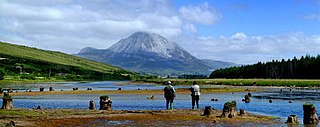
County Donegal is a county of Ireland in the province of Ulster and in the Northern and Western Region. It is named after the town of Donegal in the south of the county. It has also been known as County Tyrconnell or Tirconaill, after the historic territory. Donegal County Council is the local council and Lifford is the county town.

Lifford is the county town of County Donegal, Ireland, the administrative centre of the county and the seat of Donegal County Council, although the town of Letterkenny is often mistaken as holding this role.
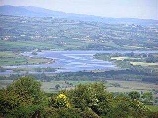
The River Foyle is a river in west Ulster in the northwest of the island of Ireland, which flows from the confluence of the rivers Finn and Mourne at the towns of Lifford in County Donegal, Republic of Ireland, and Strabane in County Tyrone, Northern Ireland. From here it flows to the city of Derry, where it discharges into Lough Foyle and, ultimately, the Atlantic Ocean. The total length of the River Foyle is 32 km (20 mi). The river separates part of County Donegal from parts of both County Londonderry and County Tyrone. The district of County Donegal that borders the western bank of the River Foyle is traditionally known as the Laggan. This district includes the villages of St Johnston and Carrigans, both of which are nestled on the banks of the River.

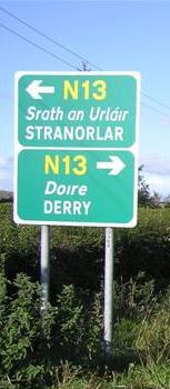
The N13 road is a national primary road in Ireland, running in County Donegal in Ulster from Stranorlar to just outside Derry. This road connects Letterkenny to Sligo, Derry and onwards to other destinations.

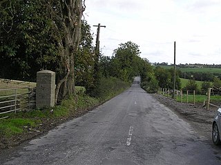
The R236 road runs in County Donegal in Ulster, and links Stranorlar, via Convoy and Raphoe, to St Johnston and Carrigans, becoming the A40 into Derry in Northern Ireland.

Raphoe is a small town in County Donegal in the north-west of Ulster, the northern province in Ireland. It is the main town in the fertile district of East Donegal known as the Laggan, as well as giving its name to the Barony of Raphoe, which was later divided into the baronies of Raphoe North and Raphoe South, as well as to the Roman Catholic Diocese of Raphoe and the Church of Ireland (Anglican) Diocese of Derry and Raphoe. There is also a civil parish of Raphoe.
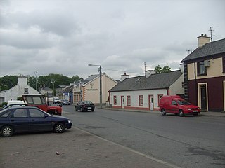
Convoy is a village and civil parish in the east of County Donegal, Ireland. The village is located in the Finn Valley district and is part of the Barony of Raphoe South. It is situated on the Burn Dale, and is located on the R236 road to Raphoe.

Ballindrait is a townland, village and census town in County Donegal, Ireland. Located near Lifford, the village and townland of Ballindrait is in the civil parish of Clonleigh and the barony of Raphoe North. The Burn Dale flows through the centre of Ballindrait.

Porthall is a village and townland in County Donegal, Ireland. The village is located on the west bank of the River Foyle, in The Laggan district of East Donegal, on the R265 road. The nearest town is Lifford, the county town.

The North West Liberties of Londonderry is a barony in County Londonderry, Northern Ireland. It is bordered by two other baronies in Northern Ireland: Tirkeeran to the east, across Lough Foyle, and Strabane Lower to the south. It also borders two baronies in County Donegal in the Republic of Ireland. It borders Raphoe North, to the south-west; and Inishowen West to the north.
Deele College, formerly Raphoe Vocational School, is a mixed non-denominational secondary school in Raphoe, County Donegal, Ireland. The population of the school is roughly about 800 students and 50 teachers.

The R265 is a regional road in County Donegal, Ireland. It runs north to south from near Newtown Cunningham to Rossgier near Lifford. The road runs from near Lough Swilly and generally along the west bank of the River Foyle. The road runs through mostly arable farmland in the East Donegal area.
Castleforward Demesne is a townland just east of Newtowncunningham, a village in The Laggan, a district in the east of County Donegal in Ireland. The townland is near the south-eastern shores of Lough Swilly and is in the Barony of Raphoe North.
The R264 road is a regional road in Ireland, located in County Donegal in Ulster. It runs between Raphoe and Lifford. The road passes through the village of Ballindrait, where it crosses over the Burn Dale.

Raphoe North, or North Raphoe, is a barony in County Donegal, Ireland. Baronies were mainly cadastral rather than administrative units. They acquired modest local taxation and spending functions in the 19th century before being superseded by the Local Government (Ireland) Act 1898.
The Clady River is a small river in Gweedore, a district in the north-west of County Donegal in Ulster, the northern province in Ireland. The river flows entirely within the Civil Parish of Tullaghobegly.
The Drumenny Burn, also known as the Drumonny Burn, the Drumenny River, the Drummenny River or the Drimminy River, is a burn in the south of County Donegal in Ulster, the northern province in Ireland. The lower stretch of the burn flows around the eastern edge of Donegal Town, where it flows into the River Eske. In the Ulster Scots dialect, a 'burn' is a stream or small river. The Drumenny Burn probably takes its name from the townland of Drumenny Upper, through which it flows, or else from the townlands of Drumenny Middle and Drumenny Lower, around the edges of which it flows. Almost all of the burn flows within the Civil Parish of Donegal.

Drumkeen is a village and townland in County Donegal, Ireland. The village is near the N13 primary road, about 8 kilometres (5 mi) west of Convoy. The village population was 193 at the 2016 census. The local soccer club, Drumkeen United, play at St Patrick's Park. The village is located just above the Burn Dale, which flows along the southern edge of the village. Drumkeen is the 660th biggest town-land and has an area of 2.2662 km2.
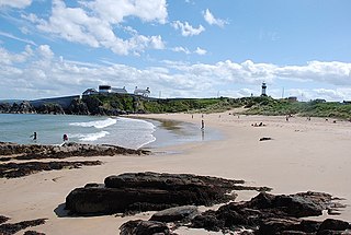
Shrove is a coastal hamlet and townland in Inishowen in the north of County Donegal in the north of Ulster, the northern province in Ireland. The hamlet is located a short distance to the north of Greencastle in the north-east of Inishowen, a peninsula on the north coast of Ireland. The name of both the hamlet and the townland is also sometimes written as Shroove, and is sometimes written as Stroove by some government bodies.
Largy Waterfall is a small waterfall located in the south-west of County Donegal in Ulster, the northern province in Ireland. The coastal waterfall is in Largy, a hamlet just west of Fintra Strand, a few miles west of Killybegs. The waterfall is often popularly known as County Donegal's Secret Waterfall or South Donegal's Secret Waterfall.
References
- 1 2 3 4 5 6 7 8 Discovery Series Sheet 6 (4th Edition). Ordnance Survey of Ireland (O.S.I.), Dublin, 2012.
- 1 2 Discoverer Series Sheet 12 (E Edition). Ordnance Survey of Northern Ireland (O.S.N.I.), Land and Property Services, Belfast, 2013.
- 1 2 Patrick McKay, A Dictionary of Ulster Place-Names, p. 54. The Institute of Irish Studies, The Queen's University of Belfast, Belfast, 1999.
- ↑ Martina O'Donnell, 'Settlement and Society in the Barony of East Inishowen, c. 1850' in William Nolan, Liam Ronayne and Mairead Dunlevy (Editors), Donegal: History and Society, p. 513. Geography Publications, Dublin, 1995 (reprinted 2002).
- 1 2 LOUGHS AGENCY: Foyle and Carlingford Catchments - Deele River. https://fishinginireland.info/trout/loughsagency/
- 1 2 3 River Deele and Tributaries Catchment Status Report 2010 (Report Ref.: LA/CSR/04/11), p. 10. Loughs Agency, Derry, 2010 (this publication can be viewed online).
- ↑ Mindat.org: Deele River, County Donegal, Ulster, Ireland. https://www.mindat.org/feature-2964855.html
- ↑ Irish White Water: Deele River. https://www.iww.ie/river_guide/river.php?id=474
- 1 2 3 4 Angélique Day and Patrick McWilliams (Editors), Ordnance Survey Memoirs of Ireland Volume 39 - Parishes of County Donegal II, 1835-6: Mid, West and South Donegal, p. 1, p. 18 and p. 188. The Institute of Irish Studies, The Queen's University of Belfast, Belfast, 1997 (in association with the Royal Irish Academy).
- 1 2 3 Samuel Lewis, Counties Londonderry and Donegal: A Topographical Dictionary, p. 72. Friar's Bush Press, Belfast, 2004 (originally published in London in 1837).
- ↑ Patrick McKay, A Dictionary of Ulster Place-Names, p. 31 (see entries for 'Burnfoot' and 'Burntollet River') and p. 150. The Institute of Irish Studies, The Queen's University of Belfast, Belfast, 1999.
- ↑ Drumkeen Townland, Co. Donegal. https://www.townlands.ie/donegal/raphoe-south/convoy/convoy/drumkeen/
- ↑ Samuel Lewis, Counties Londonderry and Donegal: A Topographical Dictionary, p. 82. Friar's Bush Press, Belfast, 2004 (originally published in London in 1837).
- 1 2 Ballindrait Townland, Co. Donegal. https://www.townlands.ie/donegal/raphoe-north/clonleigh/clonleigh-north/ballindrait/
- ↑ Angélique Day and Patrick McWilliams (Editors), Ordnance Survey Memoirs of Ireland Volume 39 - Parishes of County Donegal II, 1835-6: Mid, West and South Donegal, p. 14. The Institute of Irish Studies, The Queen's University of Belfast, Belfast, 1997 (in association with the Royal Irish Academy).
- ↑ Barony of Raphoe South, Co. Donegal. https://www.townlands.ie/donegal/raphoe-south/
- ↑ Barony of Raphoe North, Co. Donegal. https://www.townlands.ie/donegal/raphoe-north/
- ↑ Coolatee Townland, Co. Donegal. https://www.townlands.ie/donegal/raphoe-north/clonleigh/clonleigh-north/coolatee/
- ↑ Wood Island Townland, Co. Donegal. https://www.townlands.ie/donegal/raphoe-north/clonleigh/clonleigh-south/wood-island/
- ↑ Angélique Day and Patrick McWilliams, Ordnance Survey Memoirs of Ireland Volume 39 - Parishes of County Donegal II, 1835-6: Mid, West and South Donegal, p. 7. The Institute of Irish Studies, The Queen's University of Belfast, Belfast, 1997 (in association with the Royal Irish Academy).
- ↑ Island More Townland, Co. Donegal. https://www.townlands.ie/donegal/raphoe-north/clonleigh/clonleigh-north/island-more/