Convoy, County Donegal

Last updated

Convoy
Conmhaigh
Village
Convoydonegal.JPG
Convoy's main street
Ireland adm location map.svg
Red pog.svg
Convoy
Location in Ireland
Coordinates: 54°51′36″N7°39′50″W / 54.859998°N 7.663976°W / 54.859998; -7.663976
CountryIreland
Province Ulster
County County Donegal
Barony Raphoe South
Dáil Éireann Donegal
Elevation
40 m (130 ft)
Population
 (2022) [1]
1,702
Irish Grid Reference C216014
St. Ninian's Church of Ireland Church Convoychurch.JPG
St. Ninian's Church of Ireland Church
The old Convoy Woollen Mill The old Convoy woollen mill - geograph.org.uk - 1159075.jpg
The old Convoy Woollen Mill

Convoy (Irish: Conmhaigh, "plain of hounds") [2] is a village and civil parish in the east of County Donegal, Ireland. The village is located in the Finn Valley district and is part of the Barony of Raphoe South. It is situated on the Burn Dale (also known as the Burn Deele), and is located on the R236 road to Raphoe. [3]

Contents

Convoy had a total population of 1,702 according to the 2022 census. [1] Like many other towns in the vicinity, it has its origins in the Plantation of Ulster. Convoy is home to a mixed religious community which is reflected in the schools and churches in the town.

There is a Catholic and a mixed primary school in the town. There is also a Catholic church (popularly known as 'the Chapel'), a Church of Ireland church and a Free Presbyterian Church of Ulster church or 'kirk' (which was opened by the Church's founder, The Rev. Ian Paisley) in the town. There is also a Reformed Presbyterian Church in Ballyboe. There are no secondary schools in Convoy and local children tend to travel to Raphoe or Stranorlar for second-level education.

The Burn Dale (also known in English as the Burn Deele) is a burn (a small river) that flows along the southern edge of Convoy.

Woollen mill

Convoy once had a woollen mill located on the banks of the Burn Dale (also spelt as the Burn Deele), but this closed in the early 1980s with the loss of many local jobs.[ citation needed ] The woollen mill is now host to a business area that was promoted by the former state development body Foras Áiseanna Saothair (FÁS).[ citation needed ]

Convoy House

The Montgomery family of Convoy is descended from Alexander Montgomery, Prebendary of Doe, who died about 1658. He was brought over from Scotland by his kinsman, George Montgomery, who became the first Protestant Bishop of Raphoe in 1604. Alexander Montgomery of Croaghan, near Lifford, bought the Convoy estate from the Nesbitt family in 1719. Boyton House was first occupied in November 1807 by the family of Robert Montgomery of Brandrim who had inherited the estate from his cousin, Sandy Montgomery of Convoy. Sandy represented Donegal in Grattan's Parliament for thirty-two years. He spent part of his youth in America and was noted for his duelling. His brothers were John of Lisbon and Richard, a general in Washington's army who fell at the siege of Quebec in 1775. Sandy was a friend of Lord Edward Fitzgerald and a secret supporter of the United Irishmen. He voted against the Act of Union in 1800. Boyton House used to contain the letter which Washington wrote to the family on Richard's death and receipts for meat bought by the hundred-weight in Raphoe by the Montgomery family for free distribution in Convoy during the Famine. The house passed through marriage to the Boyton family in the nineteenth century. [4]

Transport

There are Bus Éireann buses serving Convoy which go to such places as Derry, Letterkenny and Strabane several times a day, excluding Sundays.

Convoy railway station opened on 1 January 1909, and closed on 1 January 1960. [5]

The nearest railway station is operated by Northern Ireland Railways and runs from Waterside Station in Derry, via Coleraine, to Belfast Central railway station and Belfast Great Victoria Street railway station.[ citation needed ]

Sport

Convoy near Donegal GAA's "centre of excellence" training facility at Milltown. [6]

Naomh Mhuire Conmhaigh is the local GAA club. Founded in 1928 the players of this Gaelic football club come from the villages of Convoy, Drumkeen and Raphoe with the pitch located in Convoy.[ citation needed ] The club has won several junior titles.[ citation needed ]

Convoy has a local amateur soccer team, known as Convoy Arsenal. The club were Donegal Junior League winners in 2003, won the Division One title in 2004, and were runners-up in the premier division in 2005. Convoy Arsenal subsequently joined the Ulster Senior League in 2005. They also field teams in the Donegal Saturday League in several underage grades.[ citation needed ]

See also

Related Research Articles

<span class="mw-page-title-main">Derry</span> City in Northern Ireland

Derry, officially Londonderry, is the largest city in County Londonderry, the second-largest in Northern Ireland and the fifth-largest on the island of Ireland. The old walled city lies on the west bank of the River Foyle, which is spanned by two road bridges and one footbridge. The city now covers both banks.

<span class="mw-page-title-main">County Donegal</span> County in Ireland

County Donegal is a county of Ireland in the province of Ulster and in the Northern and Western Region. It is named after the town of Donegal in the south of the county. It has also been known as County Tyrconnell or Tirconaill, after the historic territory. Donegal County Council is the local council and Lifford is the county town.

<span class="mw-page-title-main">Lifford</span> County town of Donegal, Ireland

Lifford is the county town of County Donegal, Ireland, the administrative centre of the county and the seat of Donegal County Council, although the town of Letterkenny is often mistaken as holding this role.

<span class="mw-page-title-main">Donegal (town)</span> Town in County Donegal, Ulster, Ireland

Donegal is a town in County Donegal, Ireland. The name was also historically spelt 'Dunnagall'. Although Donegal gave its name to the county, now Lifford is the county town. From the 15th until the early 17th century, Donegal was the 'capital' of Tyrconnell, a Gaelic kingdom controlled by the O'Donnell dynasty of the Northern Uí Néill.

<span class="mw-page-title-main">Dunfanaghy</span> Village in Donegal, Republic of Ireland

Dunfanaghy is a small town, former fishing port, and commercial centre on the north coast of County Donegal, Ireland. It lies on Donegal's North West coast, specifically the west side of Sheephaven Bay, on the N56 road, 30 km north-west of Letterkenny.

<span class="mw-page-title-main">Buncrana</span> Town in County Donegal, Ireland

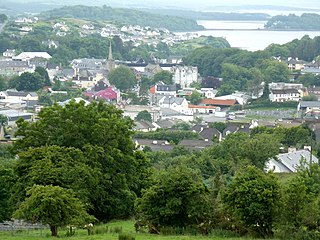
Buncrana is a town in County Donegal, Ireland. It is beside Lough Swilly on the Inishowen peninsula, 23 kilometres (14 mi) northwest of Derry and 43 kilometres (27 mi) north of Letterkenny. In the 2022 census, the population was 6,971, making it the second most populous town in County Donegal, after Letterkenny, and the largest in Inishowen.

<span class="mw-page-title-main">River Foyle</span> River in the northwest of the island of Ireland

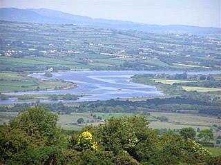
The River Foyle is a river in west Ulster in the northwest of the island of Ireland, which flows from the confluence of the rivers Finn and Mourne at the towns of Lifford in County Donegal, Republic of Ireland, and Strabane in County Tyrone, Northern Ireland. From here it flows to the city of Derry, where it discharges into Lough Foyle and, ultimately, the Atlantic Ocean. The total length of the River Foyle is 32 km (20 mi). The river separates part of County Donegal from parts of both County Londonderry and County Tyrone. The district of County Donegal that borders the western bank of the River Foyle is traditionally known as the Laggan. This district includes the villages of St Johnston and Carrigans, both of which are nestled on the banks of the River.

<span class="mw-page-title-main">Stranorlar</span> Town in County Donegal, Ireland

Stranorlar is a town, townland and civil parish in the Finn Valley of County Donegal, in Ireland. Stranorlar and Ballybofey form the Twin Towns.

<span class="mw-page-title-main">Newtown Cunningham</span> Village in County Donegal, Ireland

Newtown Cunningham, usually spelled Newtowncunningham or abbreviated to Newton, is a village and townland in the Laggan district in the east of County Donegal, Ireland, located on the N13 road 18 kilometres (11 mi) east of Letterkenny and 16 km (10 mi) west of Derry. At the 2016 census, the village population was 1,080.

<span class="mw-page-title-main">N13 road (Ireland)</span> Road in Ireland

The N13 road is a national primary road in Ireland, running in County Donegal in Ulster from Stranorlar to just outside Derry. This road connects Letterkenny to Sligo, Derry and onwards to other destinations.

<span class="mw-page-title-main">R236 road (Ireland)</span> Road in Ireland

The R236 road runs in County Donegal in Ulster, and links Stranorlar, via Convoy and Raphoe, to St Johnston and Carrigans, becoming the A40 into Derry in Northern Ireland.

<span class="mw-page-title-main">Raphoe</span> Town in County Donegal, Ireland

Raphoe is a small town in County Donegal in the north-west of Ulster, the northern province in Ireland. It is the main town in the fertile district of East Donegal known as the Laggan, as well as giving its name to the Barony of Raphoe, which was later divided into the baronies of Raphoe North and Raphoe South, as well as to the Roman Catholic Diocese of Raphoe and the Church of Ireland (Anglican) Diocese of Derry and Raphoe. There is also a civil parish of Raphoe.

<span class="mw-page-title-main">Castlefin</span> Town in County Donegal, Ireland

Castlefin, sometimes spelt Castlefinn, is a market town and townland in the Finn Valley of County Donegal in Ulster, the northern province in Ireland. It is located between Ballybofey and Lifford in East Donegal and, as of 2016, the population was 705. The River Finn flows by the town. The town is located in along the main N15 national primary road, which runs from Bundoran to Lifford. The town lies 6 miles from Lifford and 8 miles from the twin towns of Ballybofey and Stranorlar. It has close links to Letterkenny, to the twin towns of Ballybofey and Stranorlar, and to West Tyrone in Northern Ireland, especially with the towns of Strabane and Castlederg.

<span class="mw-page-title-main">Downings</span> Gaeltacht village in County Donegal, Ireland

Downings or Downies is a Gaeltacht village and townland on the Rosguill peninsula in County Donegal, Ireland. The village is on the shores of Sheephaven Bay on the north coast of Ireland.

<span class="mw-page-title-main">Manorcunningham</span> Village in County Donegal, Ireland

Manorcunningham, or Manor is a small village and townland in County Donegal, Ireland. It is located 7 kilometers from Letterkenny on the main road to Derry. It is known locally and throughout Donegal as just Manor.

<span class="mw-page-title-main">Termon</span> Village in County Donegal, Ireland

Termon is a village in the north of County Donegal, Ireland.

<span class="mw-page-title-main">St Johnston, County Donegal</span> Village in County Donegal, Ireland

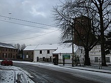
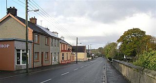
St Johnston, officially Saint Johnstown, is a village, townland, and an electoral division in County Donegal, Ireland. It is in the Laggan district of East Donegal on the left bank of the River Foyle. It is in the civil parish of Taughboyne and barony of Raphoe North, on the R236 (Lifford–Newtowncunningham) road where it overlaps the R265 (Carrigans–Raphoe) road. The village is about 12 kilometres (7.5 mi) south of Derry.

<span class="mw-page-title-main">Killygordon</span> Village in County Donegal, Ireland

Killygordon is a small village in the Finn Valley in the east of County Donegal in Ulster, the northern province in Ireland. As of 2016, the population was 614. It is located on the N15 between Ballybofey and Castlefin. The separate hamlet and townland of Crossroads, usually known as The Cross, lies half a mile from Killygordon. The River Finn passes by the village on its way towards its confluence with the River Mourne and the River Foyle.

Deele College, formerly Raphoe Vocational School, is a mixed non-denominational secondary school in Raphoe, County Donegal, Ireland. The population of the school is roughly about 800 students and 50 teachers.

The Burn Dale is a burn or small river in the east of County Donegal in Ulster, the northern province in Ireland. The burn is also known in English as the Dale Burn, the Burn Deele, the Burndale River, the Deele River or the River Deele. In the Ulster Scots dialect, a 'burn' is a stream or small river.

References

  1. 1 2 "Interactive Data Visualisations: Towns: Convoy". Census 2022. Central Statistics Office . Retrieved 30 September 2023.
  2. "Conmhaigh/Convoy". Placenames Database of Ireland (logainm.ie). Department of Culture, Heritage and the Gaeltacht and Dublin City University . Retrieved 21 July 2020.
  3. "Convoy, Donegal". Topographical Dictionary of Ireland: Samuel Lewis, 1837. Archived from the original on 2 April 2012.
  4. "Archived copy" (PDF). Archived from the original (PDF) on 25 September 2011. Retrieved 17 October 2011.{{cite web}}: CS1 maint: archived copy as title (link)
  5. "Convoy station" (PDF). Railscot – Irish Railways. Retrieved 23 September 2007.
  6. "Donegal GAA Centre Completed – CLG Dhún na nGall".