
Rockall is an uninhabitable granite islet in the North Atlantic Ocean. The United Kingdom claims that Rockall lies within its territorial sea and is part of its territory, but this claim is not recognised by Ireland. It and the nearby skerries of Hasselwood Rock and Helen's Reef are the only emergent parts of the Rockall Plateau. The rock was formed by magmatism as part of the North Atlantic Igneous Province during the Paleogene.

County Donegal is a county of Ireland in the province of Ulster and in the Northern and Western Region. It is named after the town of Donegal in the south of the county. It has also been known as County Tyrconnell or Tirconaill, after the historic territory. Donegal County Council is the local council and Lifford is the county town.

Cranford is a township in Union County, in the U.S. state of New Jersey, located 18 miles (29 km) southwest of Manhattan. As of the 2020 United States census, the township's population was 23,847, an increase of 1,222 (+5.4%) from the 2010 census count of 22,625, which in turn reflected an increase of 47 (+0.2%) from the 22,578 counted in the 2000 census.

Donegal is a borough in Westmoreland County, Pennsylvania, United States. It is a distinct municipality from the adjacent Donegal Township. The population was 103 at the 2020 census. Donegal is best known as an exit on the Pennsylvania Turnpike with restaurants, gas stations, and two hotels for travelers.

Letterkenny, nicknamed the Cathedral Town, is a large town in County Donegal, Ireland, on the River Swilly in the north-west of Ulster. Along with the nearby city of Derry, Letterkenny is a regional economic gateway for the north-west of Ireland.

This is a list of the extreme points of Ireland – the points that are farthest north, south, east or west in Ireland. It includes the Republic of Ireland and Northern Ireland.

Buncrana is a town in County Donegal, Ireland. It is beside Lough Swilly on the Inishowen peninsula, 23 kilometres (14 mi) northwest of Derry and 43 kilometres (27 mi) north of Letterkenny. In the 2022 census, the population was 6,971, making it the second most populous town in County Donegal, after Letterkenny, and the largest in Inishowen.

Tory Island, or simply Tory, is an island 14.5 kilometres off the north-west coast of County Donegal in the north-west of Ulster, the northern province in Ireland. It is officially known by its Irish name Toraigh, which, although spelled thus, is pronounced the same as the English version. It is the most remote inhabited island of Ireland. The name toraigh means "place of steep rocky heights".

Gweedore is a Gaeltacht (Irish-speaking) district and parish located on the Atlantic coast of County Donegal in the north-west of Ireland. Gweedore stretches some 26 kilometres (16 mi) from Glasserchoo and Bloody Foreland in the north to Crolly in the south and around 14 kilometres (9 mi) from Dunlewey in the east to Magheraclogher and Magheralosk in the west, and is sometimes described as one of Europe's most densely populated rural areas. It is the largest Irish-speaking parish in Ireland with a population of around 4,065, and is also the home of the northwest regional studios of the Irish-language radio service RTÉ Raidió na Gaeltachta, as well as an external campus of the University of Galway. Gweedore includes the settlements of Brinlack, Bunbeg, Derrybeg, Crolly and Dunlewey, and sits in the shade of County Donegal's highest peak, Errigal.

The Donegal County Board or Donegal GAA is one of 32 county boards of the Gaelic Athletic Association (GAA) in Ireland, and is responsible for the administration of Gaelic games in County Donegal.

Ballymagorry or Ballymagory is a small village and townland in County Tyrone, Northern Ireland. It is west of Artigarvan and 5 kilometres (3.1 mi) north of Strabane. In the 2001 Census it had a population of 565. It lies within the Strabane District Council area and lies on the River Glenmornan.

Rossnowlagh is a seaside village in the south of County Donegal, Ireland. It is about 8 kilometres (5 mi) north of Ballyshannon and 16 km (10 mi) southwest of Donegal Town. The area's 3 km (2 mi) long beach, or 2 km (1.2 mi) if measuring from the cliffs to Carrickfad, is frequented by walkers, surfers, windsurfers, kite-surfers and swimmers.
The Donegal Senior Football Championship is an annual football competition organised by Donegal GAA and contested by the highest-level clubs, to determine the best team in County Donegal. Since 2016, it has been known as Michael Murphy Sports and Leisure Donegal SFC after its headline sponsor.

Fanad United Football Club is an Irish association football club based in Fanad in the north of County Donegal. Their senior men's team currently plays in the Donegal Junior League. In 1986–87 they were both founding members and inaugural champions of the Ulster Senior League. They remain the USL's most successful club, having won fourteen titles. They also field teams in both the Donegal Youth League and the Donegal Women's League. They have previously fielded teams in both the A Championship and the League of Ireland U19 Division. They have also played in the FAI Cup, the League of Ireland Cup and the FAI Intermediate Cup. They have won the latter competition on two occasions, in 1987–88 and 1994–95. In September 2020 the club made the decision to Leave the USL and Intermediate Football and return to Junior Football in the Donegal League.

An Bun Beag, meaning "the small river mouth", is a small Gaeltacht village and townland in County Donegal, Ireland. It is officially the smallest townland in Gaoth Dobhair (Gweedore), but today the name Bunbeg is used to describe a large region of the parish. It is situated between Derrybeg and the townland of Dore and is home to many of Gweedore's amenities and businesses. The Clady River flows into the Crolly River beside Bunbeg Quay, on the south-western outskirts of Bunbeg.
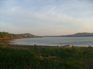
Mulroy Bay is a relatively small bay / sea loch on the north coast of County Donegal, Ireland.

St Johnston, officially Saint Johnstown, is a village, townland, and an electoral division in County Donegal, Ireland. It is in the Laggan district of East Donegal on the left bank of the River Foyle. It is in the civil parish of Taughboyne and barony of Raphoe North, on the R236 (Lifford–Newtowncunningham) road where it overlaps the R265 (Carrigans–Raphoe) road. The village is about 12 kilometres (7.5 mi) south of Derry.
Anthony Molloy is an Irish former Gaelic footballer who played for Ard an Rátha and the Donegal county team.
Odhrán Mac Niallais is an Irish Gaelic footballer who plays for Gaoth Dobhair and, formerly, for the Donegal county team.
The Donegal county football team represents Donegal in men's Gaelic football and is governed by Donegal GAA, the county board of the Gaelic Athletic Association. The team competes in the three major annual inter-county competitions; the All-Ireland Senior Football Championship, the Ulster Senior Football Championship and the National Football League.
