Burnfoot, County Donegal

Last updated

Burnfoot
Bun na hAbhann
Village
Burnfoot Donegal - panoramio.jpg
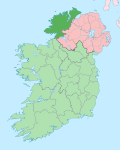
Ireland adm location map.svg
Red pog.svg
Burnfoot
Location in Ireland
Coordinates: 55°03′31″N7°24′18″W / 55.058473°N 7.404956°W / 55.058473; -7.404956
Country Ireland
Province Ulster
County County Donegal
Government
   Dáil Éireann Donegal
Population
 (2016) [1]
  Total450
Time zone UTC+0 (WET)
  Summer (DST) UTC-1 (IST (WEST))

Burnfoot (Irish : Bun na hAbhann) [2] is a small village on the Inishowen peninsula in County Donegal, Ireland. It lies within the townland of Ballyderowen. It has a few local shops and a pub. As of 2016, the population was 450. [1]

There is a small industrial estate which, among other firms, houses E&I Engineering, a major local employer with over 300 employees. Burnfoot is also home to Wild Ireland, an animal sanctuary that includes Irish bears, wolves and monkeys.[ citation needed ]

Related Research Articles

<span class="mw-page-title-main">County Donegal</span> County in Ireland

County Donegal is a county of Ireland in the province of Ulster and in the Northern and Western Region. It is named after the town of Donegal in the south of the county. It has also been known as County Tyrconnell, after the historic territory. Donegal County Council is the local council and Lifford is the county town.

<i>Gaeltacht</i> Primarily Irish-speaking regions in Ireland

Gaeltacht are the districts of Ireland, individually or collectively, where the Irish government recognises that the Irish language is the predominant vernacular, or language of the home. The Gaeltacht districts were first officially recognised during the 1920s in the early years of the Irish Free State, following the Gaelic revival, as part of a government policy aimed at restoring the Irish language.

<span class="mw-page-title-main">Glenties</span> Small town in County Donegal, Ireland

Glenties is a town in County Donegal, Ireland. It is situated where two glens meet, north-west of the Bluestack Mountains, near the confluence of two rivers. Glenties is the largest centre of population in the parish of Iniskeel. Glenties has won the Irish Tidy Towns Competition five times in 1958, 1959, 1960, 1962 and 1995 and has won a medal many other times. As of 2016, the population is 805.

<span class="mw-page-title-main">Inishowen</span> Large peninsula in County Donegal, Ireland

Inishowen is a peninsula in the north of County Donegal in Ireland. Inishowen is the largest peninsula on the island of Ireland.

<span class="mw-page-title-main">Enniscrone</span> Seaside town in County Sligo, Ireland

Enniscrone – also spelt Inniscrone and officially named Inishcrone – is a small seaside town in County Sligo, Ireland. Its sandy beach, tourist campsite, and golf course all attract visitors. As of the 2016 census, the town had a population of 1,156 people.

<span class="mw-page-title-main">Bundoran</span> Seaside resort in County Donegal, Ireland

Bundoran is a town in County Donegal, Ireland. The town is located near the N15 road near Ballyshannon, and is the most southerly town in Donegal. The town is a tourist seaside resort, and tourism has been at the heart of the local economy since the 18th century. Bundoran is a surfing destination and was listed by National Geographic magazine in 2012 as one of the world's top 20 surf towns.

<span class="mw-page-title-main">Killybegs</span> Fishing port in County Donegal, Ireland

Killybegs is a town in County Donegal, Ireland. It is the largest fishing port in the country and on the island of Ireland. It is located on the south coast of the county, north of Donegal Bay, near Donegal Town. Its Irish name Na Cealla Beaga means 'little cells', a reference to early monastic settlements. The town is situated at the head of a scenic harbour and at the base of a vast mountainous tract extending northward. In the summer, there is a street festival celebrating the fish catches and incorporating the traditional "Blessing of the Boats". As of 2016, the population was 1,236.

<span class="mw-page-title-main">Buncrana</span> Town in County Donegal, Ireland

Buncrana is a town in County Donegal, Ireland. It is beside Lough Swilly on the Inishowen peninsula, 23 kilometres (14 mi) northwest of Derry and 43 kilometres (27 mi) north of Letterkenny. In the 2016 census, the population was 6,785 making it the second most populous town in County Donegal, after Letterkenny, and the largest in Inishowen.

<span class="mw-page-title-main">Carraroe</span> Village in Connemara, County Galway. Ireland

Carraroe is a village in Connemara, the coastal Irish-speaking region (Gaeltacht) of County Galway, Ireland. It is known for its traditional fishing boats, the Galway Hookers. Its population is widely dispersed over the Carraroe peninsula between Cuan an Fhir Mhóir and Cuan Chasla. Carraroe has an unusual beach, Trá an Dóilín, a biogenic gravel beach made of coralline algae known as "maerl".

<span class="mw-page-title-main">Gweedore</span> Gaeltacht parish in County Donegal, Ireland

Gweedore is an Irish-speaking district and parish located on the Atlantic coast of County Donegal in the north-west of Ireland. Gweedore stretches some 26 kilometres (16 mi) from Glasserchoo in the north to Crolly in the south and around 14 kilometres (9 mi) from Dunlewey in the east to Magheraclogher in the west, and is one of Europe's most densely populated rural areas. It is the largest Irish-speaking parish in Ireland with a population of around 4,065, and is also the home of the northwest regional studios of the Irish-language radio service RTÉ Raidió na Gaeltachta, as well as an external campus of National University of Ireland, Galway. Gweedore includes the villages Bunbeg, Derrybeg, Dunlewey, Crolly and Brinlack, and sits in the shade of County Donegal's highest peak, Errigal.

<span class="mw-page-title-main">Ballybofey</span> Town in County Donegal, Ireland

Ballybofey is a town located on the south bank of the River Finn, County Donegal, Ireland. Together with the smaller town of Stranorlar on the north side of the River Finn, the towns form the Twin Towns of Ballybofey-Stranorlar. Ballybofey-Stranorlar, a census town, had a population of 4,852 in 2016.

<span class="mw-page-title-main">Baile na hAbhann, County Galway</span> Village and townland in Connacht, Ireland

Baile na hAbhann, anglicised as Ballynahown, is a Gaeltacht village about 31 km (19 mi) west of Galway, Ireland, on the R336 regional road between Indreabhán and Casla. The name means "town of the river". The village is in the townland of Baile na hAbhann Theas.

<span class="mw-page-title-main">Burnfoot, County Londonderry</span> Village in County Londonderry, Northern Ireland

Burnfoot is a small village within the townland of Bonnanaboigh in County Londonderry, Northern Ireland.

The Morris Tribunal was a public inquiry to address allegations of the 1990s and early 2000s against the Garda Síochána, the national police force of Ireland. Subjects explored included suggestions of corrupt and dishonest policing in County Donegal but its recommendations and conclusions have more widespread consequences and importance.

<span class="mw-page-title-main">Falcarragh</span> Town in County Donegal, Ireland

An Fál Carrach, sometimes called Na Crois Bhealaí is a small Gaeltacht town and townland in north-west County Donegal, Ireland. The settlement is in the old parish of Cloughaneely.

<i>Nuacht RTÉ</i> Irish TV series or program

Nuacht RTÉ le TG4 is the main news service for Irish speakers on RTÉ television. The service is broadcast from the news studios at Baile na hAbhann in the Connemara Gaeltacht, County Galway, Ireland.

<span class="mw-page-title-main">Riverchapel</span> Village in County Wexford, Ireland

Riverchapel is a village in County Wexford, Ireland. It lies just south of Courtown on the R742 regional road and has been a summer holiday resort for Dublin people at least since tourists started to arrive in 1863, when the railway line from Dublin reached nearby Gorey. The population of the area has also grown significantly since the mid-2000s. Riverchapel is 1 km inland from the Irish Sea coast and has merged into the adjoining village of Courtown.

<span class="mw-page-title-main">River Dun (Northern Ireland)</span>

The River Dun, also known as the Glendun River is a river in County Antrim, Northern Ireland. It runs through Glendun, one of the nine Glens of Antrim. The river is named after its brown colour, which comes from the peat bogs at its source on the slopes of Slievenanee on the Antrim Plateau. The source of the river is a few hundred metres from that of the River Bush, which flows north-east to meet the sea at Bushmills. Cushendun is a small coastal resort town lying at the mouth of the River Dun and Glendun.

<span class="mw-page-title-main">Bridgend, County Donegal</span> Village in County Donegal, Ireland

Bridgend or Bridge End is a village in County Donegal, Ireland, at the base of the Inishowen peninsula. It is located on the road to Letterkenny, on the western outskirts of Derry and near the border between the Republic of Ireland and Northern Ireland.

The Cronaniv Burn is a burn or small river that flows through the Poisoned Glen in Gaoth Dobhair, a district in the north-west of County Donegal in Ulster, the northern province in Ireland. In the Ulster Scots dialect, a 'burn' is a stream or small river.

References

  1. 1 2 "Census 2016 Sapmap Area: Settlements Burnfoot". Central Statistics Office (Ireland) . Retrieved 8 June 2018.
  2. "Bun na hAbhann/Burnfoot". Placenames Database of Ireland. Government of Ireland - Department of Arts, Heritage and the Gaeltacht and Dublin City University . Retrieved 8 June 2018.