Inch Island

Last updated

Inch Island
Native name:
An Inis / Inis na nOsirí [1] [2]
Inch island donegal.png
Inch Island from Grianan of Aileach
Island of Ireland location map.svg
Red pog.svg
Inch Island
Geography
Location Lough Swilly
Coordinates 55°03′54″N7°29′42″W / 55.065°N 7.495°W / 55.065; -7.495
Area13 km2 (5.0 sq mi)
Highest elevation222 m (728 ft)
Administration
Province Ulster
County Donegal
Demographics
Population396 (2022) [3]

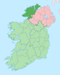
Inch Island (Irish : An Inis, meaning 'the island' [4] [5] ) is in Lough Swilly, a sea lough in County Donegal on the northern coast of Ireland. [6] [7] Inch is also the name of the civil parish covering the island. [4]
Contents

Geography and History

Inch Island is around 5 square miles (13 square kilometres) in area. [8] The island lies in Lough Swilly, Inch being just off the south-western coast of the Inishowen mainland, near the village of Burt. [6] Inch Island is connected to the mainland by a causeway road, known as the Inch Banks. The island's highest hill, Inch Top, is 222 metres in height. [6] [9] Another Irish language name for Inch Island is Inis na nOsirí, meaning 'Island of the Oysters'. [1] [2]

Population

Historical population
YearPop.±%
1841 978    
1851 769−21.4%
1901 462−39.9%
1951 414−10.4%
1996 397−4.1%
YearPop.±%
2002 438+10.3%
2006 438+0.0%
2011448+2.3%
2016461+2.9%
2022396−14.1%
Source: John Chambers. "Islands - Change in Population 1841 - 2011". irishislands.info. Retrieved 19 February 2015.

The table reports data taken from Discover the Islands of Ireland (Alex Ritsema, Collins Press, 1999) and the Census of Ireland.

Buildings

Presbyterian kirk (church), located at Carnaghan. Inch Presbyterian Church - geograph.org.uk - 967576.jpg
Presbyterian kirk (church), located at Carnaghan.
The beach looking ENE Inch Island - the beach - geograph.org.uk - 967719.jpg
The beach looking ENE

The remains of a portal tomb with a nearby burial chamber, probably constructed using parts of the original tomb, is located near Carnaghan (Irish: Baile Mhic Cearnachain) on the south-western part of the island. [10]

A 15th century castle, known as Inch Castle, stands on a cliff overlooking Lough Swilly. At the northern tip of the island is Inch Fort, an early 19C defensive structure.

The island's Presbyterian church is one of the smallest of the surrounding area (just some 14 families are members of it); [11] the island's Catholic church, usually known simply as 'the Chapel', is dedicated to Our Lady of Lourdes and was built in 1932. [8]

Nature

Inch island is a well known birdwatching site with a relevant population of migratory and wintering birds. Bird species on the island include Greenland white fronted goose, whooper swan and greylag goose. [12]

Tourism

Inch Wildfowl Reserve features an 8 km looped walk, catering for outdoor recreational activity including walking, running and cycling. The site includes two car parks, seating, viewpoints and a number of bird hides open to the public. This scenic pathway follows around the lake edge and offers panoramic views of the surrounding agricultural landscape and wetlands. [13]

See also

Related Research Articles

<span class="mw-page-title-main">County Donegal</span> County in Ireland

County Donegal is a county of Ireland in the province of Ulster and in the Northern and Western Region. It is named after the town of Donegal in the south of the county. It has also been known as County Tyrconnell or Tirconaill, after the historic territory. Donegal County Council is the local council and Lifford is the county town.

<span class="mw-page-title-main">Inishowen</span> Large peninsula in County Donegal, Ireland

Inishowen is a peninsula in the north of County Donegal in Ireland. Inishowen is the largest peninsula on the island of Ireland.

<span class="mw-page-title-main">Dunfanaghy</span> Village in Donegal, Republic of Ireland

Dunfanaghy is a small town, former fishing port, and commercial centre on the north coast of County Donegal, Ireland. It lies on Donegal's North West coast, specifically the west side of Sheephaven Bay, on the N56 road, 30 km north-west of Letterkenny.

<span class="mw-page-title-main">Buncrana</span> Town in County Donegal, Ireland

Buncrana is a town in County Donegal, Ireland. It is beside Lough Swilly on the Inishowen peninsula, 23 kilometres (14 mi) northwest of Derry and 43 kilometres (27 mi) north of Letterkenny. In the 2022 census, the population was 6,971, making it the second most populous town in County Donegal, after Letterkenny, and the largest in Inishowen.

<span class="mw-page-title-main">Lough Swilly</span> Sea inlet in County Donegal, Ireland

Lough Swilly in Ireland is a glacial fjord or sea inlet lying between the western side of the Inishowen Peninsula and the Fanad Peninsula, in County Donegal. Along with Carlingford Lough and Killary Harbour it is one of three glacial fjords in Ireland.

<span class="mw-page-title-main">Lough Ree</span> Lake in Ireland

Lough Ree, translated to English as King's Lake or King Lake, is a lake in the midlands of Ireland, the second of the three major lakes on the River Shannon. Lough Ree is the second largest lake on the Shannon after Lough Derg. The other two major lakes are Lough Allen to the north, and Lough Derg to the south. There are also several minor lakes along the length of the river. The lake serves as a border between the counties of Longford and Westmeath on the eastern side and County Roscommon in the province of Connacht on the western side. The lake is popular for fishing and boating. The lake supports a small commercial eel fishery and is locally famous for its eels on wheels truck. The town of Athlone is situated at the southern end of the lake, and has a harbour for boats going out on the lake. The small town of Lanesboro is at the northern end of the lake.

<span class="mw-page-title-main">Fanad</span> Peninsula in County Donegal, Ireland

Fanad is a peninsula that lies between Lough Swilly and Mulroy Bay on the north coast of County Donegal, Ireland. The origin of the name Fanad derives from the Irish language word Fána for "sloping ground". It is also referred to as Fannet or Fannett in older records. There are an estimated 700 people living in Fanad and 30% Irish speakers.

<span class="mw-page-title-main">Newtown Cunningham</span> Village in County Donegal, Ireland

Newtown Cunningham, usually spelled Newtowncunningham or abbreviated to Newton, is a village and townland in the Laggan district in the east of County Donegal, Ireland, located on the N13 road 18 kilometres (11 mi) east of Letterkenny and 16 km (10 mi) west of Derry. At the 2016 census, the village population was 1,080.

<span class="mw-page-title-main">Londonderry and Lough Swilly Railway</span> Irish Railway

The Londonderry and Lough Swilly Railway Company was an Irish public transport and freight company that operated in parts of County Londonderry and County Donegal between 1853 and 2014. Incorporated in June 1853, it once operated 99 miles of railways. It began the transition to bus and road freight services in 1929. It closed its last railway line in July 1953 but continued to operate bus services under the name Lough Swilly Bus Company until April 2014, becoming the oldest railway company established in the Victorian era to continue trading as a commercial concern into the 21st century. Following a High Court petition by HM Revenue and Customs, the company went into liquidation and operated its final bus services on 19 April 2014.

<span class="mw-page-title-main">Ramelton</span> Small town in County Donegal, Ireland

Ramelton, also Rathmelton, is a town and townland in County Donegal, Ireland. As of 2016, its population was 1,266.

<span class="mw-page-title-main">Quigley's Point</span> Village in County Donegal, Ireland

Quigley's Point is a village in County Donegal, Ireland. Located on the eastern shores of Inishowen and overlooking Lough Foyle, the village is sometimes known locally as "Carrowkeel" as it is in a townland of that name. To the south is the city of Derry and to the north lie the villages of Moville and Greencastle. A car ferry links Greencastle with Magilligan during the summer. The river Cabry, which flows through the area, is spanned by a late-18th century bridge at Quigley's Point.

<span class="mw-page-title-main">Rathmullan</span> Seaside village in County Donegal, Ireland

Rathmullan is a seaside village and townland on the Fanad Peninsula in County Donegal, Ireland. It is situated on the western shore of Lough Swilly, 11 kilometres (7 mi) north-east of Ramelton and 12 km (7 mi) east of Milford. Rathmullan was the point of departure during the Flight of the Earls in 1607, a major turning point in Irish history.

<span class="mw-page-title-main">Urris</span> Valley near Clonmany, County Donegal, Ireland

Urris is a valley to the west of the parish of Clonmany, in County Donegal, Ireland. It comprises the townlands of Crossconnell, Dunaff, Kinnea, Leenan, Letter, and Urrismenagh. It sits on the eastern side of Loch Swilly and it is bounded to the south-east by the Urris hills, and to the east by Binion hill. To the north, there is Rockstown bay and Tullagh peninsula. There are two entrances to Urris; the Gap of Mamore, and Crossconnell.

<span class="mw-page-title-main">Burt, County Donegal</span> Parish in Ulster, Ireland

Burt is a parish in County Donegal, Ireland, on the main road between Letterkenny and Derry.

<span class="mw-page-title-main">Drumardagh</span> Townland in Ulster, Ireland

Drumardagh is a townland in the east of County Donegal in Ulster, Ireland. The townland is about 5 kilometres east of Letterkenny in the Laggan district of East Donegal. The townland is just outside the village of Manorcunningham. The Isle Burn flows along the eastern boundary of the townland. The Irish name means 'the Ridge (drum) on the High Place (ardagh)', and it is this elevation that gives Drumardagh its commanding views over Lough Swilly, from Glenswilly to Inch Island, and beyond to the peaks of the Fanad and Inishowen peninsulae.

<span class="mw-page-title-main">Wild Atlantic Way</span> Irish coastal 2,500 km road route

The Wild Atlantic Way is a tourism trail on the west coast, and on parts of the north and south coasts, of Ireland. The 2,500 km driving route passes through nine counties and three provinces, stretching from County Donegal's Inishowen Peninsula in Ulster to Kinsale, County Cork, in Munster, on the Celtic Sea coast.

<span class="mw-page-title-main">Raghtin More</span> Mountain in Ireland

Raghtin More or Slieve Keeroge is a mountain with a height of 502 metres (1,647 ft) in Inishowen, County Donegal, Ireland. There is a megalithic cairn on its summit, which can be climbed from Mamore Gap. From the summit there is a view of Lough Swilly and the coast stretching to Malin Head.

The Burn Dale is a burn or small river in the east of County Donegal in Ulster, the northern province in Ireland. The burn is also known in English as the Dale Burn, the Burn Deele, the Burndale River, the Deele River or the River Deele. In the Ulster Scots dialect, a 'burn' is a stream or small river.

<span class="mw-page-title-main">Shrove, County Donegal</span> Hamlet and townland in Inishowen, County Donegal, in Ulster, Ireland

Shrove is a coastal hamlet and townland in Inishowen in the north of County Donegal in the north-west of Ulster, the northern province in Ireland. The hamlet is located a short distance to the north of Greencastle in the north-east of Inishowen, a peninsula on the north coast of Ireland. The name of both the hamlet and the townland is also sometimes written as Shroove, and is sometimes written as Stroove by some government bodies.

References

  1. 1 2 "New website offers 'virtual museum exhibition' of Inch island heritage". Derry Journal . 4 May 2020. Archived from the original on 22 June 2020. Retrieved 19 April 2021.
  2. 1 2 "Inch Heritage". Archived from the original on 20 October 2021.
  3. Population Density and Area Size (Report). Central Statistics Office. 2023. Retrieved 29 June 2023.
  4. 1 2 "Inch Island/An Inis". Placenames Database of Ireland .
  5. Patrick McKay, A Dictionary of Ulster Place-Names, p. 82. The Institute of Irish Studies, The Queen's University of Belfast, Belfast, 1999.
  6. 1 2 3 Discoverer Series Sheet 7 (F Edition). Ordnance Survey of Northern Ireland (O.S.N.I.), Land and Property Services, Belfast, 2017.
  7. Discovery Series Sheet 2 (3rd Edition). Ordnance Survey of Ireland (O.S.I.), Dublin, 2005.
  8. 1 2 "Donegal Islands - INCH ISLAND - Population". www.welovedonegal.com. WeLoveDonegal. Archived from the original on 21 February 2020. Retrieved 16 April 2015.
  9. "Inishowen Area /Inch Top". MountainViews. Ordnance Survey Ireland. Archived from the original on 16 April 2015. Retrieved 16 April 2015.
  10. "'Inch Island' : Portal Tomb". www.megalithomania.com. Failte Ireland. Archived from the original on 2 March 2016. Retrieved 16 April 2015.
  11. "Inch Presbyterian Church - Fahan Presbyterian Church". Archived from the original on 25 September 2021. Retrieved 20 October 2021.
  12. "Inch Island -Donegal". www.discoverireland.ie. Failte Ireland. Archived from the original on 16 April 2015. Retrieved 16 April 2015.
  13. "Inch Wildfowl Reserve Looped Walk". www.inchwildfowlreserve.ie. Archived from the original on 9 April 2018. Retrieved 28 January 2019.

Commons-logo.svg Media related to Inch Island at Wikimedia Commons