Carrigart

Last updated

Carraig Airt
Carrigart
Village
Carraigairt.JPG
Carrigart Main Street
Ireland adm location map.svg
Red pog.svg
Carraig Airt
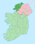
Location in Ireland
Coordinates: 55°10′37″N7°47′38″W / 55.177°N 7.794°W / 55.177; -7.794
Country Ireland
Province Ulster
County County Donegal
Population
 (2022) [1]
294
Area code(s) 074, +00 353 74
Irish Grid Reference B847228
Carraig Airt is the only official name. The anglicized spelling Carrigart has no official status.

Carraig Airt [2] (anglicised as Carrigart or Carrickart [3] ) is a small Gaeltacht village in the barony of Kilmacrenan in the north of County Donegal, Ireland. The village is on the R245 route between Letterkenny and Creeslough. Situated as it is at the base of the Rosguill peninsula, in one of the more remote but most scenic parts of the country, the village provides services for a large hinterland, with a supermarket with banking facilities, a post office, a doctor's surgery and a barracks staffed part-time by the Garda Síochána. Carrigart has a public park that borders the shoreline behind the houses on the main street. Designed by Angela Gallagher, it is maintained by the Tidy Towns Committee and has won several awards.[ citation needed ] The village and its environs remain largely agricultural, relying on passing trade and tourism during the summer months. In common with the rest of this part of Donegal, Carrigart has many second homes, owned especially by Northern Irish holiday makers.[ citation needed ]

The village, which celebrated its centenary in 2002, although there is evidence of Carrigart's existence for longer than that, originally formed part of the estates of the Earls of Leitrim, nearby Mulroy House being one of their seats. William Clements, 3rd Earl of Leitrim, was assassinated in nearby Cratlagh wood in 1878 by men from the neighbouring peninsula of Fanad.

In the 18th and 19th centuries, Carrigart had a fair day on 21 June. [4] The town now hosts a festival that runs from 8 to 14 August.[ citation needed ]

The official name given to Carrigart is Carraig Airt but it has also been translated as Ceathrú Fhiodhghoirt, meaning Quarterland of the Wood of the Field [5]

See also

Related Research Articles

<i>Gaeltacht</i> Primarily Irish-speaking regions in Ireland

A Gaeltacht is a district of Ireland, either individually or collectively, where the Irish government recognises that the Irish language is the predominant vernacular, or language of the home. The Gaeltacht districts were first officially recognised during the 1920s in the early years of the Irish Free State, following the Gaelic revival, as part of a government policy aimed at restoring the Irish language.

Earl of Leitrim was a title in the Peerage of Ireland.

<span class="mw-page-title-main">Carndonagh</span> Town in County Donegal, Ireland

Carndonagh is a town on the Inishowen peninsula in County Donegal, Ireland, close to Trawbreaga Bay. It is the site of the Carndonagh stones. The Irish name, Carn Domhnach, means "the cairn or mound of the church".

<span class="mw-page-title-main">Carrigallen</span> Village in County Leitrim, Ireland

Carrigallen is a small village in County Leitrim, Ireland. It is on the R201 and R203 roads in the east of the county, 19 km west of Cavan town. As of 2016, the village had a population of 387. The village is in a civil parish of the same name.

<span class="mw-page-title-main">Leitrim, County Leitrim</span> Village in County Leitrim, Ireland

Leitrim is a village in County Leitrim, Ireland, on the River Shannon near the border with County Roscommon. It is at the junction of the R280 and R284 regional roads.

<span class="mw-page-title-main">Tullaghan</span> Village in County Leitrim, Ireland

Tullaghan is the most northerly village in County Leitrim, Ireland. Lying at the northern end of Glenade, Tullaghan is in the parish of Kinlough and Glenade and is part of the Manorhamilton electoral area.

<span class="mw-page-title-main">Creeslough</span> Village in County Donegal, Ireland

Creeslough is a village in County Donegal, Ireland, 12 kilometres (7 mi) south of Dunfanaghy on the N56 road. It overlooks an arm of Sheephaven Bay, with the population of the surrounding area engaged mainly in agriculture, mostly livestock rearing.

<span class="mw-page-title-main">Ramelton</span> Town in County Donegal, Ulster, Ireland

Ramelton, also Rathmelton, is a town and townland in County Donegal, Ireland. As of 2022, its population was 1,288.

<span class="mw-page-title-main">Gortahork</span> Village in Ulster, Ireland

Gort an Choirce or Gort a' Choirce, anglicised as Gortahork, is a village and townland in the northwest of County Donegal, Ireland. It is a Gaeltacht community, where the Irish language is the main language spoken in the area. Along with Falcarragh, it forms part of the district known as Cloughaneely.

<span class="mw-page-title-main">Rathmullan</span> Seaside village in County Donegal, Ireland

Rathmullan is a seaside village and townland on the Fanad Peninsula in County Donegal, Ireland. It is situated on the western shore of Lough Swilly, 11 kilometres (7 mi) north-east of Ramelton and 12 km (7 mi) east of Milford. Rathmullan was the point of departure during the Flight of the Earls in 1607, a major turning point in Irish history.

<span class="mw-page-title-main">Downings</span> Gaeltacht village in County Donegal, Ireland

Downings or Downies is a Gaeltacht village and townland on the Rosguill peninsula in County Donegal, Ireland. The village is on the shores of Sheephaven Bay on the north coast of Ireland.

<span class="mw-page-title-main">Carrigaholt</span> Fishing village in County Clare, Ireland

Carrigaholt is a small fishing village in County Clare, Ireland, a castle and a Catholic parish by the same name. The area was officially classified as part of the West Clare Gaeltacht; an Irish-speaking community; until 1956.

<span class="mw-page-title-main">Malin, County Donegal</span> Village in County Donegal, Ireland

Malin is a village in County Donegal, Ireland, situated 6 km (4 mi) north of Carndonagh. A further 13 km (8 mi) north further is Malin Head, the most northerly point of the island of Ireland. It was a planned settlement plotted around a triangular green. Malin won the Irish Tidy Towns Competition in 1970 and 1991.

<span class="mw-page-title-main">Burnfoot, County Donegal</span> Village in County Donegal, Ireland

Burnfoot is a small village on the Inishowen peninsula in County Donegal, Ireland. It lies within the townland of Ballyderowen. It has a few local shops and a pub. As of 2022, the population was 413.

<span class="mw-page-title-main">Culdaff</span> Seaside village in County Donegal, Ireland

Culdaff is a village, civil parish and townland on the Inishowen peninsula of County Donegal, Ireland. Known for its beach, it attracts tourists from all over Ireland. As of 2016, the population was 237.

<span class="mw-page-title-main">Bridgend, County Donegal</span> Village in County Donegal, Ireland

Bridgend or Bridge End is a village in County Donegal, Ireland, at the base of the Inishowen peninsula. It is located on the N13 road to Letterkenny, on the western outskirts of Derry and near the border between the Republic of Ireland and Northern Ireland.

<span class="mw-page-title-main">Killygordon</span> Village in County Donegal, Ireland

Killygordon is a small village in the Finn Valley in the east of County Donegal, Ireland. As of 2022, the population was 716. It is located on the N15 between Stranorlar and Castlefin. The separate hamlet and townland of Crossroads, usually known as The Cross, lies half a mile from Killygordon. The River Finn passes by the village on its way towards its confluence with the River Mourne and the River Foyle.

<span class="mw-page-title-main">Carrigans, County Donegal</span> Village in County Donegal, Ireland

Carrigans is a village in The Laggan, a district in the east of County Donegal, Ireland. The village is located on the R236 regional road, a short distance from the River Foyle.

Gaeltacht an Láir is an Irish-speaking area in the central part of County Donegal in the west of Ulster, the northern province in Ireland. It centres on the village of Baile na Finne (Fintown) and stretches south to Gleann Colm Cille and north to Fanad and Rosguill. There are nearly 7,000 people living in the area and 2,000 daily Irish speakers.

<span class="mw-page-title-main">Redcastle, County Donegal</span> Village in County Donegal, Ireland

Redcastle is a village in County Donegal, Ireland, located on the eastern shores of Inishowen and overlooking the wide expanse of Lough Foyle. To the south is the city of Derry and to the north lie the villages of Moville and Greencastle.

References

  1. "Census Interactive Map – Towns: Carraig Airt". Census 2022 . Central Statistics Office . Retrieved 23 October 2024.
  2. Placenames (Ceantair Ghaeltachta) Order 2004.
  3. "Carraig Airt/Carrickart". Placenames Database of Ireland. Government of Ireland - Department of Arts, Heritage and the Gaeltacht and Dublin City University . Retrieved 10 June 2018.
  4. Statistical Survey of the County of Donegal with Observations on the Means of Improvement, Drawn up in the year 1801, For the consideration and under the direction of The Dublin Society, by James McParlan M.D.
  5. Deirdre and Laurence Flanagan, Irish Place Names, Gill & Macmillan, 2002.