Muff, County Donegal

Last updated

Muff
Magh
Village
Muff, County Donegal - geograph.org.uk - 1406102.jpg
Main Street
Ireland adm location map.svg
Red pog.svg
Muff
Location in Ireland
Coordinates: 55°04′03″N7°16′09″W / 55.067586°N 7.26903°W / 55.067586; -7.26903
Country Ireland
Province Ulster
County County Donegal
Government
   Dáil constituency Donegal
   EU Parliament Midlands–North-West
Population
 (2016) [1]
   Urban
1,226
Time zone UTC+0 (WET)
  Summer (DST) UTC-1 (IST (WEST))

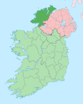
Muff (from Irish Magh) [2] is a village, civil parish and townland in County Donegal, Ireland. It is near the mouth of the River Foyle (where it flows into Lough Foyle) and sits close to the border between the Republic of Ireland and Northern Ireland. The village of Culmore and the city of Derry are to the south in Northern Ireland.

Contents

History

Muff was one of several Protestant villages in eastern Donegal that would have been transferred to Northern Ireland, had the recommendations of the Irish Boundary Commission been enacted in 1925. [3]

Muff has experienced significant growth in population during the last decade as people from Northern Ireland migrate across the border.[ citation needed ]

Education

The village has a primary school, Scoil Naomh Bríd, which has slightly over 200 students enrolled. [4] It is a co-educational primary school under the patronage of the Roman Catholic Bishop of Derry. The staff comprises an administrative principal, eight mainstream class teachers and three special education teachers (SETs), one of whom is shared with another school. Historically, many children crossed the border to attend either Culmore Primary School [5] or Hollybush Primary School. [6]

Sport and recreation

The local association football team is called Quigley's Point Swifts. [7] The club was formed in 1975. In 1985 they then joined the Derry & District League (D&D). In the nineties the club developed its reserve teams and several underage squads.

The Local Gaelic football club, Naomh Padraig was founded on 16 February 1989. It has developed a pitch and clubhouse and competes at underage levels as well as Donegal's all county league divisions.

Each summer, usually during the first week in August, the village celebrates Muff Festival; [8] which includes céilidhs, competitions, street parties, parades, amusements, night-time entertainment, and live performances.

Because of the village's proximity to a beach, it is a popular destination for diving. [9]

Notable residents

See also

Further reading

Related Research Articles

<span class="mw-page-title-main">Derry</span> City in Northern Ireland

Derry, officially Londonderry, is the largest city in County Londonderry, the second-largest in Northern Ireland and the fifth-largest on the island of Ireland. The old walled city lies on the west bank of the River Foyle, which is spanned by two road bridges and one footbridge. The city now covers both banks.

<span class="mw-page-title-main">County Londonderry</span> County in Northern Ireland

County Londonderry, also known as County Derry, is one of the six counties of Northern Ireland, one of the thirty-two counties of Ireland and one of the nine counties of Ulster. Before the partition of Ireland, it was one of the counties of the Kingdom of Ireland from 1613 onward and then of the United Kingdom after the Acts of Union 1800. Adjoining the north-west shore of Lough Neagh, the county covers an area of 2,118 km2 (818 sq mi) and today has a population of about 252,231.

<span class="mw-page-title-main">Lifford</span> County town of Donegal, Ireland

Lifford is the county town of County Donegal, Ireland, the administrative centre of the county and the seat of Donegal County Council, although the town of Letterkenny is often mistaken as holding this role.

<span class="mw-page-title-main">Inishowen</span> Large peninsula in County Donegal, Ireland

Inishowen is a peninsula in the north of County Donegal in Ireland. Inishowen is the largest peninsula on the island of Ireland.

<span class="mw-page-title-main">Buncrana</span> Town in County Donegal, Ireland

Buncrana is a town in County Donegal, Ireland. It is beside Lough Swilly on the Inishowen peninsula, 23 kilometres (14 mi) northwest of Derry and 43 kilometres (27 mi) north of Letterkenny. In the 2022 census, the population was 6,971, making it the second most populous town in County Donegal, after Letterkenny, and the largest in Inishowen.

<span class="mw-page-title-main">Greencastle, County Donegal</span> Fishing port in County Donegal, Ireland

Greencastle is a commercial fishing port located in the north-east of the Inishowen Peninsula on the north coast of County Donegal in Ulster, Ireland. The port is on the western shores of Lough Foyle. Nowadays, given the decline in the fishing industry, it resembles more closely a 'typical' Donegal holiday village. It is located a few miles from Moville and is about 20 miles from Derry.

<span class="mw-page-title-main">Ballintra</span> Village in County Donegal, Ireland

Ballintra is a village in the parish of Drumholm in the south of County Donegal, Ireland, just off the N15 road between Donegal town and Ballyshannon. Ballintra lies on the northern bank of the Blackwater river. The river rises in the hills that lie inland from the town, and flows through a number of small lakes before spilling over a small waterfall in a gorge behind the village.

<span class="mw-page-title-main">Convoy, County Donegal</span> Village in County Donegal, Ireland

Convoy is a village and civil parish in the east of County Donegal, Ireland. The village is located in the Finn Valley district and is part of the Barony of Raphoe South. It is situated on the Burn Dale, and is located on the R236 road to Raphoe.

<span class="mw-page-title-main">Laghy</span> Village in County Donegal, Ireland

Laghy or Laghey is a village and townland in County Donegal, Ireland, between Ballintra and Donegal Town. It is one of three villages that make up the parish of Drumholm, formerly a civil and Church of Ireland parish, now only used as a division of the Roman Catholic Diocese of Raphoe. The village has a quarry, a supermarket, garden centre, filling station, two public houses, a church with a graveyard, an Orange hall, a recycling centre, a Donegal County Council yard and salt depot, and a national school. Rossnowlagh and Murvagh beaches are nearby. Murvagh is also the home to Donegal Golf Club.

<span class="mw-page-title-main">Eglinton, County Londonderry</span> Village in County Londonderry, Northern Ireland

Eglinton is a village in County Londonderry, Northern Ireland. It lies 5.5 miles (8.9 km) east-north-east of Derry, to which it serves as a sleeper village, and 9.5 miles (15.3 km) west-south-west of Limavady. It resides within Derry and Strabane district. The City of Derry Airport, also known as Eglinton Aerodrome and formerly as Londonderry Eglinton Airport, lies a short distance from the village.

<span class="mw-page-title-main">Culmore</span> Village near Derry, Northern Ireland

Culmore is a village and townland in Derry, County Londonderry, Northern Ireland. It is at the mouth of the River Foyle. In the 2011 Census it had a population of 3,465 people. It is situated within Derry and Strabane district.

<span class="mw-page-title-main">Annagry</span> Village in County Donegal, Ireland

Anagaire is a village in The Rosses district of County Donegal, Ireland. As of 2016, the population was 236.

<span class="mw-page-title-main">Castlefin</span> Town in County Donegal, Ireland

Castlefin, sometimes spelt Castlefinn, is a market town and townland in the Finn Valley of County Donegal in Ulster, the northern province in Ireland. It is located between Ballybofey and Lifford in East Donegal and, as of 2016, the population was 705. The River Finn flows by the town. The town is located in along the main N15 national primary road, which runs from Bundoran to Lifford. The town lies 6 miles from Lifford and 8 miles from the twin towns of Ballybofey and Stranorlar. It has close links to Letterkenny, to the twin towns of Ballybofey and Stranorlar, and to West Tyrone in Northern Ireland, especially with the towns of Strabane and Castlederg.

<span class="mw-page-title-main">Quigley's Point</span> Village in County Donegal, Ireland

Quigley's Point is a village in County Donegal, Ireland. Located on the eastern shores of Inishowen and overlooking Lough Foyle, the village is sometimes known locally as "Carrowkeel" as it is in a townland of that name. To the south is the city of Derry and to the north lie the villages of Moville and Greencastle. A car ferry links Greencastle with Magilligan during the summer. The river Cabry, which flows through the area, is spanned by a late-18th century bridge at Quigley's Point.

<span class="mw-page-title-main">Gortahork</span> Village in Ulster, Ireland

Gort an Choirce or Gort a' Choirce, anglicised as Gortahork, is a village and townland in the northwest of County Donegal, Ireland. It is a Gaeltacht community, where the Irish language is the main language spoken in the area. Along with Falcarragh, it forms part of the district known as Cloughaneely.

<span class="mw-page-title-main">Kincasslagh</span> Gaeltacht village in County Donegal, Ireland

Cionn Caslach is a small Gaeltacht seaside village in the Rosses area of County Donegal, Ireland. Despite only having a population of just over 40 people, the village has attracted much international attention due to the success of local singer Daniel O'Donnell.

<span class="mw-page-title-main">Rory Kavanagh</span> Donegal Gaelic footballer

Rory Kavanagh is an Irish Gaelic football manager and former player with St Eunan's and the Donegal county team. He was manager of St Eunan's from November 2020 until the end of the 2023 championship.

<span class="mw-page-title-main">Bridgend, County Donegal</span> Village in County Donegal, Ireland

Bridgend or Bridge End is a village in County Donegal, Ireland, at the base of the Inishowen peninsula. It is located on the road to Letterkenny, on the western outskirts of Derry and near the border between the Republic of Ireland and Northern Ireland.

<span class="mw-page-title-main">Killygordon</span> Village in County Donegal, Ireland

Killygordon is a small village in the Finn Valley in the east of County Donegal in Ulster, the northern province in Ireland. As of 2016, the population was 614. It is located on the N15 between Ballybofey and Castlefin. The separate hamlet and townland of Crossroads, usually known as The Cross, lies half a mile from Killygordon. The River Finn passes by the village on its way towards its confluence with the River Mourne and the River Foyle.

References

  1. "Census 2016 Sapmap Area: Settlements Muff". Central Statistics Office (Ireland). Archived from the original on 15 June 2018. Retrieved 15 June 2018.
  2. "Placenames Database of Ireland". Archived from the original on 15 October 2013. Retrieved 15 October 2013.
  3. "Irish Boundary Commission Report". National Archives. 1925. pp. 140–43. Archived from the original on 26 November 2020. Retrieved 10 August 2020.
  4. "Scoil Naomh Brid". Scoil Naomh Brid. Retrieved 10 October 2023.
  5. "Culmore Primary School". Culmore Primary School. Retrieved 10 October 2023.
  6. "Hollybush Primary School". Hollybush Primary School. Retrieved 10 October 2023.
  7. "The Quigleys Point Swifts". Archived from the original on 15 January 2021. Retrieved 26 January 2019.
  8. "Muff Festival". Archived from the original on 22 January 2018. Retrieved 24 September 2021.
  9. "Muff Diving Club in Muff, Ireland". Muff Diving Club. Retrieved 13 March 2023.
  10. "Brian Friel, Playwright Called the Irish Chekhov, Dies at 86". New York Times. 2 October 2015. Archived from the original on 3 June 2020. Retrieved 10 August 2020.