Machaire Rabhartaigh

Last updated

Machaire Rabhartaigh
Village
Machairerabhartaigh2011.jpg
Machaire Rabhartaigh strand, October 2011
Ireland adm location map.svg
Red pog.svg
Machaire Rabhartaigh
Location in Ireland
Coordinates: 55°08′28″N8°10′18″W / 55.14123°N 8.17155°W / 55.14123; -8.17155
CountryIreland
Province Ulster
County County Donegal
Government
   Dáil Éireann Donegal
Area code(s) 074, +000 353 74
Irish Grid Reference B847228

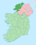
Machaire Rabhartaigh (known in English as Magheroarty), meaning "plain of the spring tide/plain of Roarty", [1] is a Gaeltacht village and townland on the north-west coast of County Donegal in Ulster, the northern province in Ireland. It is in the parish of Cloughaneely and its main access road is the R257.

It has been home to a Gael Linn Irish language Summer school since 1981 which runs courses for teenagers aged 1218 every summer, and has an intake of about 200 students per course. [2]

The village has a port used by fishing vessels. It also the main ferry port for Tory Island.[ citation needed ]

It attracts tourists during the summer and watersports enthusiasts visit the area to windsurf/surf/kitesurf and to go kayaking in the bay. A natural reef exists to the left of the pier which provides conditions suitable for surfing throughout the year.[ citation needed ] Amenities include a pub, café and Scoil Naomh Dubhthach Machaire Rabhartaigh, an Irish-speaking primary school.[ citation needed ]

Related Research Articles

<span class="mw-page-title-main">Kilkeel</span> Town in County Down, Northern Ireland

Kilkeel is a small town, civil parish and townland in County Down, Northern Ireland. It is the southernmost town in Northern Ireland. It lies within the historic barony of Mourne. Kilkeel town is the main fishing port on the Down coast, and its harbour is home to the largest fishing fleet in Northern Ireland. It had a population of 6,633 people at the 2021 census. The town contains the ruins of a 14th-century church and fort, winding streets and terraced shops. It lies just south of the Mourne Mountains.

<span class="mw-page-title-main">Letterkenny</span> Town in County Donegal, Ireland

Letterkenny, nicknamed the Cathedral Town, is a large town in County Donegal, Ireland, on the River Swilly in the north-west of Ulster. Along with the nearby city of Derry, Letterkenny is a regional economic gateway for the north-west of Ireland.

<span class="mw-page-title-main">Inishowen</span> Large peninsula in County Donegal, Ireland

Inishowen is a peninsula in the north of County Donegal in Ireland. Inishowen is the largest peninsula on the island of Ireland.

<span class="mw-page-title-main">Bundoran</span> Seaside resort in County Donegal, Ireland

Bundoran is a town in County Donegal, Ireland. The town is located near the N15 road near Ballyshannon, and is the most southerly town in Donegal. The town is a tourist seaside resort, and tourism has been at the heart of the local economy since the 18th century. Bundoran is a surfing destination and was listed by National Geographic magazine in 2012 as one of the world's top 20 surf towns.

<span class="mw-page-title-main">Kilcar</span> Gaeltacht village in County Donegal, Ireland

Cill Charthaigh is a Gaeltacht village on the R263 regional road in the south west of County Donegal in Ireland. It is also a townland of 233 acres and a civil parish in the historic barony of Banagh.

<span class="mw-page-title-main">Joe McHugh</span> Irish politician (born 1971)

Joe McHugh is an Irish Fine Gael politician who has served as Chair of the Committee on European Union Affairs since September 2020. He has been a Teachta Dála (TD) for the Donegal constituency since 2016, and previously from 2007 to 2016 for the Donegal North-East constituency. He served as Minister for Education and Skills from 2018 to 2020 and as a Minister of State from 2014 to 2018, including as Government Chief Whip from 2017 to 2018. He was a Senator for the Administrative Panel from 2002 and 2007.

<span class="mw-page-title-main">Gweedore</span> Gaeltacht area in County Donegal, Ireland

Gweedore is a Gaeltacht (Irish-speaking) district and parish located on the Atlantic coast of County Donegal in the north-west of Ireland. Gweedore stretches some 26 kilometres (16 mi) from Glasserchoo and Bloody Foreland in the north to Crolly in the south and around 14 kilometres (9 mi) from Dunlewey in the east to Magheraclogher and Magheralosk in the west, and is sometimes described as one of Europe's most densely populated rural areas. It is the largest Irish-speaking parish in Ireland with a population of around 4,065, and is also the home of the northwest regional studios of the Irish-language radio service RTÉ Raidió na Gaeltachta, as well as an external campus of the University of Galway. Gweedore includes the settlements of Brinlack, Bunbeg, Derrybeg, Crolly and Dunlewey, and sits in the shade of County Donegal's highest peak, Errigal.

<span class="mw-page-title-main">Moville</span> Port town in County Donegal, Ireland

Moville is a coastal town located on the Inishowen Peninsula of County Donegal, Ireland, close to the northern tip of the island of Ireland. It is the first coastal town of the Wild Atlantic Way when starting on the northern end.

<span class="mw-page-title-main">Maharees</span> Isthmus in County Kerry, Ireland

Maharees or Magharees is a 5 km long tombolo located on the northern side of the Dingle Peninsula in County Kerry, Ireland.

<span class="mw-page-title-main">Machrihanish</span> Human settlement in Scotland

Machrihanish is a village in Argyll, on the west coast of Scotland. It is a short distance north of the tip of the Mull of Kintyre, which faces out towards Northern Ireland and the Atlantic.

<span class="mw-page-title-main">Castlefin</span> Town in County Donegal, Ireland

Castlefin, sometimes spelt Castlefinn, is a market town and townland in the Finn Valley of County Donegal in Ulster, the northern province in Ireland. It is located between Ballybofey and Lifford in East Donegal and, as of 2016, the population was 705. The River Finn flows by the town. The town is located in along the main N15 national primary road, which runs from Bundoran to Lifford. The town lies 6 miles from Lifford and 8 miles from the twin towns of Ballybofey and Stranorlar. It has close links to Letterkenny, to the twin towns of Ballybofey and Stranorlar, and to West Tyrone in Northern Ireland, especially with the towns of Strabane and Castlederg.

<span class="mw-page-title-main">Gortahork</span> Village in Ulster, Ireland

Gort an Choirce or Gort a' Choirce, anglicised as Gortahork, is a village and townland in the northwest of County Donegal, Ireland. It is a Gaeltacht community, where the Irish language is the main language spoken in the area. Along with Falcarragh, it forms part of the district known as Cloughaneely.

<span class="mw-page-title-main">Inishbofin, County Donegal</span> Island in County Donegal, Ireland

Inishbofin, also Inishbofinne, is an island and townland off the coast of Machaire Uí Rabhartaigh (Magheraroarty), County Donegal, Ireland.

<span class="mw-page-title-main">Rossnowlagh</span> Seaside village in County Donegal, Ireland

Rossnowlagh is a seaside village in the south of County Donegal, Ireland. It is about 8 kilometres (5 mi) north of Ballyshannon and 16 km (10 mi) southwest of Donegal Town. The area's 3 km (2 mi) long beach, or 2 km (1.2 mi) if measuring from the cliffs to Carrickfad, is frequented by walkers, surfers, windsurfers, kite-surfers and swimmers.

<span class="mw-page-title-main">Manorcunningham</span> Village in County Donegal, Ireland

Manorcunningham, or Manor is a small village and townland in County Donegal, Ireland. It is located 7 kilometres from Letterkenny on the main road to Derry. It is known locally and throughout Donegal as just Manor.

<span class="mw-page-title-main">Paddy Glackin</span> Musical artist

Paddy Glackin is an Irish fiddler and founding member of the Bothy Band. He is considered one of Ireland's leading traditional fiddle players.

<span class="mw-page-title-main">Gael Linn</span> Irish cultural promotion organisation, with record label

Gael Linn is a non-profit and non-governmental organisation focused on the promotion of the Irish language and the arts. The organisation's funding includes government and lottery sources.

<span class="mw-page-title-main">CLG Ghaoth Dobhair</span> Donegal-based Gaelic games club

CLG Ghaoth Dobhair is a GAA club based in the parish of Gaoth Dobhair in northwest County Donegal, Republic of Ireland. They are one of the strongholds of Gaelic football in County Donegal.

<span class="mw-page-title-main">Cloughaneely</span> Irish-speaking district, County Donegal, Ireland

Cloughaneely is a district in the north-west of County Donegal in Ireland. This is a mainly coastal area with a population of over 4,000 centred on the towns of Falcarragh and Gortahork. It is a Gaeltacht area, meaning the Irish language is spoken as the primary language. Cloughaneely includes the secondary school Pobalscoil Chloich Cheannfhaola, with just under 500 students. Places of interest include Cnoc na Naomh, considered to be a mountain with religious significance. Cloughaneely, The Rosses and Gweedore, known locally as "the three parishes" with 16,000 Irish speakers, together form a social and cultural region different from the rest of the county, with Gweedore serving as the main centre for industry.

Glór na nGael is one of the Irish-language lead organisation funded by Foras na Gaeilge which promotes and supports Irish in three sectors: the family, community development, and business. It was established as a Irish language community group competition in 1961, and Cardinal Tomás Ó Fiaich and Monsignor Pádraig Ó Fiannachta were among its founders.

References

  1. "Machaire Rabhartaigh/Magheraroarty". Logainm.ie.
  2. "Gael Linn - Gaeltachta: Co. Donegal". Archived from the original on 30 October 2007.