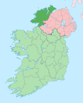
Carndonagh

Last updated

Carndonagh
Carn Domhnach
Town
Carndonagh SW View 1996 08 29-mod.jpg
Ireland adm location map.svg
Red pog.svg
Carndonagh
Location in Ireland
Coordinates: 55°15′N7°16′W / 55.25°N 7.27°W / 55.25; -7.27
Country Ireland
Province Ulster
County County Donegal
Dáil Éireann Donegal
EU Parliament Midlands–North-West
Elevation
32 m (105 ft)
Population
 (2022) [1]
2,768
Eircode routing key
F93
Telephone area code +353(0)74
Irish Grid Reference C467453

Carndonagh (karn-DUN-ah; Irish : Carn Domhnach) [2] is a town on the Inishowen peninsula in County Donegal, Ireland, close to Trawbreaga Bay. It is the site of the Carndonagh stones. [3] The Irish name, Carn Domhnach, means "the cairn or mound of the church". [4]

Contents

Amenities

The town is laid out around a central square, or Diamond, and is dominated by its Romanesque Revival Catholic chapel. It is home to 6 national schools including St. Patrick's GNS and BNS, Glentogher NS, Craigtown NS, Donagh NS, St. Bridget's NS and Carndonagh Community School, formerly the largest community school in the Republic of Ireland. Carndonagh is home to a number of musicians, artists and writers and to the Inishowen Carnival Group, Carndonagh Musical Society, Brass Band, and the Inishowen Gospel Choir (both international performers).[ citation needed ]

History

Carndonagh railway station opened on 1 July 1907, but finally closed on 2 December 1935. [5]

Transport

TFI Local Link, runs a number of public transport routes for the area: 952 (Carndonagh/Derry), [6] 954 (Carndonagh/Malin Head), [7] 955 (Buncrana/Carndonagh), [8] 2529 (Quigley's Point/Carndonagh), [6] 7748 (Shrove/Carndonagh) [9] and 7749 (Redcastle/Carndonagh). [9]

There are private coach services from the town to Derry [10] and Dublin. [11]

Carndonagh is on the R238, R240 and R244 regional roads.

Sport

Some of the sports clubs and organisations active within the community in Carndonagh are:

People

See also

Related Research Articles

<span class="mw-page-title-main">Derry</span> City in Northern Ireland

Derry, officially Londonderry, is the largest city in County Londonderry, the second-largest in Northern Ireland and the fifth-largest on the island of Ireland. The old walled city lies on the west bank of the River Foyle, which is spanned by two road bridges and one footbridge. The city now covers both banks.

<span class="mw-page-title-main">County Donegal</span> County in Ireland

County Donegal is a county of Ireland in the province of Ulster and in the Northern and Western Region. It is named after the town of Donegal in the south of the county. It has also been known as County Tyrconnell or Tirconaill, after the historic territory. Donegal County Council is the local council and Lifford is the county town.

<span class="mw-page-title-main">Letterkenny</span> Town in County Donegal, Ireland

Letterkenny, nicknamed the Cathedral Town, is a large town in County Donegal, Ireland, on the River Swilly in the north-west of Ulster. Along with the nearby city of Derry, Letterkenny is a regional economic gateway for the north-west of Ireland.

<span class="mw-page-title-main">Clonmany</span> Village in County Donegal, Ireland

Clonmany is a village and civil parish in north-west Inishowen, in County Donegal, Ireland. The Urris valley to the west of Clonmany village was the last outpost of the Irish language in Inishowen. In the 19th century, the area was an important location for poitín distillation. Outside the village, there are a number of notable townlands, including Kinnea (Rockstown), Crossconnell, Dunaff, and Leenan.

<span class="mw-page-title-main">Inishowen</span> Large peninsula in County Donegal, Ireland

Inishowen is a peninsula in the north of County Donegal in Ireland. Inishowen is the largest peninsula on the island of Ireland.

<span class="mw-page-title-main">Donegal (town)</span> Town in County Donegal, Ulster, Ireland

Donegal is a town in County Donegal in Ulster, the northern province in Ireland. Although Donegal gave its name to the county, now Lifford is the county town. From the 15th until the early 17th century, Donegal was the "capital" of Tyrconnell, a Gaelic kingdom controlled by the O'Donnell dynasty of the Northern Uí Néill.

<span class="mw-page-title-main">Buncrana</span> Town in County Donegal, Ireland

Buncrana is a town in County Donegal, Ireland. It is beside Lough Swilly on the Inishowen peninsula, 23 kilometres (14 mi) northwest of Derry and 43 kilometres (27 mi) north of Letterkenny. In the 2022 census, the population was 6,971, making it the second most populous town in County Donegal, after Letterkenny, and the largest in Inishowen.

<span class="mw-page-title-main">Stranorlar</span> Town in County Donegal, Ireland

Stranorlar is a town, townland and civil parish in the Finn Valley of County Donegal, in Ireland. Stranorlar and Ballybofey form the twin towns of Ballybofey–Stranorlar.

<span class="mw-page-title-main">Ballybofey</span> Town in County Donegal, Ireland

Ballybofey is a town located on the south bank of the River Finn, County Donegal, Ireland. Together with the smaller town of Stranorlar on the north side of the River Finn, the towns form the twin towns of Ballybofey-Stranorlar. The twin towns, a census town, had a population of 5,406 in 2022.

<span class="mw-page-title-main">Londonderry and Lough Swilly Railway</span> Irish Railway

The Londonderry and Lough Swilly Railway Company was an Irish public transport and freight company that operated in parts of County Londonderry and County Donegal between 1853 and 2014. Incorporated in June 1853, it once operated 99 miles of railways. It began the transition to bus and road freight services in 1929. It closed its last railway line in July 1953 but continued to operate bus services under the name Lough Swilly Bus Company until April 2014, becoming the oldest railway company established in the Victorian era to continue trading as a commercial concern into the 21st century. Following a High Court petition by HM Revenue and Customs, the company went into liquidation and operated its final bus services on 19 April 2014.

<span class="mw-page-title-main">Urris</span> Valley near Clonmany, County Donegal, Ireland

Urris is a valley to the west of the parish of Clonmany, in County Donegal, Ireland. It comprises the townlands of Crossconnell, Dunaff, Kinnea, Leenan, Letter, and Urrismenagh. It sits on the eastern side of Loch Swilly and it is bounded to the south-east by the Urris hills, and to the east by Binion hill. To the north, there is Rockstown bay and Tullagh peninsula. There are two entrances to Urris; the Gap of Mamore, and Crossconnell.

<i>Donegal Peoples Press</i>

The Donegal People's Press is a weekly local newspaper in north County Donegal, Ireland. The paper is published every Tuesday in the north of the county, and a separate edition of the paper, with some alterations, is published in the south of the county, as the Tuesday edition of the Donegal Democrat. It is owned by Iconic Newspapers.

The Inish Times is a local Irish newspaper based in Buncrana on the Inishowen peninsula in County Donegal. It serves the Inishowen area and is also sold in nearby areas such as Derry and Letterkenny. The paper, which is published each Tuesday, was first started in 1999 and is now part of the River Media group of publications which include the Letterkenny Post and the Donegal Post. The editor, Catriona Gallen, was at the helm at the paper's relaunch in 2010. The sports section is edited by Johnny Craig who received a Football Association of Ireland Communications Award in 2011 for Best Regional Coverage.

<span class="mw-page-title-main">Loch an Iúir</span> Gaeltacht village in County Donegal, Ireland

Loch an Iúir, anglicised as Loughanure, is a village and townland in The Rosses, a district in the west of County Donegal in Ulster, the northern province in Ireland. The village is in the Gaeltacht, being halfway between Gweedore and Dungloe, with the N56 road passing through the village. According to the 2016 census, 37% of the population spoke Irish on a daily basis outside the education system. The village of Loughanure lies within the Barony of Boylagh.

<span class="mw-page-title-main">Roman Catholic Diocese of Derry</span> Catholic diocese in Ireland

The Diocese of Derry is a Latin Church diocese of the Catholic Church which straddles the international frontier between the Republic of Ireland & Northern Ireland. It is in the ecclesiastical province of Armagh. The diocese was established in the year 1158. The diocese consists of almost fifty parishes and some number of religious congregations have houses in various parts of the diocese.

<span class="mw-page-title-main">Inishowen Football League</span> Football League

The Inishowen Football League (IOFL) is an amateur league for football clubs in the Inishowen peninsula of County Donegal, Ireland. There are three divisions, with a promotion-and-relegation system in operation. This three-division setup, introduced in 2016, replaced a structure that had been in place for twenty years.

<span class="mw-page-title-main">Bridgend, County Donegal</span> Village in County Donegal, Ireland

Bridgend or Bridge End is a village in County Donegal, Ireland, at the base of the Inishowen peninsula. It is located on the road to Letterkenny, on the western outskirts of Derry and near the border between the Republic of Ireland and Northern Ireland.

<span class="mw-page-title-main">Carndonagh railway station</span> Railway station in County Donegal, Ireland

Carndonagh railway station is a disused station that served the town of Carndonagh and surrounding area in County Donegal, Ireland. It was the terminal station on the branch line of the Londonderry and Lough Swilly Railway Line that served the northern part of the Inishowen peninsula. This extension was known as the Buncrana to Carndonagh branch line, and measured 18.5 miles. The line was sometimes also known as the Carndonagh extension.

<span class="mw-page-title-main">Mark Timlin (footballer)</span> Irish footballer (born 1994)

Mark Timlin is an Irish former professional footballer that played for League of Ireland clubs Derry City, St Patrick's Athletic and Finn Harps.

<span class="mw-page-title-main">R238 road (Ireland)</span> Regional road in Ireland

The R238 road is a regional road in Ireland. It is a ring road around the Inishowen Peninsula in County Donegal. The R238 is also part of the main road from Derry to Buncrana. Sections of the road form part of the Wild Atlantic Way. In July 2010, the road was the site of Ireland's worst road crash resulting in eight deaths.

References

  1. "Census Interactive Map – Towns: Carndonagh". Census 2022 . Central Statistics Office . Retrieved 17 July 2024.
  2. "Carn Domhnach/Carndonagh". Placenames Database of Ireland. Government of Ireland – Department of Arts, Heritage and the Gaeltacht and Dublin City University. Archived from the original on 28 March 2016. Retrieved 24 July 2017.
  3. "Donagh Cross – Visit Carndonagh". Archived from the original on 15 March 2016. Retrieved 22 June 2019.
  4. "Visit Carndonagh, County Donegal". Archived from the original on 25 October 2017. Retrieved 22 June 2019.
  5. "Carndonagh station" (PDF). Railscot – Irish Railways. Archived (PDF) from the original on 2 March 2011. Retrieved 14 September 2007.
  6. 1 2 "125908 SITT TT 952 Carndonagh to Derry 4pg DL" (PDF). Local Link Donegal-Sligo-Leitrim. Retrieved 26 August 2023.
  7. "954-jpeg-1.jpg" (JPG). Local Link Donegal-Sligo-Leitrim. Retrieved 26 August 2023.
  8. "109598-SITT-TT-955-Buncrana-to-Carndonagh-4pg-DL-new-2.jpg" (JPG). Local Link Donegal-Sligo-Leitrim. Retrieved 26 August 2023.
  9. 1 2 "East-Inishowen-1.jpg" (PDF). Local Link Donegal-Sligo-Leitrim. Retrieved 26 August 2023.
  10. "Foyle Coaches". Archived from the original on 8 July 2019. Retrieved 1 July 2015.
  11. "John McGinley Coaches". Archived from the original on 1 August 2017. Retrieved 25 July 2017.