County Donegal is a county of Ireland in the province of Ulster. It is named after the town of Donegal in the south of the county. It has also been known as County Tyrconnell, after the historic territory of the same name, on which it was based. Donegal County Council is the local council and Lifford the county town.
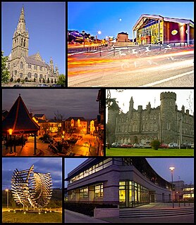
Letterkenny, nicknamed 'the Cathedral Town', is the largest and most populous town in County Donegal, Ireland. It lies on the River Swilly in East Donegal and has a population of 19,274. It is the 36th largest settlement in all of Ireland by population, and is the 15th largest settlement by population in the historic province of Ulster. Along with the nearby city of Derry, Letterkenny is considered a regional economic gateway for the north-west of Ireland. Letterkenny acts as an urban gateway to the Ulster Gaeltacht, similar to Galway's relationship to the Connemara Gaeltacht.

Inishowen is a peninsula in the north of County Donegal in Ireland. Inishowen is the largest peninsula on the island of Ireland.

Dunfanaghy is a small town, former fishing port, and commercial centre on the north coast of County Donegal, Ireland. It lies on Donegal's North West coast, specifically the west side of Sheephaven Bay, on the N56 road. The town has its own dedicated website, which gives information about the town and the surrounding area.
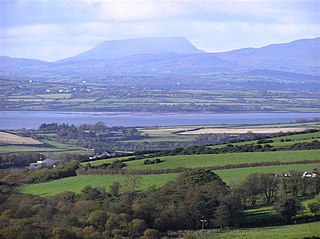
Lough Swilly in Ireland is a glacial fjord or sea inlet lying between the western side of the Inishowen Peninsula and the Fanad Peninsula, in County Donegal. Along with Carlingford Lough and Killary Harbour it is one of three glacial fjords in Ireland.
Fanad is a peninsula that lies between Lough Swilly and Mulroy Bay on the north coast of County Donegal, Ireland. The origins of the name Fanad are lost in time thought there is some speculation that the name derives from an old Gaelic word Fana for "sloping ground". It is also referred to as Fannet or Fannett in older records. There are an estimated 700 people living in Fanad and 30% Irish speakers.

Newtown Cunningham, usually spelled Newtowncunningham or abbreviated to Newton, is a village in the Laggan district in the east of County Donegal, Ireland, located on the N13 road 18 kilometres (11 mi) east of Letterkenny and 16 km (10 mi) west of Derry. The 2016 census reported a population of 1,080.

The N13 road is a national primary road in Ireland, running in County Donegal in Ulster from Stranorlar to just outside Derry. This road connects Letterkenny to Sligo, Derry and onwards to other destinations.
The Londonderry and Lough Swilly Railway Company was an Irish public transport and freight company that operated in parts of County Londonderry and County Donegal between 1853 and 2014. Incorporated in June 1853, it once operated 99 miles of railways. It began the transition to bus and road freight services in 1929. It closed its last railway line in July 1953 but continued to operate bus services under the name Lough Swilly Bus Company until April 2014, becoming the oldest railway company established in the Victorian era to continue trading as a commercial concern into the 21st century. Following a High Court petition by HM Revenue and Customs, the company went into liquidation and operated its final bus services on 19 April 2014.

Ardagh is a townland in the fertile district known as the Laggan in East Donegal, part of County Donegal in Ulster, Ireland. It is very near St. Johnston. It became part of the large Abercorn Estate and was settled by mainly Lowland Scots settlers during the Plantation of Ulster.

The River Swilly is a river in County Donegal, Ireland, which flows in an eastern direction through Letterkenny. Letterkenny, the largest town in County Donegal, is built on the river and became the first crossing point on the river in the 17th century.

Urris is a valley to the west of the parish of Clonmany, in County Donegal, Ireland. It comprises the townlands of Crossconnell, Dunaff, Kinnea, Leenan, Letter, and Urrismenagh. It sits on the eastern side of Loch Swilly and it is bounded to the south-east by the Urris hills, and to the east by Binion hill. To the north, there is Rockstown bay and Tullagh peninsula. There are two entrances to Urris; the Gap of Mamore, and Crossconnell.
Burt is a parish in County Donegal, Ireland, on the main road between Letterkenny and Derry.

Termon is a village and townland in the north of County Donegal, Ireland.
As with other towns and cities in Ireland, Letterkenny has a history of great architecture. Many examples of ancient architecture remain in the town to the present day – though much has been lost also, through decay and modern development.
Oldtown is a district of Letterkenny, County Donegal, Ireland, in the parish of Conwal and Leck to the south of the River Swilly. As its name suggests, it is the oldest part of Letterkenny—being older than Letterkenny itself—and was the starting point of the area's development.

Porthall is a village in County Donegal in Ulster, the northern province in Ireland. The village is located on the west bank of the River Foyle, in The Laggan district of East Donegal, on the R265 linked to the R236 regional road. Its nearest town is Lifford, the county town of County Donegal.

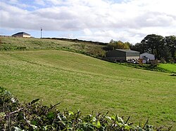
Castleforward Demesne is a townland just east of Newtowncunningham, a village in The Laggan, a district in the east of County Donegal in Ireland. The townland is near the south-eastern shores of Lough Swilly and is in the Barony of Raphoe North.

Inch Island is in Inishowen, County Donegal, Ireland. The island is in Lough Swilly, a sea lough on the northern coast of Ireland.
The Burn Dale is a burn or small river in the east of County Donegal in Ulster, the northern province in Ireland. The burn is also known in English as the Dale Burn, the Burn Deele, the Burndale River, the Deele River or the River Deele. In the Ulster Scots dialect, a 'burn' is a stream or small river.