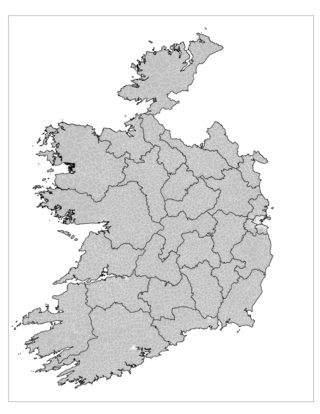
Map

The following table and map show the areas in Ireland, previously designated as Cities, Boroughs, or Towns in the Local Government Act 2001.
Under the Local Government (Ireland) Act 1898, Ireland had a two-tier system of local authorities. The first tier consisted of administrative counties and county boroughs. The county boroughs were in the major municipal population centres. The second tier consisted of urban districts, governed by urban district councils; some of the urban district retained a higher status of borough with a corporation. Below that were towns with town commissioners, administered under the Towns Improvement (Ireland) Act 1854.
Under the Local Government Act 2001, administrative counties and county boroughs were redesignated as counties and cities respectively. The lower tier consisted of boroughs and towns (including both former urban districts and towns administered by town commissioners).
Under the Local Government Reform Act 2014, only Dublin, Cork and Galway retain separate city councils. Limerick and Waterford were merged into the corresponding county councils and all borough and town councils were abolished. Municipal districts were created from local electoral areas with councillors being those elected to the county councils. In the case of Limerick and Waterford, these are called Metropolitan Districts; in the case of Drogheda, Wexford, Sligo and Clonmel, these are called Borough Districts; and in the case of Kilkenny, it is called the Municipal District of Kilkenny City. [1]
| Column name | Meaning | Explanation | Sources | ||||||||
|---|---|---|---|---|---|---|---|---|---|---|---|
| Name(s) | Names of the town | The first name listed is the commonest English name, and links to the relevant article. Alternative names are listed in parentheses. If the official name used in census reports is not the linked name, it is in italics. Only the name of the municipality is given, not that of any suburban areas (e.g. Tallaght is not named separately from Dublin). | [2] | ||||||||
| Council | Type of municipal council | The Local Government Act 2001 defines three types of municipal council, namely "City", "Borough", and "Town". The "Town council" label replaced the earlier "Urban district council" and "Town commissioners", but did not abolish the distinction in their respective powers. Values listed in this column are as follows:
| [3] [4] [5] | ||||||||
| Core County | Core county for town | County is that in which the municipal area is entirely located. In the case of cities, the namesake county is considered the core county even though the city is administratively separate from it. | [6] | ||||||||
| Other Counties | Other counties | For towns whose suburbs/environs span a county boundary, any county other than the core county. | [6] [7] | ||||||||
| 2011 Tot | Total population in 2011. | Sum of the municipal population and the suburban population. | [6] | ||||||||
| Tot area | Total area of the town | 2011 area in square kilometres (km2). Only for towns with a total population of at least 1,500. | [8] | ||||||||
| Tot dens | Population density of total area | Persons per km2. Based on 2011 total area and population. | Calculated | ||||||||
| 2011 Mun | Population of the municipal area in 2011 | Population within the 2011 municipal area. | [6] | ||||||||
| % change Mun | Change in population of the municipal area. | As a percentage of 2006 population. Where the municipal area changed in the interim, this is noted. | Calculated. For changed areas: [9] | ||||||||
| Mun area | Municipal area of the town | Area within the legally defined municipal boundary in 2011. Where this had increased since 2006, this is noted. | [10] For changed areas: [9] | ||||||||
| Mun dens | Population density of municipal area | Persons per km2. Based on 2011 municipal area and population. | Calculated | ||||||||
| 2009 elect | Electorate for the 2009 local elections. | The Local Government Act 1994 extended the boundaries of some towns for electoral purposes only. [11] That is, people living outside the municipal area were entitled to vote for the town council even though their residence was outside its jurisdiction. In a few cases, the municipal boundary of the town was subsequently extended to remove this anomaly. [9] [12] The remaining cases are marked by an asterisk in this column. Where the municipal area changed between the 2006 census and the 2009 election, this is noted. (No municipal area changed between the 2009 election and the 2011 census. [9] ) | [11] [13] | ||||||||
| 2011 Sub | Population of the suburbs/environs in 2011 | Called "Suburbs" for cities and "Environs" for boroughs and towns. Defined as "the continuation of a distinct population cluster outside its legally defined boundary in which no occupied dwelling is more than 100 metres distant from the nearest occupied dwelling. In applying the 100-metre criterion, industrial, commercial and recreational buildings and facilities are not regarded as breaking the continuity of a built-up area. New suburbs or environs are defined only where there are at least twenty occupied dwellings outside the legal boundary within the new limit." The 2006 definition was changed by reducing the limit from 200 metres to 100. [14] | [6] [14] |
| Name(s) | Council | Core County | Other Counties | 2011 Total | Tot area | Tot dens | 2011 Mun | Mun area | Mun dens | 2009 elect | 2011 Sub |
|---|---|---|---|---|---|---|---|---|---|---|---|
| Dublin | City | Dublin | Dublin (Dún Laoghaire–Rathdown, Fingal, South Dublin) | 1,110,627 | 318 | 3,493 | 527,612 | 116.58 | 4,526 | 347,312 | 583,015 |
| Cork | City | Cork | 198,582 | 494 | 402 | 119,230 | 38.59 | 3,090 | 82,896 | 79,352 | |
| Limerick | City | Limerick | Clare | 91,454 | 57 | 1,604 | 57,106 [n 2] | 28.38 [n 2] | 2,012 | 40,358 | 34,348 [n 2] |
| Galway | City | Galway | 76,778 | 53 | 1,449 | 75,529 | 50 | 1,511 | 46,164 | 1,249 | |
| Waterford | City | Waterford | Kilkenny | 51,519 | 44 | 1,171 | 46,732 | 38.35 | 1,219 | 26,598 | 4,787 |
| Drogheda | Borough | Louth | Meath | 38,578 | 15 | 2,572 | 30,393 | 12.76 | 2,382 | 23,091* | 8,185 |
| Kilkenny | City [n 1] | Kilkenny | 24,423 | 27 | 905 | 8,711 | 3.74 | 2,329 | 14,324* | 15,712 | |
| Wexford | Borough | Wexford | 20,072 | 38 | 528 | 19,913 [n 3] | 18.63 [n 3] | 1,069 | 15,752 | 159 [n 3] | |
| Sligo | Borough | Sligo | 19,452 | 31 | 627 | 17,568 | 12.84 | 1,368 | 13,941* | 1,884 | |
| Clonmel | Borough | Tipperary | Waterford | 17,908 | 17 | 1,053 | 15,793 | 11.36 | 1,390 | 10,763 | 2,115 |
| Dundalk | UD | Louth | 37,816 | 110 | 344 | 31,149 | 25.19 | 1,237 | 21,958* | 6,667 | |
| Bray | UD | Wicklow | Dublin (Dún Laoghaire–Rathdown) | 31,872 | 9 | 3,541 | 26,852 | 7.49 | 3,585 | 19,255* | 5,020 |
| Navan (An Uaimh) | UD | Meath | 28,559 | 45 | 635 | 28,158 [n 4] | 20.04 [n 4] | 1,405 | 17,541 | 401 [n 4] | |
| Ennis | UD | Clare | 25,360 | 45 | 564 | 20,180 | 14.6 | 1,382 | 14,182 | 5,180 | |
| Tralee | UD | Kerry | 23,693 | 32 | 740 | 20,814 | 12.09 | 1,722 | 16,391* | 2,879 | |
| Carlow | UD | Carlow | Laois | 23,030 | 13 | 1,772 | 13,698 | 6.45 | 2,124 | 11,835* | 9,332 |
| Naas | UD | Kildare | 20,713 | 18 | 1,151 | 20,713 | 18.24 | 1,136 | 13,434 | — | |
| Athlone | UD | Westmeath | Roscommon | 20,153 | 17 | 1,185 | 15,558 | 10.92 | 1,425 | 12,637* | 4,595 |
| Letterkenny | UD | Donegal | 19,588 | 48 | 408 | 15,387 | 19.03 | 809 | 10,905* | 4,201 | |
| Tullamore | UD | Offaly | 14,361 | 21 | 684 | 11,346 | 7.84 | 1,447 | 8,573* | 3,015 | |
| Killarney | UD | Kerry | 14,219 | 38 | 374 | 12,740 | 13.44 | 948 | 8,064* | 1,479 | |
| Arklow | UD | Wicklow | 13,009 | 14 | 929 | 12,770 | 6.44 | 1,983 | 7,831 | 239 | |
| Cobh | UD | Cork | 12,347 | 9 | 1,372 | 6,500 | 2.38 | 2,731 | 8,087* | 5,847 | |
| Castlebar | UD | Mayo | 12,318 | 27 | 456 | 10,826 | 11.5 | 941 | 8,115* | 1,492 | |
| Midleton | UD | Cork | 12,001 | 12 | 1,000 | 3,733 | 1.55 | 2,408 | 7,102* | 8,268 | |
| Mallow | UD | Cork | 11,605 | 17 | 683 | 8,578 | 6.49 | 1,322 | 7,965* | 3,027 | |
| Ballina | UD | Mayo | 11,086 | 30 | 370 | 10,361 | 13.69 | 757 | 7,569* | 725 | |
| Enniscorthy | UD | Wexford | 10,838 | 18 | 602 | 2,842 | 1.16 | 2,450 | 5,806* | 7,996 | |
| Wicklow | UD | Wicklow | 10,356 | 10 | 1,036 | 6,761 | 3.08 | 2,195 | 6,069* | 3,595 | |
| Cavan | UD | Cavan | 10,205 | 18 | 567 | 3,649 | 2.01 | 1,815 | 4,406* | 6,556 | |
| Athy | UD | Kildare | 9,926 | 25 | 397 | 9,587 | 10.29 | 932 | 6,263 | 339 | |
| Longford | UD | Longford | 9,601 | 22 | 436 | 8,002 | 8.93 | 896 | 6,100* | 1,599 | |
| Dungarvan | UD | Waterford | 9,427 | 17 | 555 | 7,991 | 6.21 | 1,287 | 6,210 | 1,436 | |
| Nenagh | UD | Tipperary | 8,439 | 18 | 469 | 8,023 | 8.46 | 948 | 5,388* | 416 | |
| Trim | UD | Meath | 8,268 | 9 | 919 | 1,441 | 0.67 | 2,151 | 4,271* | 6,827 | |
| New Ross | UD | Wexford | Kilkenny | 8,151 | 5 | 1,630 | 4,533 | 1.87 | 2,424 | 5,533* | 3,618 |
| Thurles | UD | Tipperary | 7,933 | 13 | 610 | 6,929 | 5.15 | 1,345 | 5,877* | 1,004 | |
| Youghal | UD | Cork | 7,794 | 11 | 709 | 6,990 | 4.87 | 1,435 | 5,683* | 804 | |
| Monaghan | UD | Monaghan | 7,452 | 13 | 573 | 6,637 | 5.51 | 1,205 | 5,474* | 815 | |
| Buncrana | UD | Donegal | 6,839 | 17 | 402 | 3,452 | 4.67 | 739 | 4,766* | 3,387 | |
| Ballinasloe | UD | Galway | Roscommon | 6,659 | 18 | 370 | 6,449 | 16.74 | 385 | 5,092* | 210 |
| Fermoy | UD | Cork | 6,489 | 8 | 811 | 2,223 | 1.25 | 1,778 | 5,000* | 4,266 | |
| Westport | UD | Mayo | 6,063 | 20 | 303 | 5,543 | 8.14 | 681 | 3,731 | 520 | |
| Carrick-on-Suir | UD | Tipperary | Waterford | 5,931 | 9 | 659 | 5,886 | 9 | 654 | 3,500 | 45 |
| Kells (Ceannanus Mór) | UD | Meath | 5,888 | 6 | 981 | 2,208 | 1.18 | 1,871 | 3,769* | 3,680 | |
| Birr | UD | Offaly | Tipperary | 5,822 | 19 | 306 | 4,428 | 6.35 | 697 | 3,295 | 1,394 |
| Tipperary | UD | Tipperary | 5,310 | 11 | 483 | 4,322 | 3.36 | 1,286 | 3,798* | 988 | |
| Carrickmacross | UD | Monaghan | 4,925 | 10 | 493 | 1,978 | 1.42 | 1,393 | 4,302* | 2,947 | |
| Kinsale | UD | Cork | 4,893 | 7 | 699 | 2,198 | 1.11 | 1,980 | 3,099* | 2,695 | |
| Listowel | UD | Kerry | 4,832 | 17 | 284 | 4,205 | 6.36 | 661 | 3,841* | 627 | |
| Clonakilty | UD | Cork | 4,721 | 10 | 472 | 4,000 | 4.45 | 899 | 3,634* | 721 | |
| Cashel | UD | Tipperary | 4,051 | 5 | 810 | 2,275 | 1.35 | 1,685 | 2,929* | 1,776 | |
| Macroom | UD | Cork | 3,879 | 22 | 176 | 3,738 | 10.67 | 350 | 2,937 | 141 | |
| Castleblayney (Castleblaney) | UD | Monaghan | 3,634 | 7 | 519 | 1,752 | 1.2 | 1,460 | 3,118* | 1,882 | |
| Kilrush | UD | Clare | 2,695 | 11 | 245 | 2,539 | 5.35 | 475 | 2,137 | 156 | |
| Skibbereen | UD | Cork | 2,670 | 9 | 297 | 2,568 | 4.07 | 631 | 1,947 | 102 | |
| Bundoran | UD | Donegal | 2,140 | 10 | 214 | 1,781 | 3.93 | 453 | 1,529 | 359 | |
| Templemore | UD | Tipperary | 2,071 | 10 | 207 | 1,941 | 4.35 | 446 | 1,766* | 130 | |
| Clones | UD | Monaghan | 1,761 | 5 | 352 | 1,491 | 1.83 | 815 | 1,601* | 270 | |
| Newbridge (Droichead Nua) | Comm | Kildare | 21,561 | 16 | 1,348 | 17,127 | 2.8 [n 5] | 6,117 | 13,604 | 4,434 | |
| Portlaoise (Portlaoise) | Comm | Laois | 20,145 | 19 | 1,060 | 3,639 | 2.05 [n 6] | 1,775 | 8,409* | 16,506 | |
| Mullingar | Comm | Westmeath | 20,103 | 23 | 874 | 9,414 | 5.58 [n 7] | 1,687 | 9,791* | 10,689 | |
| Balbriggan | Comm | Dublin (Fingal) | 19,960 | 13 | 1,535 | 19,932 [n 8] | 6.52 [n 8] [n 9] | 3,061 | 10,500 | 28 [n 8] | |
| Greystones | Comm | Wicklow | 17,468 | 30 | 582 | 10,173 | 3.8 [n 10] | 2,677 | 9,966* | 7,295 | |
| Leixlip | Comm | Kildare | 15,452 | 7 | 2,207 | 15,452 | 11.3 [n 11] | 1,367 | 12,724 | — | |
| Tramore | Comm | Waterford | 10,328 | 14 | 738 | 9,722 | 16.61 [n 12] | 585 | 7,712 | 606 | |
| Shannon | Comm | Clare | 9,673 | 9 | 1,075 | 9,673 [n 13] | 31.2 [n 13] | 310 | 7,113 | — [n 13] | |
| Gorey | Comm | Wexford | 9,114 | 9 | 1,013 | 3,463 | 1.71 [n 14] | 2,025 | 4,379* | 5,651 | |
| Tuam | Comm | Galway | 8,242 | 13 | 634 | 3,348 | 2.36 [n 15] | 1,419 | 5,863* | 4,894 | |
| Edenderry | Comm | Offaly | 6,977 | 17 | 410 | 6,490 | 7.93 [n 16] | 818 | 4,306* | 487 | |
| Bandon | Comm | Cork | 6,640 | 10 | 664 | 1,917 | 0.84 [n 17] | 2,282 | 3,886* | 4,723 | |
| Passage West | Comm | Cork | 5,790 | 10 | 579 | 5,122 | 4.03 [n 18] | 1,271 | 4,315* | 668 | |
| Loughrea | Comm | Galway | 5,062 | 4 | 1,266 | 5,062 | 4.25 [n 19] | 1,191 | 3,914 | — | |
| Ardee | Comm | Louth | 4,927 | 14 | 352 | 4,554 | 4.75 [n 20] | 959 | 3,197 | 373 | |
| Mountmellick | Comm | Laois | 4,735 | 8 | 592 | 2,998 | 2.27 [n 21] | 1,321 | 3,095* | 1,737 | |
| Bantry | Comm | Cork | 3,348 | 10 | 335 | 3,348 | 10 [n 22] | 335 | 2,645 | — | |
| Muine Bheag (Muinebeag, Bagenalstown) | Comm | Carlow | 2,950 | 7 | 421 | 2,775 | 2.88 [n 23] | 964 | 2,193 | 175 | |
| Boyle | Comm | Roscommon | 2,588 | 11 | 235 | 1,459 | 2.98 [n 24] | 490 | 2,500* | 1,129 | |
| Ballyshannon | Comm | Donegal | 2,503 | 10 | 250 | 1,855 | 3.43 [n 25] | 541 | 2,324* | 648 | |
| Cootehill | Comm | Cavan | 2,123 | 6 | 354 | 1,592 | 1.82 [n 26] | 875 | 1,795* | 531 | |
| Ballybay | Comm | Monaghan | 1,461 | — | — | 298 | 0.25 [n 27] | 1,192 | 1,218* | 1,163 | |
| Belturbet | Comm | Cavan | 1,407 | — | — | 1,378 | 4.38 [n 28] | 315 | 1,296 | 29 | |
| Lismore | Comm | Waterford | 1,369 | — | — | 732 | 0.57 [n 29] | 1,284 | 1,138* | 637 | |
| Kilkee | Comm | Clare | 1,139 | — | — | 1,037 | 5.25 [n 30] | 198 | 1,063 | 102 | |
| Granard | Comm | Longford | 1,021 | — | — | 1,021 | 8.12 [n 31] | 126 | 911 | — |

A borough is an administrative division in various English-speaking countries. In principle, the term borough designates a self-governing walled town, although in practice, official use of the term varies widely.

The counties of Ireland are historic administrative divisions of the island. They began as Norman structures, and as the powers exercised by the Cambro-Norman barons and the Old English nobility waned over time, new offices of political control came to be established at a county level. The number of counties varied depending on the time period, however thirty-two is the traditionally accepted and used number.
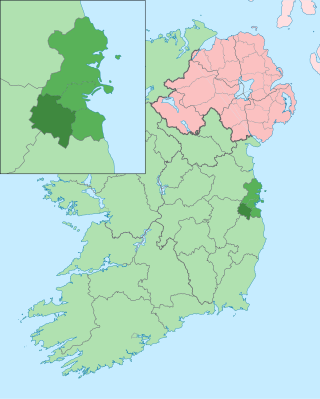
South Dublin is a county in Ireland, within the province of Leinster and the Eastern and Midland Region. It is one of three successor counties to County Dublin, which was disestablished for administrative purposes in 1994. South Dublin County Council is the local authority for the county. The county contains both dense suburbs of Dublin and stretches of unpopulated mountains. In 2022 it had a population of 301,705, making it the fourth most populous county in the state.

South Tipperary was a county in Ireland in the province of Munster. It was named after the town of Tipperary and consisted of 52% of the land area of the traditional county of Tipperary. South Tipperary County Council was the local authority for the county. The population of the county was 88,433 according to the 2011 census. It was abolished on 1 June 2014, and amalgamated with North Tipperary to form County Tipperary under a new Tipperary County Council.

Galway City Council is the local authority of the city of Galway, Ireland. As a city council, it is governed by the Local Government Act 2001. The council is responsible for housing and community, roads and transportation, urban planning and development, amenity and culture, and environment. The council has 18 elected members. Elections are held every five years and are by single transferable vote. The head of the council has the title of mayor. The city administration is headed by a chief executive, Patricia Philbin. The council meets at City Hall, College Road, Galway.

A local electoral area is an electoral area for elections to local authorities in Ireland. All elections use the single transferable vote. The Republic of Ireland is divided into 166 LEAs, with an average population of 28,700 and average area of 423.3 square kilometres (163.4 sq mi). The boundaries of LEAs are determined by order of the Minister for Housing, Local Government and Heritage, usually based on lower-level units called electoral divisions (EDs), with a total of 3,440 EDs in the state.
An electoral division is a legally defined administrative area in the Republic of Ireland, generally comprising multiple townlands, and formerly a subdivision of urban and rural districts. Until 1996, EDs were known as district electoral divisions in the 29 county council areas and wards in the five county boroughs. Until 1972, DEDs also existed in Northern Ireland. The predecessor poor law electoral divisions were introduced throughout the island of Ireland in the 1830s. The divisions were used as local-government electoral areas until 1919 in what is now the Republic and until 1972 in Northern Ireland.
Town commissioners were elected local government bodies that existed in urban areas in Ireland from the 19th century until 2002. Larger towns with commissioners were converted to urban districts by the Local Government (Ireland) Act 1898, with the smaller commissions continuing to exist beyond partition in 1922. The idea was a standardisation of the improvement commissioners established in an ad-hoc manner for particular towns in Britain and Ireland in the eighteenth century. The last town commissioners in Northern Ireland were abolished in 1962. In the Republic of Ireland, the remaining commissions became town councils in 2002, and abolished in 2014.

Cavan County Council is the authority responsible for local government in County Cavan, Ireland. As a county council, it is governed by the Local Government Act 2001. The council is responsible for housing and community, roads and transportation, urban planning and development, amenity and culture, and environment. The council has 18 elected members. Elections are held every five years and are by single transferable vote. The head of the council has the title of Cathaoirleach (chairperson). The county administration is headed by a chief executive, Tommy Ryan. The county town is Cavan.

Carlow County Council is the local authority of County Carlow, Ireland. As a county council, it is governed by the Local Government Act 2001. The council is responsible for housing and community, roads and transportation, urban planning and development, amenity and culture, and environment. The council has 18 elected members. The head of the council has the title of Cathaoirleach (chairperson). The county administration is headed by a chief executive, Kathleen Holohan. The county town is Carlow.

Louth County Council is the local authority of County Louth, Ireland. As a county council, it is governed by the Local Government Act 2001. The council is responsible for housing and community, roads and transportation, urban planning and development, amenity and culture, and environment. The council has 29 elected members. Elections are held every five years and are by single transferable vote. The head of the council has the title of Cathaoirleach (chairperson). The county administration is headed by a chief executive, Joan Martin. The county town is Dundalk.

Kilkenny County Council is the local authority of County Kilkenny, Ireland. As a county council, it is governed by the Local Government Act 2001. The council is responsible for housing and community, roads and transportation, urban planning and development, amenity and culture, and environment. The council has 24 elected members. Elections are held every five years and are by single transferable vote. The head of the council has the title of Cathaoirleach (chairperson). The county administration is headed by a chief executive, Lar Power. The county town is Kilkenny city.
Dún Laoghaire–Rathdown County Council is the local authority of the county of Dún Laoghaire–Rathdown, Ireland. It is one of three local authorities that succeeded the former Dublin County Council on its abolition on 1 January 1994 and one of four councils in the old County Dublin. As a county council, it is governed by the Local Government Act 2001. The council is responsible for housing and community, roads and transportation, urban planning and development, amenity and culture, and environment. The council has 40 elected members. Elections are held every five years and are by single transferable vote. The head of the council has the title of Cathaoirleach (chairperson). The county administration is headed by a chief executive, Frank Curran. The county town is Dún Laoghaire. It serves a population of approximately 206,260.

Fingal County Council is the local authority of the county of Fingal, Ireland. It is one of three local authorities that succeeded the former Dublin County Council on abolition on 1 January 1994 and is one of four local authorities in County Dublin. As a county council, it is governed by the Local Government Act 2001. The council is responsible for housing and community, roads and transport, urban planning and development, amenity and culture, and environment. The council has 40 elected members. Elections are held every five years on the electoral system of proportional representation by means of the single transferable vote (PR-STV). The head of the council has the title of Mayor. The county administration is headed by a chief executive, AnnMarie Farrelly. The county town is Swords.
The 1985 Irish local elections were held in all the local government areas on Thursday, 20 June 1985.

Ankers Bower is a townland and hill in St. Mary's civil parish in the barony of Brawny, County Westmeath, Ireland. It is partly within the former urban district of Athlone. The name may derive from John Ankers, who was vicar of St. Mary's in 1608.
The 1994 Irish local elections for borough and town councillors and commissioners were held on Thursday, 9 June 1994. The election to the urban district council in Castlebar was postponed to Saturday, 18 June 1994 due to the death of a candidate. There was no poll for Cootehill, as there were nine candidates for the nine town commissioners.
Local government in Dublin, the capital city of Ireland, is currently administered through the local authorities of four local government areas. The historical development of these councils dates back to medieval times.
Those towns which had their boundaries extended, for electoral purposes only, in 1994, represent an anomaly, as residents of the environs of a town may help elect the town council but do not fall within the functional area of the council. A number of these towns' boundaries have been altered since 1994, however in the majority of cases the anomaly continues to exist. The correction of this anomaly would appear to be in order.