Ardagh, County Donegal

Last updated

Ardagh, County Donegal
Townland
CountryIreland
Part of the wall, ruined house at Ardagh Ardagh House.jpg
Part of the wall, ruined house at Ardagh

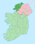
Ardagh (Irish : Ardachadh, meaning 'high field') is a townland in the fertile district known as the Laggan in East Donegal, part of County Donegal, Ireland. It is very near St Johnston. It became part of the large Abercorn Estate and was settled by mainly Lowland Scots settlers during the Plantation of Ulster.
Contents

People

See also

55°17′18″N7°23′29″W / 55.28833°N 7.39139°W / 55.28833; -7.39139

Related Research Articles

Ardagh may refer to:

<span class="mw-page-title-main">Extreme points of Ireland</span>

This is a list of the extreme points of Ireland – the points that are farthest north, south, east or west in Ireland. It includes the Republic of Ireland and Northern Ireland.

<span class="mw-page-title-main">Malin Head</span> Northernmost part of mainland Ireland

Malin Head is the most northerly point of mainland Ireland, located in the townland of Ardmalin on the Inishowen peninsula in County Donegal. The head's northernmost point is called Dunalderagh at latitude 55.38ºN. It is about 16 kilometres (10 mi) north of the village of Malin. The island of Inishtrahull is further north, about 10 km (6 mi) northeast of the headland. Malin Head gives its name to the Malin sea area. There is a weather station on the head, which is one of 22 such stations whose reports are broadcast as part of the BBC Shipping Forecast. A tower built in 1805 is on Altnadarrow, also known locally as the Tower Hill.

<span class="mw-page-title-main">Tory Island</span> Island in Ulster, Ireland

Tory Island, or simply Tory, is an island 14.5 kilometres off the north-west coast of County Donegal, Ireland, and is the most remote inhabited island of Ireland. The name means "place of steep rocky heights".

<span class="mw-page-title-main">Ballymagorry</span> Village in County Tyrone, Northern Ireland

Ballymagorry or Ballymagory is a small village and townland in County Tyrone, Northern Ireland. It is west of Artigarvan and 5 kilometres (3.1 mi) north of Strabane. In the 2001 Census it had a population of 565. It lies within the Strabane District Council area and lies on the River Glenmornan.

Tullyhommon or Tullyhomman is a townland in County Fermanagh, which forms part of the village of Pettigo. The village is primarily within County Donegal in the Republic of Ireland, however, one street, namely High Street is on the Fermanagh side. The village is divided by the River Termon, which forms part of the boundary between Northern Ireland and the Republic. In the 2011 Census the townland had a population of 63 people. The combined population of the whole village, including the portions in County Donegal and County Fermanagh is approximately 450.

<span class="mw-page-title-main">Glenveagh Castle</span> Mansion in County Donegal, Ireland

Glenveagh Castle is a large castellated mansion located in Glenveagh National Park, County Donegal, Ireland and was built in about 1870.

<span class="mw-page-title-main">Rosguill</span>

Rosguill is a peninsula situated in north-north-west County Donegal, Ireland. Lying between the peninsulae of Fanad to the east and Horn Head to the west, Rosguill is a dichotomy of heathland and ocean. With the great Sheephaven Bay with its mellow waters and pure-white strands on the one hand, and the treacherous sand banks of Mulroy Bay on the other. Between, a mixture of bog, hill and pastureland, the ancient walls, remnants of cattle enclosures, and the various evidences of fortification are proof of the area's use since antiquity. The Parish of Rosguill is an alternative name for the Parish of Mevagh, which covers the peninsula and an equally sized hinterland.

<span class="mw-page-title-main">River Swilly</span> River in County Donegal, Ireland

The River Swilly is a river in County Donegal, Ireland, which flows in an eastern direction through Letterkenny. Letterkenny, the largest town in County Donegal, is built on the river and became the first crossing point on the river in the 17th century.

Elagh More is a townland in County Londonderry, Northern Ireland and lies between Ballynagalliagh and the border with County Donegal in the Republic of Ireland, on the outskirts of Derry. It is within Derry City and Strabane district.

<span class="mw-page-title-main">Tooban</span>

Tooban, also known as Tievebane, is a townland in County Donegal in the north west of Ireland. It is traversed by the R238 road. Faghan Presbyterian church is situated near the centre of the townland.

<span class="mw-page-title-main">Bunbeg</span> Gaeltacht village in County Donegal, Ireland

An Bun Beag, meaning "the small river mouth", is a small Gaeltacht village and townland in County Donegal, Ireland. It is officially the smallest townland in Gaoth Dobhair (Gweedore), but today the name Bunbeg is used to describe a large region of the parish. It is situated between Derrybeg and the townland of Dore and is home to many of Gweedore's amenities and businesses. The Clady River flows into the Crolly River beside Bunbeg Quay, on the south-western outskirts of Bunbeg.

<span class="mw-page-title-main">Drumardagh</span> Townland in Ulster, Ireland

Drumardagh is a townland in the east of County Donegal in Ulster, Ireland. The townland is about 5 kilometres east of Letterkenny in the Laggan district of East Donegal. The townland is just outside the village of Manorcunningham. The Isle Burn flows along the eastern boundary of the townland. The Irish name means 'the Ridge (drum) on the High Place (ardagh)', and it is this elevation that gives Drumardagh its commanding views over Lough Swilly, from Glenswilly to Inch Island, and beyond to the peaks of the Fanad and Inishowen peninsulae.

Cranford is a small village located in the northeast of County Donegal, Ireland. It is situated on the western banks of Mulroy Bay on the road between two larger villages, approximately 7.9 kilometres north of Milford and 7.9 kilometres south of Carrigart. It looks almost directly at Kerrykeel across the water. The townlands of Drimicallady, Coole, The Bogue, Woodquarter, The Pans, and Seantullagh also fall within Cranfords borders.

Patrick Finegan (1858–1937) was an Irish prelate of the Roman Catholic Church who served as the Bishop of Kilmore from 1910 to 1937.

Tamney is a small village in Fanad in County Donegal, Ireland. It is sometimes spelt as Tawny or Tawney, and in the Irish language it is known as An Tamhnaigh. It was the only Postal town of the peninsula of Fanad in the late 18th and early 19th centuries, when its population was about 10,000.

Crossconnell is a townland in the Urris Valley, located in the north-west corner of the Inishowen Peninsula.

The Burn Dale is a burn or small river in the east of County Donegal in Ulster, the northern province in Ireland. The burn is also known in English as the Dale Burn, the Burn Deele, the Burndale River, the Deele River or the River Deele. In the Ulster Scots dialect, a 'burn' is a stream or small river.

<span class="mw-page-title-main">Gleneely</span> Village in County Donegal, Ireland

Gleneely is a village and census town on the Inishowen peninsula in the north of County Donegal in Ulster, Ireland. As of the 2016 census, the village had a population of 236 people.

<span class="mw-page-title-main">Cabry River</span> River in County Donegal, Ireland

The Cabry River is located in north County Donegal, Ireland. It flows into Lough Foyle after passing under the late-18th century bridge at Quigley's Point, known locally as "Carrowkeel". The mouth of the river is in Quigley's Point, a village within the nearby townlands of Cabry, Carrowkeel, Gortanny, Magheralahan, and Meenavanaghan, all in County Donegal.