Portsalon

Last updated • a couple of secsFrom Wikipedia, The Free Encyclopedia

Portsalon
Port an tSalainn
Village
Portsalon.JPG
Portsalon beach
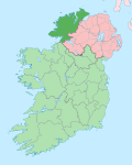
Ireland adm location map.svg
Red pog.svg
Portsalon
Location in Ireland
Coordinates: 55°12′00″N7°37′01″W / 55.200°N 7.617°W / 55.200; -7.617 Coordinates: 55°12′00″N7°37′01″W / 55.200°N 7.617°W / 55.200; -7.617
Country Ireland
Province Ulster
County County Donegal
Government
   Dáil Éireann Donegal
Area
  Total13 km2 (5 sq mi)
Time zone UTC+0 (WET)
  Summer (DST) UTC-1 (IST (WEST))
Area code(s) 075, +000 353 74
Irish Grid Reference B847228

Portsalon (Irish : Port an tSalainn) is a coastal townland in County Donegal, Ireland. It's situated on the scenic Lough Swilly and it is known for its beach, which was deemed to be the second most beautiful beach in the world by The Observer newspaper. [1]

Up until the second half of the 20th century, there was very little in the area. Now it is a tourist resort and many visitors have built holiday homes around Portsalon.[ citation needed ]

Recent times

September 2019, Donegal County Council took action to tackle flooding problems at Portsalon. [2]

Related Research Articles

County Donegal County in Ireland

County Donegal is a county of Ireland in the province of Ulster and in the Northern and Western Region. It is named after the town of Donegal in the south of the county. It has also been known as County Tyrconnell, after the historic territory of the same name, on which it was based. Donegal County Council is the local council and Lifford the county town.

Inishowen Peninsula in Ireland

Inishowen is a peninsula in the north of County Donegal in Ireland. Inishowen is the largest peninsula on the island of Ireland.

Bundoran Town in Ulster, Ireland

Bundoran is a town in County Donegal, Ireland. The town is located near the N15 road near Ballyshannon, and is the most southerly town in Donegal. The town is a tourist seaside resort, and tourism has been at the heart of the local economy since the 18th century. Bundoran is a surfing destination and was listed by National Geographic magazine in 2012 as one of the world's top 20 surf towns.

Buncrana Town in Ulster, Ireland

Buncrana is a town in County Donegal, Ireland. It is beside Lough Swilly on the Inishowen peninsula, 23 kilometres (14 mi) northwest of Derry and 43 kilometres (27 mi) north of Letterkenny. In the 2016 census, the population was 6,785 making it the second most populous town in County Donegal, after Letterkenny, and the largest in Inishowen.

Donegal Bay

Donegal Bay is an inlet in the northwest of Ireland. Three counties – Donegal to the north and west, Leitrim and Sligo to the south – have shorelines on the bay, which is bounded on the west by the Atlantic Ocean. The town of Donegal and the River Eske lie at the head of the bay.

Ballintra Village in Ulster, Ireland

Ballintra is a village in the parish of Drumholm in the south of County Donegal, Ireland, just off the N15 road between Donegal town and Ballyshannon. Ballintra lies on the northern bank of the Blackwater river. The river rises in the hills that lie inland from the town, and flows through a number of small lakes before spilling over a small waterfall in a gorge behind the village.

Regional road (Ireland) Class of road in Ireland

A regional road in the Republic of Ireland is a class of road not forming a major route, but nevertheless forming a link in the national route network. There are over 11,600 kilometres of regional roads. Regional roads are numbered with three-digit route numbers, prefixed by "R". The equivalent road category in Northern Ireland are B roads.

Laghy Village in Ulster, Ireland

Laghy or Laghey is a village and townland in County Donegal, Ireland, between Ballintra and Donegal Town. It is one of three villages that make up the parish of Drumholm, formerly a civil and Church of Ireland parish, now only used as a division of the Roman Catholic Diocese of Raphoe. The village has a quarry, a supermarket, garden centre, filling station, two public houses, a church with a graveyard, an Orange hall, a recycling centre, a Donegal County Council yard and salt depot, and a national school. Rossnowlagh and Murvagh beaches are nearby. Murvagh is also the home to Donegal Golf Club.

Rossnowlagh is a seaside village in the south of County Donegal, Ireland. It is about 8 kilometres (5 mi) north of Ballyshannon and 16 km (10 mi) southwest of Donegal Town. The area's 3 km (2 mi) long beach, or 2 km (1.2 mi) if measuring from the cliffs to Carrickfad, is frequented by walkers, surfers, windsurfers, kite-surfers and swimmers.

Letterkenny University Hospital Hospital in County Donegal, Ireland

Letterkenny University Hospital is a general hospital at Letterkenny, County Donegal, in Ulster, Republic of Ireland. One of Ireland's busiest, the campus is divided by a main road heading on towards the North/West of Donegal on the N56 road (Ireland). A teaching hospital, it maintains links with NUI Galway, LYIT and the Royal College of Surgeons.

Gola Island

Gola is a small island off the coast of Gweedore, County Donegal, Ireland. The island was unpopulated as recently as 1996 but in recent years people have started to return. A ferry service operates during the holiday season and on request for the remainder of the year.

Portnablagh Village in County Donegal, Ireland

Portnablagh is a small village in County Donegal, Ireland. Portnablagh is located on the north-west coast of County Donegal, specifically the west side of Sheephaven Bay. It is on the N56 road.

Kerrykeel Village in Ulster, Ireland

Kerrykeel is a small village in County Donegal, Ireland. It lies between Knockalla Mountain and Ranny Hill and is on the shores of Mulroy Bay. Kerrykeel is accessible via the R245 and R247 roads which converge in the centre of the village. Kerrykeel is also in close to the tourist area of Portsalon. Portsalon serves as the gateway to the Fanad Peninsula.

CLG Ard an Rátha

CLG Ard an Rátha is a GAA club based in Ardara in County Donegal. The Ard an Rátha in the club's title is the place name in Irish, while CLG refers to "GAA". They are one of the strongholds of Gaelic football in Donegal.

Dermot Brick Molloy is a Gaelic footballer who plays forward for Naomh Conaill and also, formerly, for the Donegal county team.

Kindrum Lough Lake in County Donegal, Ireland

Kindrum Lough is a freshwater lake in the northwest of Ireland. It is located in north County Donegal on the Fanad Peninsula.

R246 road (Ireland)

The R246 road is a regional road in Ireland. It is a road mostly on the Fanad peninsula in County Donegal. The northernmost section of the road at Portsalon forms part of the Wild Atlantic Way.

Henry Chichester Hart Anglo-Irish botanist, explorer, and editor (1847–1908)

Henry Chichester Hart MRIA FLS (1847–1908) was an Anglo-Irish botanist and explorer.

Donegal county football team Gaelic football team

The Donegal county football team represents Donegal in men's Gaelic football and is governed by Donegal GAA, the county board of the Gaelic Athletic Association. The team competes in the three major annual inter-county competitions; the All-Ireland Senior Football Championship, the Ulster Senior Football Championship and the National Football League.

References

  1. "Introducing Portsalon & Fanad Head". Lonely Planet . Retrieved 22 February 2015.
  2. "Council urged to tackle flooding problems at Portsalon".