
Badgers are short-legged omnivores in the family Mustelidae. Badgers are a polyphyletic rather than a natural taxonomic grouping, being united by their squat bodies and adaptions for fossorial activity. All belong to the caniform suborder of carnivoran mammals.

Árainn Mhór is an island off the west coast of County Donegal in Ulster, the northern province in Ireland. Arranmore is the largest inhabited island of County Donegal, with a population of 478 in 2022, but has had a gradually falling native population since the 1990s. Its main settlement is Leabgarrow. The island is part of the Gaeltacht, with most of the inhabitants speaking Ulster Irish.

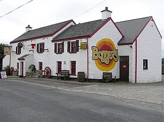
Ailt an Chorráin or Ailt a' Chorráin is a Gaeltacht fishing village about 7 km (4 mi) northwest of Dungloe in The Rosses district of County Donegal, Ireland. The main employers in the village were the Burtonport Fishermen's Co-op and the Bord Iascaigh Mhara ice plant; but these have both since closed and their former premises were demolished in 2021 as part of a seafront environment upgrade scheme.
The Rosses is a traditional 'district' in the west of County Donegal in Ulster, the northern province in Ireland. The Rosses has a population of over 7,000 centred on the town of Dungloe, which acts as the educational, shopping and civic centre for the area. Defined by physical boundaries in the form of rivers, as well as history and language use, the area has a distinctive identity, separate from the rest of County Donegal. The extensive district lies between the parish and district of Gweedore to the north and the town of Glenties to the south. A large part of the Rosses is in the Gaeltacht, which means that Irish is the spoken language. The Rosses, Cloughaneely and Gweedore, known locally as "the three parishes", with 16,000 Irish speakers, together form a social and cultural region different from the rest of the county, with Gweedore serving as the main centre for socialising and industry. Gaeltacht an Láir is another Irish-speaking area.

The Londonderry and Lough Swilly Railway Company was an Irish public transport and freight company that operated in parts of County Londonderry and County Donegal between 1853 and 2014. Incorporated in June 1853, it once operated 99 miles of railways. It began the transition to bus and road freight services in 1929. It closed its last railway line in July 1953 but continued to operate bus services under the name Lough Swilly Bus Company until April 2014, becoming the oldest railway company established in the Victorian era to continue trading as a commercial concern into the 21st century. Following a High Court petition by HM Revenue and Customs, the company went into liquidation and operated its final bus services on 19 April 2014.

Gola is a small island off the coast of Gweedore, County Donegal, Ireland. It was unpopulated as late as 1996 but more recently people have started to return. A ferry service operates during the summer holiday season and on request for the remainder of the year.

Loch an Iúir, anglicised as Loughanure, is a village and townland in The Rosses, a district in the west of County Donegal in Ulster, the northern province in Ireland. The village is in the Gaeltacht, being halfway between Gweedore and Dungloe, with the N56 road passing through the village. According to the 2016 census, 37% of the population spoke Irish on a daily basis outside the education system. The village of Loughanure lies within the Barony of Boylagh.
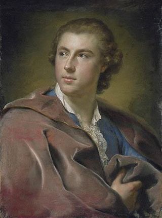
William Burton Conyngham was an Anglo-Irish politician.

MV Canna is a car ferry built for Caledonian MacBrayne (CalMac) in 1975. She spent 21 years in various locations on the west of Scotland and 20 years at Rathlin Island, Northern Island, before moving to Arranmore.

Boylagh is a historic barony in County Donegal in Ireland. Patrick Weston Joyce said the name Boylagh comes from the territory of the O'Boyles. It was created along with Banagh when the former barony of Boylagh and Banagh was split in 1791 by an Act of the Parliament of Ireland.
Mullaghduff is a townland in northwest County Donegal, Ireland. It forms part of the greater Rosses region and is officially in the Gaeltacht, however, English is the predominantly spoken language today.
Gaeltacht Way, Donegal comprises four circular long-distance trails in the Gaeltacht areas of County Donegal in Ireland. All four trails are designated as a National Waymarked Trails by the National Trails Office of the Irish Sports Council and managed by Donegal County Council and Údaras na Gaeltachta.

MV Rhum is a car ferry built for Caledonian MacBrayne in 1974. Until 1987, she operated the seasonal Lochranza crossing to Arran. Since 1998, she has been one of the Arranmore ferries in County Donegal.

MV Clew Bay Queen is a car ferry at Clare Island. Built in 1972 as MV Kilbrannan for Caledonian MacBrayne, she operated mainly at Scalpay, Outer Hebrides until 1992. As Arainn Mhor, she then operated the Arranmore ferry in County Donegal.

Owey Island is an island off the coast of west County Donegal, Ireland.
SS Stolwijk, a Dutch cargo ship of 2,489 tons, was wrecked off the coast of County Donegal, Ireland on 6 December 1940. She was part of a Convoy SC 13 sailing from the Dominion of Newfoundland to Liverpool, England, when her rudder was damaged in a fierce storm. Attempts to rescue her by her destroyer escort failed and she went on the rocks off Tory Island, County Donegal, Ireland. Ten of her crew were lost but the remaining 18 were rescued the following day by Arranmore Lifeboat and landed safely in Burtonport. The rescue of the survivors was conducted in terrible weather conditions and both the RNLI and Queen Wilhelmina of the Netherlands awarded medals to the Irish lifeboat crew.

Inishmeane is a small island and a townland off the coast of Gweedore, County Donegal, Ireland and was once home to a vibrant fishing community. The island has been unpopulated for decades but in recent years some people have started to return.
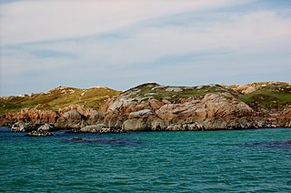
Eighter Island is a small island and a townland off the coast of County Donegal, Ireland. The closest town on the mainland is Burtonport.

Inishcoo is a small island and a townland off the coast of County Donegal, Ireland. The closest town on the mainland is Burtonport.
Inishfree refers to two small islands off the coast of County Donegal in the north of Ireland. Inishfree Upper is the larger of the two at around 0.6 square miles (1.6 km2). It is often known simply as "Inishfree".


