This article needs additional citations for verification .(April 2021) |
Leitir Mhic an Bhaird | |
---|---|
Village | |
Coordinates: 54°47′51″N8°16′57″W / 54.7975°N 8.2825°W | |
Country | Ireland |
Province | Ulster |
County | County Donegal |
Elevation | 78 m (256 ft) |
Irish Grid Reference | G818944 |
Leitir Mhic an Bhaird is the only official name. The anglicized spelling Lettermacaward has no official status. |
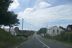
Leitir Mhic an Bhaird or Leitir Mhic a' Bhaird (anglicised as Lettermacaward) [1] is a Gaeltacht village in the Rosses region of County Donegal, Ireland. The village, known colloquially as Leitir (pronounced letcher), is between the larger towns of Glenties and Dungloe. It is also a civil parish in the historic barony of Boylagh. [2]
There are approximately 650 people living in the Leitir Mhic an Bhaird ED and 19% Irish speakers.
The village has two shops, 'Clerkin's', a family run service station, and 'Gallagher's Stop & Shop'. There are 3 pubs; Elliott's, the Gweebarra Bar, and Packie's Bar.
The local Gaelic games club is Na Rossa.
The civil parish contains the village of Lettermacaward. [2]
The civil parish contains the following townlands: [2]
Warrenpoint is a small port town and civil parish in County Down, Northern Ireland. It sits at the head of Carlingford Lough, south of Newry, and is separated from the Republic of Ireland by a narrow strait. The town is beside the village of Rostrevor and is overlooked by the Mournes and Cooley Mountains. Warrenpoint sprang up within the townland of Ringmackilroy, and is locally nicknamed "The Point", which also represents the town's full name in Irish, An Pointe".
The Rosses is a geographical and social region in the west of County Donegal, Ireland, with a population of over 7,000 centred on the town of Dungloe, which acts as the educational, shopping and civic centre for the area. Defined by physical boundaries in the form of rivers, as well as history and language use, the area has a distinctive identity, separate from the rest of Donegal. The extensive region lies between the parish of Gweedore to the north and the town of Glenties to the south. A large part of the Rosses is in the Gaeltacht, which means that Irish is the spoken language. The Rosses, Cloughaneely and Gweedore, known locally as "the three parishes" with 16,000 Irish speakers, together form a social and cultural region different from the rest of the county, with Gweedore serving as the main centre for socialising and industry. Gaeltacht an Láir is another Irish-speaking area.
Ballymakeera or Ballymakeery is a small townland and Gaeltacht village in the civil parish of Ballyvourney, barony of Muskerry West, County Cork, Ireland.
Drumquin is a village and townland in County Tyrone, Northern Ireland. It lies between Omagh and Castlederg, on the banks of the Drumquin River (Fairywater). It is situated in the civil parishes of both Longfield West and Longfield East. The main part of the village is located in Longfield East, in the townland of Drumnaforbe, whilst Longfield West is where its namesake townland Drumquin is located. Drumquin is in the historic barony of Omagh West.
Loughmacrory is a village and townland in County Tyrone, Northern Ireland. The village is situated 8 miles (13 km) east of Omagh in the historic barony of Omagh East and the civil parish of Termonmaguirk. it had a population of 237 in the 2001 Census. Loughmacrory has houses, shops, a church and a primary school. There is also an old mill and ancient cairns nearby.
Ballyrashane is a small village and civil parish outside Coleraine, County Londonderry, Northern Ireland. The civil parish of Ballyrashane covers areas of County Antrim, as well as County Londonderry. It is part of Causeway Coast and Glens district.
Ballykinler, often transcribed as Ballykinlar, is a village and civil parish in County Down, Northern Ireland. It lies 12 kilometres south west of Downpatrick, in the parish of Tyrella and Dundrum. In the 2001 census it had a population of 348 people. It is within the Newry, Mourne and Down area and runs parallel to the Irish Sea coast. Located within the Lecale Coast Area of Outstanding Natural Beauty, the village is surrounded by low drumlins and marshes. It is also the site of a former British Army base known as Abercorn Barracks.
Derrynoose is a village and civil parish in south County Armagh, Northern Ireland, 4.5 km south-west of Keady.
Killyman is a small village and a civil parish in Northern Ireland, situated on the eastern boundary of County Tyrone and extending into County Armagh. The majority of townlands are in the historic barony of Dungannon Middle in County Tyrone, the rest being in the barony of Oneilland West in County Armagh.
Kilmacrennan, also Kilmacrenan, is a village, townland and civil parish in County Donegal, Ireland. The village population was 753, as of the 2016 census. The village's population has increased steadily over the last decade with many new housing developments catering, in particular, for an overspill population from Letterkenny. Kilmacrennan was historically the caput of its eponymous Barony of Kilmacrennan, of the eight Baronies of Donegal.
Inver is a small village in County Donegal, Ireland.
Kilmurry McMahon, also called Kilmurry-Clonderalaw, is a civil parish in County Clare in Ireland. It is also a Catholic parish in the Diocese of Killaloe.
The barony of Castleknock is one of the baronies of Ireland. Originally part of the Lordship of Meath, it was then constituted as part of County Dublin. Today, it is in the modern county of Fingal, Ireland. The barony was originally also a feudal title, which became one of the subsidiary titles of the Viscounts Gormanston.
Boylagh is a historic barony in County Donegal in Ireland. Patrick Weston Joyce said the name Boylagh comes from the territory of the O'Boyles. It was created along with Banagh when the former barony of Boylagh and Banagh was split in 1791 by an Act of the Parliament of Ireland.
Moyarta is a civil parish in County Clare, Ireland. It lies on the Loop Head peninsula between the Atlantic Ocean and the Shannon Estuary. The parish contains the villages of Carrigaholt and Doonaha.
Kilmacrehy, sometimes also Kilmacreehy, is a civil parish in County Clare, Ireland. The ruins of the old parish church lie near the coastal village of Liscannor, which is also a part of the parish.
Kilmacduane is a civil parish in County Clare, Ireland. It contains the villages of Cooraclare and Cree.
Killonaghan or Killonahan is a civil parish in County Clare, Ireland. It covers a part of the Burren, a rugged area on the Atlantic coast, and contains the seaside village of Fanore.
Kilkenny West, previously Maherquirke or Dillons country, is a barony in west County Westmeath, Ireland. It was formed by 1542. It is bordered by County Longford to the west; it is also bordered by three other Westmeath baronies: Rathconrath, Brawny and Clonlonan. The largest centre of population in the barony is the village of Glassan.
Kilcommon, is a civil parish in the ancient barony of Ballinacor South in County Wicklow, Ireland. The parish is centered on the village of Tinahely. It is divided into 28 townlands