Ballyness

Last updated

Ballyness
Townland
United Kingdom Northern Ireland adm location map.svg
Red pog.svg
Ballyness
Location within Northern Ireland
County
Country Northern Ireland
Sovereign state United Kingdom
Police Northern Ireland
Fire Northern Ireland
Ambulance Northern Ireland
List of places
UK
Northern Ireland
55°8′38.494″N8°6′54.140″W / 55.14402611°N 8.11503889°W / 55.14402611; -8.11503889

Panorama of Ballyness Panorama of Ballyness-1.jpg
Panorama of Ballyness

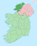
Ballyness (Irish : Baile an Easa, meaning 'townland of the waterfall') is a townland in the parish of Cloughaneely in the north west of County Donegal. Its Irish name is Baile an Easa meaning town of the waterfall. [1] It is known for its salmon fishing at the bawann pool.
Related Research Articles

<span class="mw-page-title-main">The Rosses</span> Region of western County Donegal, Ireland

The Rosses is a traditional 'district' in the west of County Donegal in Ulster, the northern province in Ireland. The Rosses has a population of over 7,000 centred on the town of Dungloe, which acts as the educational, shopping and civic centre for the area. Defined by physical boundaries in the form of rivers, as well as history and language use, the area has a distinctive identity, separate from the rest of County Donegal. The extensive district lies between the parish and district of Gweedore to the north and the town of Glenties to the south. A large part of the Rosses is in the Gaeltacht, which means that Irish is the spoken language. The Rosses, Cloughaneely and Gweedore, known locally as "the three parishes", with 16,000 Irish speakers, together form a social and cultural region different from the rest of the county, with Gweedore serving as the main centre for socialising and industry. Gaeltacht an Láir is another Irish-speaking area.

A townland is a small geographical division of land, historically and currently used in Ireland and in the Western Isles in Scotland, typically covering 100–500 acres (40–202 ha). The townland system is of Gaelic origin, antedating the Norman invasion, and most have names of Irish origin. However, some townland names and boundaries come from Norman manors, plantation divisions, or later creations of the Ordnance Survey. The total number of inhabited townlands in Ireland was 60,679 in 1911. The total number recognised by the Irish Place Names database as of 2014 was 61,098, including uninhabited townlands, mainly small islands.

<span class="mw-page-title-main">Tory Island</span> Island in Ulster, Ireland

Tory Island, or simply Tory, is an island 14.5 kilometres off the north-west coast of County Donegal, Ireland. It is officially known by its Irish name Toraigh, which, although spelled thus, is pronounced the same as the English version. It is the most remote inhabited island of Ireland. The name toraigh means "place of steep rocky heights".

<span class="mw-page-title-main">Ballintra</span> Village in County Donegal, Ireland

Ballintra is a village in the parish of Drumholm in the south of County Donegal, Ireland, just off the N15 road between Donegal town and Ballyshannon. Ballintra lies on the northern bank of the Blackwater river. The river rises in the hills that lie inland from the town, and flows through a number of small lakes before spilling over a small waterfall in a gorge behind the village.

<span class="mw-page-title-main">Ballysadare</span> Town in County Sligo, Ireland

Ballysadare, locally also Ballisodare, is a town in County Sligo, Ireland. It is about 7 kilometres south of Sligo town. The town developed on an important crossing of the Owenmore River.

<span class="mw-page-title-main">Newbuildings</span> Village in County Londonderry, Northern Ireland

Newbuildings or New Buildings is a large village in County Londonderry, Northern Ireland. It lies close to the banks of the River Foyle and 3 mi (5 km) south of the city of Derry. It had a population of 3,381 in the 2011 Census. It is within Derry and Strabane district.

Ballynagalliagh is a townland in County Londonderry, Northern Ireland. It lies within Derry and Strabane district.

<span class="mw-page-title-main">Carrickaness</span> Village in County Armagh, Northern Ireland

Carrickaness is a small village and townland in County Armagh, Northern Ireland. In the 2001 Census it had a population of 99 people. It is within the Armagh City and District Council area.

<span class="mw-page-title-main">Gortahork</span> Village in Ulster, Ireland

Gort an Choirce or Gort a' Choirce, anglicised as Gortahork, is a village and townland in the northwest of County Donegal, Ireland. It is a Gaeltacht community, where the Irish language is the main language spoken in the area. Along with Falcarragh, it forms part of the district known as Cloughaneely.

<span class="mw-page-title-main">Naul, Dublin</span> Village in County Dublin, Ireland

Naul, is a village, townland, and civil parish at the northern edge of the traditional County Dublin in Ireland. The Delvin River to the north of the village marks the county boundary with County Meath. Naul civil parish is in the historic barony of Balrothery West.

<span class="mw-page-title-main">Machaire Rabhartaigh</span> Village in Ulster, Ireland

Machaire Rabhartaigh, meaning "plain of the spring tide/plain of Roarty", is a Gaeltacht village and townland on the north-west coast of County Donegal in Ulster, the northern province in Ireland. It is in the parish of Cloughaneely and its main access road is the R257.

<span class="mw-page-title-main">Fintown</span> Village in County Donegal, Ireland

Fintown is a small village and townland on the banks of Lough Finn in County Donegal, Ireland. It is within the Gaeltacht, an Irish-speaking area, in the west of the county. Overlooked by Aghla and Screig Mountains, its main attraction is an Mhuc Dhubh, the Fintown Railway, which runs along the length of Lough Finn. The village was named after a mythological woman, Fionngheal, who drowned in the lake after attempting to save her wounded brother Feargamhain.

<span class="mw-page-title-main">Cloughaneely</span> Irish-speaking district, County Donegal, Ireland

Cloughaneely is a district in the north-west of County Donegal in Ireland. This is a mainly coastal area with a population of over 4,000 centred on the towns of Falcarragh and Gortahork. It is a Gaeltacht area, meaning the Irish language is spoken as the primary language. Cloughaneely includes the secondary school Pobalscoil Chloich Cheannfhaola, with just under 500 students. Places of interest include Cnoc na Naomh, considered to be a mountain with religious significance. Cloughaneely, The Rosses and Gweedore, known locally as "the three parishes" with 16,000 Irish speakers, together form a social and cultural region different from the rest of the county, with Gweedore serving as the main centre for industry.

<span class="mw-page-title-main">Portnablagh</span> Village in County Donegal, Ireland

Portnablagh is a small village in County Donegal in Ulster, the northern province in Ireland. Portnablagh is located on the north-west coast of County Donegal, specifically the west side of Sheephaven Bay. It is on the N56 road.

<span class="mw-page-title-main">Ballindrait</span> Village in County Donegal, Ireland

Ballindrait is a townland, village and census town in County Donegal, Ireland. Located near Lifford, the village and townland of Ballindrait is in the civil parish of Clonleigh and the barony of Raphoe North. The Burn Dale flows through the centre of Ballindrait.

<span class="mw-page-title-main">Crolly</span> Gaeltacht village in County Donegal, Ireland

Croithlí or Croichshlí is a village in the Gaeltacht parishes and traditional districts of Gweedore and The Rosses in the west of County Donegal in Ulster, the northern province in Ireland. The two 'districts' are separated by the Crolly River. It has one convenience shop/restaurant and petrol station and one public house, Páidí Óg's. Crolly is located in two baronies: the Gweedore part of the village is in the Barony of Kilmacrenan, while The Rosses part of the village is in the Barony of Boylagh, the Crolly River being the boundary between the two baronies.

<span class="mw-page-title-main">Bofealan</span> Townland in the civil parish of Templeport, County Cavan, Ireland

Bofealan is a townland in the civil parish of Templeport, County Cavan, Ireland. It lies in the Roman Catholic parish of Templeport and barony of Tullyhaw.

Corrasmongan is a townland in the civil parish of Templeport, County Cavan, Ireland. It lies in the Roman Catholic parish of Templeport and barony of Tullyhaw. The local pronunciation is Corasmonaghan.

<span class="mw-page-title-main">Commas (Kinawley)</span> Townland in County Cavan, Ireland

Commas is a townland in the civil parish of Kinawley, barony of Tullyhaw, County Cavan, Ireland. Sub-divisions of the townland are- (a) The Strait - A name given to a hollow in the townland up near Cuilcagh mountain; (b) Knocknamaddoo (Irish derived place name Cnoc na Mada, meaning ‘The Hill of the Dogs ’; Sruhan Doo, Easa Iarainn and Loinin, are names given to streams flowing down the mountain in Commas.

Largy Waterfall is a small waterfall located in the south-west of County Donegal in Ulster, the northern province in Ireland. The coastal waterfall is in Largy, a hamlet just west of Fintra Strand, a few miles west of Killybegs. The waterfall is often popularly known as County Donegal's Secret Waterfall or South Donegal's Secret Waterfall.

References

  1. "Place Names in Cloughaneely - Logainmneacha Cloch Cheann Fhaola from an Fál Carrach, Falcarragh, Co. Donegal, Ireland". Archived from the original on 12 September 2011. Retrieved 7 August 2011.