Moville

Last updated

Moville
Bun an Phobail
Town
Moville Market Square 2019 08 28.jpg
Moville Market Square
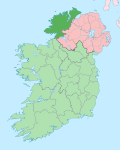
Ireland adm location map.svg
Red pog.svg
Moville
Location in Ireland
Coordinates: 55°11′20″N7°2′26″W / 55.18889°N 7.04056°W / 55.18889; -7.04056
Country Republic of Ireland
Province Ulster
County County Donegal
Elevation
30 m (100 ft)
Population
 (2022) [1]
1,390
Irish Grid Reference C648397

Moville (moh-VIL; Irish : Bun an Phobail) [2] is a coastal town located on the Inishowen Peninsula of County Donegal, Ireland, close to the northern tip of the island of Ireland. It is the first coastal town of the Wild Atlantic Way when starting on the northern end.

Contents

Location

The town is located on the western shore of Lough Foyle, approximately 30 kilometres (20 mi) from Derry, [3] which lies across the border in Northern Ireland. Features include Moville Green, a pier, a large seaside park in the Victorian style which features bandstands, walking trails, playgrounds, a coastal footpath and views east across the waters of the lough to Northern Ireland. Moville is close to several beaches, and receives visitors and daytrippers in the summer months.[ citation needed ]

The town is in the civil parish of Moville Lower (Irish : Maigh Bhile Íochtarach). [2] This alternative Irish language version of the place name, Maigh Bhile, which means “plain of the ancient tree”, is one possible origin of the English language name. [4]

Moville Community College is located to the south of the town centre, in the townland of Carrownaff. [5]

History

In the second half of the 19th century, Moville was a point of embarkation for travellers, especially emigrants, to Canada and the United States of America. In the late 19th century, steamships of the Glasgow-based Anchor Line and Allan Line made port at Moville while en route to and from New York, while just after the turn of the 20th century, the Canadian Pacific Line also established a terminal at the port as part of their service connecting Liverpool and Montreal for Canadian-bound Irish immigrants.[ citation needed ] Today, the town receives little maritime traffic but retains a small fishing harbour. The commercial fishing port at Greencastle lies a few miles away.[ citation needed ]

The ancestors of Field-Marshal Bernard Montgomery, the Montgomerys of New Park, were a landed family of the town. When flying over the town in 1947 he commented: "It looks just the same. My dear old Irish home". [6] His grandfather Robert Montgomery had built Montgomery Terrace in 1884. [7]

Festivals

An annual regatta is held at Moville every year and has done so since early in the 19th century.[ citation needed ]

Several music festivals take place in the area annually, including a festival of Bob Dylan music (DylanFest) which has taken place on the last weekend in August since 2007, [8] and a festival of Beatles' music (BeatlesFest) which takes place on the August bank holiday weekend at the start of the month. [9]

Notable people

Related Research Articles

<span class="mw-page-title-main">County Donegal</span> County in Ireland

County Donegal is a county of Ireland in the province of Ulster and in the Northern and Western Region. It is named after the town of Donegal in the south of the county. It has also been known as County Tyrconnell or Tirconaill, after the historic territory. Donegal County Council is the local council and Lifford is the county town.

<span class="mw-page-title-main">Inishowen</span> Large peninsula in County Donegal, Ireland

Inishowen is a peninsula in the north of County Donegal in Ireland. Inishowen is the largest peninsula on the island of Ireland.

<span class="mw-page-title-main">Buncrana</span> Town in County Donegal, Ireland

Buncrana is a town in County Donegal, Ireland. It is beside Lough Swilly on the Inishowen peninsula, 23 kilometres (14 mi) northwest of Derry and 43 kilometres (27 mi) north of Letterkenny. In the 2022 census, the population was 6,971, making it the second most populous town in County Donegal, after Letterkenny, and the largest in Inishowen.

<span class="mw-page-title-main">Lough Swilly</span> Sea inlet in County Donegal, Ireland

Lough Swilly in Ireland is a glacial fjord or sea inlet lying between the western side of the Inishowen Peninsula and the Fanad Peninsula, in County Donegal. Along with Carlingford Lough and Killary Harbour it is one of three glacial fjords in Ireland.

<span class="mw-page-title-main">Lough Foyle</span> Estuary of the River Foyle, north Ireland

Lough Foyle, sometimes Loch Foyle, is the estuary of the River Foyle, on the north coast of Ireland. It lies between County Londonderry in Northern Ireland and County Donegal in the Republic of Ireland. Sovereignty over the waters has been in dispute since the Partition of Ireland.

<span class="mw-page-title-main">River Foyle</span> River in the northwest of the island of Ireland

The River Foyle is a river in west Ulster in the northwest of the island of Ireland, which flows from the confluence of the rivers Finn and Mourne at the towns of Lifford in County Donegal, Republic of Ireland, and Strabane in County Tyrone, Northern Ireland. From here it flows to the city of Derry, where it discharges into Lough Foyle and, ultimately, the Atlantic Ocean. The total length of the River Foyle is 32 km (20 mi). The river separates part of County Donegal from parts of both County Londonderry and County Tyrone. The district of County Donegal that borders the western bank of the River Foyle is traditionally known as the Laggan. This district includes the villages of St Johnston and Carrigans, both of which are nestled on the banks of the River.

<span class="mw-page-title-main">Greencastle, County Donegal</span> Fishing port in County Donegal, Ireland

Greencastle is a commercial fishing port located in the north-east of the Inishowen Peninsula on the north coast of County Donegal in Ulster, Ireland. The port is on the western shores of Lough Foyle. Nowadays, given the decline in the fishing industry, it resembles more closely a 'typical' Donegal holiday village. It is located a few miles from Moville and is about 20 miles from Derry.

<span class="mw-page-title-main">O'Doherty family</span> Irish clan

The O'Doherty family of County Donegal is an Irish clan who were a prominent sept of the Northern Uí Néill's Cenél Conaill, and one of most powerful clans of Tír Connaill.

The Londonderry and Lough Swilly Railway Company was an Irish public transport and freight company that operated in parts of County Londonderry and County Donegal between 1853 and 2014. Incorporated in June 1853, it once operated 99 miles of railways. It began the transition to bus and road freight services in 1929. It closed its last railway line in July 1953 but continued to operate bus services under the name Lough Swilly Bus Company until April 2014, becoming the oldest railway company established in the Victorian era to continue trading as a commercial concern into the 21st century. Following a High Court petition by HM Revenue and Customs, the company went into liquidation and operated its final bus services on 19 April 2014.

<span class="mw-page-title-main">Quigley's Point</span> Village in County Donegal, Ireland

Quigley's Point is a village in County Donegal, Ireland. Located on the eastern shores of Inishowen and overlooking Lough Foyle, the village is sometimes known locally as "Carrowkeel" as it is in a townland of that name. To the south is the city of Derry and to the north lie the villages of Moville and Greencastle. A car ferry links Greencastle with Magilligan during the summer. The river Cabry, which flows through the area, is spanned by a late-18th century bridge at Quigley's Point.

<span class="mw-page-title-main">Londonderry Port</span> Dock and shipyards in Northern Ireland

Londonderry Port, now operating as Foyle Port, is a port located on Lough Foyle in Northern Ireland. It is the United Kingdom’s most westerly port and an important northerly port on the island of Ireland. The current port is at Lisahally, County Londonderry, though historically the port was upriver in the city of Derry itself. It is operated by the Londonderry Port and Harbour Commissioners, whose former offices, just north of the city's walls, are now a museum.

<span class="mw-page-title-main">Burt, County Donegal</span> Parish in Ulster, Ireland

Burt is a parish in County Donegal, Ireland, on the main road between Letterkenny and Derry.

<span class="mw-page-title-main">Attacks on shipping in Lough Foyle (1981–82)</span> IRA bombings at Lough Foyle inlet

The Provisional Irish Republican Army (IRA) carried out two bomb attacks against British coal ships in February 1981 and February 1982 at Lough Foyle, a large inlet between County Londonderry in Northern Ireland and County Donegal in the Republic of Ireland. The IRA used hijacked pilot boats to board the ships. Both vessels were sunk, but their crews reached the coastline safely in lifeboats.

<span class="mw-page-title-main">North West Liberties of Londonderry</span> Administrative division in Northern Ireland

The North West Liberties of Londonderry is a barony in County Londonderry, Northern Ireland. It is bordered by two other baronies in Northern Ireland: Tirkeeran to the east, across Lough Foyle, and Strabane Lower to the south. It also borders two baronies in County Donegal in the Republic of Ireland. It borders Raphoe North, to the south-west; and Inishowen West to the north.

Art Parkinson is an Irish actor from Moville in Inishowen, County Donegal, in Ireland. He began his professional acting career at the age of seven. He is best known for his role as Rickon Stark on the HBO series Game of Thrones, and Kubo in the film Kubo and the Two Strings (2016).

<span class="mw-page-title-main">R238 road (Ireland)</span> Regional road in Ireland

The R238 road is a regional road in Ireland. It is a ring road around the Inishowen Peninsula in County Donegal. The R238 is also part of the main road from Derry to Buncrana. Sections of the road form part of the Wild Atlantic Way. In July 2010, the road was the site of Ireland's worst road crash resulting in eight deaths.

<span class="mw-page-title-main">R241 road (Ireland)</span> Road in Ireland

The R241 road is a regional road in the north-west of Ireland. It is a coastal road on the eastern side of Inishowen, a peninsula in the north of County Donegal in Ulster. The road forms part of the Wild Atlantic Way. Part of the road is on the Inishowen Head Loop walking trail.

<span class="mw-page-title-main">U.S. Naval Air Station Lough Foyle Ireland</span> Airport in County Donegal, Ireland

U.S. Naval Air Station Lough Foyle was a seaplane station at Lough Foyle in Ireland, which was operated by the United States Navy (USN) and commissioned on July 1, 1918 with Commander Henry D. Cooke, USN as the commanding officer. Located near Quigley's Point in County Donegal, and approximately 6 miles (9.7 km) north of Derry in County Londonderry, the station was disestablished in early 1919.

<span class="mw-page-title-main">Redcastle, County Donegal</span> Village in County Donegal, Ireland

Redcastle is a village in County Donegal, Ireland, located on the eastern shores of Inishowen and overlooking the wide expanse of Lough Foyle. To the south is the city of Derry and to the north lie the villages of Moville and Greencastle.

<span class="mw-page-title-main">Shrove, County Donegal</span> Hamlet and townland in Inishowen, County Donegal, in Ulster, Ireland

Shrove is a coastal hamlet and townland in Inishowen in the north of County Donegal in the north-west of Ulster, the northern province in Ireland. The hamlet is located a short distance to the north of Greencastle in the north-east of Inishowen, a peninsula on the north coast of Ireland. The name of both the hamlet and the townland is also sometimes written as Shroove, and is sometimes written as Stroove by some government bodies.

References

  1. "Interactive Data Visualisations: Towns: Moville". Census 2022. Central Statistics Office . Retrieved 30 September 2023.
  2. 1 2 "Bun an Phobail / Moville". logainm.ie. Irish Placenames Commission. Retrieved 9 November 2018. Civil Parish [..] Maigh Bhile Íochtarach/Moville Lower
  3. A Topographical Dictionary of Ireland. Samuel Lewis. 1837.
  4. "Towns & Regions in Donegal - Moville Heritage Town". govisitdonegal.com. Retrieved 23 August 2023. Moville has two possible Gaelic origins, translated from Bun a Phobail, meaning 'Foot of the Parish' or Magh Bhile, meaning 'Plain of the Ancient Tree'
  5. "Moville Community College – Contact Us". movillecc.ie. Moville Community College. Retrieved 9 November 2018.
  6. "Notes on the 1947 visit". Movilleinishowen.com. Archived from the original on 25 March 2012.
  7. "Black and White Postcards Moville Inishowen Co Donegal". Movilleinishowen.com. NE Inishowen Company. Archived from the original on 25 March 2012.
  8. "Dylanfest event to take place in Derry in 2018". derryjournal.com. Derry Journal. 18 December 2017.
  9. "BeatlesFest Moville Programme of Events 2017". inishowennews.com. Inishowen News Donegal. 3 August 2017. Retrieved 9 November 2018.
  10. "Montgomery, Sir Robert (1809–1887)". Oxford Dictionary of National Biography (online ed.). Oxford University Press. 2004. doi:10.1093/ref:odnb/19075.(Subscription or UK public library membership required.)
  11. "Sheila McClean's vibrant personality and life matched her art". irishnews.com. Irish News. 13 August 2016.
  12. "Donegal teenager Art Parkinson gets his Hollywood break in new disaster film". bbc.com. BBC News. 1 June 2015.
  13. "Parish History". Moville Parish, Derry Diocese, Ireland. Retrieved 9 May 2015.