Ballon is a village in County Carlow, Ireland. It is located on the N80 road near Carlow town.

Graiguenamanagh or Graignamanagh is a town on the River Barrow in County Kilkenny, Ireland. Part of the settlement, known as Tinnahinch, is on the County Carlow side of the river, and Carlow County Council refers to the whole village as "Graiguenamanagh-Tinnahinch". Also combined for census purposes, as of the 2016 census, Graiguenamanagh-Tinnahinch had a population of 1,475 people.

The River Dodder is one of the three main rivers in Dublin, Ireland, the others being the Liffey, of which the Dodder is the largest tributary, and the Tolka.

The River Slaney is a large river in the southeast of Ireland. It rises on Lugnaquilla Mountain in the western Wicklow Mountains and flows west and then south through counties Wicklow, Carlow and Wexford for 117.5 km (73 mi), before entering St George's Channel in the Irish Sea at Wexford town. The estuary of the Slaney is wide and shallow and is known as Wexford Harbour. The catchment area of the River Slaney is 1,762 km2. The long term average flow rate of the River Slaney is 37.4m3/s

The Shimna River is a river in County Down, Northern Ireland. It rises on the slopes of Ott Mountain, in the Mourne Mountains, and enters the Irish Sea at Newcastle, on Dundrum Bay. It is acidic and nutrient-poor, as a result of which its most common flora are mosses and liverworts, including the rare Portuguese feather-moss and Holt's mouse-tail moss. Its principal fish are salmon and sea trout, and it is managed by the Shimna Angling Club. The river is an Area of Special Scientific Interest (ASSI).

Lough Bane is a lake on the border of County Meath and County Westmeath in Ireland. The county border runs east–west through the centre of the lake.

Lough Talt is a lake in the Ox Mountains of south County Sligo, Ireland. The lake is located between the villages of Tubbercurry and Bonniconlon on the R294 road. Lough Talt is part of the Lough Hoe Bog Special Area of Conservation, an area of montane bogland and oligotrophic lakes.

The Nenagh River rises in the Silvermine Mountains in County Tipperary, Ireland. It flows east of Nenagh and into Lough Derg just north of Dromineer.
The Lyreen River is a small river in County Kildare, Ireland, a tributary of the Rye River (Ryewater), and ultimately of the River Liffey.
The River Greese is a small, fast-flowing river in south-east, Ireland, and a tributary of the River Barrow.
Tully Stream is a stream in County Kildare, Ireland.

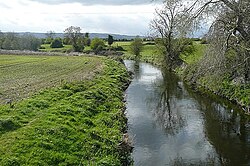
The River Derreen is a large river in the southeast of Ireland. It rises on the southern slopes of Lybagh and Slievemaan and flows southwest until it joins the River Slaney in County Carlow, south of Tullow, passing close to Hacketstown and Tullow, County Carlow before it joins the Slaney upstream of Aghade bridge. Running through tillage and pastureland in its lower reaches, the Derreen with its sandy, gravelly bottom is a prime salmon spawning tributary of the Slaney. Passing through counties Wicklow and Carlow, it is the first large, major tributary of the River Slaney.
Muckanagh Lough is a freshwater lake in the Burren region of County Clare, Ireland.
The River Dinan, Deen or Dinin is a river in Ireland, flowing through County Kilkenny and County Laois.
Keshcarrigan Lough is a mesotrophic freshwater lake near Keshcarrigan in County Leitrim, Ireland. Known for quality coarse fishing, the lake allows bank fishing from concrete stands on the northern shore, two with wheelchair access. The ecology of Keshcarrigan Lough, and other county waterways, is threatened by curly waterweed, zebra mussel, and freshwater clam invasive species.

Padbury Brook is a stream/river in Oxfordshire and Buckinghamshire; it is a small tributary of the River Great Ouse approximately 12 km in length.

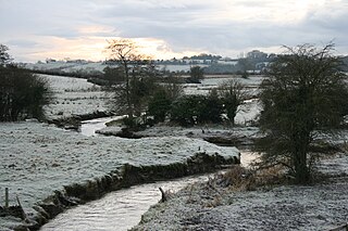
Rathtoe, also spelled Rathoe, is a village and townland in County Carlow, Ireland. The village is located in the civil parish of Gilbertstown, between Tullow and Ballon, County Carlow. The Burren River flows through the area. Rathtoe is a census town, and had a population of 304 as of the 2016 census.

Rathvilly Gaelic Athletic Association is a Gaelic football and ladies' Gaelic football club based in Rathvilly, County Carlow, Ireland.

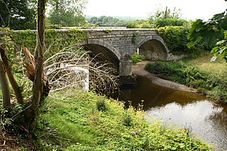
River Blackwater is a tributary of the River Suir in County Kilkenny, Ireland. It is formed by the confluence of the Derrylacky River and the Poulanassy or Assy River just to the south of Mullinavat before it flows southwards through the village of Kilmacow before joining the Suir estuary below the townland of Dunkitt.