Rosclogher Ros Clochair (Irish) | |
|---|---|
 | |
| Country | Ireland |
| Province | Connacht |
| County | Leitrim |
| Area | |
| • Total | 330.23 km2 (127.5 sq mi) |
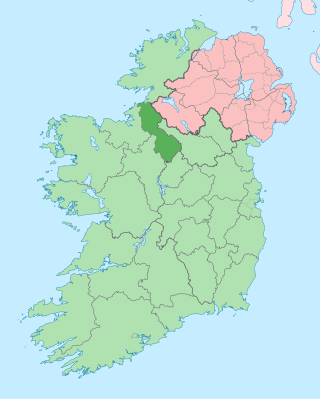
Rosclogher (Irish : Ros Clochair) is a barony in County Leitrim, Ireland.
Rosclogher Ros Clochair (Irish) | |
|---|---|
 | |
| Country | Ireland |
| Province | Connacht |
| County | Leitrim |
| Area | |
| • Total | 330.23 km2 (127.5 sq mi) |
Rosclogher (Irish : Ros Clochair) is a barony in County Leitrim, Ireland.
Rosclogher barony takes its name from the townland of Rosclogher (Irish : Ros Clochair, "stony wooded height"), which gives its name to Rosclogher Castle. [1]
Rosclogher is found in north County Leitrim, reaching from its 3 km (2 mi) of Atlantic coastline (the least coastline of any coastal county), past Lough Melvin, east of the Kilcoo River, up to Saddle Hill.
Rosclogher barony is bordered to the south by Drumahaire, County Leitrim; to the north by Tirhugh, County Donegal; to the east by Magheraboy and Clanawley, County Fermanagh; and to the west by the barony of Carbury, County Sligo.
The O'Murroughs, or O'Murreys, were chiefs in the barony of Rosclogher. Their territory was the Hy Murragh. The Mac Murry or Mac Morrow were chiefs in Loghmoyltagh. The MacClancy's were chiefs of Dartraighe (Dartry) in the barony of Rosclogher. Uí Miadhachain (O'Meehan) is found here at the time of the Norman invasion of Ireland. [2]
Below is a list of settlements in Rosclogher barony:

County Leitrim is a county in Ireland. It is in the province of Connacht and is part of the Northern and Western Region. It is named after the village of Leitrim. Leitrim County Council is the local authority for the county, which had a population of 35,199 according to the 2022 census.

Carrick-on-Shannon is the county town of County Leitrim in Ireland. It is the largest town in the county. A smaller part of the town located on the west bank of the River Shannon lies in County Roscommon and is home to the town's main train station. As of the 2022 census, the population of the town was 4,743. It is situated on a strategic crossing point of the River Shannon. The main part of the town, the County Leitrim part, is in the civil parish of Kiltoghert, which is in the barony of Leitrim, while Cortober, which is the County Roscommon side of the town, is in the civil parish of Killukin, in the barony of Boyle.

The Conmaicne were a people of early Ireland, perhaps related to the Laigin, who dispersed to various parts of Ireland. They settled in Connacht and Longford, giving their name to several Conmaicne territories. T. F. O'Rahilly's assertion the Conmaicne were non-Goidelic is not widely accepted.

Tyrconnell, also spelled Tirconnell and Tirconaill, was a kingdom of Gaelic Ireland. It is associated geographically with present-day County Donegal, which was officially named County Tirconaill between 1922 and 1927. At times it also included parts of County Fermanagh, County Sligo, County Leitrim, County Tyrone and County Londonderry at its greatest extent. The kingdom represented the core homeland of the Cenél Conaill people of the Northern Uí Néill and although they ruled, there were smaller groups of other Gaels in the area.
North Leitrim was a parliamentary constituency in Ireland. From 1885 to 1918 it returned one Member of Parliament (MP) to the House of Commons of the United Kingdom of Great Britain and Ireland.

The Kingdom of Breifne or Bréifne, anglicized as Breffny, was a medieval overkingdom in Gaelic Ireland. It comprised what is now County Leitrim, County Cavan and parts of neighbouring counties, and corresponds roughly to the Roman Catholic Diocese of Kilmore. It had emerged by the 10th century, as a confederation of túatha headed by an overking drawn from the Uí Briúin Bréifne.

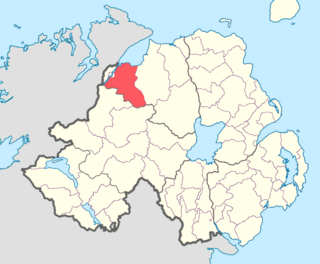
Tirkeeran is a barony in County Londonderry, Northern Ireland. It connects to the north-Londonderry coastline, and is bordered by four other baronies: Keenaght to the east; Strabane Lower to the south-east; North West Liberties of Londonderry to the west; and Strabane Upper to the south.

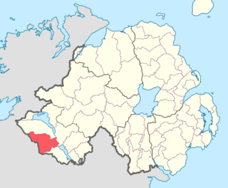
Clanawley is a barony in County Fermanagh, Northern Ireland. To its east lies Upper Lough Erne, and it is bordered by three other baronies: Magheraboy to the north; Tirkennedy and Knockninny to the east. It also borders three baronies in the Republic of Ireland: Tullyhaw to the south; and Drumahaire and Rosclogher to the west.

Magheraboy is a barony in County Fermanagh, Northern Ireland. To its east lies Lower Lough Erne, and it is bordered by three other baronies in Northern Ireland: Lurg to the north; Tirkennedy to the east; and Clanawley to the south It also borders two baronies in the Republic of Ireland: Tirhugh to the north; and Rosclogher to the south. The westernmost point of Magheraboy is also the westernmost point of Northern Ireland..

The Muintir Eolais of Conmaicne Réin were nobles of Gaelic Ireland. For seven hundred years from the 8th century, they lived in and ruled an area roughly conterminous with present-day south County Leitrim. Their territory comprised the lands named Maigh Nissi and Maigh Rein, today the baronies of Leitrim and Mohill respectively.

The Kingdom of West Breifne or Breifne O'Rourke was a historic kingdom of Ireland that existed from 1256 to 1605, located in the area that is now County Leitrim. It took its present boundaries in 1583 when West Breifne was shired and renamed Leitrim, after the village of Leitrim, which was an O'Rourke stronghold. The kingdom came into existence after a battle between the ruling O'Rourke clan and the ascendant O'Reillys caused the breakup of the older Kingdom of Breifne and led to the formation of East Breifne and West Breifne. The kingdom was ruled by the O'Rourke clan and lasted until the early 17th century, when their lands were confiscated by England.

Cairbre Drom Cliabh was an Irish túath in the ancient confederation of Íochtar Connacht, now County Sligo in the west of Ireland. It is now represented by the barony of Carbury. Also known as Cairbre na Catha. It existed from at least the 6th century to the 16th century AD.

Carrigallen is a barony in County Leitrim, Ireland.

Drumahaire is a barony in County Leitrim, Ireland.

The barony of Mohill is an ancient barony in County Leitrim, Ireland.

The barony of Leitrim is a barony in County Leitrim, Ireland.
Leitrim is a barony in Ireland that lies partly in County Galway and partly in County Clare. It is located in the south-eastern corner of County Galway and the north-eastern corner of County Clare. Prior to 1898, the entire barony was contained in County Galway. The Local Government (Ireland) Act 1898 split the barony: part of the barony was transferred to County Clare. Leitrim is bounded, clockwise from the southwest, by the Clare baronies of Tulla Upper and Tulla Lower; the Galway baronies of Loughrea to the west, Kilconnell to the north, and Longford to the east; and by Lough Derg to the south and southeast. It measures 20 miles (32 km) from north to south and 9.5 miles (15.3 km) from east to west.

Roscommon is a barony in County Roscommon, Ireland.
The Conmhaicne Luacháin or Cenel Luchain, were an early people of Ireland, whose tuath comprised the parishes of Oughteragh and Drumreilly, barony of Carrigallen, in southern County Leitrim.