The N8 road is a national primary road in Ireland, connecting Cork with Dublin via the M7. The N8 is further classified by the United Nations as the entirety of the European route E 201, part of the trans-Europe International E-road network. The road is motorway standard from junction 19 on the M7 to the Dunkettle interchange in Cork City and is designated as the M8 motorway. From here the route continues into Cork city centre and terminates at the N22 road at St. Patrick's Street. The M8 motorway was completed in May 2010, replacing the single carriageway sections of the old N8 and bypassing towns on the main Cork to Dublin road. It is now possible to travel from Cork to Dublin on the M/N8 in about 2 hours 30 minutes. The route commences just south of Portlaoise, and reaches Cork via the midlands and the Golden Vale of Ireland, through Counties Laois, Kilkenny, Tipperary, Limerick and Cork.

Fethard is a small town in County Tipperary, Ireland. Dating to the Norman invasion of Ireland, the town's walls were first laid-out in the 13th century, with some sections of these defensive fortifications surviving today.

A national secondary road is a category of road in Ireland. These roads form an important part of the national route network but are secondary to the main arterial routes which are classified as national primary roads. National secondary roads are designated with route numbers higher than those used for primary roads, but with the same "N" prefix. Routes N51 and higher are all national secondary roads.
Clonoulty is a small village and a civil parish in County Tipperary, Ireland. It is one of nine civil parishes in the barony of Kilnamanagh Lower. It is also one half of the ecclesiastical parish of Clonoulty-Rossmore in the Roman Catholic Archdiocese of Cashel and Emly. Clonoulty may also refer to a slightly larger area which forms one half of the catchment area for Clonoulty-Rossmore GAA club.
Cashel King Cormacs GAA is a Gaelic Athletic Association club located in the town of Cashel, County Tipperary in Ireland. They play their games in Leahy Park, on the Clonmel Road in Cashel. The club is named for the king-bishop Cormac Mac Cárthaigh.

Emly or Emlybeg is a village in County Tipperary, Ireland. It is a civil parish in the historical barony of Clanwilliam. It is also an Ecclesiastical parish in the Roman Catholic Archdiocese of Cashel and Emly.

Dundrum is a village in County Tipperary, Ireland. In the 2016 census, the population was 165. It is in the barony of Kilnamanagh Lower.
Golden is a village in County Tipperary in Ireland. The village is situated on the River Suir. It is located between the towns of Cashel and Tipperary on the N74 road. In older times the village was known as Goldenbridge. It is also a parish in the Roman Catholic Archdiocese of Cashel and Emly, and is in the historical barony of Clanwilliam.

The R639 road is one of Ireland's regional roads. Once designated the N8 national primary road, it was reclassified in stages as the R639 following the progressive opening of sections of the M8 motorway, which rendered the single carriageway N8 redundant as a national primary road. By-passed sections of the old N8 were generally reclassified as R639 as soon as a new section of M8 opened, thereby increasing the length of the R639. With the completion of the M8 on 28 May 2010, the R639 now stretches from Durrow, County Laois to Cork, running through counties Laois, Kilkenny, Tipperary, Limerick and Cork.

The N75 road is a national secondary road in Ireland. It runs for its entire length in County Tipperary, east to west from Thurles to its junction with the M8 motorway close to the village of Two-Mile Borris.
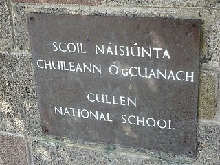
Cullen is a rural village in County Tipperary, Ireland. The centre of the village is located at a junction of two roads in south Tipperary. These roads lead to Monard, Lattin, the "Rocky Road" and Oola respectively.
The R692 road is a regional road in Ireland linking Cashel, County Tipperary to Callan, County Kilkenny. It passes through Fethard and Mullinahone en route, and meets the M8 motorway 1km east of Cashel. The road is 47 km (29 mi) long.
The R505 road is a regional road in Ireland which runs east-west from Cashel, County Tipperary to the N24 southeast of Limerick City. En route it passes through Dundrum and Cappawhite in County Tipperary and Doon and Cappamore in County Limerick. The road is 45 km (28 mi) long.
The R670 road is a regional road in Ireland. The route runs from its junction with the R639 and N24 at Cloughabreeda 2 km north of Cahir through Cahir town and onwards for a further 8 km to Ardfinnan, where it joins the R665 road. The R670 is located entirely in County Tipperary.
Middle Third is a barony in County Tipperary, Ireland. This geographical unit of land is one of 12 baronies in County Tipperary. Its chief town is Cashel. The barony lies between Eliogarty to the north, Iffa and Offa East to the south, Clanwilliam to the west and Slievardagh to the east. It is currently administered by Tipperary County Council.
Kilfeacle & District Rugby Football Club is an amateur rugby union club based in the village of Kilfeacle, County Tipperary. The club was founded in 1981. Today, the club's playing grounds, called Morrissey Park, or more affectionately known as "The Hill", are located in the village of Kilfeacle, approximately four miles from Tipperary Town on the N74 Tipperary to Cashel road.
The Tipperary Heritage Way is a long-distance trail in County Tipperary, Ireland. It is 56 kilometres long and begins at the Vee Gap, near Clogheen, and ends in Cashel. It is typically completed in two days. It is designated as a National Waymarked Trail by the National Trails Office of the Irish Sports Council and is managed by Tipperary County Council, South Tipperary Integrated Development Company and the Tipperary Heritage Way Committee. The trail was opened on 7 September 2002 by Michael Smith, Minister for Defence.
Rathanadav, also called Carron Henge, Rathnadob, Rathnadov or Fort Aengus, is a ringfort (rath) and henge, and a National Monument located in County Tipperary, Ireland.
Ballysheehan is a village in the southern part of County Tipperary, Ireland. It is also a civil parish in the barony of Middle Third, within the Munster province.

The R932 road is a regional road in Ireland which links the N74 road with the R505 regional road in Cashel in County Tipperary.


