R164 road (Ireland)

Last updated

R164 Regional Route Shield Ireland.png

R164 road
Route information
Length36 km (22 mi)
Location
Primary
destinations
Road network

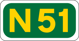
The R164 road is a regional road in Ireland, linking Kingscourt in County Cavan to the N51 near Athboy, County Meath.

Regional road (Ireland) Class of road in Ireland

A regional road in Ireland is a class of road not forming a major route, but nevertheless forming a link in the national route network. There are over 11,600 kilometres of regional roads. Regional roads are numbered with three-digit route numbers, prefixed by "R".

Republic of Ireland Country in Europe on the island of Ireland

Ireland, also known as the Republic of Ireland, is a country in north-western Europe occupying 26 of 32 counties of the island of Ireland. The capital and largest city is Dublin, which is located on the eastern side of the island. Around a third of the country's population of 4.9 million people resides in the greater Dublin area. The sovereign state shares its only land border with Northern Ireland, a part of the United Kingdom. It is otherwise surrounded by the Atlantic Ocean, with the Celtic Sea to the south, St George's Channel to the south-east, and the Irish Sea to the east. It is a unitary, parliamentary republic. The legislature, the Oireachtas, consists of a lower house, Dáil Éireann, an upper house, Seanad Éireann, and an elected President who serves as the largely ceremonial head of state, but with some important powers and duties. The head of government is the Taoiseach, who is elected by the Dáil and appointed by the President; the Taoiseach in turn appoints other government ministers.

Kingscourt Town in Ulster, Ireland

Kingscourt, historically known as Dunaree, is a town in County Cavan, Ireland. It is located near the Cavan–Meath border. The town was founded near the site of the old village of Cabra, by Mervyn Pratt, towards the end of the 18th century, and was completed by his brother, The Rev. Joseph Pratt.

Contents

Route

R164 crosses the Blackwater near Kells IMG R164overBlackwater.jpg
R164 crosses the Blackwater near Kells

North to South the route starts in Kingscourt, County Cavan and in 2 km crosses into County Meath. It continues southwards through Moynalty, across the Kells Blackwater river and into Kells.

Moynalty Town in Leinster, Ireland

Moynalty is a village in the north-west of County Meath in Ireland. It is located at the junction of the R194 and R164 regional roads 8 km (5 mi) north of Kells, near the border with County Cavan. It was part of the Kells Poor Law Union. The Borora river flows through the village. Its population in 2011 was 116 people.

Kells Blackwater river in Ireland

The Kells Blackwater, also called the River Blackwater or Leinster Blackwater, is a river that flows through the counties of Cavan and Meath in Ireland. It is a tributary of the River Boyne which flows into the Irish Sea at Drogheda..

Kells, County Meath Town in Leinster, Ireland

Kells is a town in County Meath, Ireland. The town lies off the M3 motorway, 16 km (10 mi) from Navan and 65 km (40 mi) from Dublin. It is best known as the site of Kells Abbey, from which the Book of Kells takes its name.

In Kells it joins the R147 at Carrick Street and continues through Castle Street; turns into the N52 at Cross Street; continues through Farrell Street and Bective Street before leaving the N52 and heading south along Rockfield Street.

R147 road (Ireland)

The R147 is a regional road in Ireland. Its first section runs from St Peters Church in Phibsborough, Dublin to its junction with the M50. It then follows the route of a former section of the N3 between Clonee and Kells. It serves as an alternative route for non-motorway traffic and traffic wishing to avoid tolls on the M3.

N52 road (Ireland) Ireland

The N52 road is a national secondary road in Ireland. It links the M7 motorway from just south of Nenagh, County Tipperary to the M1 motorway north of Dundalk in County Louth. The route forms a connection between the north east of Ireland and the mid west traversing the midlands. It interchanges with the M6 at Kilbeggan and at Tyrrellspass, the N4 at Mullingar, the N3 at Kells, and the N2 at Ardee before continuing towards Dundalk.

It leaves Kells south through Scurlockstown and Fordstown before terminating at the N51 3 km east of Athboy.

N51 road (Ireland) road in Ireland

The N51 road is a national secondary road in Ireland. West to east, it starts in Delvin, County Westmeath at a junction with the N52. It passes through Athboy, a junction with M3 motorway, Navan and Slane, where it crosses the N2 road, all in County Meath, before crossing the M1 motorway and terminating near Drogheda in County Louth at a roundabout on the R132.

Athboy Town in Leinster, Ireland

Athboy, is a small agricultural town located in County Meath. The town is located on the Yellow Ford River, in wooded country near the County Westmeath border.

See also

Roads in Ireland

The island of Ireland, comprising Northern Ireland and the Republic of Ireland, has an extensive network of tens of thousands of kilometres of public roads, usually surfaced. These roads have been developed and modernised over centuries, from trackways suitable only for walkers and horses, to surfaced roads including modern motorways. The major routes were established before Irish independence and consequently take little cognisance of the border other than a change of identification number and street furniture. Northern Ireland has had motorways since 1962, and has a well-developed network of primary, secondary and local routes. The Republic started work on its motorway network in the early 1980s; and historically, the road network there was once somewhat less well developed. However, the Celtic Tiger economic boom and an influx of European Union structural funding, saw national roads and regional roads in the Republic come up to international standard quite quickly. In the mid-1990s, for example, the Republic went from having only a few short sections of motorway to a network of motorways, dual carriageways and other improvements on most major routes as part of a National Development Plan. Road construction in Northern Ireland now tends to proceed at a slower pace than in the Republic, although a number of important bypasses and upgrades to dual carriageway have recently been completed or are about to begin.

National primary road Ireland

A national primary road is a road classification in Ireland. National primary roads form the major routes between the major urban centres. There are 2649 km of national primary roads. This category of road has the prefix "N" followed by one or two digits. Motorways are prefixed "M" followed by one or two digits.

National secondary road Wikimedia list article

A national secondary road is a category of road in Ireland. These roads form an important part of the national route network, but are secondary to the main arterial routes which are classified as national primary roads. National secondary roads are designated with route numbers higher than those used for primary roads, but with the same "N" prefix. Routes N51 and higher are all national secondary roads.

Related Research Articles

County Meath County in the Republic of Ireland

County Meath is a county in Ireland. It is in the province of Leinster and is part of the Mid-East Region. It is named after the historic Kingdom of Meath. Meath County Council is the local authority for the county. At the 2016 census, the population of the county was 195,044. The county town of Meath is Navan. Other towns in the county include Trim, Kells, Laytown, Ashbourne, Dunboyne, and Slane.

County Cavan County in the Republic of Ireland

County Cavan is a county in Ireland. It is in the province of Ulster and is part of the Border Region. It is named after the town of Cavan and is based on the historic Gaelic territory of East Breffny (Bréifne). Cavan County Council is the local authority for the county, which had a population of 76,176 at the 2016 census.

Carnaross

Carnaross or Carnaros is a small town in County Meath, Ireland, some 4 km northwest of Kells on the R147 road between Kells and Virginia.

Kiltale Village in Leinster, Ireland

Kiltale is a small rural community district in County Meath, Ireland with a population of approx. 300. Kiltale is situated on the R154 regional road, the main Dublin to Trim road. It is approximately 9 km east of Trim, about 9 km west of Dunshaughlin and 19 km south of Navan. Kiltale is just over 7 km from the historical seat of the High King of Ireland at the Hill of Tara.

The N3 road is a national primary road in Ireland, running between Dublin, Cavan and the border with County Fermanagh. The A509 and A46 roads in Northern Ireland form part of an overall route connecting to Enniskillen, and northwest to the border again where the N3 reappears to serve Ballyshannon in County Donegal.

Nobber Village in Leinster, Ireland

Nobber is a village in north County Meath, Ireland.The village is located near a river called the Dee and near Whitewood Lake, which is situated in the townland of Whitewood. It is on the Navan–Kingscourt road (R162) about 12 miles (19 km) north of Navan. This places the village about 37 miles (60 km) from the M50 motorway ; the orbital motorway of Dublin. The town of Kells is to the west and the town of Ardee to the east and the town of Kingscourt is to the north. Villages that border the parish are Kilmainhamwood, Moynalty and Kilbeg to the west, Castletown to the south and Drumconrath and Lobinstown to the east.

R148 road (Ireland)

The R148 road is one of Ireland's regional roads which was classified following the opening of a by-passed national primary road.

R154 road (Ireland)

The R154 road is a regional road in Ireland, linking the R147 near Clonee, County Meath to Crossdoney in County Cavan. The road is single carriageway throughout. Many parts of the route have dangerous bends.

R747 road (Ireland) road

The R747 road is a regional road in Ireland running north-west/south-east from the M9 near Ballitore in County Kildare to Arklow in County Wicklow, a distance of 66 km (41 mi).

R165 road (Ireland)

The R165 road is a regional road in Ireland, linking the R188 5 km (3.1 mi) west of Cootehill in County Cavan to the N2 near Ardee, County Louth.

R162 road (Ireland)

The R162 road is a regional road in Ireland, linking Monaghan Town to Navan, County Meath. The route is 80 km (50 mi) long.

R421 road (Ireland)

The R421 road is a regional road in Ireland which runs southwest-northeast from the R445 south of Roscrea to the N52 north of Tullamore. The route passes through the following towns and villages Roscrea, Clareen, Kinnitty, Killurin and Tullamore. The bulk of the route is in County Offaly with small sections in counties Tipperary and Laois.

References

The Department of Transport, Tourism and Sport is a department of the Government of Ireland that is responsible for transport policy and overseeing transport services and infrastructure. The department is led by the Minister for Transport, Tourism and Sport who is assisted by one Minister of State.