
The M1 motorway is a motorway in Ireland. It forms the large majority of the N1 national primary road connecting Dublin towards Belfast along the east of the island of Ireland. The route heads north via Swords, Drogheda and Dundalk to the Northern Irish border just south of Newry in County Armagh, where it joins the A1 road and further on, the M1 motorway in Northern Ireland. It also forms a significant part of the road connection between Dublin and the Northern Irish cities of Newry, and Lisburn. The route is part of European route E01.

The island of Ireland, comprising Northern Ireland and the Republic of Ireland, has an extensive network of tens of thousands of kilometres of public roads, usually surfaced. These roads have been developed and modernised over centuries, from trackways suitable only for walkers and horses, to surfaced roads including modern motorways. The major routes were established before Irish independence and consequently take little cognisance of the border other than a change of identification number and street furniture. Northern Ireland has had motorways since 1962, and has a well-developed network of primary, secondary and local routes. The Republic started work on its motorway network in the early 1980s; and historically, the road network there was once somewhat less well developed. However, the Celtic Tiger economic boom and an influx of European Union structural funding, saw national roads and regional roads in the Republic come up to international standard quite quickly. In the mid-1990s, for example, the Republic went from having only a few short sections of motorway to a network of motorways, dual carriageways and other improvements on most major routes as part of a National Development Plan. Road construction in Northern Ireland now tends to proceed at a slower pace than in the Republic, although a number of important bypasses and upgrades to dual carriageway have recently been completed or are about to begin.
The N7 road is a national primary road in Ireland, connecting Limerick and Dublin. The majority of the route is motorway standard and is designated as the M7 motorway. At the Rosbrien interchange in Limerick the route continues as the N18 dual carriageway to Shannon and Ennis. The road passes through the midlands of Ireland, and acts as a trunk route out of Dublin for the N8 and N9 national primary routes to Cork and Waterford respectively. It forms part of European route E20.

Tallaght is the largest settlement, and county town, of South Dublin, Ireland, and the largest satellite town of Dublin. The central village area was the site of a monastic settlement from at least the 8th century, which became one of medieval Ireland's more important monastic centres.

The N5 road is a national primary road in Ireland, connecting Longford town with Westport. It is the main access route from Dublin to most of County Mayo, including the county's largest towns, Castlebar, Ballina, and Westport.

The N81 road is a national secondary road in Ireland, from the M50 motorway to Tullow, County Carlow, north to south. The N81 continues past Tullow for another 8 km to terminate at the village of Closh, County Carlow, where it intersects the N80. The N81 is 76.784 km (47.711 mi) long. The road is a dual carriageway between M50 motorway and west of Tallaght, known as the Tallaght Bypass or Blessington Road. It intersects with the M50 motorway at Junction 11. There are plans to extend the dual carriageway by 5 km (3.1 mi) to the urban boundary.

The R113 road is a regional road in Ireland. Located in Dublin, it forms a semi-orbital route around the south of the city. As of 2007, clockwise, it starts at the N31 at Temple Hill in Blackrock and ends at a junction with the N4 at Palmerstown.

The N20 road is a national primary road in Ireland, connecting the cities of Cork and Limerick. Buttevant, Croom, Charleville, Mallow and Blarney are major towns along the route. A short section of the route is motorway standard and is designated as the M20 Motorway.

A national secondary road is a category of road in Ireland. These roads form an important part of the national route network but are secondary to the main arterial routes which are classified as national primary roads. National secondary roads are designated with route numbers higher than those used for primary roads, but with the same "N" prefix. Routes N51 and higher are all national secondary roads.

The N33 road is a national primary road in Ireland. It provides a link road in County Louth between the N2 Dublin-Derry, M1 Dublin-Belfast, and Ardee-Dunleer routes. The route connects to the N2 and N52 near Ardee, and connects to a junction on the M1 along the Dunleer Bypass almost directly east of the junction on the N2, a distance of 7.59 km. As of 2008 it is the most recently allocated National Primary Route number, and held the record until 2012 when the N40 was created around the south of Cork City.

Road speed limits in Ireland apply on all public roads in the state. These are signposted and legislated for in kilometres per hour. Speed limits are demarcated by regulatory road signs. These consist of white circular signs with a red outline. Speed limits are marked in black with "km/h" below the speed limit. Smaller "repeater" speed limit signs are used along stretches of road where there is no change in speed limit, in order to remind motorists currently on the road and to inform traffic merging from junctions that a certain speed limit applies.
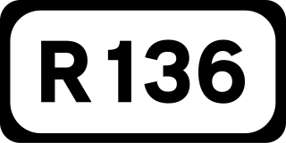
The R136 road is a regional road in Ireland, located in the southwest of Dublin. Named the Outer Ring Road, the route, which is dual carriageway, runs from the N4 at Lucan to the N81 at Tallaght, bypassing west of Clondalkin and crossing the N7 near Citywest. It was built as part of the planning for the new town of Adamstown.

A national primary road is a road classification in Ireland. National primary roads form the major routes between the major urban centres. There are 2649 km of national primary roads. This category of road has the prefix "N" followed by one or two digits. Motorways are prefixed "M" followed by one or two digits.

Citywest is a suburban development on the southwestern periphery of Dublin, originally developed as a "business campus." It contains a large hotel, with a convention centre, a small shopping centre and an expanding residential element. Citywest is situated in the southwest of the traditional County Dublin, in the jurisdiction of South Dublin County Council; the nearest major suburban centre is Tallaght, while the semi-suburban village of Saggart is adjacent.

A High-quality dual carriageway (HQDC) is a road category in Ireland. It is defined as an all-purpose dual carriageway road type built to near motorway standards, but without motorway classification or motorway restrictions. High-quality dual carriageways have full grade-separated access and do not have junctions with minor roads. Such roads in the Republic of Ireland have been built as part of the 2000–2006 and 2007–2013 National Development Plans, including interurban routes from Dublin to other cities.
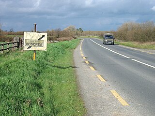
The N62 road is a national secondary road in Ireland. It links the M6 motorway east of Athlone, County Westmeath with junction 6 of the M8 motorway at Kilnoe near Horse and Jockey in County Tipperary, 96.625 kilometres (60.040 mi) to the south. The route also forms a junction with the M7 motorway south of Roscrea.

The R111 road is a regional road in south Dublin, Ireland, and includes a major element of the Dublin Outer Orbital Route.
The R813 road is a regional road in Dublin, Ireland.
The R819 road is a regional road in Dublin, Ireland.
The R137 road is a road in Dublin, Ireland connecting College Green in the City Centre to the junction of the M50 and N81 routes, via Dame Street, Patrick Street, Harold's Cross, Terenure, and Templeogue.

