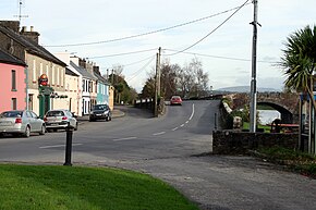
The N7 road is a national primary road in Ireland, connecting Limerick and Dublin. The majority of the route is motorway standard and is designated as the M7 motorway. At the Rosbrien interchange in Limerick the route continues as the N18 dual carriageway to Galway, Shannon and Ennis. The road passes through the midlands of Ireland, and acts as a trunk route out of Dublin for the N8 and N9 national primary routes to Cork and Waterford respectively. It forms part of European route E20.
The M7 motorway is a motorway in Ireland. The motorway runs continuously from the outskirts of Naas in County Kildare to Rossbrien on the outskirts of Limerick city. The M7 forms part of the Dublin to Limerick N7 national primary road. The section of the motorway bypassing Naas, an 8 km stretch, was the first section of motorway to open in Ireland, in 1983. Following substantial works to extend the M7 to Limerick, by the end of 2010, the motorway replaced all of the old single-carriageway N7 route which is now designated as R445. At 166.5 km, the M7 is the longest motorway in Ireland.

A regional road in the Republic of Ireland is a class of road not forming a major route, but nevertheless forming a link in the national route network. There are over 11,600 kilometres of regional roads. Regional roads are numbered with three-digit route numbers, prefixed by "R". The equivalent road category in Northern Ireland are B roads.

The R445 road is a regional road in Ireland. The route is a non-motorway alternative route to the N7/M7 motorway between Naas and Limerick, and at 170 km it is one of the longest regional roads in Ireland. Indeed, much of the route comprises roads that were formerly part of the N7 between the cities, prior to motorway and other bypasses. Some of the R445 route also comprises local link roads to new N7/M7 route sections.

The N82 road was a national secondary road in Ireland, and was located entirely in Dublin. The route was designated along the Citywest Road, which runs through the Citywest Business Campus between the N81 west of Tallaght and the Citywest Interchange of the N7.
The R415 road is a regional road in Ireland, which runs north-south from its junction with the R403 in Allenwood to the R448 at Crookstown, passing through Kildare town, and crossing the N78 between Kilcullen and Athy. The route is entirely within County Kildare.

The R417 road is a regional road in Ireland, which runs north-south from the R445 in Monasterevin, County Kildare to the R448 in Carlow, County Carlow.
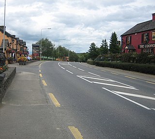
Birdhill is a village in County Tipperary, Ireland. It is in the barony of Owney and Arra and is part of the parish of Newport, Birdhill and Toor in the Roman Catholic Archdiocese of Cashel and Emly. Its Irish name was historically anglicised as Knockan or Knockaneeneen.

The R430 road is a regional road in Ireland, which runs west-east from the R445 in Mountrath, County Laois to the R448 in Carlow, County Carlow. The route is 47 km (29 mi) long.
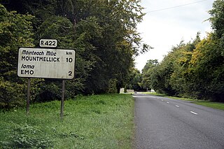
The R422 road is a regional road in Ireland, which runs west-east from the R421 north of the Slieve Bloom Mountains to the R445 at New Inn, County Laois. The route is 29 km (18 mi) long.

The R421 road is a regional road in Ireland which runs southwest-northeast from the R445 south of Roscrea to the N52 north of Tullamore. The route also passes through Clareen, Kinnitty and Killurin. The bulk of the route is in County Offaly with small sections in counties Tipperary and Laois. The route is 50 km (31 mi) long.

The R420 road is a regional road in Ireland, which runs northwest-southeast from the R446 near Moate in County Westmeath to the R445 just west of Monasterevin. The road travels through the towns of Clara, Tullamore & Portarlington. The route is 35 km (22 mi) long.

The R499 road is a regional road in Ireland which runs southwest-northeast from the R445 7 km east of Birdhill, County Tipperary, rejoining the R445 in Toomevara, County Tipperary. The route is 23 km (14 mi) long.
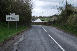
The R434 road is a regional road in Ireland linking Borris-in-Ossory on the R445 to Durrow on the N77. En route it passes through Aghaboe and Ballycolla, and over both the M7 and M8 motorways. The entire route is within County Laois.

The R494 road is a regional road in Ireland which runs southwest-northeast from Junction 27 of the M7 at Birdhill, County Tipperary to the N52 at Nenagh - all in County Tipperary. It leaves the M7 and loops around the Arra Mountains between the hills and Lough Derg returning to what was the N7 in Nenagh.

The R463 road is a regional road in Ireland which runs north-south from the R352 at Tuamgraney, County Clare to Limerick city centre. The road passes on its way through Killaloe and O'Briensbridge. The route is 41 km (25 mi) long.
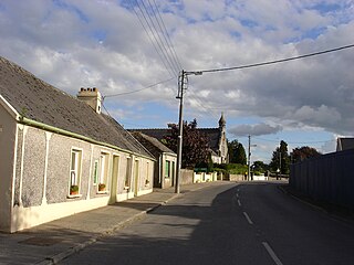
The R506 road is a regional road in the east of County Limerick, Ireland which runs west-east from its junction with the R445 regional road at Garraunykee, Annacotty and its junction with the R505 regional road in the townland of Dromsally on the outskirts of the village of Cappamore. En route it passes through the village of Murroe. The road is 18 km (11 mi) long.
The R504 road is a regional road in Ireland which runs north-south from Birdhill to its junction with the R503 at Shower Cross, one kilometre west of the town of Newport, all in County Tipperary. En route it passes through Clery's Cross and Barna Cross, and crosses over the M7 motorway.

The R352 road is a regional road in Ireland, located in County Clare and County Galway.

The R526 is a regional road in County Limerick, Ireland which follows the former route of the N20 that is now classified as the M20 Motorway, from Junction 5 of the M20 to a junction with the R445 in Limerick city centre.
