Clonee Cluain Aodha | |
---|---|
Village | |
Coordinates: 53°24′42″N6°26′39″W / 53.4117°N 6.4442°W | |
Country | Ireland |
Province | Leinster |
County | County Meath |
Elevation | 65 m (213 ft) |
Population | |
• Urban | 1,205 |
Time zone | UTC+0 (WET) |
• Summer (DST) | UTC-1 (IST (WEST)) |
Irish Grid Reference | O032412 |
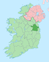
Clonee (Irish : Cluain Aodha, meaning 'Aodh's pasture' [2] ) is a village and a townland [3] in County Meath, Ireland. It borders County Dublin to the east at the townlands of Huntstown and Littlepace, and is sometimes used in addresses for housing in those townlands. [4] The River Tolka passes the village.
Clonee is situated on fairly level land, with the River Tolka passing, joined by the Clonee Stream at one end of the village. [5]
The townland is part of the civil parish of Dunboyne which is just a couple of km away down the R156 road. It is situated just off the main N3 Dublin to Cavan road and is 4 miles north-west of the M50 motorway.
Clonee village is about 14 km from Dublin and is accessible by Dublin Bus routes 70 (Baggot St- Dunboyne), 70D (to and from Dublin City University), and 270 (Blanchardstown Shopping Centre-Dunboyne). It is close to the suburb of Ongar which is served by route 39/A (Belfield/Baggot Street).
Bus Éireann routes 109 (to/from Dunshaughlin, Navan, Kells, Virginia and Cavan) and 105 (to/from Ratoath via Fairyhouse Racecourse) also serve Clonee. The stops for this route are outside and opposite Lidl. [6]
Clonee is served by Hansfield railway station, approximately 3km away. Trains can be taken to Clonsilla, Coolmine, Castleknock, Ashtown and Dublin Docklands via Dublin city direction and Dunboyne and M3 parkway in opposite direction.
Between 2011 and 2022, Clonee village's population almost doubled, from 631 to 1,205. [7] [1]
There is one public house, The Grasshopper Inn, and two supermarkets (Aldi & Lidl). Clonee is home to Dunboyne Tennis Club, [8] Clonee United [9] and the Royal Meath Pitch and Putt club. The GAA club, Erin Go Bragh, is located in Littlepace.
'Gateway to Meath' is a public art installation on the N3 Clonee Bypass. It features a 2.7m tall bronze man at a 4m high bronze gate by the artist Ann Meldon Hugh.
The Kepak Group, a large food processing company with a turnover in excess of €500 million and employing more than 2000 people in Ireland and the UK, moved its headquarters to Clonee in 1981. [10]
Facebook datacenters with 300 employees were built from 2018 onwards, powered by Ireland's first private 220kV substation. [11]
County Meath is a county in the Eastern and Midland Region of Ireland, within the province of Leinster. It is bordered by County Dublin to the southeast, Louth to the northeast, Kildare to the south, Offaly to the southwest, Westmeath to the west, Cavan to the northwest, and Monaghan to the north. To the east, Meath also borders the Irish Sea along a narrow strip between the rivers Boyne and Delvin, giving it the second shortest coastline of any county. Meath County Council is the local authority for the county.
County Cavan is a county in Ireland. It is in the province of Ulster and is part of the Northern and Western Region. It is named after the town of Cavan and is based on the historic Gaelic territory of East Breffny (Bréifne). Cavan County Council is the local authority for the county, which had a population of 81,704 at the 2022 census.
Blanchardstown is a large outer suburb of Dublin in the modern county of Fingal, Ireland. Located ten kilometres (6 mi) northwest of Dublin city centre, it has developed since the 1960s from a small village to a point where Greater Blanchardstown is the largest urban area in Fingal.
Cavan is the county town of County Cavan in Ireland. The town lies in Ulster, near the border with County Fermanagh in Northern Ireland. The town is bypassed by the main N3 road that links Dublin with Enniskillen, Ballyshannon and Donegal Town.
Mulhuddart is an outer suburb situated 12 km north-west of Dublin, Ireland. The River Tolka passes near the village.
The N3 road is a national primary road in the Republic of Ireland, running between Dublin, Cavan and the border with County Fermanagh. The A509 and A46 roads in Northern Ireland form part of an overall route connecting to Enniskillen, and northwest to the border again where the N3 reappears to serve Ballyshannon in County Donegal.
Dunboyne is a town in County Meath, Ireland, 15 km (9 mi) north-west of Dublin city centre. It is a commuter town for Dublin. In the 20 years between the 1996 and 2016 censuses, the population of Dunboyne more than doubled from 3,080 to 7,272 inhabitants. As per the 2022 census, the population decreased slightly to 7,155. The town is in a townland and civil parish of the same name.
Stradone is a village located in County Cavan, Ireland. It is situated in the civil parish of Larah six miles from Cavan, near the N3 road between Cavan and Virginia. Stradone is classified as a 'small village' in the Cavan County Council Development Plan 2014-2020.
The River Tolka, also once spelled Tolga, is one of Dublin's three main rivers, flowing from County Meath to Fingal within the old County Dublin, and through the north of Dublin city, Ireland. By flow of water, the Tolka is the second largest river in Dublin, following the Liffey, but runs more slowly than the Dodder.
Kinawley or Kinawly is a small village, townland and civil parish straddling County Fermanagh, Northern Ireland and County Cavan, Republic of Ireland. The village and townland are both in the civil parish of Kinawley in the historic barony of Clanawley, while other areas of the parish are in the baronies of Knockninny in County Fermanagh and Tullyhaw in County Cavan. In the 2011 Census it had a population of 141 people.
Athboy is a small agricultural town located in County Meath. The town is located on the Yellow Ford River, in wooded country near the County Westmeath border. It is around 15 km west of Navan and 50 km north-west of Dublin. The town is in a civil parish of the same name.
Arvagh, or Arva, is a village in County Cavan, Ireland, on the shores of Garty Lough and overlooked by Bruse Mountain. It is located on the junction of the R198 and R203 regional roads.
Ongar is an outer western suburb of Dublin, Ireland. Developed on a greenfield basis since 2001, it comprises the townlands of Castaheany (northerly) and "Hansfield or Phibblestown" (southerly), within the ancient Barony of Castleknock, County Dublin. It is close to Castleknock, Blanchardstown and Clonsilla. The development has a number of amenities on the main street, there are several schools in the area, and the nearby railway line at Hansfield railway station connects to the Luas Green Line and ultimately the N3 national route / M3 motorway. Employers in the nearby business parks and Greater Blanchardstown include Intel, Hewlett-Packard, IBM, Kepak and eBay.
Kingscourt, historically known as Dunaree, is a town in County Cavan, Ireland. It is located near the Cavan–Meath border. The town was founded near the site of the old village of Cabra, by Mervyn Pratt, towards the end of the 18th century, and was completed by his brother, the Reverend Joseph Pratt. As of the 2022 census, the population was 2,955.
Mountnugent, or Mount Nugent, historically known as Dalysbridge, is a village and townland in southern County Cavan, Ireland. The village is on the R154 regional road, at a river crossing near Lough Sheelin.
Rathmolyon is a village in the southern portion of County Meath, Ireland, situated 8 km south of Trim. It is situated at the junction of the R156 regional road and the R159 regional road connecting Trim to Enfield. Rathmolyon serves as a service centre for the surrounding rural area. The village is in a townland and civil parish of the same name.
The R147 is a regional road in Ireland. Its first section runs from St Peters Church in Phibsborough, Dublin to its junction with the M50. It then follows the route of a former section of the N3 between Clonee and Kells. It serves as an alternative route for non-motorway traffic and traffic wishing to avoid tolls on the M3.
Huntstown and Littlepace is a set of modern housing developments that forms a remote suburb of Dublin city in the county of Fingal in Ireland. It was built in the townlands of Littlepace (westerly) and Huntstown (easterly) which are the southernmost townlands of the civil parish of Mulhuddart. The district is also a parish in the Blanchardstown deanery of the Roman Catholic Archdiocese of Dublin. The nearest villages in the county are Ongar, Mulhuddart and Clonsilla along with Clonee in County Meath.
Ballivor is a village in County Meath, Ireland. It had a population of 1,809 at the 2016 census. It is on the R156 road between the towns of Mullingar and Trim, and is around 50 km north-west of Dublin.
Farbill is a barony in east County Westmeath, in Ireland. It was formed by 1672. It is bordered by County Meath to the south and east and three other baronies: Fartullagh, Moyashel and Magheradernon and Delvin. The largest centre of population in the barony is the town of Kinnegad.