Kentstown

Last updated

Kentstown
Irish: Baile an Cheantaigh
Town
Kentstown, County Meath (2) - geograph.org.uk - 1817494.jpg
Kentstown on the R150
Ireland adm location map.svg
Red pog.svg
Kentstown
Location in Ireland
Coordinates: 53°37′39″N6°31′59″W / 53.62750°N 6.53306°W / 53.62750; -6.53306
Country Ireland
Province Leinster
County Meath
Elevation
55 m (180 ft)
Population
 (2016) [1]
1,179
Time zone UTC+0 (WET)
  Summer (DST) UTC-1 (IST (WEST))
Irish Grid Reference N970651

Kentstown (Irish : Baile an Cheantaigh) [2] is a village in County Meath in Ireland at the junction of the R153 and R150 regional roads. The village is in a townland and civil parish of the same name. [2]

Contents

History

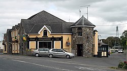
There are two churches in Kentstown, the Roman Catholic Church of the Assumption (built in 1844 by the then parish priest Revd. J. Sheridan) [3] and the Church of Ireland Saint Mary's [4] (built in 1798 with funds from the local protestant Somerville family). The Somerville family mausoleum can be found at the back of the church. The ruins of a medieval church are located in Danestown Cemetery, just outside of Kentstown which is next to Danestown Fort. [5]

In Saint Mary's Church (Church of Ireland) is an effigy in the shape of a medieval Norman knight carved on a slab. The knight wears a tight-fitting jupon and has a dagger on his right hip. An inscription, in Latin, accompanies it: "Here lies Thomas de Tuite, Knight, once Lord of Kentstown, who died on 2nd June 1363". [6]

Saint Mary's Church of Ireland,Kentstown. Saint Mary's Church of Ireland Anglican, Kentstown.jpg
Saint Mary's Church of Ireland,Kentstown.
Saint Mary's Church of Ireland, Kentstown interior. Inside of Saint Mary's Church of Ireland Kentstown.jpg
Saint Mary's Church of Ireland, Kentstown interior.

In the (Catholic) Church of the Assumption there is a medieval holy water font moved from the old ruined church in nearby Timoole. An inscription on the font reads: "This font stone was built by Robar e Hollywood, Anno Domini,1597, he being proctor (PlsXXVIII7XXIX)". There is also a large painting depicting the marriage of Saint Catherine to the side of the main door which was donated by the local Somerville family. [7]

Church of the Assumption. Catholic Church of the Assumption Kentstown.jpg
Church of the Assumption.

Demographics

In the 20 years between the 1996 and 2016 census, the population of Kentstown more than tripled from 324 to 1,179 inhabitants. [1] [8] According to the 2016 census, 71% of the village's homes (252 of 353 households) were built between 1991 and 2010. [1]

Transport

Kentstown village is served by Bus Éireann route 105, which operates hourly in each direction providing links to Duleek, Drogheda and in the other direction to Ashbourne, Ratoath and Blanchardstown. [9] In addition, route 103X (Dublin-Ashbourne-Navan) provides a limited service of a morning journey to Dublin and an evening journey to Navan Mondays to Fridays inclusive. [10] In 2023 a new Transport for Ireland local link bus route, the 188 was added to Kentstown. The route, which starts in Athboy and ends in Drogheda connects Kentstown with other local villages and towns such as Navan, Donore and Duleek and also Newgrange Neolithic tomb. [11]

Nanny river

The Nanny rises outside of Kentstown, and flows about 18 miles to the Irish sea at Laytown. [12]

Notes

  1. 1 2 3 "Sapmap Area - Settlements - Kentstown". Census 2016. Central Statistics Office. April 2016. Retrieved 16 February 2020.
  2. 1 2 "Baile an Cheantaigh/Kentstown". logainm.ie. Placenames Database of Ireland . Retrieved 15 October 2021.
  3. FUSIO. "Catholic Church of the Assumption, Kentstown, Kentstown, Meath". Buildings of Ireland. Retrieved 21 May 2024.
  4. FUSIO. "Saint Mary's Church (Kentstown), Kentstown, Kentstown, Meath". Buildings of Ireland. Retrieved 21 May 2024.
  5. "Meath County Council - Record of Protected Structures - County Development Plan 2007-2013 - Adopted 2nd March 2007" (PDF). Archived from the original (PDF) on 20 November 2007. Retrieved 27 August 2008.
  6. "Historic Meath". octavehouse.com. Archived from the original on 28 July 2009. Retrieved 27 August 2008.
  7. "Kentstown Church History". www.beauparcparish.ie. Retrieved 21 May 2024.
  8. "Kentstown (Ireland) Census Town". City Population. Retrieved 16 February 2020.
  9. "Route 105 Timetable" (PDF). buseireann.ie. Bus Éireann. Retrieved 15 October 2021.
  10. "Route 103X Timetable" (PDF). buseireann.ie. Bus Éireann. Retrieved 15 October 2021.
  11. "New bus service from Athboy to Drogheda launches tomorrow". LMFM. Retrieved 20 May 2024.
  12. O'Reilly, Peter (1 April 2003). Rivers of Ireland: A Flyfisher's Guide. Stackpole Books. p. 226.


Related Research Articles

<span class="mw-page-title-main">Slane</span> Village in County Meath, Ireland

Slane is a village in County Meath, in Ireland. The village stands on a steep hillside on the left bank of the River Boyne at the intersection of the N2 and the N51. As of the 2022 census, Slane's population was 1,445. The village and surrounding area contains many historic sites dating back over 5,000 years. The village centre, as it is laid-out today, dates mainly from the 18th century. The village is in a townland and civil parish of the same name.

<span class="mw-page-title-main">County Meath</span> County in Ireland

County Meath is a county in the Eastern and Midland Region of Ireland, within the province of Leinster. It is bordered by County Dublin to the southeast, Louth to the northeast, Kildare to the south, Offaly to the southwest, Westmeath to the west, Cavan to the northwest, and Monaghan to the north. To the east, Meath also borders the Irish Sea along a narrow strip between the rivers Boyne and Delvin, giving it the second shortest coastline of any county. Meath County Council is the local authority for the county.

<span class="mw-page-title-main">Trim, County Meath</span> Town in County Meath, Ireland

Trim is a town in County Meath, Ireland. It is situated on the River Boyne and, as of the 2022 census, had a population of 9,563. The town is in a civil parish of the same name.

<span class="mw-page-title-main">Bus Éireann</span> Bus and coach operator in Ireland

Bus Éireann is a state-owned bus and coach operator providing services throughout Ireland, with the exception of Dublin and the Greater Dublin Area, where bus services are provided by sister company Dublin Bus. It is a subsidiary of Córas Iompair Éireann (CIÉ). The company's primary hub is Busáras, located in Store Street, Dublin. In 2022 it operated 229 Public Service Obligation Routes, 14 expressway routes and 8940 school transport routes.

<span class="mw-page-title-main">Navan</span> Town in County Meath, Ireland

Navan is the county town and largest town of County Meath, Ireland. It is at the confluence of the River Boyne and Blackwater, around 50 km northwest of Dublin. At the 2022 census, it had a population of 33,886, making it the ninth largest settlement in Ireland. The town is in a civil parish of the same name.

<span class="mw-page-title-main">Duleek</span> Town in County Meath, Ireland

Duleek is a small town in County Meath, Ireland.

<span class="mw-page-title-main">Ráth Chairn</span> Village and Gaeltacht in County Meath, Ireland

Ráth Chairn is a small village and Gaeltacht in County Meath, Ireland. It is about 55 km northwest of Dublin. Ráth Chairn Gaeltacht was founded in 1935 when 27 families from Connemara, mostly from Ceantar na nOileán, were settled on land previously acquired by the Irish Land Commission, followed by a further 11 families in 1937. In all 443 people moved to the area.

<span class="mw-page-title-main">Nobber</span> Village in County Meath, Ireland

Nobber is a village in north County Meath, Ireland. It is on the Navan–Kingscourt road (R162), about 19 kilometres (12 mi) north of Navan. This places the village about 60 kilometres (37 mi) from the M50 motorway, the orbital motorway of Dublin. The village is in a townland and civil parish of the same name.

<span class="mw-page-title-main">Dunboyne</span> Town near Dublin, Ireland

Dunboyne is a town in County Meath, Ireland, 15 km (9 mi) north-west of Dublin city centre. It is a commuter town for Dublin. In the 20 years between the 1996 and 2016 censuses, the population of Dunboyne more than doubled from 3,080 to 7,272 inhabitants. As per the 2022 census, the population decreased slightly to 7,155. The town is in a townland and civil parish of the same name.

<span class="mw-page-title-main">Termonfeckin</span> Village in County Louth, Ireland

Termonfeckin or Termonfechin is a small village and townland in County Louth, Ireland. It is within a civil parish of the same name, and is 8 km (5.0 mi) north-east of Drogheda. The population of the village almost quadrupled in the period between the 1996 and 2022 census, growing from 530 to 1,983 inhabitants.

<span class="mw-page-title-main">Raharney</span> Village in Leinster, Ireland

Raharney is a village in east County Westmeath, Ireland. It has a population of 221 according to the 2016 census.

Athboy is a small agricultural town located in County Meath. The town is located on the Yellow Ford River, in wooded country near the County Westmeath border. It is around 15 km west of Navan and 50 km north-west of Dublin. The town is in a civil parish of the same name.

<span class="mw-page-title-main">Baltray</span> Village in County Louth, Ireland

Baltray is a village and townland in County Louth, Ireland. It sits on the northern shore of the River Boyne estuary.

<span class="mw-page-title-main">Batterstown</span> Small rural village in the townland of Rathregan , County Meath, Ireland

Batterstown is a small rural village in the townland of Rathregan, County Meath, Ireland. It is about 23 km (14 mi) northwest of Dublin, on the R154 regional road. It hosts a yearly cycling race. There are approximately forty houses in Batterstown. The population of Batterstown is approximately 150 people.

<span class="mw-page-title-main">Ashbourne, County Meath</span> Commuter town in County Meath, Ireland

Ashbourne is a town in County Meath, Ireland. Located about 20 km north of Dublin and close to the M2 motorway, Ashbourne is a commuter town within Greater Dublin. In the 26 years between the 1996 and 2022 census, the town tripled in population from approximately 4,900 to 15,680 inhabitants. The town is passed by the Broad Meadow Water, which comes from Ratoath and Dunshaughlin.

<span class="mw-page-title-main">Navan railway station</span>

Navan railway station is a former train station which served the town of Navan in County Meath, Ireland.

<span class="mw-page-title-main">Duleek railway station</span>

Duleek railway station is a former railway station that served the town of Duleek in County Meath. Located on the Drogheda-Oldcastle branch line and operated by the GNR(I), the station opened in 1850 and closed to passenger services, along with the rest of the line, in 1958.

<span class="mw-page-title-main">Ballivor</span> Village in County Meath, Ireland

Ballivor is a village in County Meath, Ireland. It had a population of 1,809 at the 2016 census. It is on the R156 road between the towns of Mullingar and Trim, and is around 50 km north-west of Dublin.

<span class="mw-page-title-main">R150 road (Ireland)</span> Road in Ireland

The R150 road is a regional road in Ireland. It runs from Drogheda to the Meath coast and back inland across east County Meath.