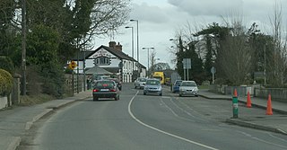
Dunshaughlin is a town in County Meath, Ireland. A commuter town for nearby Dublin, Dunshaughlin more than tripled in population between the 1991 and 2016 censuses.

Moynalty is a village in the north-west of County Meath in Ireland. It is located at the junction of the R194 and R164 regional roads 8 km (5 mi) north of Kells, near the border with County Cavan. It was part of the Kells Poor Law Union. The Borora river flows through the village. Its population in 2011 was 116 people.

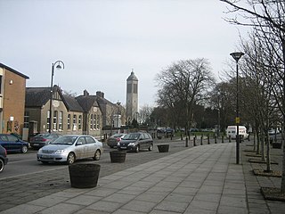
Ratoath is a village in County Meath, Ireland. A branch of the Broad Meadow Water flows through the town. The R125 and R155 roads meet in the village. At the 2016 census, there were 9,533 people living in Ratoath.

Nobber is a village in north County Meath, Ireland. The village is located near a river called the Dee and near Whitewood Lake, which is situated in the townland of Whitewood. It is on the Navan–Kingscourt road (R162) about 19 kilometres (12 mi) north of Navan. This places the village about 60 kilometres (37 mi) from the M50 motorway ; the orbital motorway of Dublin. The town of Kells is to the west and the town of Ardee to the east and the town of Kingscourt is to the north. Villages that border the parish are Kilmainhamwood, Moynalty and Kilbeg to the west, Castletown-Kilpatrick to the south and Drumconrath and Lobinstown to the east.
Dunboyne is a town in Meath, Ireland. It is a commuter town for Dublin. In the 20 years between the 1996 and 2016 censuses, the population of Dunboyne more than doubled from 3,080 to 7,272 inhabitants.

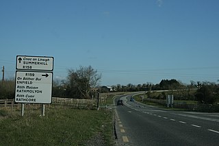
Kilcloon or Kilclone is a parish situated in the south-east of County Meath in Ireland. Kilcloon parish is largely rural and contains the village of Kilcloon itself and the neighbouring villages of Batterstown and Mulhussey. The parish church is located at Ballynare Cross Roads in the village of Kilcloon with chapels in Kilcock and Batterstown.

Naul, is a village, townland, and civil parish at the northern edge of Fingal and the traditional County Dublin in Ireland. The Delvin River to the north of the village marks the county boundary with County Meath. Naul civil parish is in the historic barony of Balrothery West.

Kilcogy, is a small village and townland in the civil parish of Drumlumman in south-western County Cavan, Ireland. Kilcogy is located on the R394 road.
Mountnugent, historically known as Dalysbridge, is a village and townland in southern County Cavan, Ireland. The village is on the R154 regional road, at a river crossing near Lough Sheelin.
Mulhussey is a townland and village in County Meath, Ireland. It has a school, a castle with accompanying cemetery, a nearby church at the edge of the Kilcloon parish in Kilcock, and a religious antiquity, St Bridgid's Well, located in Calgath near Mulhussey.

Bective is a small hamlet and townland in County Meath, Ireland. Bective is situated on the left bank of the River Boyne and on the Clady River which joins the former in the east of the townland, approximately 6 kilometres east of Trim, on the Athboy to Dunshaughlin road.

Rossnaree is a small village and townland in County Meath, Ireland, on the south bank of the River Boyne. The Brú na Bóinne complex of neolithic monuments is nearby, on the north bank of the Boyne. Rossnaree commands a ford that was used by the Williamites at the Battle of the Boyne in 1690. The walls of the mill at Rosnaree once contained a Sheela na Gig, although this has been removed for safekeeping and is in private possession.

Donaghpatrick is a village and townland in County Meath, Ireland. It lies approximately 5 km northwest of Navan off the R147 regional road between Navan and Kells on the northern bank of the River Blackwater. The Irish language name of the townland, Domhnach Phádraig, means "the church of Patrick". The local Church of Ireland church, dedicated to Saint Patrick, was built in 1896 close to the site of a much earlier church, and incorporating parts of a medieval tower house.
Laracor, in Irish Láithreach Cora, is a civil parish which is located in County Meath in Ireland, south of Trim. It overlaps with the electoral division of the same name.

Farbill is a barony in east County Westmeath, in the Republic of Ireland. It was formed by 1672. It is bordered by County Meath to the south and east and three other baronies: Fartullagh, Moyashel and Magheradernon and Delvin. The largest centre of population in the barony is the town of Kinnegad.
Castlelost is a civil parish in County Westmeath, Ireland. It is located about 12.81 kilometres (8 mi) south of Mullingar.
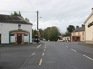
Carlanstown is a village and townland in County Meath, Ireland. It is located approximately 4 km northeast of the larger town of Kells, County Meath on the N52 road. As of the 2016 census, there were 664 people living in the village.
Meedin, also Meedian, is a village and townland in County Westmeath, Ireland. It is located in the south of the county on the N52 road, to the north of Tyrrellspass and Rochfortbridge and to the south of Mullingar.

Castlejordan is a village and townland in County Meath, Ireland. It is located in the south of the county, close to the border with County Offaly, to the south of Kinnegad. The townland of Castlejordan has an area of approximately 2.2 square kilometres (0.85 sq mi), and had a population of 85 people as of the 2011 census.
Ballinabrackey is a village in County Meath in Ireland. It is in the civil parish of Castlejordan.

