The Baile Ghib Gaeltacht was founded in 1937 when 52 families were settled on land previously acquired by the Irish Land Commission, followed by a further 9 families in 1939 who settled in Clongill. In all 373 people moved to the area.[2][3]
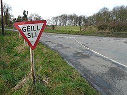
It and the nearby area of Ráth Chairn make up the Meath Gaeltacht. At the 2022 census the villages of Ráth Chairn and Baile Ghib had a combined population of 420.[4] The Meath Gaeltacht had a population of 1,857 in 2016, representing 1.9% of the total population of Ireland's Gaeltacht.[5] According to the 2016 census 15.9% of the population of Baile Ghib and Ráth Chairn spoke Irish on a daily basis outside the education system.[6]
History
Establishment of the Meath Gaeltacht
The Meath Gaeltacht was formed when the Irish Land Commission redistributed the large estates of absentee landlords and farmers from the Gaeltacht areas of the western seaboard were resettled in Meath in the 1930s. The migrants were from Cork, Kerry, Connemara, Mayo and Donegal. The government's goals were to relieve overcrowding and poverty in the western counties and to spread the Irish language. It was also a social experiment to redress the 17th-century ethnic cleansing of Ireland by Oliver Cromwell’s draconian action ‘To hell or Connaught’. Due to the limited size of the Gaeltacht the difficulty of providing services in Irish made bilingualism necessary.[7][8][9]
Foundation of the Baile Ghib Gaeltacht
The Baile Ghib Gaeltacht was founded in 1937, when Irish-speaking families from Mayo, Kerry, Donegal and Cork Gaeltachtaí settled in the area. This diversity is reflected in the local street names, including Donegal Road, and Mayo Road. Baile Ailin (English: Allenstown) was established nearby at the same time as Baile Ghib, but proved less successful, with most of its inhabitants moving away. Each family received a house, 22 acres, farm animals and farm implements in exchange for land and property in their native county. Baile Ghib was eventually given official Gaeltacht status, along with Ráth Chairn, in 1967.[10]
New History of the Baile Ghib Gaeltacht
A new history Ceann Scríbe Baile Ghib - Destination Gibbstown was published in 2024.[11]
This page is based on this Wikipedia article Text is available under the CC BY-SA 4.0 license; additional terms may apply. Images, videos and audio are available under their respective licenses.