Mullinavat (Irish: Muileann an Bhata, meaning 'mill of the stick')[2] is a village in south County Kilkenny, Ireland. The village's Irish name, Muileann an Bhata, translates as 'mill of the stick' which, according to local tradition, refers to a mill which could only be approached by means of a rough stick over the Glendonnel River, close to where Mullinavat Bridge is now located.[3]
Two streams, Abhainn na Bhata and the Poulanassa River, join the Blackwater River to the south of Mullinavat.[3] Other local geographic features include Tory Hill which rises to 290m (950ft) above sea level.[3] This hill is said to have derived its name from an outlaw named Edmund Den, who was active in the area around the year 1700. There is a pattern held each year on Tory Hill on the second Sunday of July. This is locally called 'Tory Hill Sunday' and 'Frocchans Sunday'. It was not previously a religious celebration, but consisted of local people gathering to pick the wild berries called 'Frocchans'. In the "holy year" of 1950, a large cross was erected on the summit of the hill, and since then, the rosary has been said by the people who gather beneath the cross.[citation needed]
Named after 'Fort of the Wren', nearby Listrolin is in the Walsh Mountains, overlooking Mullinavat, Mooncoin, Kilmacow and Tempelorum. Listrolin and the Walsh Mountains were acquired by the Walsh family when they landed in Ireland with Strongbow in the 12th century. This area was controlled by the family until the Cromwellian conquest of Ireland in the 17th century. It was once home to several castles owned by the family's descendants. In 1946, the townlands of Clonassy, Listrolin and Rochestown were annexed from Mooncoin, becoming part of Mullinavat district parish. The ancient church of this district stood in Listrrolin, in the laneway leading over the Assy River to Ballinacoaley.[citation needed]
History
Evidence of ancient settlement in the area includes a number of fulacht fiadh, enclosure and ringfort sites in the surrounding townlands of Deerpark, Garrandarragh and Glendonnell.[5]
Mullinavat (Irish: Muileann an Bhata, meaning 'mill of the stick') was historically associated with milling,[3] and 19th century saw mill and corn mill buildings still stand in Mullinavat and Glendonnell townlands.[6][7] The local church, Saint Beacon's Catholic Church in Garrandarragh, dates to c.1890.[8] A 19th century Church of Ireland church, outside the village, was demolished in the 20th century - though its graveyard remains.[9] These churches, and Kilbeacon parish, are historically associated with Saint Beacon (Bécán).
Inchicarron (or Inchacarran) Castle, to the east of Mullinavat, was occupied by poet John Mac Walter Walsh (also known as 'Tatter Jack Walsh'). While only one of his poems survives, a dance tune (jib) is still known as 'Tatter Jack Walsh'. His property was confiscated in his old age. He died in 1660 and was reputedly buried in Kilbeacon cemetery.[citation needed]
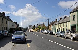
Transport
Bilingual signage approaching Mullinavat
The area is served by Bus Éireann route 4, which travels each way from Dublin to Carlow, Waterford and New Ross.[10]
Mullinavat is located on the R448Naas–Waterford road. The village was bypassed in July 2010 when the Kilkenny–Waterford section of the M9 motorway opened. It is at junction 11 of the motorway. The R704 road goes to New Ross.
There are two national (primary) schools serving the area: St. Beacon's National School and St. Colmcille's National School.[3] The nearest secondary school is in Ballyhale.[3]
Public services include a health centre, credit union, post office, restaurant and a number of public houses.[3] There is also a Teagasc office in the area.[15]
Mulinavat is in an area of productive land, which is used for both agriculture and forestry.[citation needed] The main tillage crops include barley, oats, wheat, miscanthus and maize. Production of sugar beet stopped with the closure of the Carlow sugar plant. Dairy farming is also important with most milk being supplied to Tirlán. There is also beef or livestock farming.[citation needed]
Afforestation in the area has been undertaken by Coillte. Forestry has been important in Mullinavat since the 1960s, mainly conifer plantations. Government policy has also promoted the development of some deciduous woodlands.[citation needed]
Between the 2002 census and 2016 census, the population of Mullinavat decreased from 309 to 233.[3][17] As of the 2022 census, it had a population of 210.[1] Of these, over 95% (200 people) were Irish citizens, 2% (5 people) were from the United Kingdom, with a small number (3 people) holding citizenship of other European countries.[1] As of the 2022 census, nearly 91% of respondents indicated that they were Catholic, with 1% other religions and 8% either of no religion or no stated religion.[1]
This page is based on this Wikipedia article Text is available under the CC BY-SA 4.0 license; additional terms may apply. Images, videos and audio are available under their respective licenses.