Dublin is the capital and largest city of Ireland. On a bay at the mouth of the River Liffey, it is in the province of Leinster, bordered on the south by the Dublin Mountains, a part of the Wicklow Mountains range. At the 2016 census, it had a population of 1,173,179, while the population of County Dublin as a whole was 1,347,359, and the Greater Dublin Area was 1,904,806.

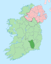
County Kilkenny is a county in Ireland. It is in the province of Leinster and is part of the South-East Region. It is named after the city of Kilkenny. Kilkenny County Council is the local authority for the county. As of the 2022 census the population of the county was just over 100,000. The county was based on the historic Gaelic kingdom of Ossory (Osraighe), which was coterminous with the Diocese of Ossory.

Dyfed is a preserved county in southwestern Wales. It is a mostly rural area with a coastline on the Irish Sea and the Bristol Channel.

The River Shannon, at 360.5 km in length, is the longest river in the British Isles It drains the Shannon River Basin, which has an area of 16,865 km2 (6,512 sq mi), – approximately one fifth of the area of the island of Ireland.

County Tipperary is a county in Ireland. It is in the province of Munster and the Southern Region. The county is named after the town of Tipperary, and was established in the early 13th century, shortly after the Norman invasion of Ireland. It is Ireland's largest inland county and shares a border with 8 counties, more than any other. The population of the county was 159,553 at the 2016 census. The largest towns are Clonmel, Nenagh and Thurles.

The Barrow is a river in Ireland. It is one of The Three Sisters; the other two being the River Suir and the River Nore. The Barrow is the longest of the three rivers, and at 192 km (120 mi), the second-longest river in Ireland, behind the River Shannon. The catchment area of the River Barrow is 3,067 km2 before River Nore joins it a little over 20 km before its mouth. The river's long term average flow rate, again before it is joined by River Nore, is 37.4 cubic metres per second. At the merger with the River Suir, its catchment area is ca. 5,500 km2 and its discharge over 80 m3/s.

Shown here are all the major rivers and tributaries of Ireland with their lengths. Starting with the Northern Ireland rivers, and going in a clockwise direction, the rivers are listed in regard to their entry into the different seas: the Irish Sea, the Celtic Sea and the Atlantic Ocean. Also shown are two tables. Table 1 shows the longest rivers in Ireland with their lengths, the counties they flow through, and their catchment areas. Table 2 shows the largest rivers in Ireland in cubic metres per second.

The River Lagan is a major river in Northern Ireland which runs 53.5 miles (86 km) from the Slieve Croob mountain in County Down to Belfast where it enters Belfast Lough, an inlet of the Irish Sea. The Lagan forms much of the border between County Antrim and County Down in the east of Ulster. It rises as a tiny, fast-moving stream near to the summit of Slieve Croob; Transmitter Road runs nearby. It runs to Belfast through Dromara, Donaghcloney and Dromore. On the lower slopes of the mountain, it combines with a branch from Legananny Mountain, just opposite Slieve Croob. The river then turns east to Magheralin into a broad plain between the plateaus of Antrim and Down.

The River Dodder is one of the three main rivers in Dublin, Ireland, the others being the Liffey, of which the Dodder is the largest tributary, and the Tolka.
The River Nore is one of the principal rivers in the South-East Region of Ireland. The 140-kilometre-long (87 mi) river drains approximately 2,530 square kilometres (977 sq mi) of Leinster and Munster, that encompasses parts of three counties. Along with the River Suir and River Barrow, it is one of the constituent rivers of the group known as the Three Sisters.

The River Bandon is a river in County Cork, Ireland.

Clady is a small village in County Londonderry, Northern Ireland. It had a population of 562 people in the 2011 Census. It is within the Mid-Ulster District area.

The Blackwater or Munster Blackwater is a river which flows through counties Kerry, Cork, and Waterford in Ireland. It rises in the Mullaghareirk Mountains in County Kerry and then flows in an easterly direction through County Cork, through Mallow and Fermoy. It then enters County Waterford where it flows through Lismore, before abruptly turning south at Cappoquin, and finally draining into the Celtic Sea at Youghal Harbour. In total, the Blackwater is 169 km (105 mi) long. The total catchment area of the River Blackwater is 3,324 km2. The long term average flow rate of the River Blackwater is 89.1 cubic metres per second (m3/s) The Blackwater is notable for being one of the best salmon fishing rivers in the country. Like many Irish and British rivers, salmon stocks declined in recent years, but the Irish government banned commercial netting of salmon off the coast of Ireland in November 2006.

Aughrim is a small town in County Wicklow, Ireland. It lies in a scenic valley in the Wicklow Mountains in the east of Ireland where the Ow and Derry rivers meet to form the Aughrim River. Aughrim is on the R747 road between Arklow and Baltinglass, and the R753 regional road.

The Castletown River is a river which flows through the town of Dundalk, County Louth, Ireland. It rises near Newtownhamilton, County Armagh, Northern Ireland, and is known as the Creggan River in its upper reaches. Its two main tributaries are the Kilcurry and Falmore rivers and it enters the Irish Sea at Dundalk Bay.