The Great Famine, also known as the Great Hunger, the Famine or the Irish Potato Famine, was a period of mass starvation and disease in Ireland from 1845 to 1852. With the most severely affected areas in the west and south of Ireland, where the Irish language was dominant, the period was contemporaneously known in Irish as an Drochshaol, loosely translated as "the hard times". The worst year of the period was 1847, known as "Black '47". During the Great Hunger, about 1 million people died and more than a million fled the country, causing the country's population to fall by 20%–25%, in some towns falling as much as 67% between 1841 and 1851. Between 1845 and 1855, no fewer than 2.1 million people left Ireland, primarily on packet ships but also steamboats and barks—one of the greatest mass exoduses from a single island in history.

Allegany State Park is a state park in western New York State, located in Cattaraugus County just north of the Allegheny National Forest in Pennsylvania. The park is divided into two sections: The Red House Area and the Quaker Run Area. It lies within the Allegheny Highlands forests ecoregion.
Garrison is the collective term for any body of troops stationed in a particular location, originally to guard it. The term now often applies to certain facilities that constitute a military base or fortified military headquarters. A garrison is usually in a city, town, fort, castle, ship, or similar site. "Garrison town" is a common expression for any town that has a military base nearby.

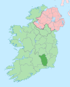
Skibbereen is a town in County Cork, Ireland. It is located in West Cork on the N71 national secondary road. The name "Skibbereen" means "little boat harbour". The River Ilen runs through the town; it reaches the sea about 12 kilometres away, at the seaside village of Baltimore. As of the Census of Ireland 2011, the population of the town was 2,568. Skibbereen is in the Cork South-West constituency, and has three seats.

Connemara is a cultural region in County Galway, in the west of Ireland. The area has a strong association with traditional Irish culture and contains a major part of the Connacht Irish-speaking Gaeltacht, which is a key part of the identity of the region and is the largest Gaeltacht in the country.

Donegal is a town in County Donegal, Ireland. The name was also historically spelt 'Dunnagall'. Although Donegal gave its name to the county, now Lifford is the county town. From the 15th until the early 17th century, Donegal was the 'capital' of Tyrconnell, a Gaelic kingdom controlled by the O'Donnell dynasty of the Northern Uí Néill.

Kilmallock is a town in south County Limerick, Ireland, near the border with County Cork. There is a Dominican Priory in the town and King's Castle. The remains of medieval walls which encircled the settlement are still visible.

Newcastle West or simply Newcastle is a town in west County Limerick, Ireland. It is the largest town in the county, excluding Limerick city, It is also the county town, and sits on the River Arra which flows into the River Deel. Newcastle West is in the middle of a great bowl-shaped valley in West Limerick, known one time as the valley of the Wild Boar, apparently due to the abundance of this animal here when the area was thickly wooded. The crest of the town carries the image of a wild boar. Newcastle West is on the N21 road from Limerick to Tralee, between Rathkeale and Abbeyfeale. In 2016, the population of the town was 6,619.
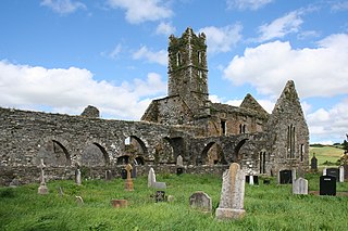
Timoleague is a village in the eastern division of Carbery East in County Cork, Ireland. It is located along Ireland's southern coast between Kinsale and Clonakilty, on the estuary of the Argideen River. Nearby is the village of Courtmacsherry. It is about 17 km (11 mi) south of Bandon and 48 km (30 mi) from Cork on the R600 coastal road.

Cill Chiaráin is a coastal village in the Connemara area of County Galway, in the Republic of Ireland. The R340 passes through Cill Chiaráin.

Scarriff or Scariff is a large village in east County Clare, Ireland, situated in the midwest of Ireland. The town is on the West end of Lough Derg and is best known for its harbour. The Scarriff Market House is easily recognisable, and it is therefore often used to represent the town.

Scotch Street is a village in County Armagh, Northern Ireland. It is within the townland of Timakeel and part of the Armagh City, Banbridge and Craigavon Borough Council area. In the 2001 Census it had a population of 120 people. Currently there is estimated to be around 1000 people living there.
Teemore is a townland in County Fermanagh, Northern Ireland, three miles south of Derrylin. In the 2001 Census it had a population of four hundred people. It is situated within the Fermanagh and Omagh District Council area.

Courtown, is a village which developed after Lord Courtown ordered the construction of a harbour during the Famine years, 1839–1846. The economic boost of the new harbour led to a small village developing with fishing being the primary economy of the village. Courtown is situated on the Irish Sea coast and with the recent development during the Celtic Tiger years, has merged into the adjoining village of Riverchapel. It lies on the R742 regional road.

Crookedwood is a small village in County Westmeath on the R394 regional road. Historically it was called Taghmon, after the townland it occupies.

Tinure is a small village and townland in the parish of Monasterboice, County Louth, Ireland. The official spelling of the village's name is Tinure however it is also sometimes referred to as "Tenure".

Timolin is a village in the south of County Kildare, Ireland. It is located off the R448 road, the former N9 road about 80 km (50 mi) south of Dublin. It is a small village, with less than a hundred inhabitants, one shop and two pubs. It is located close to the Moone High Cross Inn. The closest village to Timolin is Moone, less than 1 kilometre to the south.
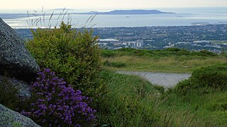
Ticknock or Tiknock is a townland southwest of Sandyford in Dublin at the northeastern foothills of the Dublin Mountains. The townland of Tiknock is in the electoral division of Dundrum, and has an area of approximately 2.6 square kilometres (1.0 sq mi).
John Keegan was an Irish ballad-writer.

Gaeltacht na nDéise is a Gaeltacht area in County Waterford consisting of the areas of Ring and Old Parish. Gaeltacht na nDéise is located 10 km from the town of Dungarvan. Gaeltacht na nDéise has a population of 1,816 people and encompasses a geographical area of 62 km2. This represents 1% of total Gaeltacht area.