Slieverue

Last updated

Slieverue
Sliabh Rua (Irish)
Village
Slieveroe church, Co. Waterford - geograph.org.uk - 571184.jpg
Slieveroe Church
Ireland adm location map.svg
Red pog.svg
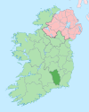
Slieverue
Location in Ireland
Coordinates: 52°17′00″N7°04′05″W / 52.28335°N 7.068086°W / 52.28335; -7.068086
Country Ireland
Province Leinster
County County Kilkenny
Population
 (2016) [1]
476

Slieverue, officially Slieveroe, (Irish : Sliabh Rua, meaning 'red mountain') [2] is a village in South County Kilkenny, Republic of Ireland. It is located in the historical barony of Ida. [2] Despite the name, the land is relatively low-lying and fertile. Slieverue's population, as of the 2016 census, was 476. [1]

Contents

Geography

The village lies alongside the main N25 road, some 5 km from Waterford City and 14 km from New Ross in County Wexford, near the point where the Rivers Barrow and Suir come together.

Landmarks

A prominent local hill, known as Carriganurra, features a large concrete cross at its summit. This cross was erected by local residents in 1950 to celebrate the Holy Year.[ citation needed ]

The Church of the Assumption is an early nineteenth century Roman Catholic church in Slieverue village. [3] The only church in the parish,[ citation needed ] it was renovated in the early 1990s. [3] It is listed on the Record of Protected Structures for County Kilkenny. [4]

Earlier churches in the area included a church at Drumdowney (built in honour of Saint Patrick), at Kilmurray crossroads (dedicated to the Blessed Virgin), at Killaspy (dedicated to the presiding bishop), and at Rathpatrick (the remains of which can still be seen).[ citation needed ]

Education

There are two national schools in the parish, at Slieverue and Ringville. [5]

People

Atateemore near Slieverue is the birthplace of John O'Donovan, a scholar who translated the ancient text Annals of the Four Masters into English.[ citation needed ]

See also

Related Research Articles

<span class="mw-page-title-main">Graiguenamanagh</span> Hamlet in County Kilkenny, Ireland

Graiguenamanagh or Graignamanagh is a town on the River Barrow in County Kilkenny, Ireland. Part of the settlement, known as Tinnahinch, is on the County Carlow side of the river, and Carlow County Council refers to the whole village as "Graiguenamanagh-Tinnahinch". Also combined for census purposes, as of the 2016 census, Graiguenamanagh-Tinnahinch had a population of 1,475 people.

<span class="mw-page-title-main">Ballintra</span> Village in County Donegal, Ireland

Ballintra is a village in the parish of Drumholm in the south of County Donegal, Ireland, just off the N15 road between Donegal town and Ballyshannon. Ballintra lies on the northern bank of the Blackwater river. The river rises in the hills that lie inland from the town, and flows through a number of small lakes before spilling over a small waterfall in a gorge behind the village.

<span class="mw-page-title-main">Ballyragget</span> Town in County Kilkenny, Ireland

Ballyragget is a small town on the river Nore in the north of County Kilkenny in Ireland. Ballyragget is on the N77 18 km (11 mi) north of Kilkenny. As of the 2016 census, it had a population of 1,082 people.

<span class="mw-page-title-main">Croagh</span> Village in mid County Limerick, Ireland

Croagh is a small village and civil parish in County Limerick, Ireland. It is located in mid-Limerick between Rathkeale and Adare just off the N21 national primary road, approximately 22 kilometres south west of Limerick City. The village was originally part of this route before construction of the Croagh by-pass in 1986. The village is in the agricultural area known as the Golden Vale.

<span class="mw-page-title-main">Gneeveguilla</span> Village in County Kerry, Ireland

Gneeveguilla,, officially Gneevgullia, is a small village in the Sliabh Luachra region of East County Kerry, Ireland. It lies about 19 km (12 mi) east of Killarney, close to the County Kerry/County Cork border.

Brosna is a village and parish situated in the Sliabh Luachra area of County Kerry, Ireland. It lies 16 km (9.9 mi) from the town of Castleisland. The civil parish of Brosna consists of the village and a number of townlands. It is a mainly agricultural area, supporting two churches, two schools, a post office, and five public houses.

<span class="mw-page-title-main">Scotstown</span> Village in County Monaghan, Ireland

Scotstown is a village in the townland of Bough in north County Monaghan, Ireland. Scotstown is located in the parish of Tydavnet, along the Monaghan Blackwater, Scotstown being the village closest to the river's source. Scotstown is centred in the townland of Bough, but extends into Carrowhatta, Teraverty, Drumdesco and Stracrunnion townlands.

<span class="mw-page-title-main">Mooncoin</span> Town in County Kilkenny, Ireland

Mooncoin is an urban area in County Kilkenny, in Ireland. The population was 1,175 in 2016. Historically part of the Gaelic kingdom of Osraige, today it is in the far south of the county of Kilkenny, located in the valley of the River Suir. It is surrounded by the uplands of the Slievenamon and Comeragh Mountains, just 10 kilometres (6.2 mi) north of Waterford City along the N24 national primary road, and it is 48 kilometres (30 mi) south of Kilkenny.

<span class="mw-page-title-main">Kildangan</span> Village in County Kildare, Ireland

Kildangan is a village in County Kildare in Ireland.

<span class="mw-page-title-main">Mullinahone</span> Village in Munster, Ireland

Mullinahone is a village located in the barony of Slievardagh, County Tipperary in Ireland. It is also a parish in the Roman Catholic Archdiocese of Cashel and Emly. As of 2016, the village population was 499.

<span class="mw-page-title-main">Stoneyford, County Kilkenny</span> Village in County Kilkenny, Ireland

Stoneyford, officially Stonyford is a small town in County Kilkenny, Ireland. It lies on the N9 Waterford road some 14 km south of Kilkenny City. Stoneyford is a part of the parish of Aghaviller in the Diocese of Ossory.

<span class="mw-page-title-main">Gortnahoe</span> Village in Munster, Ireland

Gortnahoe, also known as Gortnahoo, is a village in County Tipperary, Ireland. It is located on the R689 regional road 6 km (3.7 mi) south of Urlingford, County Kilkenny. It is 3 km (1.9 mi) southeast of the N8 Dublin - Cork road. Gortnahoe, pronounced "Gurt/na/hoo" by the locals, is part of the parish of Gortnahoe–Glengoole.

<span class="mw-page-title-main">Portroe</span> Village in County Tipperary, Ireland

Portroe is a village in County Tipperary, Ireland. The village is located on the R494 regional road, 3 km from the eastern shore of Lough Derg and 10 km west of the town of Nenagh. Portroe spans the townlands of Garrykennedy, Glencrue and Shesharoe.

Currow is a rural village in County Kerry in south west Ireland, located approximately 12 km from Killarney and 18 km from Tralee. Currow is situated on the Brown Flesk River, a tributary of the River Maine.

Bree is a village located in the centre of County Wexford, in Ireland. As of the 2016 census, Bree had a population of 193 people.

<span class="mw-page-title-main">Lattin, County Tipperary</span> Village in County Tipperary, Ireland

Lattin is a village and civil parish in south County Tipperary in Ireland. It is within the historical barony of Clanwilliam, and is also one half of the 'Lattin and Cullen' parish in the Roman Catholic Archdiocese of Cashel and Emly. Lattin village is located on the R515 regional road between the towns of Emly and Tipperary.

<span class="mw-page-title-main">Glenville, County Cork</span> Village in County Cork, Ireland

Glenville is a village and townland in County Cork, Ireland. It is situated approximately 20 km northeast of Cork city. Glenville is part of the Cork North-Central.

Moneenroe is a townland, electoral division and village in north County Kilkenny, Ireland. It is located in the province of Leinster along the N78 road about 21 kilometres (13 mi) from Kilkenny city in the south-east of the island of Ireland. As of 2016, the population of Moneenroe was 722.

<span class="mw-page-title-main">Clogh, County Kilkenny</span> Village in County Kilkenny, Ireland

Clogh is a village, and namesake of an electoral district in County Kilkenny, Ireland. It is also a townland in the civil parish of Castlecomer in the ancient barony of Fassadinin.

<span class="mw-page-title-main">Carrick, County Donegal</span> Village in County Donegal, Ireland

Carrick is a village located within the civil parish of Glencolmcille in County Donegal, Ireland. As of the 2016 census, the population of the village was 265. Carrick is located between neighbouring towns Glencolmcille, Meenanary, Teelin and Kilcar. Nearby is Sliabh Liag, the highest sea cliff in Europe.

References

  1. 1 2 "Sapmap Area - Settlements - Slieverue". Census 2016. Central Statistics Office. April 2016. Retrieved 21 January 2020.
  2. 1 2 "Slieveroe/Sliabh Rua". logainm.ie. Placenames Database of Ireland. Retrieved 21 January 2020.
  3. 1 2 "Catholic Church Of The Assumption, Kilmurry, County Kilkenny". buildingsofireland.ie. National Inventory of Architectural Heritage. Retrieved 21 January 2020.
  4. Slieverue Local Area Plan (PDF) (Report). Kilkenny County Council. 16 October 2006. p. 7. Slieverue has one protected structure [..] the existing Catholic Church in the village which dates from circa 1800
  5. "Slieverue Parish Website". slieverue.com. Retrieved 21 January 2020.